

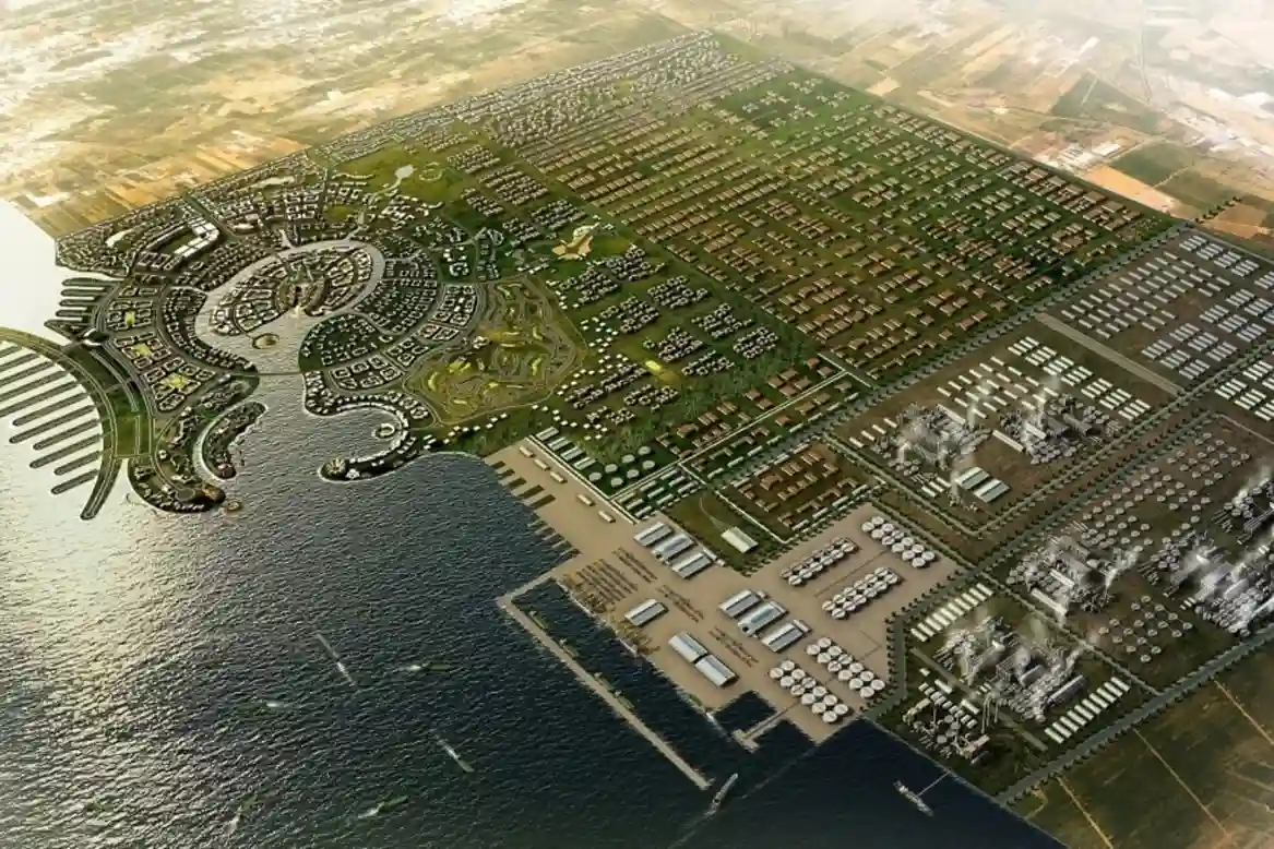
Jazan Special Economic Zone (Jazan SEZ) located within Jazan City for Primary and Downstream Industries (JCPDI). It’s expands the industrial operations along 24.6 km2 of Red Sea coastline, protecting marine ecosystems and coastal water quality has become a primary operational focus.
Housing heavy downstream manufacturing, food processing facilities, mineral refineries, and port logistics at JCPDI Port, the zone discharges treated cooling water and stormwater runoff into surrounding marine waters.
Effective environmental governance requires continuous surveillance to monitor outfall discharge points, evaluate thermal plumes, and detect chemical leaks before effluent enters sensitive coastal ecosystems.
Traditional environmental monitoring relies on manual water sampling from boats or shoreline foot patrols.
However, sparse point sampling cannot capture dynamic outfall dispersion patterns across vast coastal channels, while manual foot walks along breakwaters and mudflats introduce safety risks for inspection crews.
As industrial zones scale up environmental oversight, market data from Fortune Business Insights showing the global drone inspection and environmental monitoring market reached SAR 37.91 billion in 2026 and is projected to expand to SAR 132.56 billion by 2034, driven by industrial coastal facilities adopting automated thermal and environmental surveillance, reflects the growing reliance on high-frequency aerial data collection.
Deploying dedicated drone monitoring networks transforms periodic manual sampling into continuous spatial intelligence across Jazan SEZ.
Thermal Infrared (TIR) and Plume Mapping
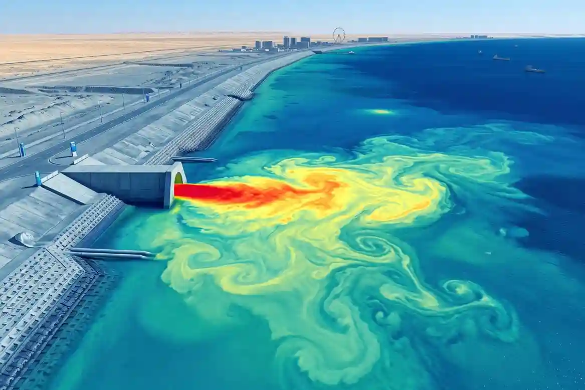
Monitoring thermal water discharges from industrial cooling systems requires high-sensitivity thermal sensors capable of resolving minor temperature differentials across open sea surfaces.
Operating heavy-lift flight platforms, such as the DJI Matrice 400 (M400) paired with the DJI Zenmuse H30T payload, allows environmental management teams to execute repeated aerial thermography sweeps along industrial outfall canals locked to precise RTK spatial coordinates.
The DJI Zenmuse H30T payload features a high-resolution radiometric thermal sensor (1280 x 1024 thermal resolution) with a Noise Equivalent Temperature Difference (NETD ≤ 50 mK).
Operating from high flight altitudes, the aircraft captures true surface water temperatures across broad coastal areas during both day and night missions.
Environmental research published on ResearchGate establishing that calibrated drone-based radiometric thermal infrared (TIR) sensors achieve surface water temperature measurement precision with a Root Mean Square Error (RMSE) below 0.43°C across coastal sea environments, mapping localized outfall thermal gradients of up to 13°C and distinct mixing zones that remain undetected by coarse satellite imagery or sparse point sampling, demonstrates why airborne radiometric thermography is essential for coastal water audits.
High-resolution thermal models allow environmental officers to trace thermal discharge plumes from concrete outfall headwalls out into open marine waters.
Measuring mixing zone boundaries and thermal dissipation rates ensures industrial operators comply with environmental thermal limits established by the National Center for Environmental Compliance (NCEC).
Multispectral Screening and Automated Outfall Auditing
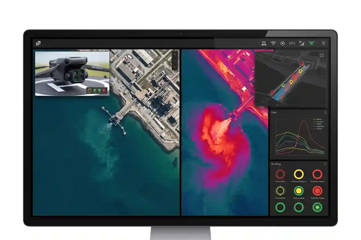
In addition to thermal monitoring, detecting chemical effluent runoff, industrial oil sheens, and suspended solid concentrations along Red Sea shorelines requires multispectral aerial analysis.
Combining thermal sweeps from the DJI Matrice 400 with specialized multispectral platforms, such as the DJI Mavic 3 Multispectral (M3M), provides multi-band spectral reflectance mapping across visible and near-infrared (NIR) wavelengths.
The DJI Mavic 3 Multispectral integrates a 20 MP RGB camera with four narrow multispectral sensors (Green 560 nm, Red 650 nm, Red Edge 730 nm, and Near-Infrared 860 nm). Shifts in water surface reflectance profiles allow environmental analysts to identify subtle chemical film accumulation, turbidity spikes, and localized algae blooms along outfall channels before pollutants disperse into open ocean currents.
Transitioning from manual ground walks along tidal mudflats and rocky breakwaters to automated computer vision workflows significantly accelerates field detection.
Technical research published on ResearchGate demonstrating that replacing traditional manual coastal walk-through inspections with drone aerial photogrammetry and lightweight vision algorithms reduces outfall identification time per imagery frame from approximately 10 minutes down to real-time automated detection while maintaining an 81.5% outfall identification accuracy across complex industrial shorelines confirms the operational efficiency of automated aerial computer vision.
Integration with SEZ Environmental Governance
The core value of aerial coastal monitoring lies in integrating aerial spatial datasets directly into enterprise governance platforms used by JCPDI leadership, facility operators, and environmental regulators.
- ArcGIS and NCEC Reporting Integration: Georeferenced thermal orthomosaics, multispectral reflectance maps, and automated outfall anomaly points convert into spatial layers compatible with ArcGIS Enterprise dashboards and NCEC compliance reporting formats.
- Data Privacy and Regulatory Compliance: All flight workflows adhere to Civil Aviation Authority (GACA) airspace permits, Saudi Data and Artificial Intelligence Authority (SDAIA) data management guidelines, and National Cybersecurity Authority (NCA) security controls, ensuring sensitive industrial infrastructure records remain protected.
- Proactive Environmental Loop: Continuous scheduled aerial monitoring establishes an objective baseline for coastal water quality, shifting environmental management across Jazan SEZ from reactive incident response to proactive, data-driven marine protection.
Consult with Our Experts
Streamline your coastal water monitoring, aerial thermal outfall audits, and multispectral environmental surveillance. Contact our specialist to deploy advanced aerial drone solutions for your industrial infrastructure projects.

 English