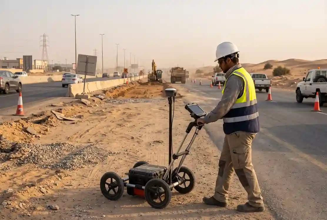
Every construction project in Saudi Arabia starts with the same question: what is already under the ground? In May 2026, the Kingdom awarded 18 construction projects worth SAR 30.03 billion, and infrastructure led the list. Roads, pipelines and utility corridors all need excavation. Excavation needs a clear picture of the buried services first.
That picture is often missing. Old drawings may be incomplete. Records may not match what was built. Marks on the ground may be faded or wrong. And when a crew digs into a live pipe or cable, the cost is not only the repair. It is also delay, outages and risk to people.
In January 2026, a street in north Riyadh collapsed. The Riyadh Infrastructure Projects Center said excavation at a nearby site had weakened the soil under water pipelines. It shows how closely buried services and nearby digging are linked, even when the digging is not directly on top of the pipe.
This is why GPR utility locating is a common first step in design. GPR stands for ground penetrating radar. A GPR survey scans the ground without digging and shows where buried services are likely to be. Enabling works for 2027 project packages are being scoped in Q4, so now is the time to decide how the utility question will be answered.
This guide explains why utility strikes happen, how a GPR survey works step by step, what GPR can and cannot detect, and how to know if it fits your project.
Why Utility Strikes Happen
Utility strikes are rarely bad luck. They usually come from missing or wrong information. Most of the data on this comes from the United States, because we found no public Saudi figures on utility strikes. The pattern is still useful to understand.
Missing and wrong records
The Common Ground Alliance (CGA) collects damage reports from across the United States. In 2024, it analysed 196,977 damage reports to buried utilities, and about a quarter of them (24.54%) happened because no one called before digging. In the US, the call goes to 811, the national call-before-you-dig line.
The lesson is simple. If the dig team does not know what is below, the risk goes up. A call, a record check or a survey are all ways to fill that gap before work starts.
Note that reporting to the CGA is voluntary. The real number of damage events is likely higher than the reported number.
Marking is not the same as locating
Calling is only the first step. Someone still has to find and mark the service on the ground, and that step can go wrong too. In the same 2024 data, locator error caused 20.52% of reported damages. That is 11.94% from services that were not marked and 8.58% from services that were marked in the wrong place.
In other words, one in five damages came from a marking problem. Paint on the ground is a short-term answer. It fades, gets covered or moves with traffic. It also gives the designer nothing to work with. A survey that records each service with coordinates gives the design team data they can check and use.
The real cost is bigger than the repair
When a buried utility is hit, the repair bill is the smallest part of the cost. CGA puts the yearly cost of buried utility damage in the United States at about SAR 312.0 billion, and only about SAR 18.4 billion of that (5.9%) is direct repair. The rest is indirect. It includes community and environment impact, business disruption and emergency response.
The same analysis values the injuries and deaths from buried utility damage at about SAR 23.3 billion a year. This is an economic value, not a count of people. It still shows that safety is part of the cost, not an extra.
These are US estimates and should not be read as Saudi figures. But the logic applies on any site. A strike on a water main, a fibre cable or a power line stops work, affects people nearby and takes weeks to fix.
The best time to deal with this risk is before the design is final. Early on, a utility conflict costs a drawing change. Late, it costs a stopped excavation.
GPR Utility Locating, Step by Step
At Terra Drone Arabia, we do GPR utility locating at the feasibility and design stage. This is an existing-conditions survey. Our work ends with a utility map that the designer and the permit team can use. Excavation, relocation and repair are done by the contractor and the utility owner.
To keep this practical, we use one example throughout: a road-widening corridor. The road is being widened by one lane on each side. The design team needs to know which services run under the new lanes, the shoulders and the verge.
Before the survey
A good survey starts with good preparation. The survey team needs:
- The limits of the corridor and the design alignment.
- Any as-built drawings and utility records from the owner and the service providers.
- Site access, including a traffic plan if lanes need to be closed.
- A list of what the design team needs, such as which services, what depth range and what drawing format.
Old drawings are a starting point, not proof. They show what someone planned or recorded in the past. The survey shows what is there now. When the two do not match, the survey result is what the design team should check first.
For the road-widening corridor, the team also asks about known services. Typical ones are water lines, sewer lines, power and telecom ducts, and street lighting cables. Knowing what to expect helps the survey team read the scan.
Step 1: Scan the excavation corridor with GPR
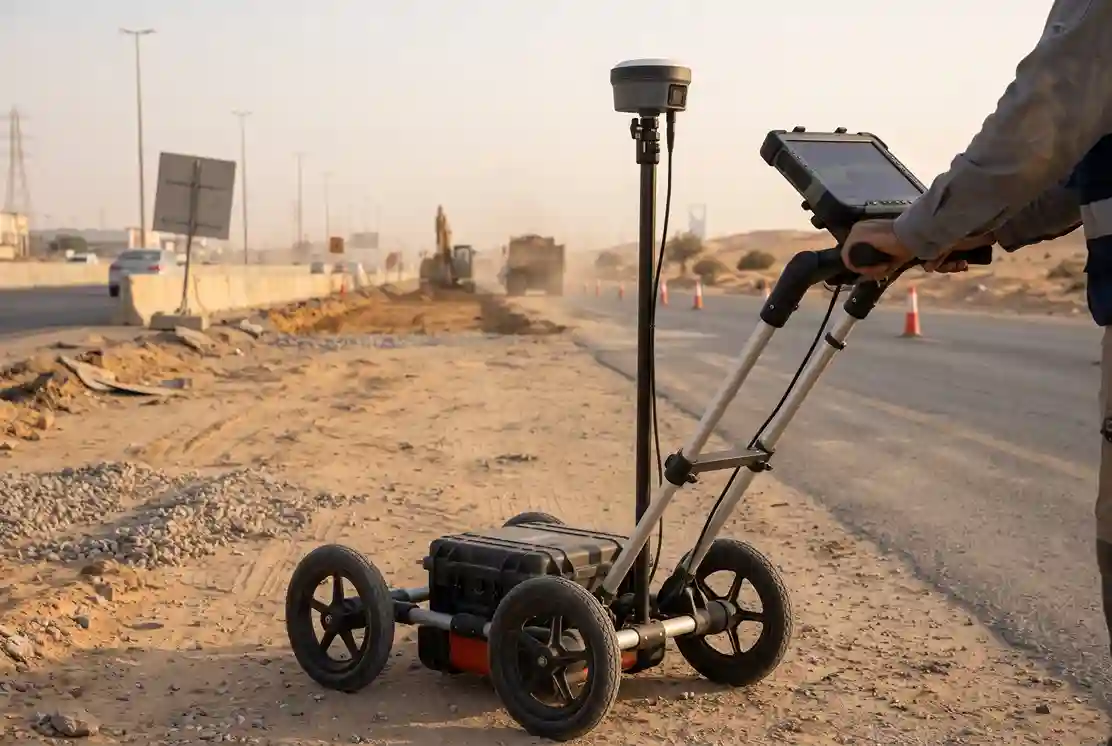
GPR works like a very simple sonar for the ground. A scanner sends short radar pulses into the soil. When the pulses hit something different from the soil, such as a pipe, a cable or a duct bank, part of the signal bounces back. The scanner records the echoes. A trained operator reads the pattern to find where buried objects are.
On the road-widening corridor, the survey team scans the area where new excavation will happen. That means the new lane, the shoulder and the verge. The scan lines run across the corridor, so a pipe or cable that runs along the road will show up as a repeated signal on each pass. The team adds more passes where the signals are unclear or crowded.
A few things make a scan more reliable:
- Clear ground. Debris, parked vehicles and loose material make scanning slower and results weaker.
- Close line spacing. The closer the lines, the better the team can follow a service from one pass to the next.
- Field notes. Surface clues such as manholes, valve covers, light poles and road patches help the operator explain what the scan shows.
The output of this step is a set of detected service positions, not yet a map. The next step turns them into usable coordinates.
Step 2: Tie every detected service to coordinates with RTK GNSS
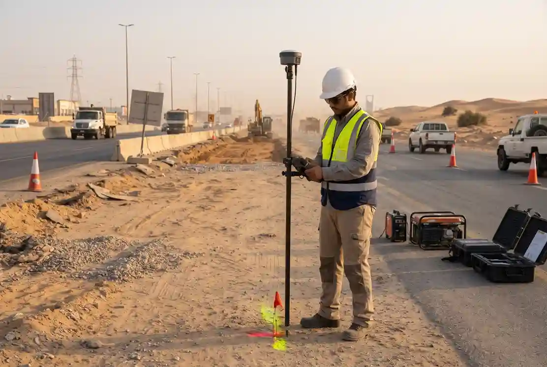
A signal on a screen is not useful to a designer. A service with a position, a type and a depth range is.
This is why we record each detected service using RTK GNSS. RTK GNSS is a satellite positioning method that corrects its own errors in real time and gives centimetre-level coordinates. We use the FJD Trion V10i for this work. Each detected service gets a position in the same coordinate system as the project design model.
This matters for two reasons. First, the utility map and the design drawings line up, so the designer can see a pipe and a new foundation in the same view. Second, anyone can come back later and find the same point, because the coordinates do not depend on a paint mark.
For the road-widening corridor, the result is a set of coordinates along each detected service. Each point is labelled with the likely service type, such as water, sewer, power or telecom, and a note on how sure the team is. Where the team cannot tell, the point is marked as unknown, and not guessed.
Step 3: Put the utility map into the design model and the permit pack
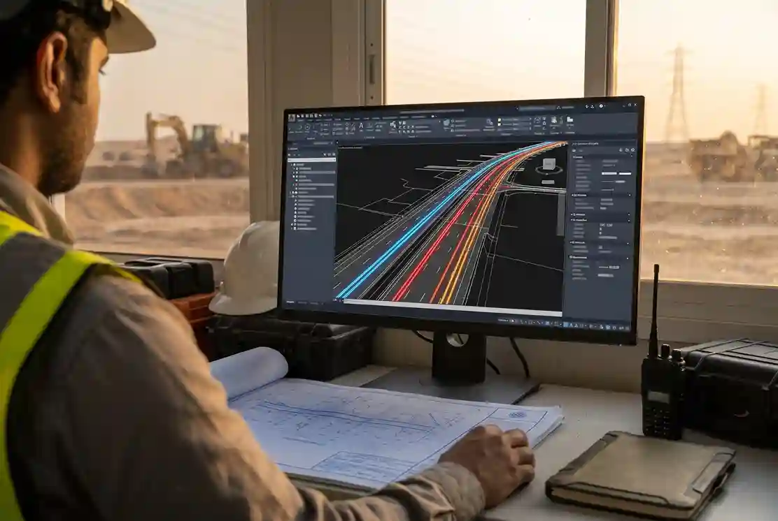
Next, the team builds a utility map from the coordinates. It shows each service as a line, with its type, its likely depth range and any notes. The map is delivered in a format that fits the design workflow, such as CAD or a layer for the BIM model.
BIM stands for building information modelling. It is a 3D model of the project that holds design data. When the utility map is placed in the BIM model, designers can see conflicts early. A new drainage line might cross an existing power duct. A new light pole foundation might sit on a water main. These are far easier to fix on screen than in the ground.
The same map goes into the excavation permit pack. Permit reviewers can see that the team checked for buried services before asking to dig. This supports a faster and cleaner review.
The cost of leaving this step too late is real. In Texas, TxDOT ran pilots of utility conflict management on five highway projects. The National Academies report says managing utility conflicts early saved about SAR 37.5 million and 38 months of delivery time across those projects. Note that the savings came from managing utility conflicts early, not from GPR alone. GPR is one of the tools that gives a team the information to do that.
Where our work stops
The utility map is the end of our scope. We do not excavate, move or repair utilities. We do not do structural design. After the map is delivered, the contractor, the utility owner and the design team decide what to do with each conflict.
This split is useful. It keeps the survey independent. The team that finds the services is not the same team that digs or moves them.
What GPR Can and Cannot Detect
GPR is strong, but it is not magic. A good survey report is honest about both sides. We do not quote a single detection rate here, because detection depends on the site, the soil and the type of service.
What GPR is good at
- Metal pipes and cables. They reflect radar strongly, so they usually show clearly.
- Non-metal pipes. Plastic and concrete pipes are hard to find with some other locators. GPR can often detect them, because it responds to changes in the ground and not only to metal.
- Ducts and duct banks. Groups of ducts under roads and verges often show as a recognisable pattern.
- Open corridors. Roads, yards, plant areas and cleared strips give the scanner room to work.
Where GPR has limits
- Wet and clay-heavy soil. It absorbs the radar signal and reduces how deep the scan can see.
- Depth. Signals fade with depth, so very deep services may not be detected.
- Crowded ground. Where many services cross or run close together, signals overlap and are harder to separate.
- Dense reinforced concrete. Heavy rebar can hide what lies beneath.
- Surface access. Obstacles on the surface stop the scanner from moving and leave gaps in the data.
Because of these limits, a good report states what was found, how sure the team is and what could not be confirmed. It should not claim to show everything.
GPR is one method, not the only one
GPR works best together with other checks. A records review gives context. A site walk finds manholes and valve covers. Where a result is unclear, other locating methods or a test pit can confirm it.
Utility data quality is also defined by a standard. ASCE 38 describes four quality levels, from QL-D (records only) to QL-A (exposed and measured). A geophysical survey such as GPR usually supports QL-B, which means the service is detected and positioned but not yet exposed. Asking for a stated quality level helps the project team know how far to trust each line on the map.
A utility map from GPR does not replace the need to dig carefully. It tells the contractor where to be careful, where to hand-dig and where to confirm before using machines.
Is GPR Utility Locating Right for Your Project?
GPR utility locating is useful on many projects. It is most useful where excavation is planned and the records are weak. Here is how it fits three main sectors.
Construction and giga-projects
Large projects have long corridors, many contractors and tight schedules. A utility conflict found at design stage costs a drawing change. A conflict found in the trench costs time, money and sometimes safety.
With SAR 30.03 billion in construction awards in May 2026 alone, a lot of excavation is coming. Utility data collected early helps designers avoid conflicts and helps contractors plan the dig.
Power and utilities
Substations, cable routes and pipelines sit close to other buried services. A strike here can cause an outage or a safety event. A GPR survey before new trenching helps the design team keep clear of existing cables and ducts, and helps asset owners keep their own records up to date.
Industrial cities
Industrial areas often have many services in a small space, built over many years, with records that do not match. A coordinated utility map gives the whole site one reference, so each new project does not start from zero.
A quick checklist
Ask yourself these questions. If the answer to any of them is yes, a survey is worth scoping:
- Are as-built drawings missing, old or unclear?
- Is excavation planned in the next 6 to 12 months?
- Does your permit process need proof that utilities were checked?
- Will the design team work in a BIM model that can hold utility data?
- Have you had a utility surprise on a past project in the same area?
Frequently Asked Questions
What is GPR utility locating?
GPR utility locating is the use of ground penetrating radar to find buried services such as pipes, cables and ducts without digging. The scanner sends radar pulses into the ground and records the echoes. A trained operator then reads the signals to find where services are.
How is a GPR survey different from calling the utility owner for marks?
Calling the utility owner gives you their records or their marks, which may be old or incomplete. A GPR survey checks what is physically in the ground. Locator error caused 20.52% of reported damages in the CGA 2024 data, so a second source of data helps. The two work best together.
Can GPR find plastic pipes?
Often, yes. GPR responds to changes in the ground, not only to metal. Plastic pipes can show up as clear echoes, especially in dry, sandy soil. Results are weaker in wet or clay-heavy ground, so the report should state any limits.
Does GPR show how deep a service is?
GPR gives an estimate of depth. The estimate depends on how fast the radar signal travels through the soil, so the team calibrates it on site. Depth should be treated as a range. If you need an exact depth, a test pit is the way to confirm it.
What does Terra Drone Arabia deliver, and what does it not do?
We deliver a utility map tied to coordinates with RTK GNSS, ready for the design model and the excavation permit pack. We do not excavate, relocate or repair utilities, and we do not do structural design.
Plan the Survey Before the Dig
Utility problems are cheapest to fix on paper. If your 2027 enabling works are being scoped now, this is the right time to decide how you will find out what is underground.
A GPR survey tied to RTK GNSS coordinates gives your design team a map they can use, and your permit team proof that the checks were done.
Talk to our survey team to scope a GPR utility locating survey for your corridor.

 English