TDSA Logo Long Positive

Topographic Land Survey Services in Saudi Arabia

GACA and GEOSA-certified topographic land survey in Saudi Arabia. Aerial surveying and mapping, drone photogrammetry, LiDAR, and GNSS RTK in one team.
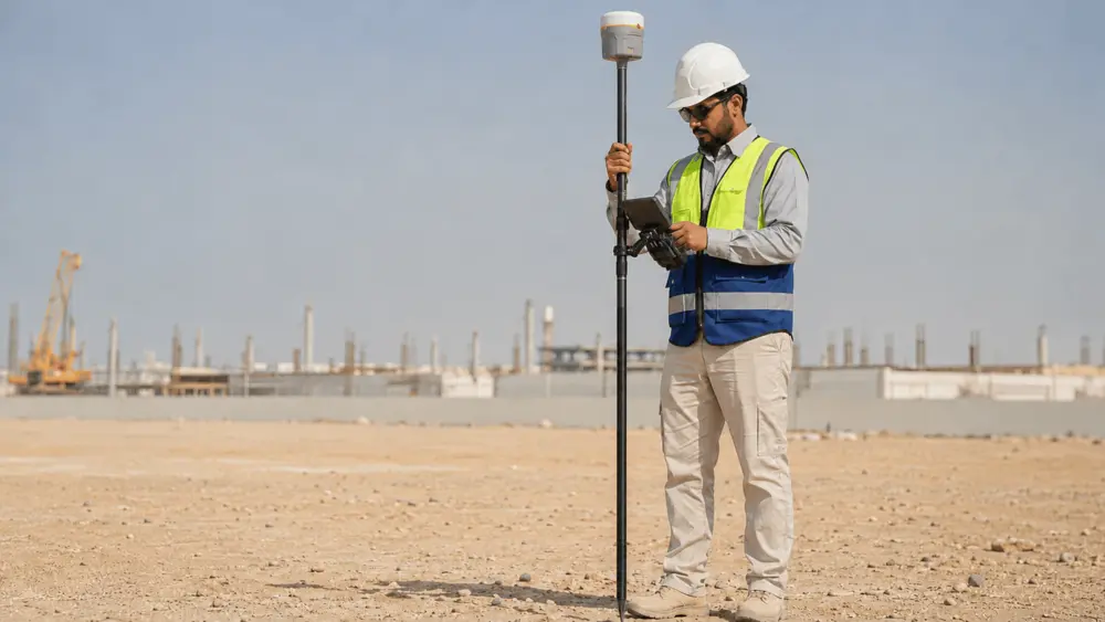
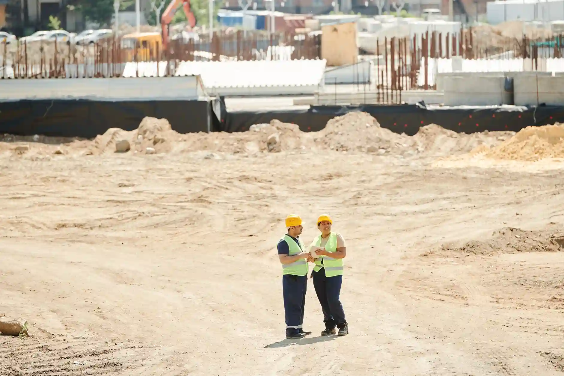
Topographic land survey in Saudi Arabia: GNSS RTK ground control point being set on a construction site, the geodetic foundation shared by every survey we run, drone or ground

BENEFITS

Survey Data Your Engineering Team Can Actually Use

Drone or ground, the same engineering-ready deliverable, chosen to fit your site, your accuracy spec, and your permit timeline.

Sub-5 cm Accuracy, Drone or Ground

RTK GNSS ground control with GCPs tied to SANSRS/WGS84 consistently achieves sub-5 cm absolute accuracy for drone photogrammetry, LiDAR, and conventional survey alike, giving engineering teams data they can sign off on without re-survey.

One Mobilization Instead of Two

Aerial photogrammetry or LiDAR covers the broad terrain while GNSS RTK and Total Station handle benchmarks, detail points, and areas the drone cannot reach. One mobilization, one team, one set of deliverables, without coordinating between separate firms.

Permits Handled for You, GACA and GEOSA Cleared

Aerial survey in Saudi Arabia requires both civil aviation authorization from GACA and a valid survey license from GEOSA. Terra Drone Arabia holds both, operating under GACAR Part 107-certified pilots with all flight permits coordinated before deployment.

Permanent Benchmarks Beyond the Project

Permanent reference markers and control monuments are installed tied to the national geodetic network (SANSRS/WGS84), giving the construction team a precise datum any licensed surveyor can pick up for future phases, stakeout, or compliance checks.

One Team Accountable for Your Accuracy

Capture, processing, and delivery all run inside our own platform stack instead of being subcontracted out. When a coordinate is questioned at design review there is one team to answer for it, with no finger pointing between the flight crew, the processor, and the surveyor.

Proven Across Saudi Arabia's Biggest Projects

Topographic and land survey delivered for residential development programmes, industrial cities, marine and port programmes, construction sites, and municipal road infrastructure across Saudi Arabia, all to the same sub-5 cm accuracy standard.

CHALLENGES

What Slows Down a Topographic Survey in Saudi Arabia

Terrain, corridor scale, permit timelines, and datum mismatches delay engineering sign-off. The survey method is the answer, not the problem.

Inaccessible Terrain and Wadis

Wadis, steep slopes, active quarry faces, and remote desert terrain block ground crews from large sections of a project, and reaching them safely costs days. The coverage gaps left behind surface later as design accuracy problems.

Large Corridors Take Weeks

On wide road corridors, pipeline ROW, and transmission routes needing high-definition corridor mapping, ground crews cover limited distance per day and deliverables slip. On compact sites those same crews are the faster route, so scale drives the schedule, not method.

Permit Timelines Blocking the Programme

GACA flight authorization and a GEOSA survey license both have to clear before any aerial work starts. When that clearance runs longer than the programme can absorb, a drone-only plan puts permitting on the critical path.

Accuracy Gaps for Engineering Sign-Off

Standard handheld GPS delivers only meter-level positioning, which fails engineering acceptance criteria. Without GCPs tied to SANSRS/WGS84, drone data can carry systematic errors that surface only at design review.

No Benchmark Reference for Future Phases

Without permanent benchmarks from the initial survey, every future mobilization starts from scratch or risks misaligning with the original datum, creating costly coordinate inconsistencies between phases.

Disconnected Survey and Aerial Data

Hiring a separate drone company for aerial coverage and a survey firm for ground control means two mobilizations, two invoices, and data in mismatched coordinate systems the CAD team must reconcile before work begins.

TECHNIQUES & METHODS

Every Method, One Team, One Coordinated Survey

Ground measurement, drone photogrammetry, LiDAR, and permanent benchmark installation, run by one team on a single mobilization.

Drone Photogrammetry Topographic Survey

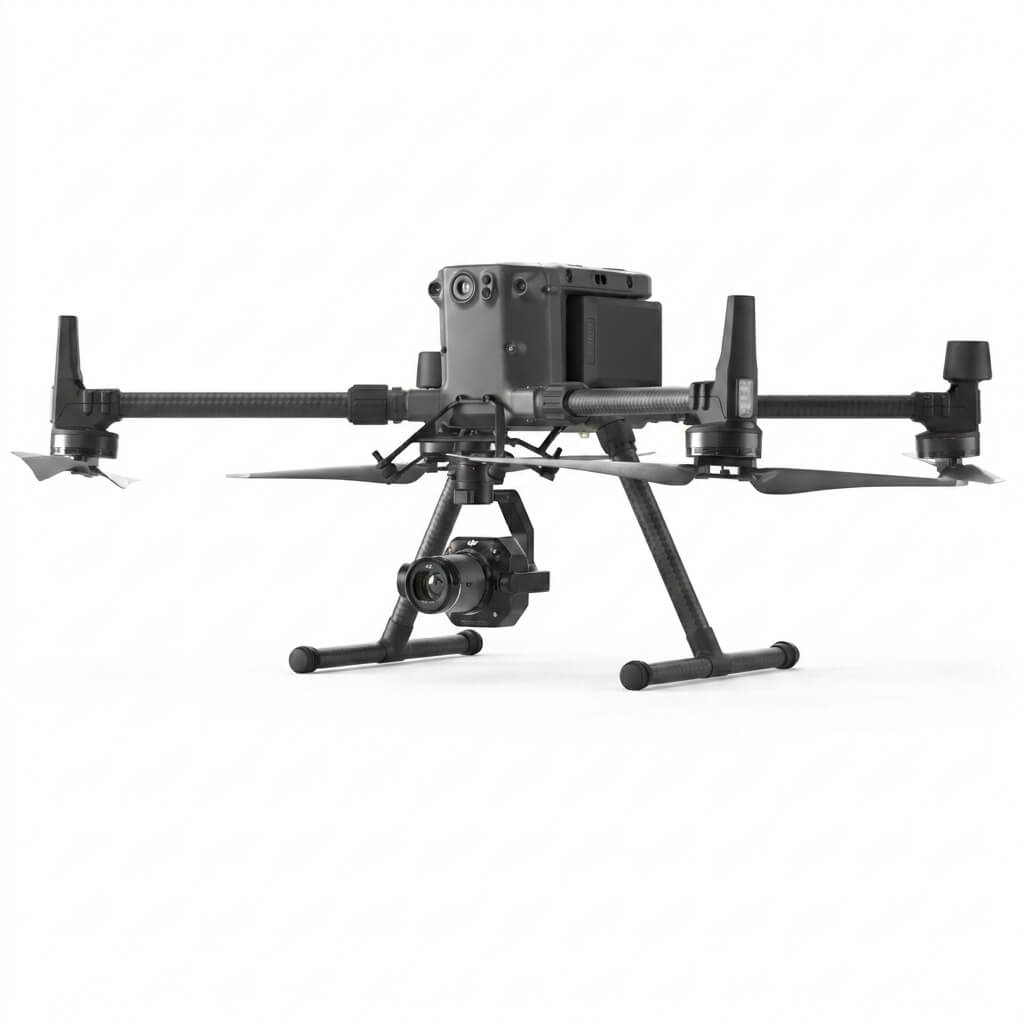
DJI M350 RTK with Zenmuse P1 delivers topographic survey by drone and aerial surveying and mapping at 2-5 cm GSD, processed in Terra Mapper into orthomosaics, DSM, DTM, and contour plans at sub-5 cm absolute accuracy. Compact and mid-size sites take days, not weeks; wide-area corridors move to the fixed-wing Trinity Pro.

Drone LiDAR Topographic Survey

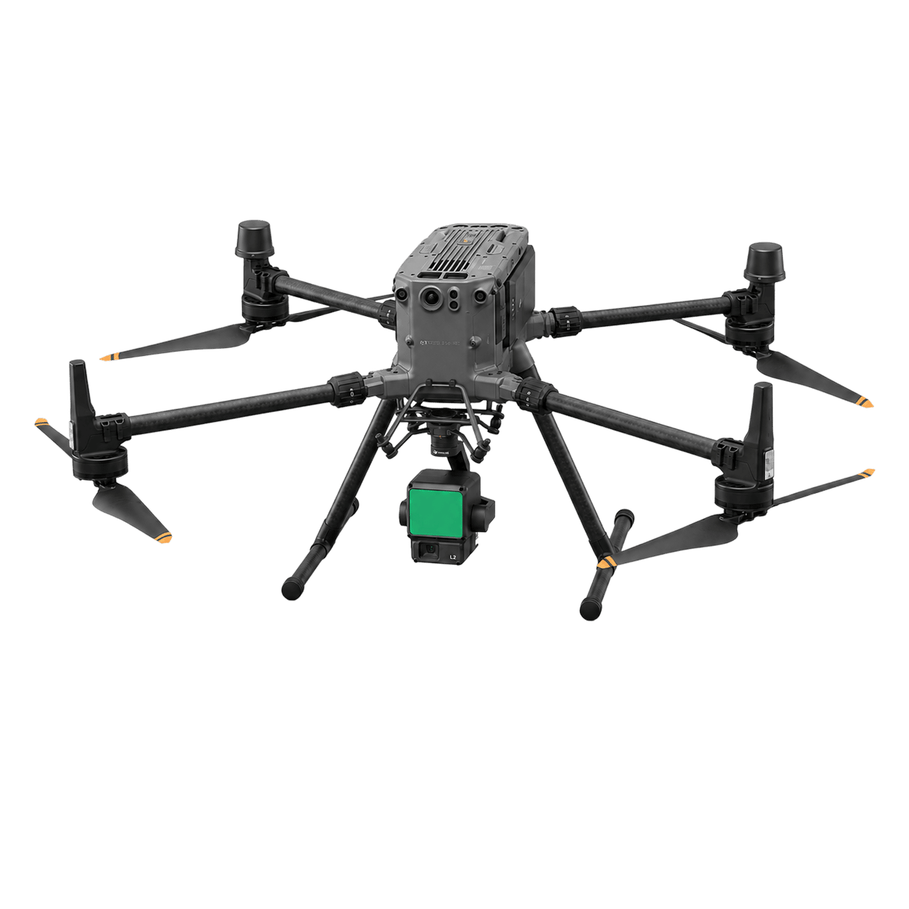
Zenmuse L2 (DJI M350 RTK) or Zenmuse L3 (M400) delivers dense LiDAR point clouds for accurate bare-earth DTM through vegetation, wadis, and complex terrain where photogrammetry alone returns an inflated surface. Classified clouds, slope and hillshade models, contour sets, and sub-5 cm terrain data are delivered per project.

GNSS RTK Control Point Survey

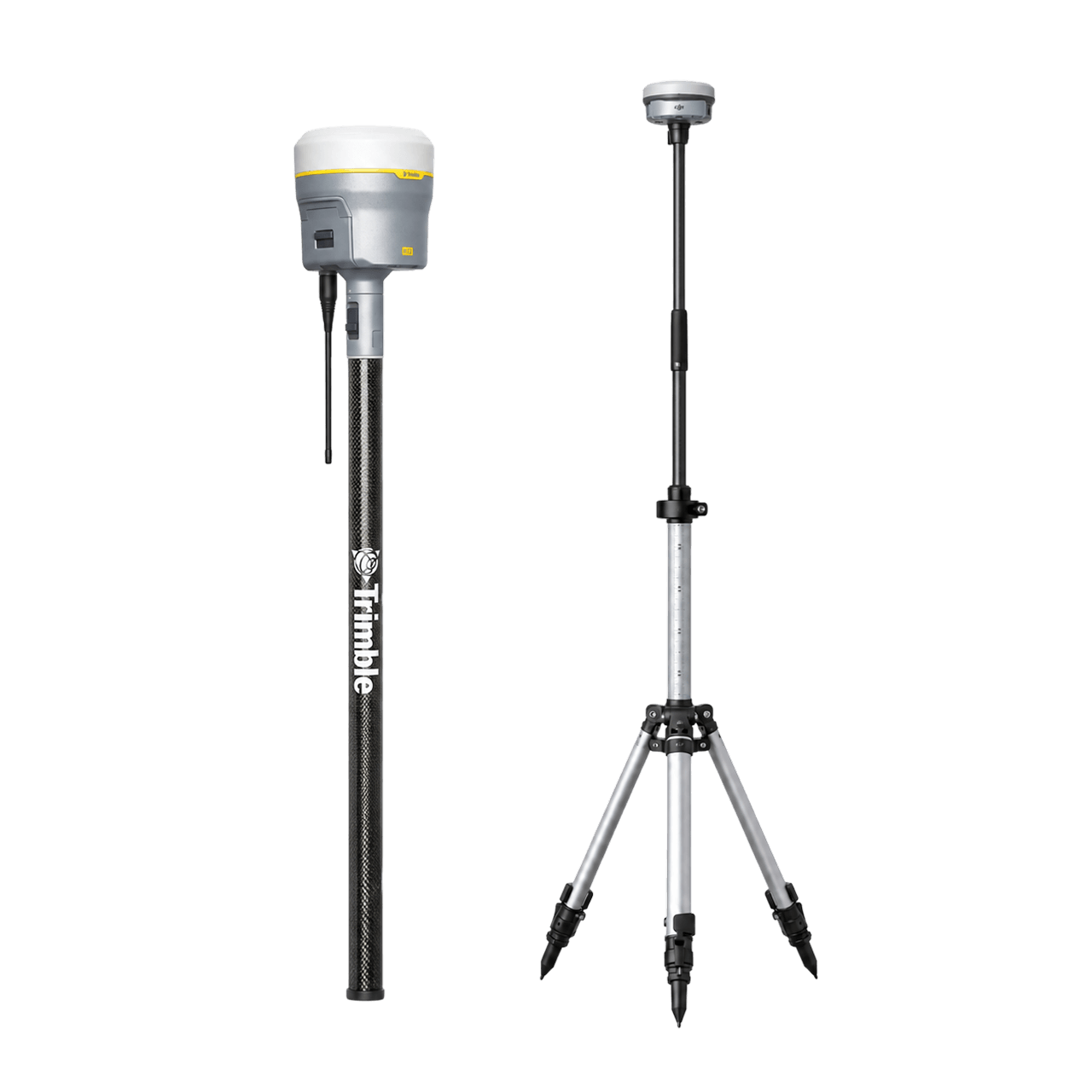
Trimble R12 receivers and DJI D-RTK 3 base stations set the geodetic foundation for every project: reference markers, ground control points, and check points tied to SANSRS/WGS84 at sub-5 cm accuracy, network-adjusted in Trimble Business Center. We also deploy FJD Trion V10i GNSS and V1t rovers for stakeout and GIS data capture.

Total Station & Conventional Survey

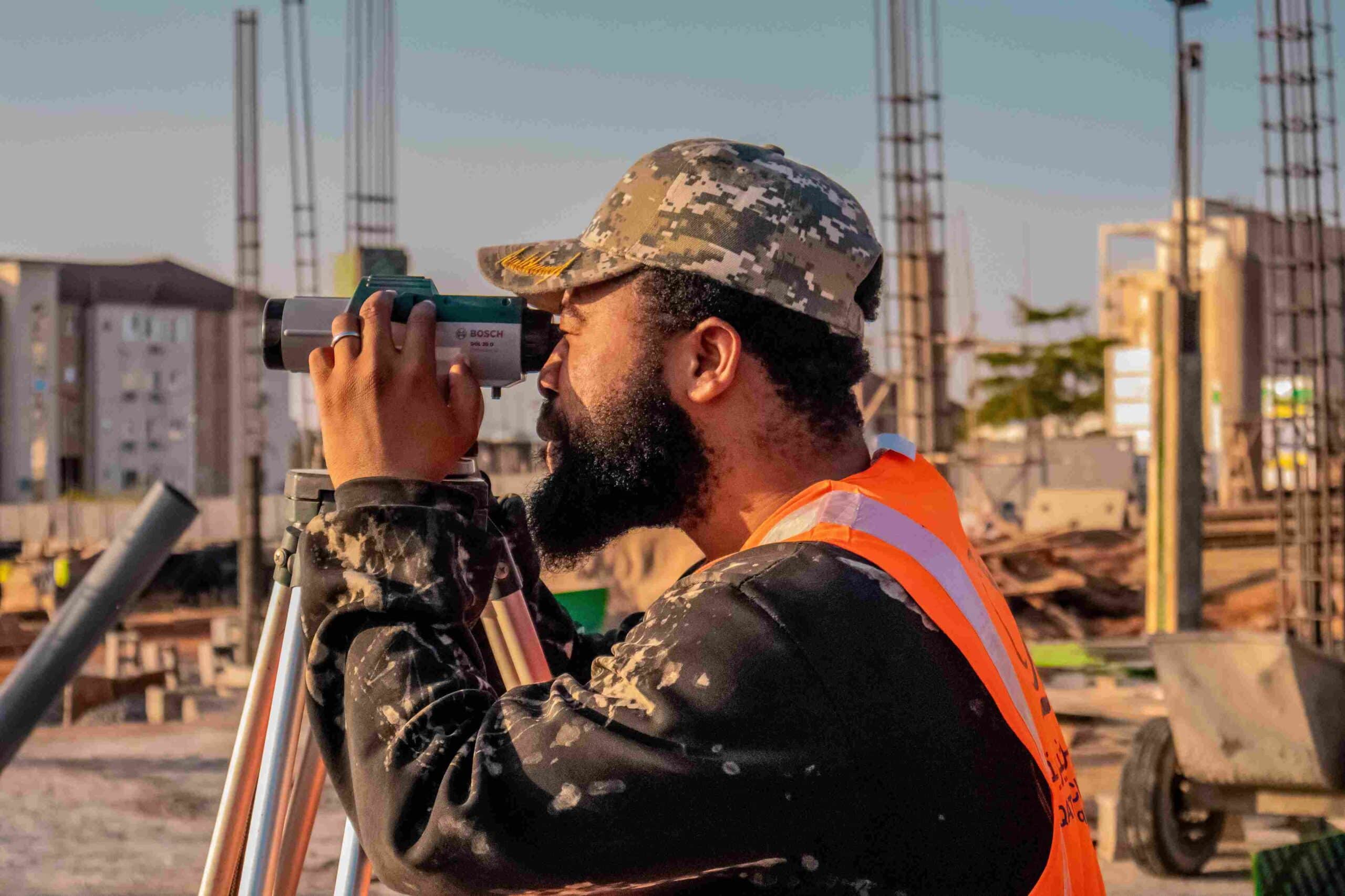
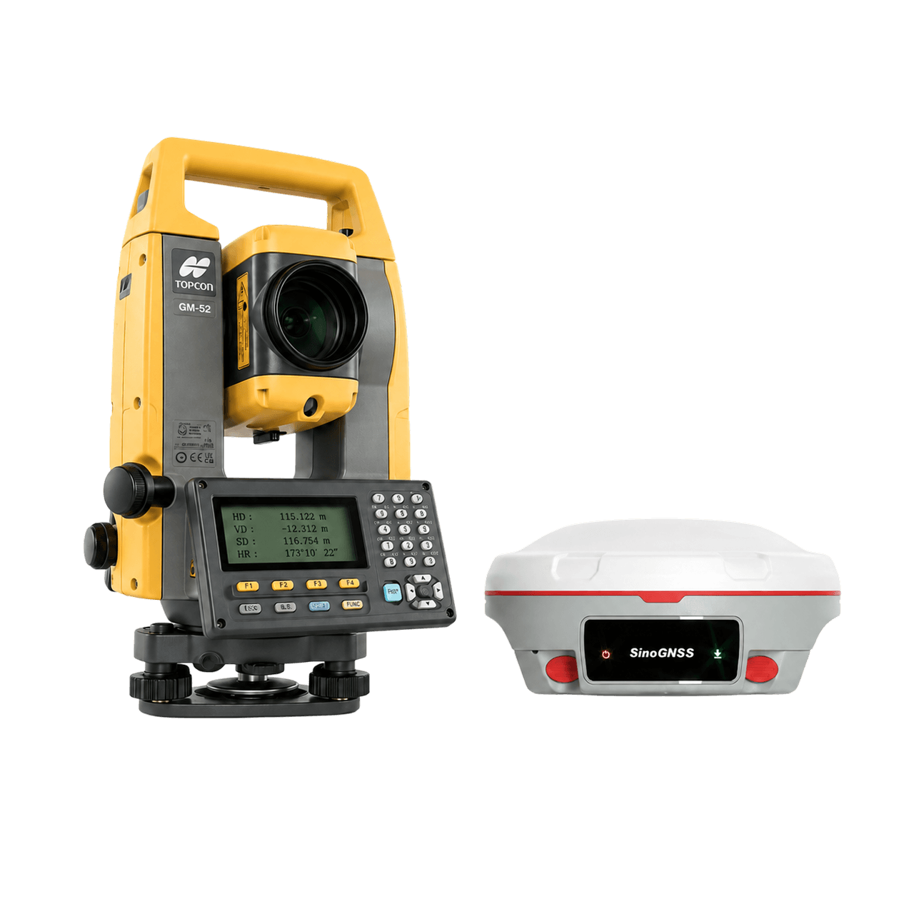
Total Station GM-52 with GNSS Sino N3 and Mars receivers handles precision detail work where drones can't reach: high-definition corridor mapping, natural ground level elevation grids, right-of-way boundaries, as-built structure positions, SAG-point crossings, overhead line clearances, and benchmark traverses on road, pipeline, and powerline ROW programmes.

Permanent Benchmark Installation

Permanent reference markers and control monuments are installed at strategic locations, typically every kilometre along a corridor and at every major turning point, tied to SANSRS/WGS84 by static GPS observation and network adjustment. These benchmarks are the datum for every construction survey on the project, eliminating coordinate drift between mobilizations.

Hybrid Drone and Conventional Survey

When a project needs aerial coverage and ground detail in one workflow, drone and conventional methods run concurrently under one team, on one mobilization. Aerial photogrammetry or LiDAR captures broad terrain while GNSS RTK and Total Station handle benchmarks, corridor detail, obstructed sections, and areas the drone can't reach.

DELIVERABLES

What You Receive From a Topographic Land Survey

Engineering-ready topographic survey outputs in standard formats for direct use by your construction, infrastructure, and GIS teams.

Orthomosaic Map (GeoTIFF, ECW, tiled)

Digital Surface Model (DSM) - GeoTIFF

Digital Terrain Model (DTM) - bare earth, GeoTIFF

3D Point Cloud (.LAS / .LAZ, classified)

CAD Topographic Plans (.DWG / .DXF, Terra GeoAIX-assisted)

Contour Lines & Elevation Grid (.DWG / CSV)

GIS-Compatible Layers (.SHP / .KML / .GeoJSON)

Survey Control Register (GCP / ICP, CSV + XYZ)

Permanent Monument Description Cards & Coordinates

Survey Accuracy Report (GCP residuals, ICP check)

3D Textured Mesh (.OBJ / .FBX)

Cut & Fill / Volumetric Report

Overhead Line Clearance & Route Profile Report

Terra MapX Portal (derive layers, live WMTS / WMS / XYZ)

PLATFORMS & APPLICATIONS

The Right Platform for Every Survey Scope

From compact sites to wide-area corridors: multirotor and fixed-wing drones, LiDAR, GNSS RTK, and Total Station, matched to each survey scope.

Construction & Infrastructure

Pre-design base surveys, permanent benchmark installation for multi-phase projects, road corridor topography, and cut-fill baseline establishment from foundation planning through to handover, for residential, industrial, and utility-sector clients.

Mining & Quarry

Pit boundary surveys, access road topography, slope stability baseline data, and recurring volumetric survey control for Saudi Arabia's mining and quarry operations. Drone photogrammetry and LiDAR handle open-pit terrain that is hazardous for ground crews, cutting site risk and survey time.

Urban Planning & Smart Cities

City-scale topographic mapping for parcel demarcation, drainage planning, and GIS integration on giga-project and urban development programmes. Drone photogrammetry delivers orthomosaic and DTM at scale, with conventional survey handling plot-level precision work.

Oil & Gas & Industrial Cities

Site preparation surveys, access road baselines, and facility area topographic mapping for O&G operators and industrial city developers across onshore projects in the Kingdom, including large-scale industrial city and onshore facility programmes.

Utilities & Power Transmission

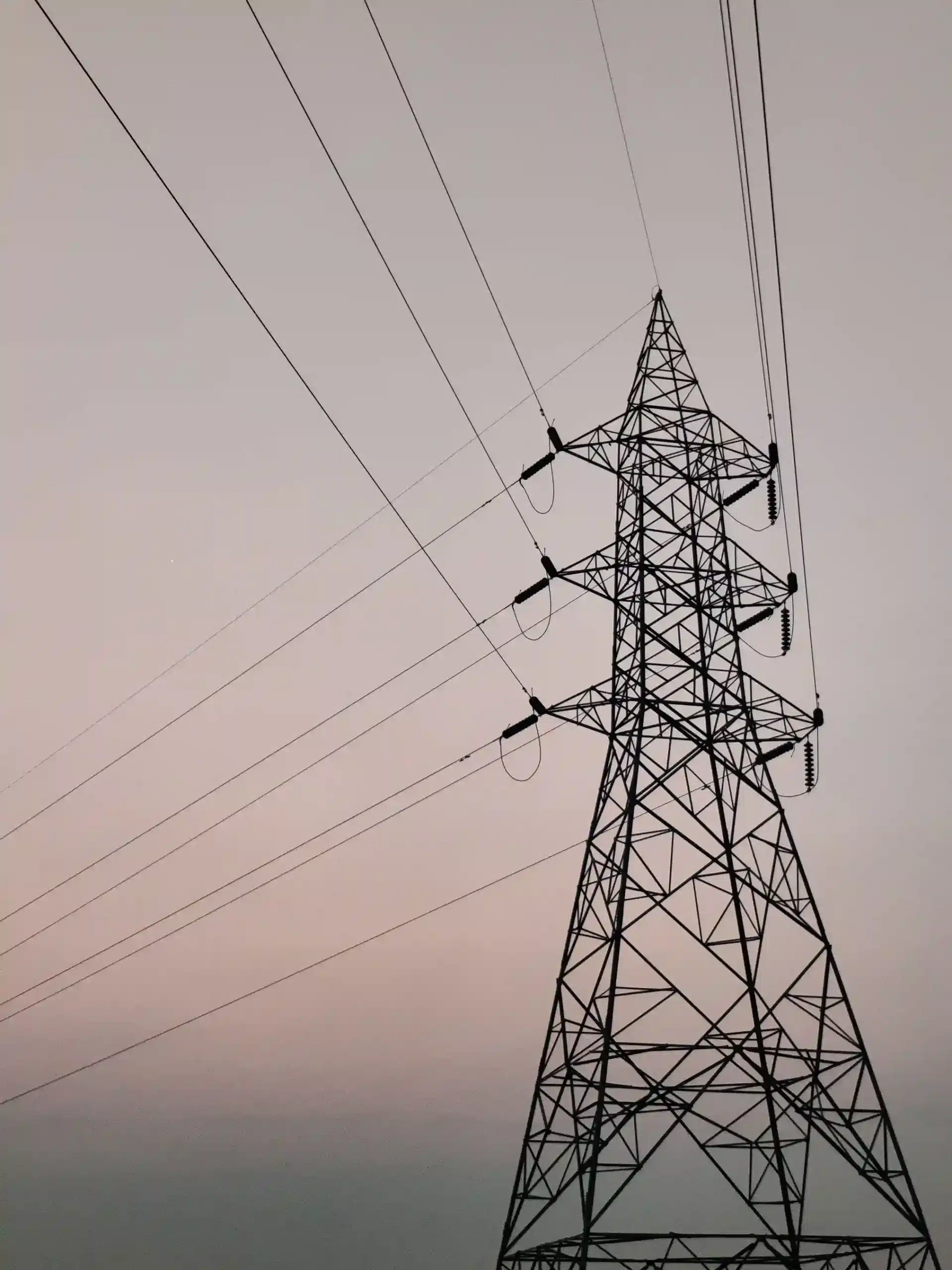
Transmission and distribution corridor topography: right-of-way boundaries, natural ground level elevation grids, as-built structure positions, overhead conductor clearance profiles, and route optimization for high-voltage line programmes, delivered by drone, by ground DGPS, or by both together.

Renewable & Solar

Site topography for solar farm and renewable energy programmes: pre-construction terrain models, array-block grading baselines, access track alignment, and cut and fill volumes, with Terra GeoAIX extracting array extents, panel rows, and access tracks from the same aerial capture.

PROVEN RESULTS

Case Studies

Topographic surveys delivered across construction sites, high-voltage power corridors, urban districts, and road alignments, by drone and by ground.

Mapping 185 km of High-Voltage Corridors with Precision Geospatial Intelligence

Executive Summary Expanding high-voltage electrical grid infrastructure requires accurate spatial baselines long before heavy construction begins. For a major energy engineering contractor constructing a 132KV double-circuit overhead transmission line (OHTL)
CERTIFIED TOPOGRAPHIC SURVEY IN SAUDI ARABIA

Frequently Asked Questions

Every route lands on the same sub-5 cm deliverable. Drone photogrammetry captures at 2-5 cm GSD and is tied to SANSRS/WGS84 by RTK GNSS ground control; drone LiDAR reaches sub-5 cm absolute accuracy on bare-earth DTM, validated against independent check points. The ground instruments that establish that control are finer still, GNSS RTK resolving to centimetre or sub-centimetre depending on session length and Total Station to millimetre level, but those are control-point figures, not terrain-surface figures, so they do not make a ground survey more accurate than an aerial one. Every delivery includes a survey accuracy assessment report with GCP residuals and ICP checks.
Yes, both. Drone operations need GACA flight authorization under GACAR Part 107, and the geospatial survey activity itself needs a valid GEOSA license. Terra Drone Arabia holds both and coordinates every permit directly with GACA and the General Authority for Survey and Geo-Information (GEOSA) before any aerial work begins, so you never file an application yourself. Permit status is tracked per project in Terra Survey Suite, which has a built-in GEOSA and GDMS permit mode. If clearance looks likely to outrun your programme, we quote the ground-only route instead.
Yes, and it is the normal case rather than the exception. Recent projects have combined conventional land survey with drone photogrammetry or LiDAR in a single-team mobilization: combined ground and aerial base mapping, topographic survey for a residential development programme, ROW and pipeline corridor survey pairing GNSS with Total Station, and multi-phase permanent benchmark installation for construction clients. One team plans, flies, measures, processes, and delivers, so there is no seam between ground control accuracy and aerial data quality, and no second mobilization to coordinate.
DSM (Digital Surface Model) is the top surface as seen from above, including buildings and vegetation. DTM (Digital Terrain Model) is bare earth, with those features removed. Road and drainage design, earthworks calculation, foundation engineering, and hydraulic modelling all need DTM. DSM is enough for volumetric comparison and change detection, where the surface features are part of what you are measuring. In vegetated terrain LiDAR separates the two far more reliably than photogrammetry, which is why it is the better choice for wadis, plantations, and mixed-terrain corridors. Most projects receive both models.
Yes, on the aerial side, and we are specific about which step is genuinely AI. Terra GeoAIX is the AI product: it learns a feature class from a handful of operator-drawn examples in seconds rather than a labelled training set, then extracts road edges, building footprints, and lane markings from photogrammetry and LiDAR datasets to about ±0.02 m boundary accuracy, digitizing work that would otherwise be traced by hand. Bare-earth DTM production from point cloud classification is rule-based processing, not AI, even though it is automated and fast. Conventional survey is not automated at all: GNSS RTK, Total Station, and benchmark coordinates are instrument-measured by GEOSA-licensed surveyors, because they form the control the aerial data is adjusted against. Every AI-derived layer is checked against that control before delivery.
A drone topographic survey uses an RTK-enabled drone carrying a photogrammetry or LiDAR sensor to capture a site from the air, then processes that capture into engineering-grade terrain products. The workflow has four parts. Ground control: GNSS RTK control points and permanent reference markers tied to SANSRS/WGS84, which set the accuracy baseline. Acquisition: a grid pattern at 80% forward overlap with 55 to 75% sidelap depending on terrain, or a LiDAR scan pattern. Processing: orthomosaic, DSM, and DTM produced in Terra Mapper. Extraction: contours, breaklines, and CAD topographic plans. On a large or hard-to-walk site this compresses the field window to one or two flying days. On a compact site a ground crew is usually the faster route to the same sub-5 cm result.
Projects run end to end in Terra Survey Suite, from inquiry through as-built, which has been assessed against the National Cybersecurity Authority’s Essential Cybersecurity Controls. Data is processed in-house in Terra Mapper and published to Terra MapX, a portal where your engineering and GIS teams get contour, slope, aspect, hillshade, and nDSM layers derived from the delivered terrain models, built-in Cut & Fill and Road Slope reports, and authenticated WMTS, WMS, and XYZ endpoints that stream straight into QGIS or ArcGIS Pro rather than a stale exported copy. Terra MapX is native to KSA-GRF17 and the Saudi UTM zones, and data is held on organisation-controlled storage inside the Kingdom, aligned to the PDPL under Royal Decree M/19. Terra Cloud handles distribution where secure client access is required.
Yes. Every survey we quote carries two routes to the same deliverable. Option A is drone: photogrammetry or LiDAR with GNSS RTK ground control tying the data to SANSRS/WGS84. Option B is ground: GNSS RTK survey with Trimble R12 or Sino receivers, Total Station for detail points and obstructed areas, and FJD Trion S2 mobile SLAM scanning, handheld or backpack with no station setup, where dense geometry is needed. Both land on sub-5 cm accuracy and the same CAD, contour, DTM, and coordinate outputs. We propose Option B whenever GACA and GEOSA clearance looks likely to outrun your programme. We hold both licenses and file the permits ourselves, so this is a scheduling decision rather than a compliance one, and you can start on the ground and add aerial capture once clearance comes through.

From control points to CAD deliverables: GACA and GEOSA-certified, one in-house team

Ready to Survey Your Next Project?

Aerial drone view of Riyadh skyline in Saudi Arabia

Get the Drone & Geospatial Brief, Saudi Arabia

Real project breakdowns, GACA regulatory updates, and field-tested case studies from oil and gas, mining, and infrastructure operations. Used by engineering and procurement teams at Saudi Arabia’s largest operators. 

Joined by 2K+ industry professionals in Saudi Arabia.