

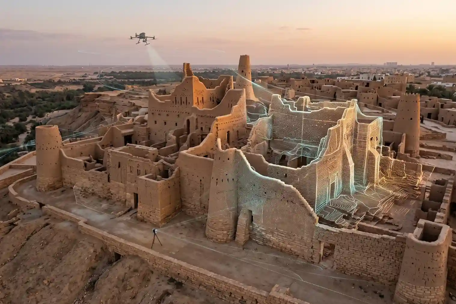
Ancient mudbrick towers, coral-stone structures, masonry arches, and historic timber frames face continuous environmental threats.
Solar radiation, wind-blown sand erosion, thermal expansion cycles, underground moisture migration, and surrounding urban development weaken the structural foundations of cultural heritage landmarks over time.
Unmonitored structural deterioration leads to irreversible material loss, wall displacement, roof collapse, and the destruction of non-renewable historical artifacts.
Evaluating the structural health of ancient landmarks using traditional manual survey methods presents severe operational limits.
Physical tape measurements, manual elevation leveling, and site visual inspections are slow and produce fragmented spatial records.
Furthermore, mounting heavy scaffolding or walking across delicate, decaying rooflines risks damaging fragile historic fabric while exposing field personnel to structural collapse hazards.
Digitizing cultural heritage requires non-intrusive, contact-free inspection tools that capture exact three-dimensional geometry without touching vulnerable structures.
As municipal authorities and cultural trusts adopt spatial technology, industry reporting from Fortune Business Insights showing the global digital twin market reached SAR 91.80 billion in 2025 and is projected to expand to SAR 1,442.96 billion (SAR 1.44 trillion) by 2034 at a 35.40% CAGR, driven by cultural heritage authorities, municipalities, and royal commissions adopting 3D digital twins for structural health monitoring and historic asset lifecycle management, underscores the global transition toward digital asset governance.
Multi-Sensor Capture: Aerial LiDAR, Drone Inspection, and SLAM Scanning
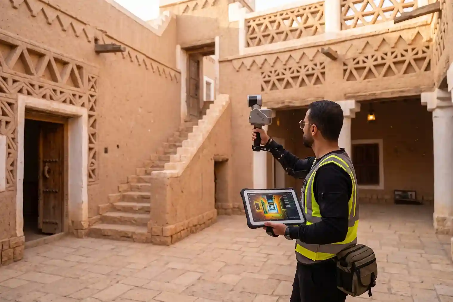
Creating an accurate three-dimensional digital twin of a historic district requires combining aerial and terrestrial reality capture tools.
Because ancient urban areas feature narrow alleyways, irregular building footprints, high perimeter walls, and inaccessible roofs, no single sensor can capture every physical detail.
Aerial LiDAR Survey and High-Altitude Photogrammetry
Aerial survey operations deploy enterprise drone platforms, such as the DJI Matrice 400 (M400), equipped with integrated LiDAR and optical photogrammetry payloads like the DJI Zenmuse L3.
Flying automated flight grids over historic districts captures high-density 3D spatial point clouds and high-resolution aerial imagery across rooflines and upper building facades.
Aerial LiDAR sensors project high-frequency laser pulses to capture exact roof slopes, parapet wall geometries, and vertical building heights.
Unlike optical photogrammetry alone, laser pulses penetrate narrow gaps between overhanging timber structures and shade canopies, capturing true ground surface elevations to generate accurate Digital Terrain Models (DTM).
Quantifying the operational and safety benefits of drone-based heritage audits, technical research published on ResearchGate proving that deploying non-contact aerial LiDAR and drone inspection over delicate historic structures and rooflines compresses site survey execution time to under 30 minutes per building (an 80% duration reduction), lowers site capture costs by over 50%, and achieves 100% direct personnel safety risk elimination by removing surveyors from fragile, decaying roofs and hazardous scaffolding confirms the value of aerial reality capture.
Terrestrial Mobile SLAM Laser Scanning
While aerial drones map roof geometry and upper facades, capturing narrow streetscapes, internal courtyards, covered walkways, and interior rooms requires ground-level scanning.
Field technicians utilize mobile Simultaneous Localization and Mapping (SLAM) laser scanners, such as the FJD Trion Laser Scanner.
Technicians carry mobile SLAM units while walking through historic alleys and interior spaces at normal walking speeds.
Onboard SLAM algorithms calculate the sensor’s exact spatial position in real time using geometric feature tracking, capturing millions of 3D points per second without requiring tripods or satellite GPS signals.
Ground point clouds capture fine architectural details, including doorway arches, wall lean angles, decorative masonry textures, and wooden window frame deformations with millimeter precision.
Validating the industry adoption of mobile 3D reality capture, market research from Fortune Business Insights demonstrating the global 3D scanning market reached SAR 21.53 billion in 2025 and is projected to reach SAR 62.44 billion by 2034 at a 12.56% CAGR, driven by heritage architecture and civil engineering teams adopting terrestrial SLAM laser scanners to accelerate indoor, courtyard, and facade as-built documentation by up to 60% over traditional manual measurement methods, highlights the operational speed of SLAM laser scanning.
Structural Health Monitoring, HBIM, and AI Defect Analysis
Combining aerial LiDAR point clouds with terrestrial SLAM scans generates a complete 3D spatial model of the historic structure.
However, protecting ancient buildings requires evaluating internal material conditions and structural defects hidden beneath surface plasterwork.
Radiometric Thermal Diagnostics and Non-Destructive Testing (NDT)
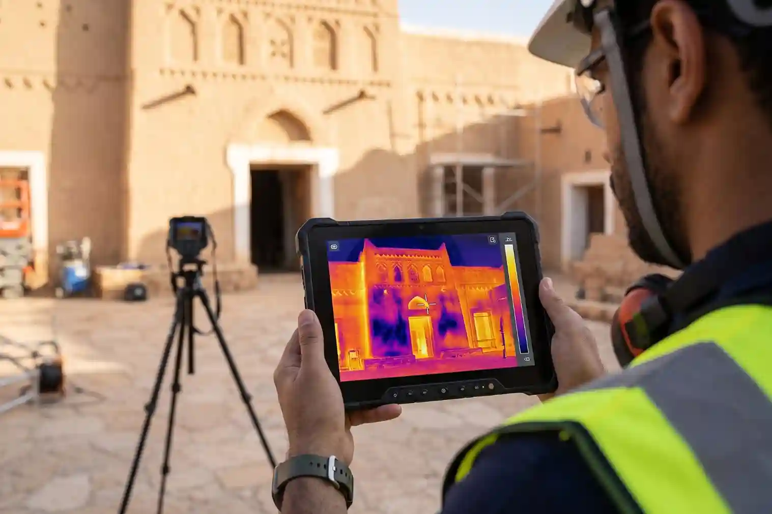
Mounting multi-sensor visual and thermal payloads, such as the DJI Zenmuse H30T, onto aerial drones enables non-destructive thermal inspections across historic facades and roofs. Radiometric thermal cameras measure subtle surface temperature variations across building envelopes:
- Moisture Trapping Detection: Damp earth, trapped rainwater, and leaking internal pipes exhibit high thermal mass, showing as cold thermal anomalies on exterior plaster surfaces. Detecting subsurface moisture early prevents timber rot and salt crystallization that breaks down mudbrick and coral stone.
- Plaster Delamination and Subsurface Voids: Subsurface air pockets between historic stone masonry and outer plaster layers create localized thermal resistance. Thermal imagery identifies detached plaster sections before major wall spalling occurs.
Heritage Building Information Modeling (HBIM) and Computer Vision
Co-registering aerial point clouds, terrestrial SLAM scans, and thermal datasets into a single coordinate system creates the foundation for Heritage Building Information Modeling (HBIM).
Unlike standard modern construction BIM models based on uniform geometric shapes, HBIM models represent irregular historical geometries, including sagging timber beams, leaning mudbrick walls, and uneven stone courses.
Deep learning computer vision algorithms process captured high-resolution image sets, automatically identifying, measuring, and tagging structural anomalies:
- Facade Crack Measurement: Algorithms measure crack lengths, widths, and orientation patterns across stone and plaster surfaces, flagging active structural movement.
- Material Weathering Mapping: Machine vision models classify areas of surface erosion, stone scaling, and biological growth, assigning condition grades to guide restoration priority.
Long-Term Conservation Governance and ArcGIS Digital Twin Integration
Transforming raw 3D point clouds and HBIM models into an operational digital twin requires publishing spatial deliverables into enterprise Geographic Information System (GIS) environments, such as Esri ArcGIS Enterprise.
Centralizing 3D scene layers, high-resolution orthomosaics, and thermal defect points creates a unified spatial registry accessible to municipal planners, conservation architects, and structural engineers.
Connecting spatial digital twins to municipal asset dashboards provides three primary operational advantages for heritage governance:
- Time-Stamped Baseline Archives: Recurring LiDAR and SLAM surveys establish repeatable 3D spatial baselines. Comparing annual scans using point-cloud change detection algorithms identifies subtle structural movements, wall tilting, or foundation settling before structural collapse occurs.
- Targeted Restoration Planning: Georeferenced defect logs allow conservation teams to plan precise, minimal interventions. Architects specify exact material quantities and locations for localized timber reinforcement or plaster repair, avoiding unnecessary structural interventions that disrupt historic authenticity.
- Digital Tourism and Remote Preservation: High-resolution 3D digital twins enable virtual access for scholars, researchers, and public visitors worldwide, generating educational engagement while protecting physically fragile landmarks from excessive foot traffic.
Maintaining a secure, auditable digital record of cultural assets ensures that historic districts across Saudi Arabia are documented, monitored, and preserved on a precise spatial foundation for future generations.
Consult with Our Experts
Preserve cultural heritage landmarks and historic districts with advanced 3D reality capture, aerial LiDAR, mobile SLAM laser scanning, and digital twin solutions.
Contact our geospatial specialist to build sustainable conservation frameworks for your historic assets.

 English