

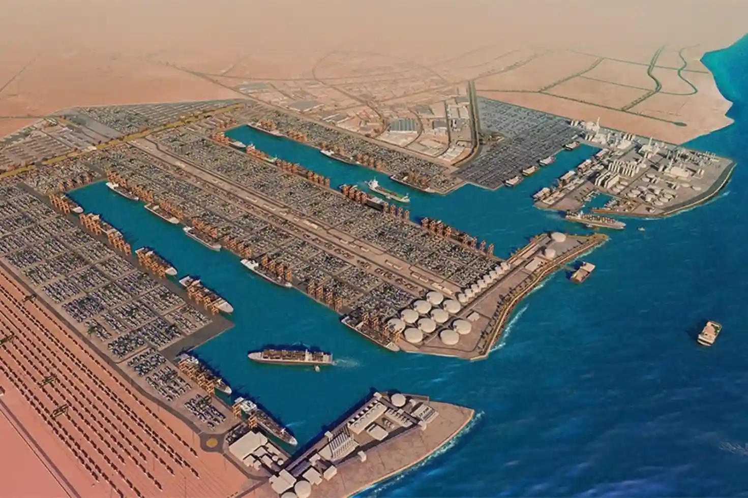
King Abdullah Port, located within King Abdullah Economic City (KAEC) along the Red Sea coast, serves as a major deep-water logistics hub in Saudi Arabia.
Handling over 2 million TEUs annually, the port operates extensive deep-water berths, container terminals, bulk facilities, and roll-on/roll-off (RoPax) terminals.
Maintaining structural integrity across these large-scale marine assets is critical to ensuring uninterrupted maritime trade and supply chain operations.
Port infrastructure operates in an aggressive marine environment. Continuous exposure to saltwater splash zones, tidal currents, marine bio-fouling, thermal expansion, and heavy vessel thruster scour causes progressive structural degradation.
Above the waterline, ship-to-shore (STS) gantry cranes, container yard lighting towers, and concrete quay wall caps suffer from salt-induced rebar corrosion, concrete spalling, and mechanical fatigue.
Below the waterline, submerged quay wall pilings, berth beds, and wastewater outfall channels face seabed scour, marine growth accumulation, and submerged structural cracking.
As port authorities scale up digital asset maintenance, market analysis from Fortune Business Insights shows the global inspection drone market reaching SAR 17.63 billion by 2034, driven by port authorities and maritime terminals adopting aerial and subsea robotic surveillance for asset maintenance, highlighting a global transition toward automated inspection workflows.
Combining aerial drones with underwater Remotely Operated Vehicles (ROVs) provides complete structural visibility across both above-water and subsea port assets.
Aerial Infrastructure Monitoring and Thermal Diagnostics
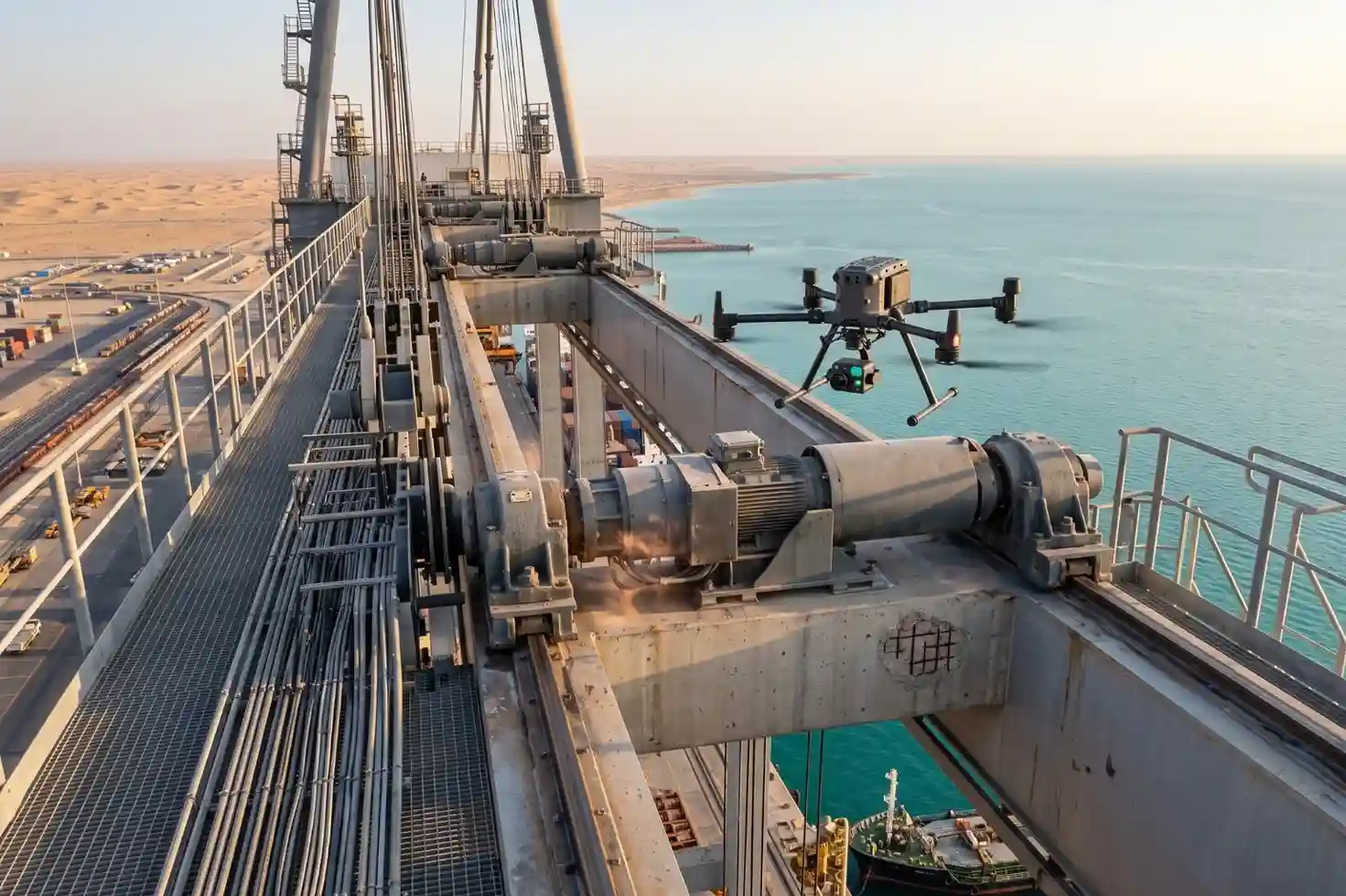
Auditing above-water port infrastructure requires high-altitude flight stability, high-magnification optical zoom, and thermal sensing capabilities.
Deploying enterprise flight platforms, such as the دي جي آي ماتريس 400 (إم 400) equipped with the DJI Zenmuse H30T multi-sensor payload, allows inspection teams to examine tall terminal assets safely from the air.
The DJI Zenmuse H30T payload combines multi-sensor capabilities for structural diagnostics:
- High-Magnification Optical Zoom: A 40 MP zoom camera featuring 34 optical zoom and up to 400 digital zoom captures high-resolution imagery of fine structural defects. Integrated Electronic Dehazing algorithms cut through marine humidity, sea fog, and solar glare along the Red Sea coast.
- High-Resolution Radiometric Thermal Sensor: A 12801024 radiometric thermal camera with high temperature sensitivity (NETD50mK) detects subtle surface temperature anomalies. Thermal imaging pinpoints overheating electrical transformers on STS cranes, friction wear in conveyor bearings, and thermal discharge plumes from industrial outfall pipes.
- Laser Rangefinder Coordinate Tagging: An integrated 3,000-meter Laser Rangefinder logs exact 3D spatial coordinates (X,Y,Z) for detected structural anomalies, automatically generating georeferenced defect markers.
Operating heavy-lift drones removes the need to deploy scaffolding, rope-access climbers, or elevated work platforms around active container yards and berth cranes.
Quantifying the operational impact of airborne surveys, technical research published on ResearchGate demonstrates that deploying aerial drones for visual and thermal infrastructure audits reduces average inspection time from 66.45 minutes down to 21.20 minutes per asset (a 68.1% improvement in time efficiency), cuts direct operational costs by 54%, and improves structural defect detection accuracy by 159.7% compared to manual inspections, proving the analytical and economic value of aerial thermography and optical zoom auditing.
Subsea ROV Inspections for Submerged Infrastructure
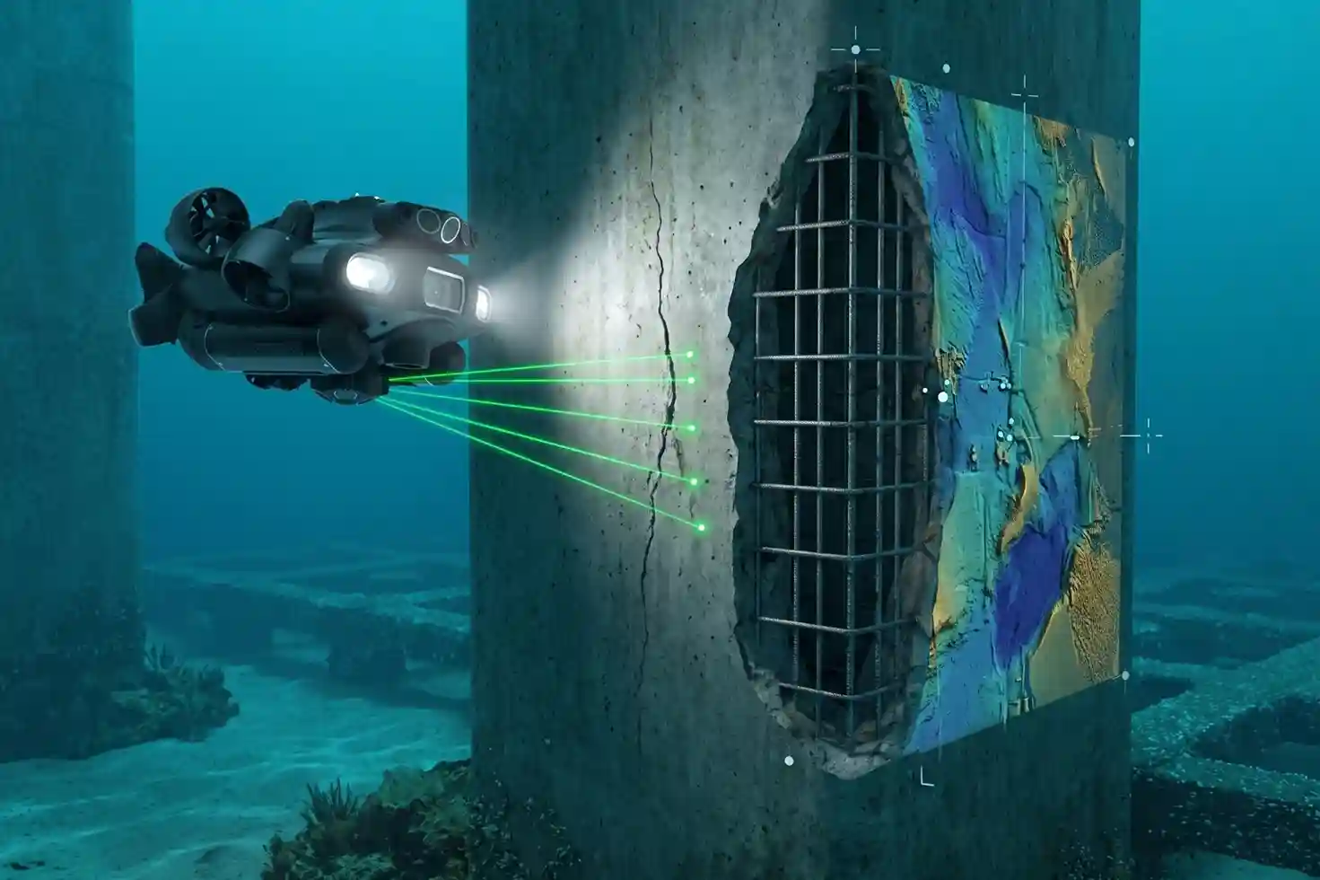
While aerial drones audit structures above the waterline, submerged port assets require dedicated subsea robotic systems.
Deep-water berths, quay wall pilings, seabed scour aprons, and underwater marine outfalls remain hidden from aerial sensors.
Deploying compact underwater Remotely Operated Vehicles, such as the QYSEA FIFISH Industrial ROV, allows port engineers to inspect submerged structures without sending human divers into hazardous berth waters.
The QYSEA FIFISH ROV utilizes specialized subsea inspection payloads:
- Low-Light 4K Imaging and LED Lighting: A high-sensitivity 4K camera paired with a 12,000-lumen LED lighting array provides clear video feeds inside dark, turbid port waters, recording concrete erosion, exposed rebar, and marine growth coverage.
- 2D Multibeam Imaging Sonar: Imaging sonar penetrates murky water conditions, mapping subsea seabed profiles, detecting structural voids beneath quay wall foundations, and locating underwater pipeline defects.
- Laser Scalers and Sample Collection: Parallel laser scalers project calibrated millimeter reference dots onto submerged structures to measure crack widths and corrosion pitting depths, while a robotic arm enables physical sampling.
Conducting subsea inspections via tethered ROVs eliminates severe occupational safety risks associated with commercial diving operations in active shipping channels.
Eliminating subsea hazards for human personnel, maritime engineering research published in Frontiers in Robotics and AI proving that replacing traditional commercial diving teams with underwater Remotely Operated Vehicles (ROVs) reduces underwater operational inspection costs by 50% to 90%, compresses inspection duration by approximately 60%, and achieves 100% direct personnel risk elimination by keeping human divers out of hazardous active berths confirms the financial and safety advantages of subsea robotics.
Digital Twin Asset Governance and Port Operations Integration
The core value of combining aerial drone and subsea ROV data lies in unifying multi-domain inspection outputs into centralized asset management systems.
- Enterprise GIS and Port Asset Integration: Georeferenced aerial orthomosaics, 3D thermal models, and subsea ROV inspection logs import directly into Esri ArcGIS Enterprise dashboards and King Abdullah Port Computerized Maintenance Management Systems (CMMS). Maintenance managers review tagged defect severity ratings, view linked photo evidence, and issue automated repair work orders directly to maintenance contractors.
- Regulatory Compliance and Data Governance: Flight operations follow Civil Aviation Authority (GACA) airspace permits, Saudi Air Navigation Services (SANS) NOTAM coordination, and General Authority for Survey and Geospatial Information (GEOSA) guidelines. All captured inspection imagery and structural datasets adhere strictly to Saudi Data and Artificial Intelligence Authority (SDAIA) data management standards and National Cybersecurity Authority (NCA) security requirements.
- Predictive Maintenance Baseline: Scheduled, recurring drone and ROV surveys establish time-stamped digital baselines across all port assets. Tracking structural degradation over time shifts port facility management from reactive emergency repairs to predictive, data-driven asset governance.
Consult with Our Experts
Streamline your port infrastructure inspections, aerial thermal audits, and subsea ROV marine surveys.
Contact our specialist to deploy advanced aerial and underwater robotic solutions for your port facilities.

 العربية