


شعار TDSA إيجابي طويل

GIS Solutions & Spatial Analytics in Saudi Arabia

We turn drone, LiDAR, and ground-survey outputs into structured GIS data, ArcGIS geodatabases, and spatial analysis workflows. Terra GeoAIX can accelerate feature extraction, while on-premises deployment is available when required by your security architecture and project scope.
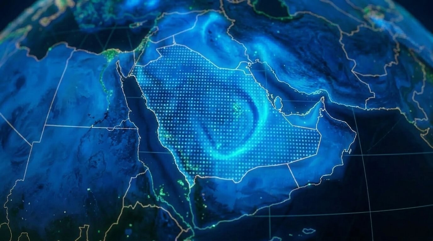
خريطة نظم المعلومات الجغرافية الرقمية للمملكة العربية السعودية مع تحليلات البيانات المكانية ونقاط الاتصال لإدارة البنية التحتية للمؤسسات

WHY THIS GIS WORKFLOW

From Static Maps to Live Enterprise Spatial Intelligence

A GIS is only as reliable as the field survey feeding it. We connect aerial capture, ground survey, feature extraction, and enterprise GIS architecture into an integrated workflow with validation at key handoff points.

Client-Controlled On-Premises Architecture

Configure Esri ArcGIS Enterprise on client-controlled infrastructure when project security requirements call for it. Data residency, access controls, backups, and compliance responsibilities are defined in the agreed architecture and governance process.

Field Capture to Structured Geodatabase

Reduce handoff errors by validating drone photogrammetry, LiDAR, GNSS control, coordinate reference systems, and spatial schemas before delivery to the client GIS environment.

AI-Assisted Extraction with Terra GeoAIX

Use Terra GeoAIX to help derive vector features from suitable aerial imagery. In a defined internal reference test, it reached 94.6% performance on a relief-classification task against manual tracing. Results vary by feature class and input quality, and outputs require operator review.

Procedural 3D with Terra 2.5D

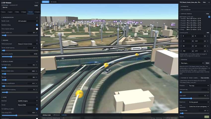
Render GeoPackage vector layers as interactive 3D browser scenes without heavy tileset preprocessing. Local, offline, or client-controlled deployments can keep survey files within the selected environment.

OGC Endpoints & Enterprise Feeds

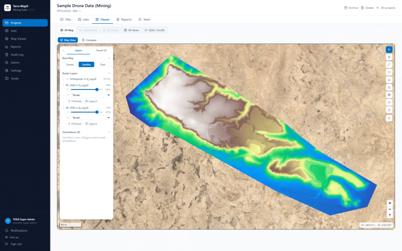
When Terra MapX is configured for the project, publish WMTS, WMS, and XYZ map services to client QGIS and ArcGIS environments, giving teams shared access to current published layers.

Geodetic Reference & SANSRS Support

Deliver the agreed coordinate reference system, including SANSRS and WGS84-based projections where required, with survey control and quality-assurance records documented to the project scope and applicable GEOSA requirements.

THE SPATIAL ANALYSIS CHALLENGE

Why Disconnected GIS Data Stalls Enterprise Decisions

Without a structured spatial pipeline, organizations accumulate uncoordinated CAD drawings, unstandardized drone orthophotos, and legacy spatial layers that can undermine reliable engineering analysis.

CAD & GIS Data Silos

Project files scattered across DWG, DXF, and shapefile formats leave engineering, operations, and planning departments with conflicting spatial baselines.

Manual Digitization Bottlenecks

Manual tracing of infrastructure features from high-resolution imagery can take days or weeks depending on the area, feature classes, and review requirements, while introducing drafting inconsistencies.

Cloud Security & Sovereign Restrictions

Sensitive infrastructure, defense, and energy datasets may have restrictions on where and how detailed coordinates are stored or processed. The applicable controls depend on data classification, client governance, and project requirements.

Outdated Spatial Baselines

Planning with outdated satellite or municipal layers can miss recent brownfield changes, increasing the risk of rework and redesign.

Coordinate & Projection Mismatches

Surveys delivered in different coordinate reference systems without geodetic transformation can create overlay errors that undermine corridor analysis and clash checks.

Static Maps That Lack Predictive Insight

Displaying dots on a map is not analytics. Terrain modeling, network routing, and spatial statistics can give asset managers more useful inputs for risk assessment and planning.

التقنيات و الأساليب

Enterprise Spatial Analysis & Geodatabase Design

Our GIS specialists can apply structured spatial data engineering, from relational geodatabase architecture to machine-learning-assisted feature classification and corridor routing.

Enterprise Geodatabase Architecture

Design and configure multi-user enterprise geodatabases on Esri ArcGIS Enterprise, subject to the client's ArcGIS licensing, schema, and IT standards. This can include topology rules, spatial domains, subtype validation, and versioned editing workflows.

GeoAI Feature Extraction & Vectorization

Use Terra GeoAIX for machine-learning-assisted classification and boundary delineation of suitable road, kerb, manhole, building, and solar features. Outputs can be prepared in GeoPackage or Shapefile formats and require operator review and QA.

Corridor Route Optimization & Terrain Modeling

Use least-cost path analysis to support pipeline, power-line, and haul-road planning. Depending on the survey inputs, the workflow can include DTM/DSM derivation, slope assessment, cut-and-fill volume estimates, and watershed runoff modeling.

Location Intelligence & Spatial Autocorrelation

Apply multi-criteria spatial decision analysis (MCDA), asset proximity scoring, hotspot clustering, land suitability modeling, and risk-mapping inputs to support maintenance planning across utility and industrial asset networks.

From Survey Data to Enterprise Spatial Intelligence

Our GIS workflows can combine TDSA platforms : Terra MapX, Terra GeoAIX, and Terra 2.5D Viewer with Esri ArcGIS Enterprise for structured data delivery aligned with agreed project and security requirements.

Capture Ingestion

Ingest drone photogrammetry, LiDAR point clouds, and GNSS control into Terra MapX when the platform is configured for the project.

AI Extraction

Terra GeoAIX can help detect and vectorize suitable asset boundaries and features; outputs are reviewed and quality-checked before delivery.

GIS Geodatabase

Use ArcGIS Pro to validate topology, schema attributes, and coordinate references as part of the agreed QA process.

Web Delivery

Publish WMS/WMTS feeds through Terra MapX and browser 3D scenes through Terra 2.5D, depending on the selected deployment and project configuration.

المخرجات

Enterprise-Ready Spatial Data Formats

Structured spatial data products prepared for integration with enterprise GIS, CAD, and asset management systems, subject to the client’s schema and system configuration.

File Geodatabase (.gdb) or Enterprise Geodatabase Configuration

Standard GIS Vector Layers (GeoPackage / Shapefile)

OGC Map Services (WMS / WMTS / XYZ), where configured

Interactive Web GIS Dashboards & Portals, by scope

Digital Elevation & Surface Models (DEM / DTM / DSM), where included

Orthomosaic Rasters (GeoTIFF / ECW), where included

Corridor Alignment & Route Optimization Reports, by scope

Topology QA/QC & SANSRS Geodetic QA Record, where required

المنصات والتطبيقات

Enterprise Tools Matched to High-Stakes Operations

We combine established GIS environments with TDSA tools to support geographic workflows across infrastructure, energy, urban, mining, and renewable-energy applications in Saudi Arabia.

Corridor & Pipeline Infrastructure

Typical applications include route planning, right-of-way (ROW) clearance analysis, and elevation-profile modeling for oil, gas, and power-transmission projects in Saudi Arabia.

التخطيط الحضري والمدن الذكية

Potential applications include land-use classification, parcel geodatabase integration, building-footprint vectorization, and 3D zoning analysis for large development programmes and municipal workflows.

Mining & Quarry Asset Management

Potential applications include highwall slope assessment, haul-road grade planning, cut-and-fill change detection from repeat surveys, and spatial environmental-buffer monitoring.

Renewable Energy & Solar Siting

Potential applications include multi-criteria site-suitability analysis, terrain-based solar modeling, flood-runoff risk mapping, and solar-panel inventory tracking with GeoAI where suitable inputs and models are available.

نتائج مثبتة

Published Spatial Analytics Case Studies

Real project outcomes demonstrating engineering-grade terrain modeling, contour analysis, and large-scale spatial data integration in Saudi Arabia.

Hybrid Topographic Surveying for Critical Utility Expansion

Project Profile Parameter Specifications Industrial Sector Municipal Infrastructure & Utilities Project Stage Pre-Construction Land & Aerial Topographic Survey Field Execution Window Hybrid Geodetic Control, Ground Surveying, & Drone Remote Sensing


GIS & SPATIAL ANALYTICS FAQ

أسئلة متكررة

GIS solutions and spatial analytics transform survey measurements, drone photogrammetry, and LiDAR point clouds into structured spatial data and databases. Terra Drone Arabia can connect these outputs with Esri ArcGIS to support route planning, land administration, asset visualization, and maintenance risk analysis.
Where required, we can configure Esri ArcGIS Enterprise, Terra MapX, or related workflows on client-controlled or approved in-Kingdom infrastructure. Data residency, access control, backup, and cybersecurity requirements are defined by the project architecture and the client’s governance process.
Through Terra MapX, drone LiDAR point clouds, multispectral imagery, and orthomosaics can be processed, standardized, and published as georeferenced GIS layers, GeoPackages, and WMTS/WMS/XYZ feeds after schema, CRS, and quality checks. Integration timing depends on the source data and client environment.
We can provide commonly supported formats, including Esri File Geodatabase (.gdb), enterprise geodatabase configurations for ArcGIS Enterprise, GeoPackage (.gpkg), Shapefile (.shp), and web map services such as REST endpoints, WMS, and WMTS. Final integration depends on the client’s schema, licence, endpoint access, and validation process.
Terra GeoAIX is our AI-assisted feature-extraction workflow for deriving vector features from suitable aerial imagery and point-cloud inputs. Internal reference benchmarks include 94.6% performance for a defined classification task; results vary by feature class, input resolution, training examples, and operator review.
Depending on the available inputs and agreed scope, our spatial analytics can include corridor slope analysis, cut-and-fill volumetrics, viewshed analysis, least-cost route alignment for pipelines and transmission lines, proximity scoring, flood-risk modeling, and asset condition or degradation indexing.
We can deliver data referenced to SANSRS and WGS84-based projections where required, with survey control and quality-assurance documentation defined in the project scope and applicable GEOSA requirements.
Timing depends on the area, source data, feature classes, review requirements, and client milestones. We agree delivery phases and timelines during project scoping.

From survey data to enterprise GIS workflows.

Ready to Build Your Enterprise GIS Database?

Aerial drone view of Riyadh skyline in Saudi Arabia

Get the Drone & Geospatial Brief, Saudi Arabia

Real project breakdowns, GACA regulatory updates, and field-tested case studies from oil and gas, mining, and infrastructure operations. Used by engineering and procurement teams at Saudi Arabia’s largest operators. 

Joined by 2K+ industry professionals in Saudi Arabia.

