

شعار TDSA إيجابي طويل

Crop Monitoring Drone Services for Precision Agriculture

We fly multispectral crop health surveys, variable-rate spraying, and plantation mapping for large farms across Saudi Arabia.
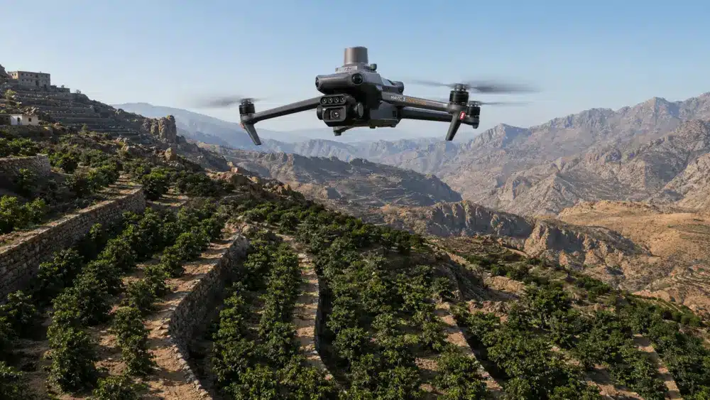
Crop monitoring drone flying over a mountain terrace plantation in Saudi Arabia.

المزايا

Crop Health Data Without the Ground Crew

Multispectral drones read crop health from above, so your agronomists stop walking fields and start acting on data.

Crop Health Visibility Without Field Checks

NDVI, NDRE, and OSAVI index maps show which blocks are struggling and which are fine across the whole holding, so scouting time goes only where it changes a decision.

Catch Stress While It Is Still Correctable

Multispectral imagery picks up chlorosis, nitrogen deficit, and irrigation stress before ground teams can see them, leaving room to correct the problem instead of absorbing the loss.

Permits and HSSE Handled Before You Fly

Every agricultural flight runs under GACAR Part 107 authorization with ISO-certified HSSE procedures, and we file the paperwork ourselves, so your season is not waiting on approvals.

Spend Less on Inputs, Not on Yield

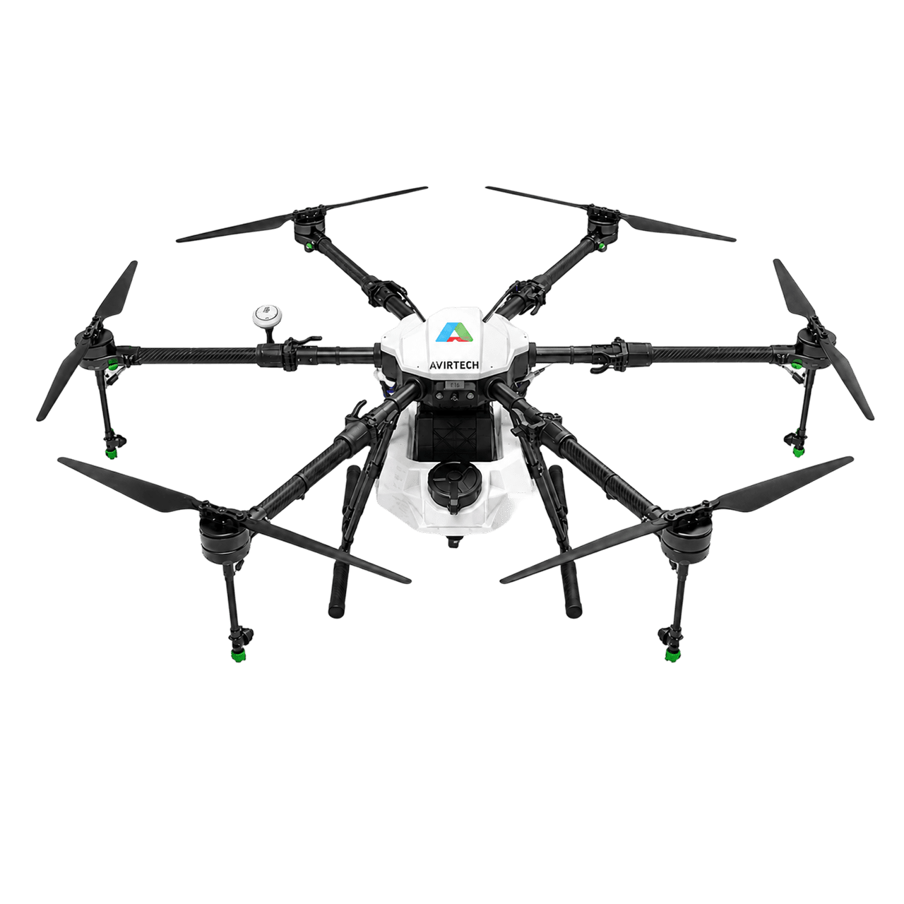
Aviro Sprayer platforms put foliar treatments, crop protection, and liquid fertilizer only on the zones that need them, so chemical volume and drift fall while treated crops keep performing.

Plantation Inventories Without Hand Counting

LiDAR point clouds separate individual tree crowns and pull canopy attributes automatically, replacing weeks of manual digitizing and walking rows with a delivered tree inventory.

Live Crop Layers, Held Inside the Kingdom

Terra Mapper and SimActive Correlator3D process your data in-house, Terra MapX serves it live to QGIS and ArcGIS, and it all sits on storage in the Kingdom under the PDPL.

تحديات

Why Manual Farm Management Falls Short

Ground checks crawl across large farms, stress hides until symptoms spread, and uniform spraying wastes costly inputs.

Ground Checks Are Slow Across Large Farms

Manual scouting covers limited area per day. A multispectral drone assesses entire fields in a single flight, while ground teams would take days or weeks across the same hectares.

Stress Stays Invisible Until Symptoms Spread

Water and nitrogen stress are often invisible to the eye until yield loss is underway. Multispectral indices reveal the deficit while it is still correctable.

Uniform Spraying Wastes Water, Fertilizer & Chemicals

Blanket application treats healthy and stressed zones identically, over-applying inputs across large areas and increasing chemical drift and cost.

Plantation Inventories Drag On by Hand

Counting trees and assessing canopy health manually across large plantations is slow and inconsistent, delaying replanting and yield planning.

Disconnected Field Data Delays Agronomic Decisions

Patchy, outdated field records make irrigation scheduling, fertilizer programs, and harvest timing reactive rather than planned against the farming calendar.

Permitting Friction Delays Aerial Programs

Agricultural flights need GACAR Part 107 authorization. We run the full SORA documentation pipeline in-house through Terra SORA Studio, so approvals move with your season.

التقنيات و الأساليب

Six Precision Agriculture Methods, One Drone Fleet

One fleet flies crop health assessment, variable-rate spraying, plantation LiDAR, leak detection, and decision support.

Multispectral Crop Health Assessment

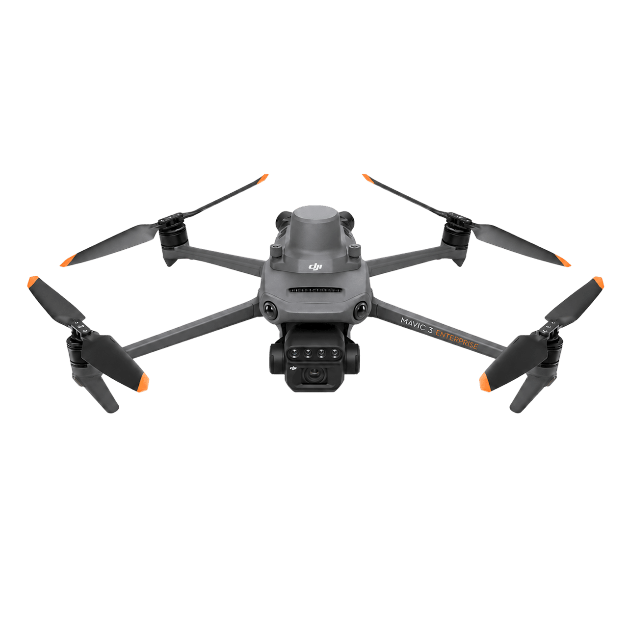
Visible and near-infrared bands are captured on flight paths synced to phenological stages, processed into NDVI, NDRE, and OSAVI rasters, then ground-truthed with agronomists before any index is trusted.

Variable-Rate Precision Spraying

Prescription zones drawn from the index maps drive the sprayer, so each pass meters output by zone instead of by field. The Aviro fleet covers D16 spot spraying, G30 fertilizer spreading, and E16 wide RTK blanket spraying.

Plantation Mapping & LiDAR Tree Segmentation

Zenmuse L2/L3 point clouds are filtered to ground and canopy, then segmented into individual tree crowns by ALS geometry, producing counts, canopy attributes, and gap positions for replanting.

Irrigation Effectiveness & Leak Detection

Elevation models and contour maps set the irrigation plan, then repeat flights read water pooling and soil-moisture variation across the block to show where the system leaks or under-delivers.

Crop Data & Decision Support

Field-level analytics become agronomic recommendations for irrigation scheduling, fertilizer programs, harvest timing, and yield estimates, delivered as live Terra MapX layers rather than a static PDF.

Scheduled Repeat-Flight Monitoring

A DJI Dock 3 station with FlightHub 2 runs the same route on a fixed cadence without a crew on site, so every comparison layer is captured from identical geometry through the critical growth stages.

المخرجات

Field Data Formatted for Agronomy Teams

You receive index maps, application maps, plantation inventories, and agronomic reports in standard GIS formats.

NDVI Crop Health Maps

NDRE Nitrogen Deficiency Maps

OSAVI Stress, Vigour & Pest-Pressure Zones

Variable-Rate Application Maps (Spraying)

LiDAR Individual-Tree Segmentation & Tree-Count Inventory (ALS)

Canopy Height Model (nDSM) & Growth Comparison Layers

Irrigation Leak & Water-Pooling Detection Map

Spray Coverage Verification Report

Orthophoto Mosaic Map (Plantation & Field)

DSM, DTM & Contour Maps for Irrigation Planning

LiDAR Point Cloud (Canopy Structure)

Geodatabase, GIS Derivatives (.KML / .SHP / .GeoJSON) & Live WMTS / WMS / XYZ Endpoints

Survey Specification & Quality Report

Agronomic Decision Support Report (EN/AR)

Terra MapX Crop Layer Access (Web Portal)

Terra Cloud Secure Delivery & Storage

المنصات والتطبيقات

Mission-Matched Agricultural Drone Fleets

We match each task to the drone, sensor, and sprayer it needs, from crop health scans to plantation LiDAR.

Field Crops & Cereals

Crop health assessment and variable-rate spraying for cereal and forage field crops, with NDVI and NDRE stress-zone maps guiding irrigation and fertilizer programs.

Tree Plantations & Coffee

Canopy health mapping, LiDAR tree counting, and precision spraying for tree crops including coffee, supporting replanting and yield planning.

Large-Scale Farms & Agri-Businesses

Field-level analytics and decision support for agri-businesses managing large holdings, turning aerial data into irrigation, fertilizer, and harvest recommendations.

Irrigation & Water Management

Contour-based irrigation planning plus leak and pooling detection from repeat flights, supporting scheduling and water conservation across Saudi farms.

Fertilizer & Nutrient Programmes

NDRE nitrogen maps and fertilizer uptake monitoring shape the nutrient plan, with G30 spreading placing product where the deficit actually sits.

Crop Protection & Spray Compliance

Pest and disease pressure zones target crop protection passes, and coverage verification confirms the treatment reached the blocks it was written for.

PROJECT EVIDENCE

Crop Health Detection and Fertilizer Management on a Southern Region Coffee Farm

A 2024 proof-of-concept in Saudi Arabia’s Southern Region combining multispectral crop health surveillance, precision spraying, land mapping, and decision support for a coffee plantation operator, cutting manual man-hours by 70 to 80%.

طائرة بدون طيار في مزرعة قهوة

Project Overview This project focuses on the precision agriculture sector located within the Southern Region of Saudi Arabia. The primary objective is to revolutionize large-scale coffee farm management by integrating


GACA-CERTIFIED PRECISION AGRICULTURE DRONE SERVICES IN SAUDI ARABIA

أسئلة متكررة

A crop monitoring drone carries a multispectral sensor that captures imagery across specific light bands, and those bands are computed into vegetation indices including NDVI, NDRE, and OSAVI. The resulting maps reveal crop stress, water and nutrient deficiencies, and pest pressure early, so intervention can be targeted before visible symptoms spread across the field. Indices are processed in Terra Mapper and published as comparable Terra MapX layers your agronomy team can review flight to flight.
Yes. Variable-rate precision spraying with Aviro Sprayer platforms applies foliar treatments, crop protection products, and liquid fertilizers only where the prescription map calls for them, which cuts chemical volume and drift. Multispectral crop health data also drives irrigation scheduling, and repeat flights read water pooling and soil-moisture variation to show where the irrigation system is leaking or under-delivering.
Precision agriculture drone services support field crops, tree plantations, and specialty crops including coffee, across holdings ranging from individual fields to large-scale farms and agri-businesses. Multispectral surveys scale from a single field to multi-block plantation programmes, with GIS-ready deliverables managed in Terra MapX.
Yes. All commercial drone operations in Saudi Arabia, including agricultural survey and spraying flights, require civil aviation authorization from the General Authority of Civil Aviation (GACA) under GACAR Part 107. Terra Drone Arabia holds active GACA certification and coordinates all flight permits directly before deployment.
Standard deliverables include NDVI and NDRE index maps, OSAVI stress, vigour and pest-pressure zones, variable-rate application maps for spraying, LiDAR individual-tree segmentation with a tree-count inventory, a canopy height model with growth comparison layers, an irrigation leak and water-pooling detection map, a spray coverage verification report, an orthophoto mosaic, DSM, DTM and contour maps for irrigation planning, a LiDAR point cloud, GIS derivatives in KML, SHP and GeoJSON, a survey quality report, and an agronomic decision support report. Layers are managed in Terra MapX, published live to QGIS and ArcGIS through authenticated WMTS, WMS, and XYZ endpoints, and delivered through Terra Cloud.
Agricultural drones do three jobs on a working farm. They see, by flying multispectral surveys that turn a whole holding into an index map instead of a walking route. They act, by spraying and spreading at variable rate so inputs land only where the map says they are needed. And they count, by capturing LiDAR over plantations to segment and inventory individual trees. The practical result for a farm manager is fewer field hours spent looking for problems, lower input spend per hectare, and irrigation and fertilizer decisions made against current data rather than last month’s impression.
Standard deliverables include NDVI, NDRE, and OSAVI crop health maps, variable-rate application maps for spraying, plantation canopy health maps, LiDAR tree count and canopy characteristic inventories, growth trend analysis, pest and disease pressure zones, and GIS-compatible derivatives in KML, SHP, and GeoJSON formats, plus an orthophoto mosaic, DSM, DTM, contour maps for irrigation planning, a LiDAR point cloud, LiDAR individual-tree segmentation layers, and an agronomic decision support report. Everything is accessible as managed layers via Terra MapX and delivered through Terra Cloud.

GACA-Certified · Multispectral Crop Health · Precision Spraying & Mapping

Put Precision Agriculture Data to Work on Your Farm

Aerial drone view of Riyadh skyline in Saudi Arabia

Get the Drone & Geospatial Brief, Saudi Arabia

Real project breakdowns, GACA regulatory updates, and field-tested case studies from oil and gas, mining, and infrastructure operations. Used by engineering and procurement teams at Saudi Arabia’s largest operators. 

Joined by 2K+ industry professionals in Saudi Arabia.

