

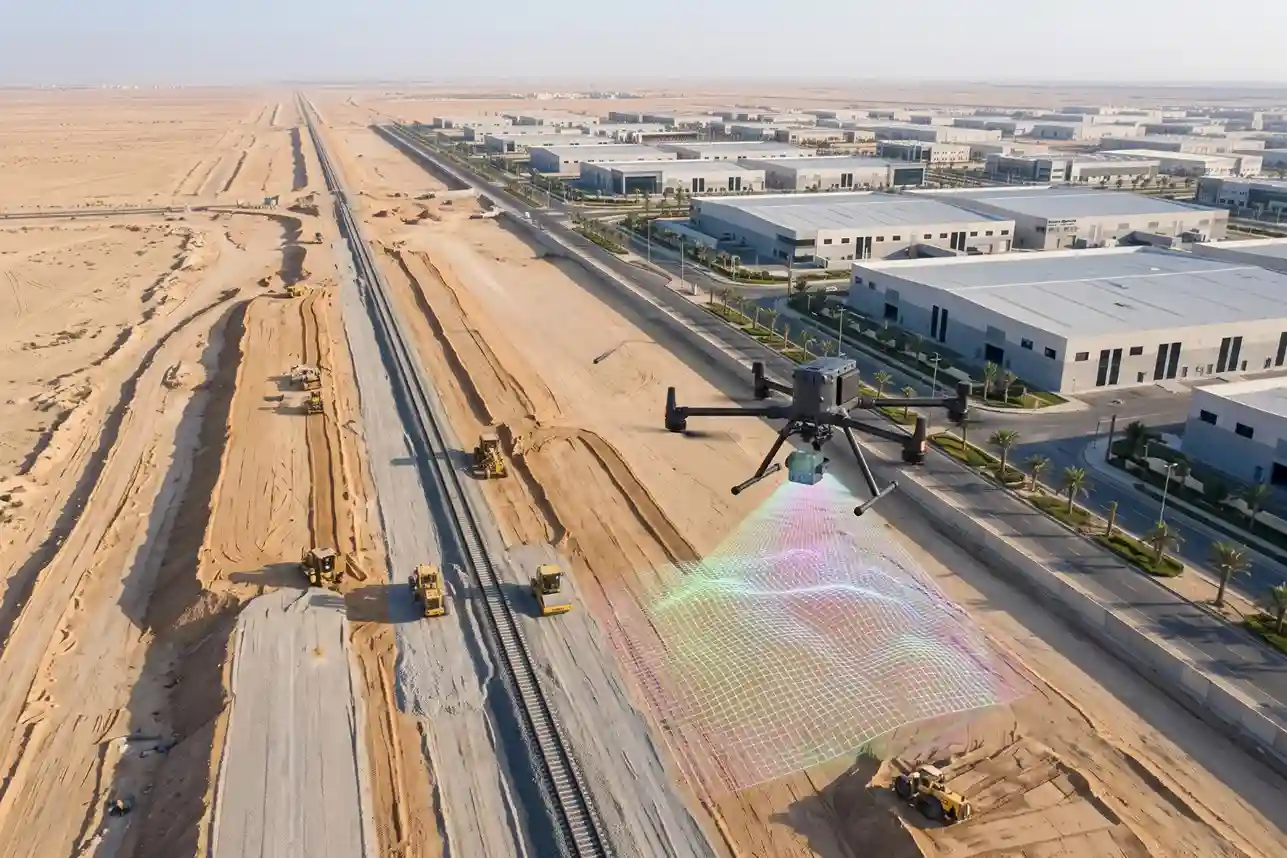
Saudi Arabia Railways (SAR) initiated the construction of the 21-kilometer single-track freight railway connecting Dammam Second Industrial City directly to the national rail network and King Abdulaziz Port.
Designed to connect over 1,000 industrial facilities, the linear infrastructure project encompasses extensive earthworks, utility protection, a 265-meter bridge spanning Highway HW615, and a 118-meter bridge crossing the Aramco Pipeline Corridor.
Managing civil earthworks, ballast placement, and structural alignments across linear corridors demands rapid, high-precision geospatial data collection.
As linear infrastructure projects scale across the Kingdom, market research from Mordor Intelligence indicating the global LiDAR drone market reached SAR 942 million in 2025 and is projected to reach SAR 1.12 billion in 2026, with construction and infrastructure capturing a 29.45% market share, reflects a shift toward automated aerial auditing.
Furthermore, corridor mapping commands 37.60% of the total global LiDAR market share underlines why rail operators and civil contractors choose airborne laser scanning over ground-based surveys.
Drone LiDAR and Earthwork Volume Verification
Executing topographical surveys along narrow 22.7-kilometer single-track rail rights-of-way can be a major field bottlenecks across Dammam Second Industrial City.
The rail link project requires heavy civil works, including extensive earthmoving, ballast placement, building a 265-meter bridge across Highway HW615, and constructing a 118-meter bridge spanning the Aramco Pipeline Corridor.
Conducting manual surveys using traditional optical total stations or handheld GNSS rovers along active highway rights-of-way and high-pressure utility corridors exposes survey crews to severe traffic hazards and heavy machinery traffic.
Transitioning to airborne laser scanning replaces slow manual boundary walks with rapid, non-contact spatial data acquisition from safe flight altitudes.
Deploying heavy-lift flight platforms, such as the DJI Matrice 400 (M400) paired with the DJI Zenmuse L3 payload, allows engineering teams to map the entire linear corridor while keeping field personnel out of hazardous work zones.
Hardware Capabilities and Multi-Return Airborne LiDAR Mechanics
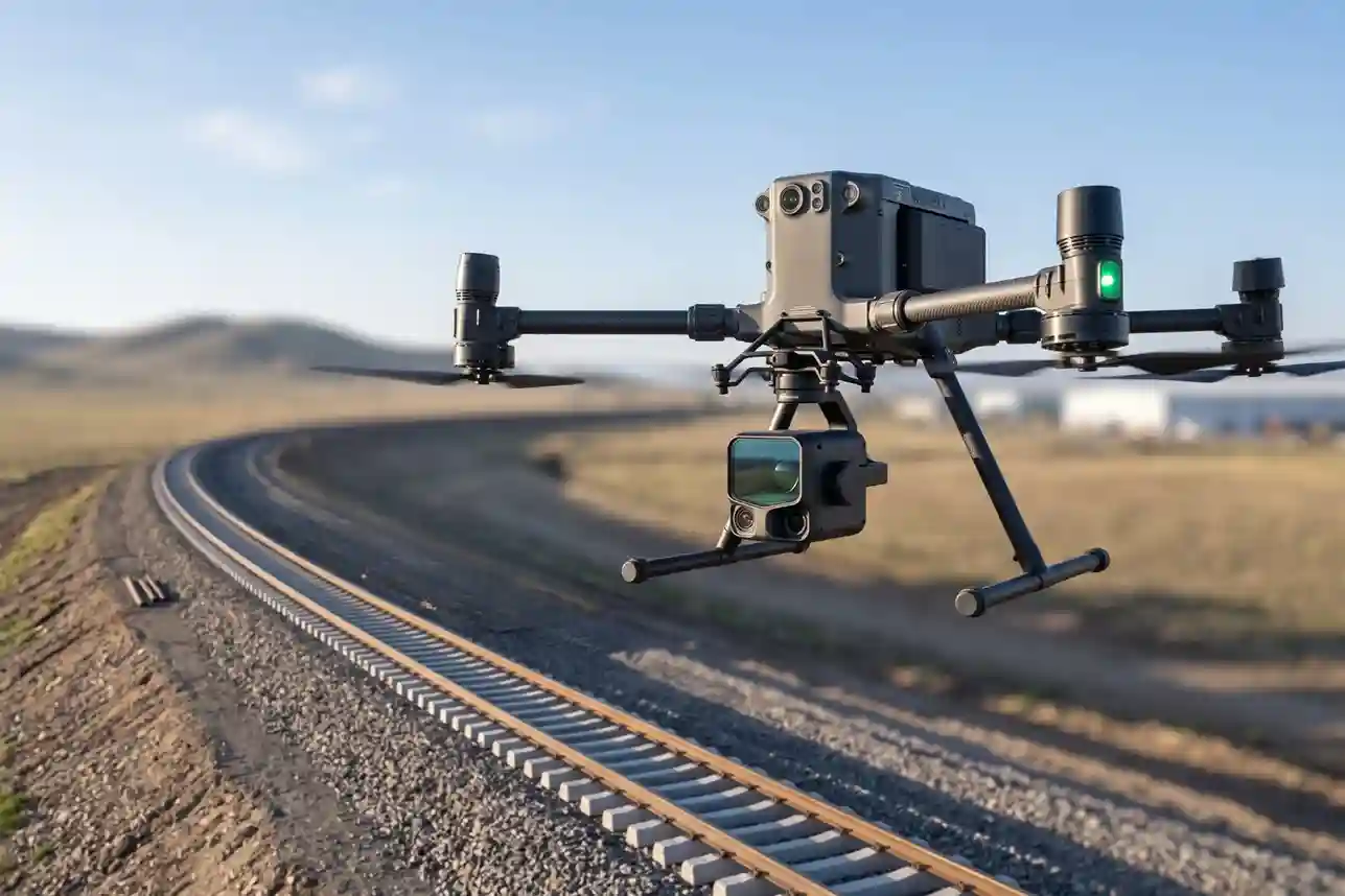
The heavy-lift DJI Matrice 400 flight platform provides extended flight endurance, high wind resistance, and redundant avionics required to sustain long linear corridor missions.
Mounting the DJI Zenmuse L3 payload on the M400 creates an integrated airborne laser scanning system capable of collecting dense 3D point clouds and high-resolution RGB photogrammetry in a single flight pass.
The Zenmuse L3 sensor incorporates specialized mechanical and electronic systems tailored for infrastructure corridor mapping:
- Multi-Return Laser Pulse System: The LiDAR sensor emits pulses at a laser pulse frequency up to 2000 kHz, generating point cloud rates up to 2,000,000 points per second. Supporting up to 16 returns per pulse allows the laser beams to penetrate dense desert scrub, dust layers, and safety fencing to hit the true ground surface underneath.
- High-Precision Positioning and IMU: An integrated high-precision Inertial Measurement Unit (IMU) pairs with real-time kinematic (RTK) GNSS positioning ($1\text{ cm} + 1\text{ ppm}$ horizontal RTK accuracy) to record exact sensor orientation and location for every emitted laser pulse.
- Ranging Accuracy and System Precision: The sensor delivers high ranging accuracy and system precision across typical flight heights above ground level (AGL).
- Dual 100 MP RGB Mapping Cameras: Built-in dual 4/3 CMOS sensors with mechanical shutters capture ultra-high-resolution true-color images simultaneously with the LiDAR scan. This RGB data colorizes the 3D laser point cloud in real time (by height, reflectivity, or true RGB color) and generates high-resolution orthomosaic maps.
Collecting high-density point clouds from the air eliminates the need to deploy ground survey teams onto active road shoulders or hazardous utility rights-of-way, drastically lowering human occupational risks during initial baseline mapping.
Earthwork Cut-and-Fill Calculations and Digital Terrain Modeling
During early construction phases, civil contractors must execute massive earthmoving operations to prepare the subgrade, level railway cuts, construct embankments, and establish sub-ballast foundations across the 22.7-kilometer single-track corridor.
Verifying contractor progress and calculating earthwork quantities requires accurate surface models that reflect daily ground movement.
Processing raw Zenmuse L3 point cloud files through processing platforms like DJI Terra automatically filters out non-ground points, such as construction vehicles, power lines, and temporary staging units.
The software generates bare-earth Digital Terrain Models (DTMs) and Digital Surface Models (DSMs) with fine grid resolution.
Comparing multi-temporal DTMs captured over consecutive weeks allows civil engineers to calculate volumetric cut-and-fill quantities across specific chainage sections.
Industry operational benchmarks show that executing aerial drone surveys across linear infrastructure corridors reduces manual ground survey field lead time by 60% to 80% compared to traditional total stations while maintaining 1 to 3 cm horizontal accuracy and 2 to 5 cm vertical accuracy.
Rapid volumetric tracking speeds up progress certification, validates monthly contractor invoicing, and prevents payment disputes over earthwork volumes.
Mitigating Construction Rework and Risk Alignment
Unidentified subgrade settlement, embankment slope instability, or minor track alignment errors can delay railway construction and cause costly rework.
Detecting geometric deviations early in the grading process ensures that sub-ballast layers meet strict civil engineering tolerances before steel rails and concrete sleepers are installed.
Overlapping aerial LiDAR scans reveal structural settlement, washouts, or slope slumping along embankment edges along the rail line.
Field studies show that deploying recurring aerial LiDAR and photogrammetry audits on heavy civil construction sites reduces project rework costs by 15% to 25% by identifying earthwork deviations, embankment slumping, and alignment errors early in the construction phase.
Furthermore, high-density point clouds provide detailed geometric profiles around critical engineering structures along the route:
- Highway HW615 Bridge Abutments: Mapping the 265-meter bridge structure spanning the regional highway ensures that bridge piers, clearance heights, and approach embankments align perfectly with structural CAD designs.
- Aramco Pipeline Corridor Crossing: Capturing high-precision 3D geometry over the 118-meter bridge crossing the Aramco Pipeline Corridor allows project managers to verify utility protection clearances and ensure zero physical encroachment onto high-pressure oil and gas lines during heavy equipment earthworks.
Identifying geometric discrepancies prior to track installation protects capital investments, keeps civil contractors on schedule, and maintains structural integrity across the Dammam Second Industrial City rail connection.
Automated Railway Topology Extraction and Digital Twin Modeling
Transforming unclassified airborne LiDAR point clouds into structured, intelligent 3D digital twins shifts construction monitoring from manual visual checks to automated spatial analysis.
While raw point clouds capture millions of spatial coordinates (X, Y, Z), civil engineering workflows require structured vector geometry, surface meshes, and object-oriented Building Information Modeling (BIM) elements.
Operating heavy-lift flight platforms, such as the DJI Matrice 400 (M400) paired with the DJI Zenmuse L3, enables rapid aerial scanning along the 22.7-kilometer single-track freight corridor in Dammam Second Industrial City.
Processing these high-density 3D datasets through automated algorithms extracts rail track centerlines, evaluates ballast cross-sections, and generates georeferenced digital twins for civil construction oversight.
Multi-Return Vegetation Penetration and Ground Point Classification
Desert terrain along industrial utility corridors often features low-lying scrub vegetation, windblown sand piles, security fences, and overhead power transmission lines.
Traditional photogrammetric aerial mapping struggles to map ground elevation under vegetation canopy because passive camera sensors cannot see beneath top leaves or scrub cover.
The multi-return laser mechanism of the Zenmuse L3 sensor overcomes these optical limits during airborne collection:
- Pulse Penetration Mechanics: Emitting up to 16 returns per laser pulse allows initial returns to reflect off top vegetation or power cables, while subsequent returns penetrate intermediate foliage to hit the underlying earth surface.
Automated Track Geometry Extraction and Digital Twin Modeling
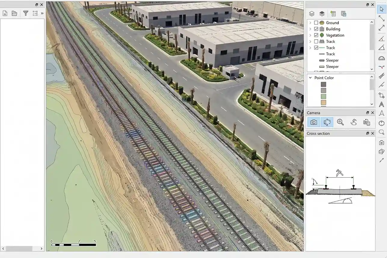
Once ground points are isolated, specialized geospatial software processes the 3D point cloud to identify and extract linear railway features.
Manual CAD tracing of 22.7 kilometers of single-track rail infrastructure requires weeks of engineering labor, creating project bottlenecks.
Automated feature extraction routines recognize distinct spatial patterns within the classified point cloud:
- Rail Head and Centerline Detection: Algorithms identify the parallel intensity signatures and elevation profiles of steel rail heads, automatically mapping the track centerline and verifying the standard track gauge (1,435 mm) along the entire corridor.
- Cross-Level and Superelevation Profiling: The software calculates cross-level tilt (cant) along curved track segments, measuring whether outer rail elevation meets civil engineering design specifications for heavy freight axle loads.
- Ballast Shoulder and Slope Auditing: Cross-sectional extraction scripts analyze the width, height, and slope angle of crushed stone ballast beds, detecting areas where ballast volume falls below design limits.
Transitioning from manual CAD tracing to automated vector extraction significantly accelerates modeling schedules.
Empirical research establishing that automated extraction of railway track geometry digital twins from airborne LiDAR point clouds delivers an 88.9% time savings over manual CAD modeling, achieving spatial accuracies of 3.4 cm RMSE for rails and 2.7 cm RMSE for trackbeds, confirms the efficiency of automated processing workflows.
Spatial Clearance Auditing at Highway and Utility Crossings
The 22.7-kilometer railway alignment intersects critical industrial infrastructure that requires strict spatial clearance auditing:
- Highway HW615 Bridge Crossing (265 meters): The single-track line crosses above Highway HW615 via a dedicated 265-meter bridge structure. The 3D digital twin models bridge pier placement, deck geometry, and vertical clearance (m) over active highway lanes, ensuring compliance with Saudi Arabia Railways (SAR) structural standards without interrupting road traffic.
- Aramco Pipeline Corridor Crossing (118 meters): Navigating the 118-meter bridge crossing over high-pressure oil and gas pipelines demands zero physical encroachment. The LiDAR digital twin maps the exact 3D spatial relationship between bridge foundations, ground anchors, and underground pipeline rights-of-way.
Integrating these high-precision 3D digital twins into MODON and SAR enterprise GIS environments (such as ArcGIS Pro) provides a shared spatial database for civil contractors, project consultants, and facility managers throughout the 28-month construction timeline.
Lifecycle Asset Integrity and Predictive Rail Maintenance
Converting airborne LiDAR data into centralized spatial databases establishes a permanent digital baseline for the 22.7-kilometer single-track freight railway connecting Dammam Second Industrial City to King Abdulaziz Port and the national rail network.
Capturing high-density 3D point clouds during civil construction creates an immutable record of subgrade elevation, ballast geometry, track alignment, and structural clearance.
Exporting these georeferenced datasets into Saudi Arabia Railways (SAR) and MODON enterprise GIS environments (such as ArcGIS Pro) transitions infrastructure management from reactive field repairs to predictive, data-driven maintenance.
Establishing Baseline Digital Records for Long-Term Maintenance
Before heavy freight operations begin, engineering teams require a precise spatial record that captures as-built conditions across the entire rail corridor.
Airborne laser scanning using the DJI Matrice 400 paired with the DJI Zenmuse L3 payload records the physical state of every track component, drainage channel, and bridge structure prior to track commission.
This initial LiDAR baseline serves several critical asset management functions:
- Georeferenced Asset Inventory: Every rail clip, concrete sleeper, ballast shoulder, and signaling cabinet is logged with precise spatial coordinates (X, Y, Z) tied to national geospatial reference frameworks.
- As-Built CAD/BIM Verification: The captured 3D point cloud is compared directly against as-designed engineering models to confirm that track gauge (1,435 mm), gradient, and curvature fall within strict civil tolerances before contractor handover.
- Temporal Change Detection Baseline: High-density point clouds provide a fixed spatial reference. Subsequent aerial inspection passes are overlaid on this initial baseline to measure subgrade settling, track deformation, or ballast erosion down to millimeter tolerances over time.
Integrating baseline point clouds, Digital Terrain Models (DTMs), and high-resolution orthomosaic imagery into enterprise GIS platforms replaces paper drawings and disconnected spreadsheets with a single, shareable spatial database accessible to maintenance crews, civil engineers, and executive management.
Transitioning from Reactive Maintenance to Predictive Health Management
Traditional railway maintenance relies heavily on scheduled manual walks or reactive repairs after physical faults, such as track misalignment, ballast degradation, or rail joint failure—cause operational delays or derailments.
On a heavy industrial freight line designed to handle high axle loads and continuous container traffic, unexpected track closures disrupt supply chains across Dammam Second Industrial City.
Periodic aerial re-surveys using airborne LiDAR enable a Predictive Maintenance (PdM) framework.
Flying the 22.7-kilometer corridor on a quarterly or bi-annual schedule allows automated software scripts to compare current track geometry against historical baselines, identifying subtle structural changes before they cause mechanical failures:
- Ballast Shoulder Erosion and Settlement: Comparing surface elevation profiles reveals localized ballast displacement or subgrade sinkholes, enabling maintenance crews to re-tamp ballast before track deformation occurs.
- Rail Alignment and Gauge Deviation: Automated point-cloud analysis detects minor horizontal or vertical track shifts caused by ground settlement or thermal expansion along unshaded desert sections.
- Slope Stability along Earthwork Cuts: Multi-temporal DTM comparisons highlight soil movement, erosion gullies, or rockfall risks on embankment slopes before debris slips onto the tracks.
Engineering research published on ResearchGate demonstrates that implementing digital twin frameworks and automated sensor monitoring across rail infrastructure improves early fault detection by 30% to 60% and lowers lifecycle maintenance costs by 10% to 25% compared to traditional periodic manual inspections.
Furthermore, academic studies published on ResearchGate show that integrating deep reinforcement learning models with 3D digital twins reduces total maintenance interventions by 21% and occurring track defects by 68%, confirming the operational efficiency of automated spatial monitoring.
Protecting Critical Structural Interfaces and Industrial Corridor Safety
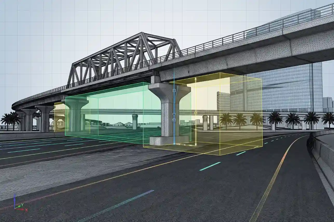
The 22.7-kilometer railway alignment intersects high-density industrial infrastructure and active transport corridors that require continuous structural monitoring:
- Highway HW615 Bridge Crossing (265 meters): The freight line crosses above Highway HW615 via a 265-meter bridge. Regular aerial LiDAR scans measure bridge deck elevation, pier verticality, and expansion joint movement under heavy freight loads without requiring highway lane closures or physical staging.
- Aramco Pipeline Corridor Crossing (118 meters): The 118-meter bridge spanning the high-pressure Aramco Pipeline Corridor represents a critical safety interface. High-precision 3D point cloud monitoring verifies that bridge foundations, ground anchors, and drainage runoff maintain required safety clearances from underground energy infrastructure.
- Industrial Utility and Drainage Networks: Subsurface culverts, stormwater channels, and utility crossings serving Dammam Second Industrial City are audited using airborne thermal and optical sensors to identify blockages, soil erosion, or water pooling near the track bed.
Maintaining an active 3D digital twin across the 28-month construction period and subsequent operational lifespan de-risks capital expenditure, protects vital energy and transport corridors, and ensures safe, uninterrupted freight movement across Saudi Arabia’s Eastern Province.
Digital Twins in Sustainable Shipyard Lifecycle Management
Centralizing airborne UT thickness logs, subsea ROV bathymetry, laser scans, and aerial photogrammetry into georeferenced 3D digital twins creates a single source of truth across the facility lifecycle.
Exporting reality-capture data directly into Enterprise Asset Management (EAM) platforms and ArcGIS dashboards optimizes maintenance scheduling, de-risks capital expenditure, and supports long-term operational reliability across Ras Al-Khair Industrial City.
Consult with Our Experts
Streamline your shipyard asset integrity audits, airborne NDT inspections, and subsea ROV surveys. Contact our specialist to deploy advanced aerial and robotic solutions for your maritime infrastructure projects.

 English