In rapidly growing cities like Riyadh and Jeddah, traffic congestion is more than a simple daily annoyance. It represents a significant drag on economic productivity and a hurdle to improving the general quality of life. The primary issue with current infrastructure is that most traffic lights operate on static, fixed timers.
These systems are unable to see when a road is empty or when a sudden surge of vehicles has created a bottleneck blocks away. To keep the Kingdom moving, we need a solution that observes the road from above and reacts to traffic flow in real time.
This gridlock is most evident during the Kingdom’s major religious and cultural celebrations. During Eid al-Fitr and Eid al-Adha, millions of residents and visitors take to the roads simultaneously, often overwhelming traditional traffic controls.
Special occasions, ranging from national festivals to the peak days of the Hajj create unique “stress tests” for city infrastructure that fixed timers simply cannot manage. In these moments, the inability to adapt to real-world flow leads to the very delays that smart systems are designed to eliminate.
To keep the Kingdom moving, we need a solution that observes the road from above and reacts to traffic flow in real-time.
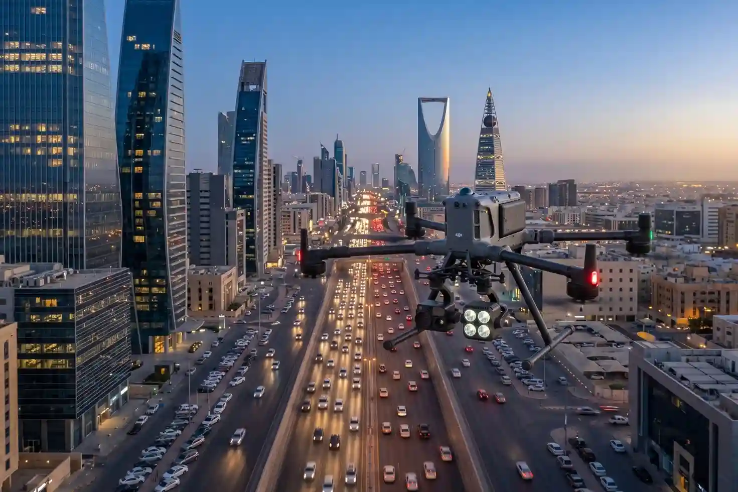
The Eye in the Sky
The DJI Matrice 400 (M400) serves as the hardware foundation for a new era of cognitive urban management. By operating as an aerial AI sensor, it provides a level of situational awareness that ground cameras cannot match.
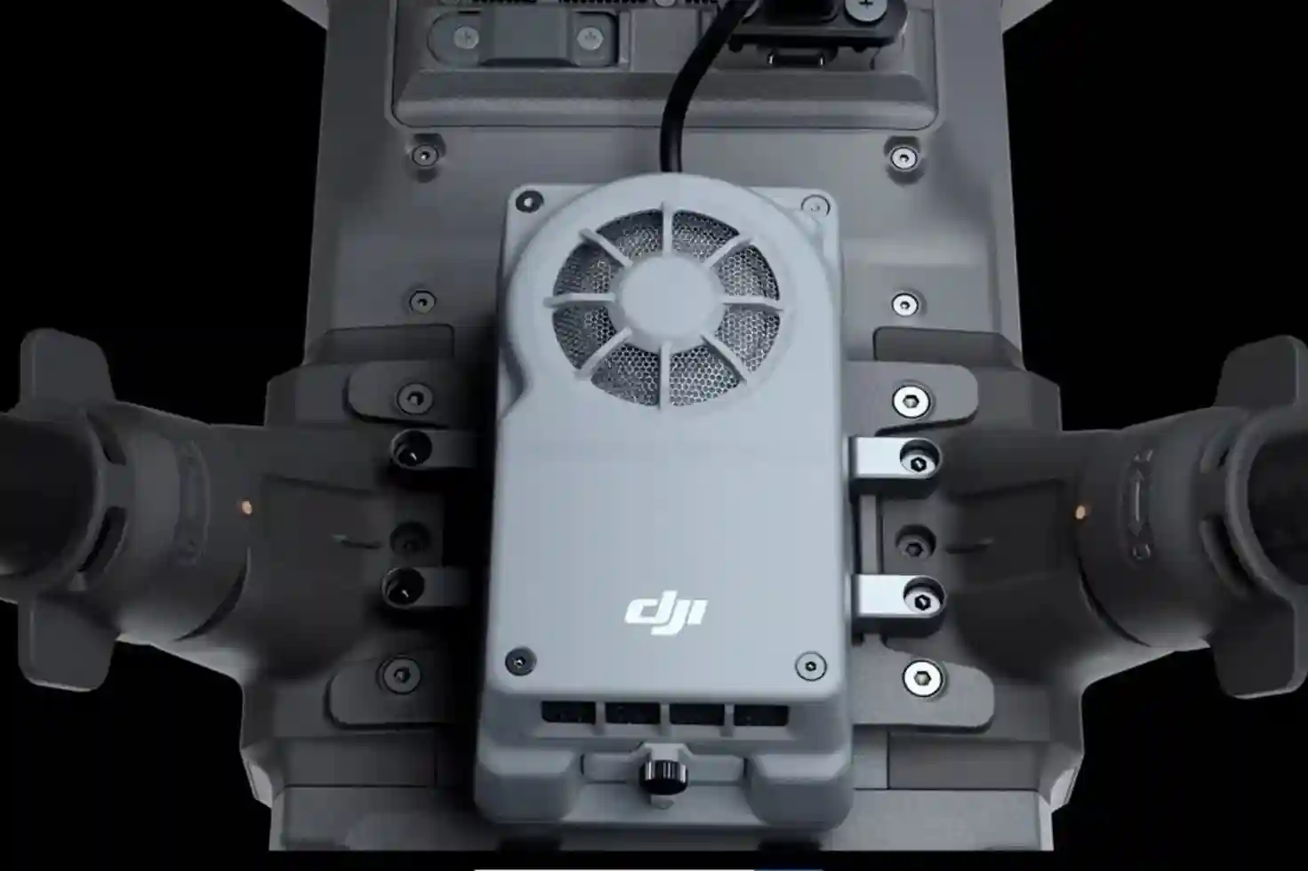
- Processing at the Edge: The M400 utilizes the Manifold 3 computing module to process complex data directly on the aircraft.
- Real-Time Vehicle Identification: Instead of merely streaming video, the system uses AI to count every vehicle in specific lanes with zero latency.
- Advanced Navigation Safety: To operate safely near dense urban infrastructure, the drone uses a Penta-Vision system and millimeter-wave radar for 360-degree obstacle detection.
- High Efficiency: A single mission can cover vast intersection networks, providing the necessary data to map out congestion patterns before they spiral out of control.
Turning Data into Green Lights
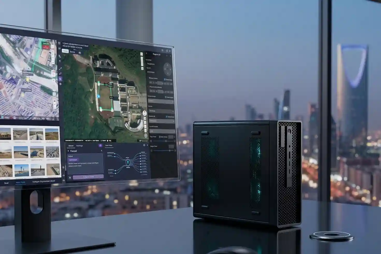
Information alone does not solve traffic; it must be connected to the city’s nervous system to create change. Through a unified cloud environment, the data captured by drones is transformed into physical action on the road.
- The Cloud Command Center: FlightHub 2 acts as the central brain, receiving vehicle density reports from the M400 instantly.
- Adaptive Signal Control: By using the Cloud API and MSDK 5, the drone’s intelligence is linked directly to the city’s traffic management servers.
- Autonomous Intervention: When the system detects a critical queue, it can automatically trigger a request to extend a green light, clearing the intersection before a jam can form.
- Quantifiable Impact: Implementing these autonomous smart systems has been shown to cut travel delays by as much as 70%.
A Smart Vision for 2030
Improving urban flow is a core objective of the Kingdom’s Vision 2030 goals for smarter and more sustainable cities. Real-time traffic management is no longer a future concept; it is a ready-to-deploy technology that can immediately improve the daily lives of millions.
We are dedicated to providing the specialized equipment and software integration required to master urban congestion. Contact us to discover how we can support your real-time drone solutions and optimize your city’s traffic flow and infrastructure.

