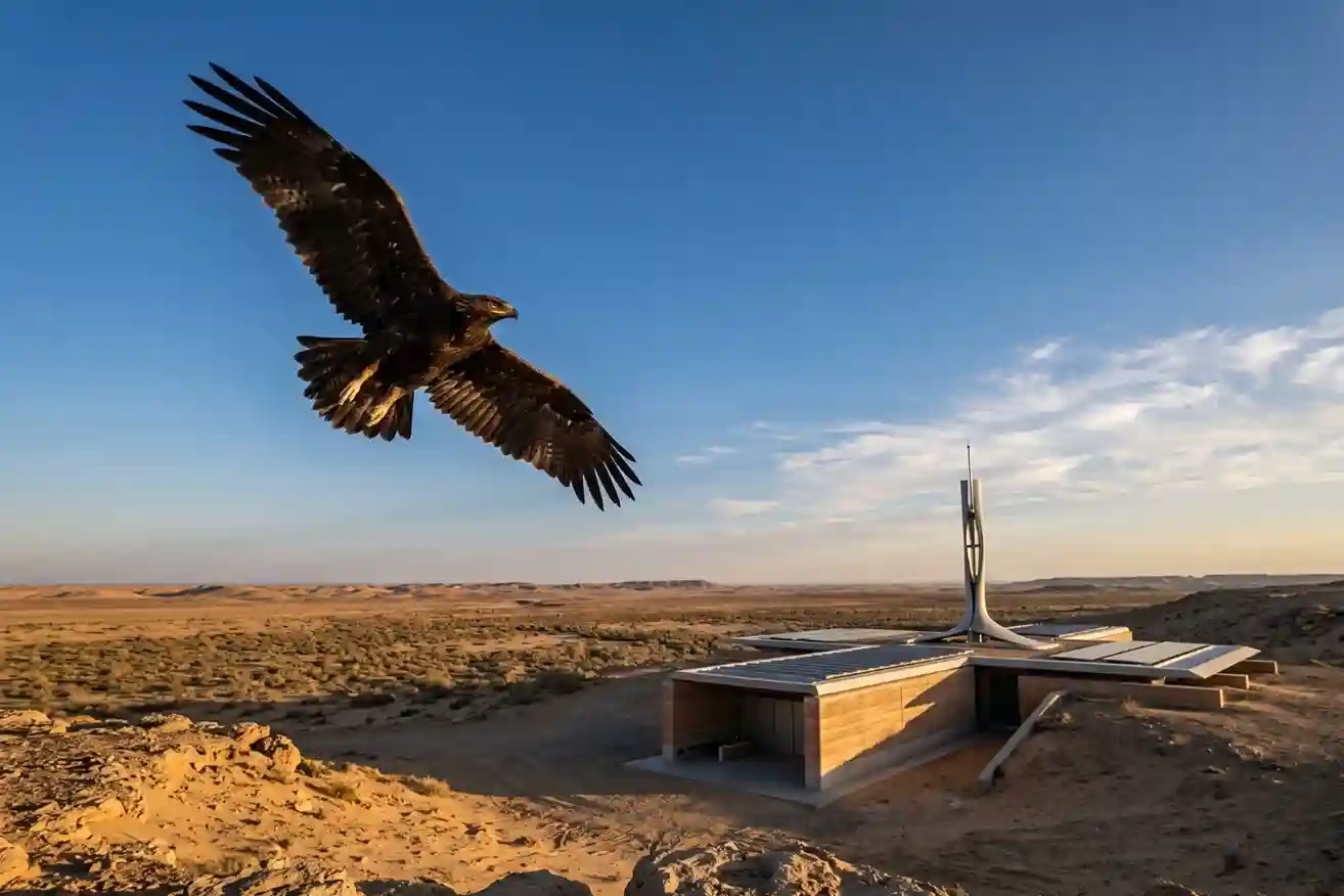
Every year, millions of birds cross continents to find better weather and food. As of May 2026, Saudi Arabia remains a vital safe haven on the African-Eurasian flyway, serving as a rest stop for these travelers. The Kingdom is home to over 500 bird species and hosts 14 out of the 15 species that are unique to the Arabian Peninsula.
At the heart of this conservation effort is the Imam Turki bin Abdullah Royal Reserve. This massive area covers nearly 91,500 square kilometers. Protecting such a large space requires more than just luck; it needs a way to identify the exact trees, water sources, and shrubs that birds need to survive their long journeys.
Wildlife Monitoring in the Desert
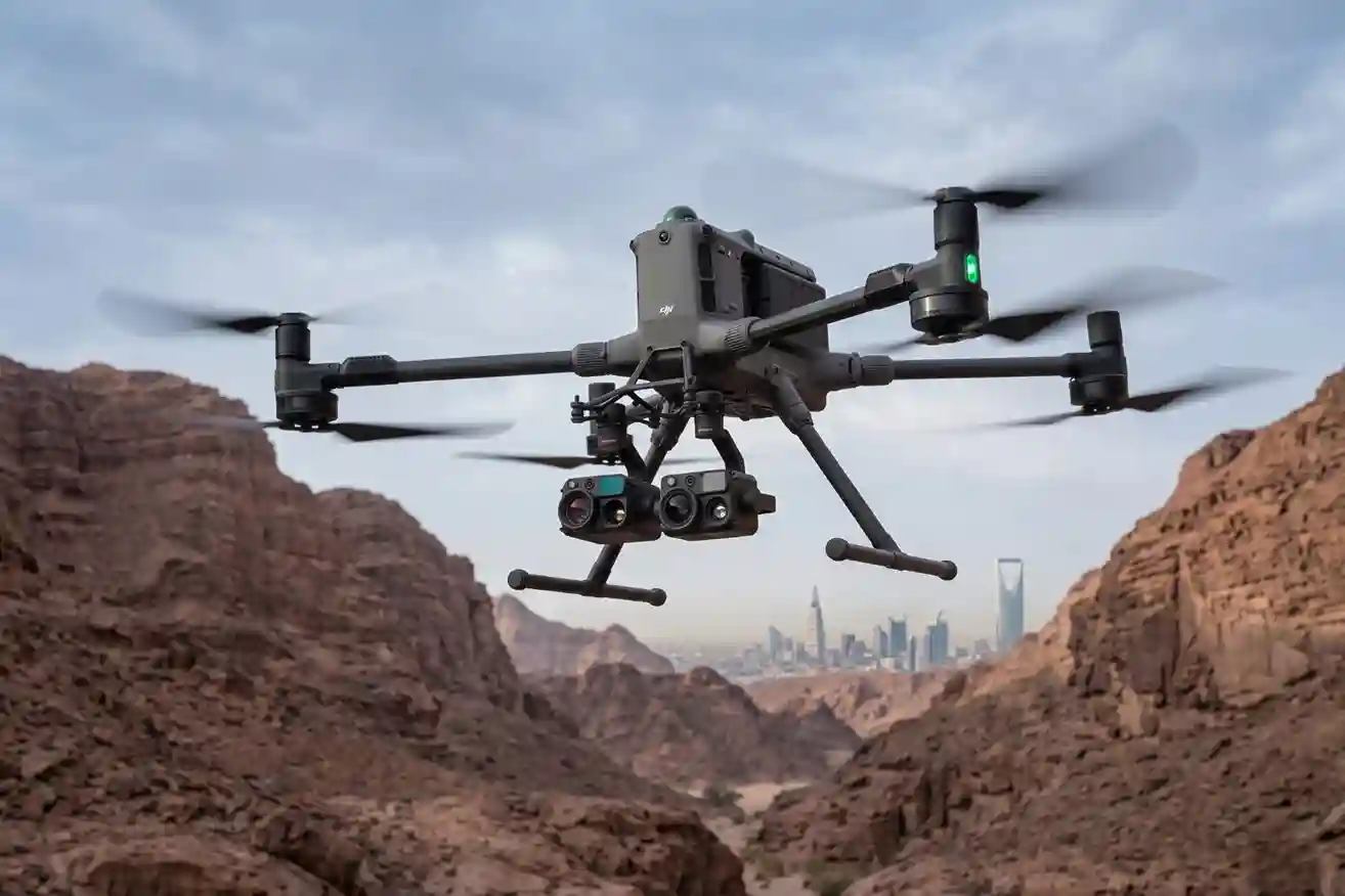
Monitoring thousands of kilometers of desert is a difficult task for teams on the ground. Traditional counting methods are slow and can often miss birds hidden in rugged terrain. This is where wildlife monitoring with the DJI M400 changes the process.
Using this technology is up to 57% faster than manual ground counts. Because the drone can fly for nearly an hour and carries high-quality thermal sensors, it can locate and count animals with 92% accuracy. This allows researchers to gather data without getting close enough to scare the birds or make them waste their energy flying away.
Drone Mapping for Vision 2030
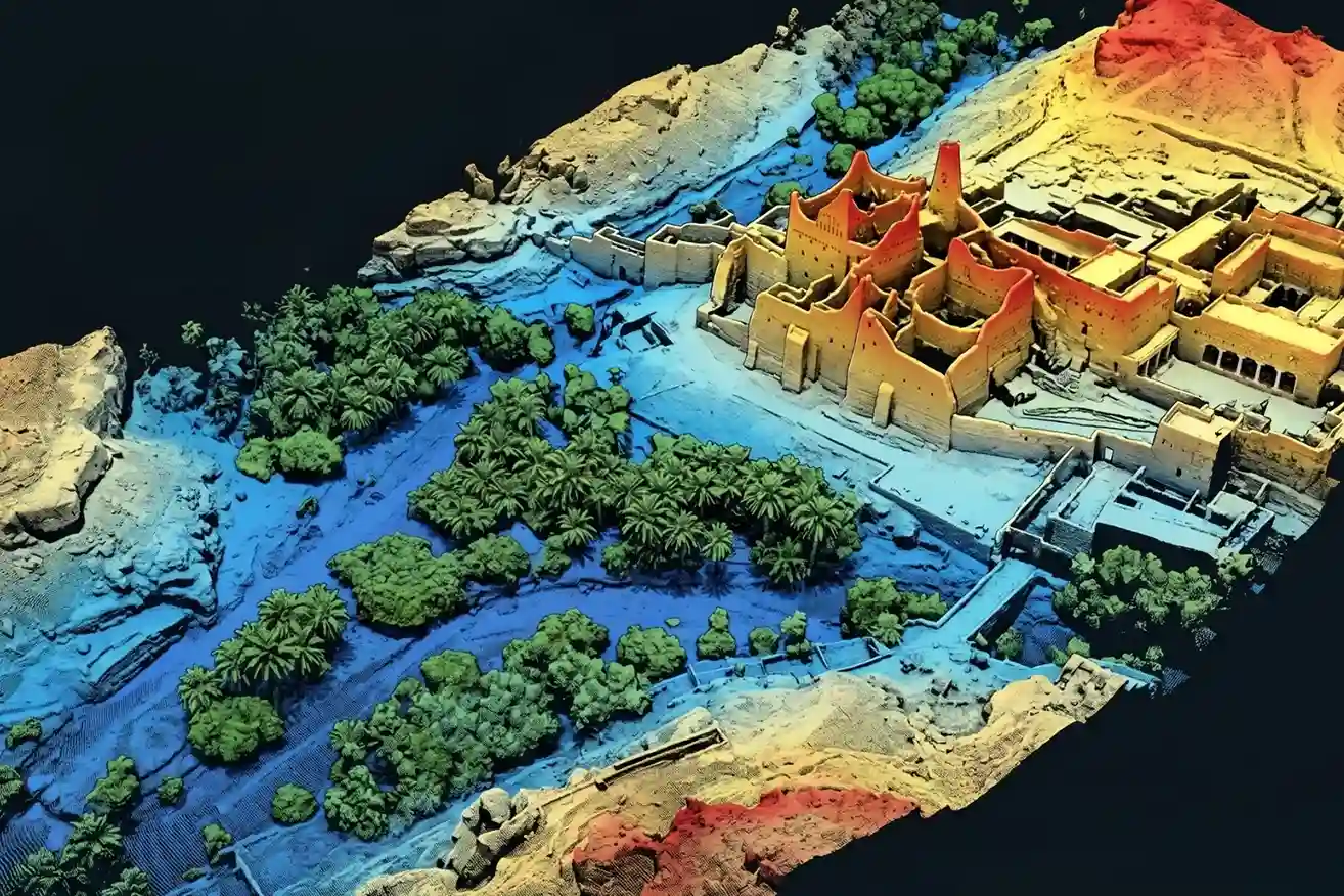
To truly protect these species, conservationists use habitat mapping to create a digital “map of survival.” By using LiDAR technology on the DJI M400, teams can create 3D models of the environment that are 99.7% accurate compared to measurements taken on the ground.
This level of ecosystem mapping helps identify the best “safe stops” for birds at a very high resolution. Interestingly, the same efficiency we see when using drones for real-time traffic management to end road jams is now being applied to nature. Instead of managing cars, we are managing the movement of living creatures across the Kingdom.
This advanced ecology mapping is a key part of Saudi Vision 2030. The government is committed to protecting 30% of its land and preserving 75% of its biodiversity by the end of the decade. High-tech mapping ensures these goals are met with real data rather than guesses.
Build Your Conservation Unit
As we look toward the future of environmental protection in 2026, automation is no longer optional. Protecting the natural heritage requires tools that can see what the human eye misses across vast distances.
Transitioning to high-precision mapping is the best way to manage large-scale environmental projects effectively. If your organization is tasked with protecting land or wildlife.
Talk to our expert to deploy your habitat mapping solution, ensuring a safe and sustainable future for the birds that call our skies home.

