Drones in Conservation: A New Eye in the Sky

Drones, also known as unmanned aerial vehicles (UAVs), have rapidly transitioned from military applications to become essential tools in various civil and environmental sectors. In the realm of environmental conservation, drones offer a unique perspective, literally and figuratively, by providing a bird’s-eye view that can be critical for monitoring vast and often inaccessible natural areas. This transformative technology is reshaping how conservation efforts are conducted, enabling researchers and conservationists to gather data more efficiently, monitor wildlife more effectively, and manage natural resources more sustainably. The Rise of UAVs in Environmental Efforts The integration of UAV technology in the field of environmental conservation represents a significant leap forward in how we understand and manage our natural environment. As ecological challenges mount, from deforestation and habitat loss to climate change-induced disasters, the need for innovative solutions has never been greater. Drones offer just that by providing a versatile platform for data collection and resource management. Bridging the Gap in Data Collection Drones provide a practical solution to the logistical challenges of traditional environmental research, which often involves labor-intensive fieldwork across difficult terrains. UAVs can access virtually any area with minimal impact, from the dense, insect-laden rainforests of the Amazon to the icy expanses of the Arctic. This capability allows for the continuous monitoring of environments that would otherwise be prohibitively expensive or dangerous for human researchers. By deploying drones, scientists can perform regular surveys over extensive areas without the need for physical presence, reducing both time and labor costs. UAVs equipped with multispectral or hyperspectral cameras can capture data across different wavelengths, providing detailed images that reveal health information about vegetation, water bodies, and even soil conditions. This data is crucial for tracking changes over time, such as the growth or reduction of vegetation in an area, the erosion of soils, or the drying up of lakes and rivers. Enhancing Precision in Environmental Management The precision data collected by drones is also instrumental in crafting targeted conservation strategies. For instance, by analyzing drone-captured images using vegetation indices, conservationists can identify specific areas suffering from degradation and intervene appropriately. This method is particularly useful in managing protected areas, where precise information about the location and extent of threats is crucial for effective stewardship. Furthermore, UAVs can facilitate the restoration of ecosystems by mapping degraded areas for reforestation and tracking the progress and success of these initiatives. This application is increasingly important as global efforts to combat climate change include significant reforestation components, which require careful planning and monitoring to ensure their long-term viability. Supporting Biodiversity and Habitat Conservation Drones also play a critical role in biodiversity conservation by enabling the detailed mapping of habitats and the species that inhabit them. UAV technology helps identify patterns of habitat use and the impacts of human activity on wildlife corridors, which are essential for the movement of species across landscapes. Such information is vital for creating effective conservation plans that accommodate both wildlife needs and human interests. For example, in marine environments, drones are used to map coral reefs and assess their health, which is vital for marine biodiversity. They provide high-resolution imagery that can detect changes in reef structures, track bleaching events, and monitor the recovery of reefs over time. In terrestrial environments, drones help in mapping forest canopy gaps, which are crucial for understanding forest health and the dynamics of various species that depend on these forests for their survival. Monitoring Wildlife with UAVs Drones are proving to be an indispensable tool in the field of wildlife conservation, offering a minimally invasive method to study and protect animal populations. This technological advancement has fundamentally changed the landscape of ecological research, providing unprecedented insights into the natural behaviors and habitats of diverse species. Non-Intrusive Observation Techniques The primary advantage of using drones in wildlife monitoring is their ability to observe animals without causing significant disturbance. Traditional wildlife monitoring techniques, which often require close physical proximity to animals, can lead to stress and behavioral changes in wildlife. Drones eliminate much of this risk by observing from a distance, making it possible to gather more naturalistic data about species in their habitats. For example, researchers use UAVs to study the nesting behaviors of birds in high treetops or cliff faces, areas that are typically inaccessible or risky for human climbers. Drones can quietly hover at a safe distance, capturing high-definition video and photographs without disrupting the nesting process. This kind of observation is crucial for understanding breeding patterns and survival rates, which are key indicators of the health of bird populations. Enhancing Data Accuracy and Coverage Drones also excel in providing broad geographical coverage and detailed, accurate data collection over expansive areas. This capability is essential for tracking wildlife across large territories or in tracking migratory patterns. Equipped with GPS and advanced imaging technologies, drones can follow herds of large mammals, such as elephants or wildebeests, across savannahs or other open landscapes, documenting their movement patterns and interactions with the environment. This data is invaluable for conservation efforts, as it helps identify critical habitats, migration corridors, and potential conflict zones with human activities. Furthermore, UAVs can be used in conjunction with other technologies, such as radio collars or satellite tracking, to provide a comprehensive understanding of wildlife dynamics. Case Studies in Conservation Success One notable success story of drone usage in wildlife monitoring is the protection of the rhinoceros from poachers in African game reserves. Drones equipped with night-vision cameras patrol vast areas of the reserve, providing live feeds to conservation teams. This proactive surveillance acts as a deterrent to poachers and has significantly increased the response times of anti-poaching units, directly contributing to the decline in poaching incidents in areas covered by drone operations. Similarly, in marine environments, scientists use drones to monitor sea turtle nesting sites on beaches. Drones conduct aerial surveys to count nests and track hatching success rates without disturbing the nests, something that ground-based observers might inadvertently do. This data helps marine biologists understand the impacts of environmental factors, such as
How Drone for Survey and Mapping Can Transform Your Business

Drones for surveying are one of the signs of the advent of drone technology have marked a significant milestone in the evolution of surveying and mapping practices. With the ability to cover vast areas in a fraction of the time it takes traditional methods, drones, or unmanned aerial vehicles (UAVs), are not just an innovation; they’re a revolution in the field. This comprehensive guide delves into how drones for survey purposes are reshaping the landscape of geospatial data collection, offering insights into its techniques, benefits, and the potential future of drone surveying. The Impact and Efficiency of Drones for Survey and Mapping The Evolution of Surveying and Mapping Techniques Surveying and mapping have been fundamental to human development, from delineating land for agricultural purposes to planning the layout of vast urban cities. Traditional surveying methods have relied heavily on manual labor and ground-based equipment, a process both time-consuming and labor-intensive. The transition to aerial photography marked the first significant leap in overcoming these limitations, yet it was the introduction of drones that truly catapulted the field into a new era. Drones have introduced a level of flexibility, efficiency, and accuracy previously unimaginable. Drone surveying techniques leverage advanced sensors and imaging technologies to capture high-resolution data from above, providing a bird’s eye view that is both comprehensive and detailed. Why Drones are Game-Changers in Surveying and Mapping The application of drones for survey work has become a game-changer for several reasons. Firstly, the cost-effectiveness of drone operations allows for frequent and extensive surveys without the significant expenses associated with manned aircraft or satellite imaging. This accessibility means that even smaller projects can benefit from high-quality aerial data. Moreover, drones can access areas that are difficult, dangerous, or even impossible for humans to reach. Whether it’s surveying a remote wilderness, monitoring an active volcano, or inspecting a hazardous construction site, drones can do so safely and efficiently. The speed at which drones can cover ground, combined with the ease of deployment, significantly reduces the time required for data collection, enabling real-time decision-making and rapid responses to changing conditions. The benefits of drone mapping also extend to the quality of data collected. With the capacity to fly at lower altitudes than manned aircraft, drones capture ultra-high-resolution images that provide detailed insights into the surveyed area. This precision supports a wide range of applications, from topographic surveys and environmental monitoring to urban planning and disaster management. The Impact of Drones on Surveying and Mapping The impact of drones on the surveying and mapping industry is profound. By democratizing access to high-quality geospatial data, drones are not just enhancing existing practices; they’re enabling new possibilities. From small-scale construction projects to large-scale environmental conservation efforts, drone technology is providing value across the board. However, the revolution goes beyond just technical capabilities. The efficiency and safety benefits of using drones for surveying have led to a cultural shift within the industry. Professionals are now more willing to embrace new technologies, leading to innovation and advancements in geospatial data analysis and application. The integration of drone technology into surveying and mapping represents a leap forward in how we understand and interact with the world around us. As we continue to explore the benefits and capabilities of drones, their role in shaping the future of surveying and mapping is undeniable. Key Applications of Drone for Surveying and Mapping The versatility of drones for survey applications is truly remarkable, spanning across multiple sectors. Each application not only showcases the adaptability of drone technology but also its potential to significantly enhance operational efficiency and data accuracy. Drones for surveying are one of the signs of the advent of drone technology have marked a significant milestone in the evolution of surveying and mapping practices. With the ability to cover vast areas in a fraction of the time it takes traditional methods, drones, or unmanned aerial vehicles (UAVs), are not just an innovation; they’re a revolution in the field. This comprehensive guide delves into how drones for survey purposes are reshaping the landscape of geospatial data collection, offering insights into its techniques, benefits, and the potential future of drone surveying. The Impact and Efficiency of Drones for Survey and Mapping The Evolution of Surveying and Mapping Techniques Surveying and mapping have been fundamental to human development, from delineating land for agricultural purposes to planning the layout of vast urban cities. Traditional surveying methods have relied heavily on manual labor and ground-based equipment, a process both time-consuming and labor-intensive. The transition to aerial photography marked the first significant leap in overcoming these limitations, yet it was the introduction of drones that truly catapulted the field into a new era. Drones have introduced a level of flexibility, efficiency, and accuracy previously unimaginable. Drone surveying techniques leverage advanced sensors and imaging technologies to capture high-resolution data from above, providing a bird’s eye view that is both comprehensive and detailed. Why Drones are Game-Changers in Surveying and Mapping The application of drones for survey work has become a game-changer for several reasons. Firstly, the cost-effectiveness of drone operations allows for frequent and extensive surveys without the significant expenses associated with manned aircraft or satellite imaging. This accessibility means that even smaller projects can benefit from high-quality aerial data. Moreover, drones can access areas that are difficult, dangerous, or even impossible for humans to reach. Whether it’s surveying a remote wilderness, monitoring an active volcano, or inspecting a hazardous construction site, drones can do so safely and efficiently. The speed at which drones can cover ground, combined with the ease of deployment, significantly reduces the time required for data collection, enabling real-time decision-making and rapid responses to changing conditions. The benefits of drone mapping also extend to the quality of data collected. With the capacity to fly at lower altitudes than manned aircraft, drones capture ultra-high-resolution images that provide detailed insights into the surveyed area. This precision supports a wide range of applications, from topographic surveys and environmental monitoring to urban planning and disaster management. The Impact
How Drone Delivery Transforming the Way the World Delivers

How Drone Delivery Transforming the Way the World Delivers The dawn of the 21st century has ushered in an era where digital innovation and sustainability converge to redefine industries. At the forefront of this revolution stands the logistics sector, a critical backbone of the global economy, now at the cusp of a transformative leap. The integration of drone delivery promises not just an evolution but a complete overhaul of traditional logistics paradigms. Let’s delve into the era of drone delivery, exploring its potential to address current challenges, the diverse applications across non-military sectors, and the path forward amidst regulatory landscapes and technological advancements. The Changing Face of Global Logistics The exponential growth of global shipping has precipitated an unprecedented demand in the logistics industry, highlighting both its significance and susceptibility to global disruptions. Recent events, such as the 2021 Suez Canal obstruction by the Ever Given vessel and the COVID-19-induced container shortage crisis, have starkly illuminated the fragility of our existing supply chains. These incidents not only disrupted global trade but also spotlighted the urgent need for more resilient and adaptable logistics solutions. On March 23, 2021, the Ever Given, a colossal container ship registered in Panama and operated by the Taiwanese company Evergreen Marine, became lodged in the Suez Canal, one of the world’s most critical maritime chokepoints. The ship, which was en route from Malaysia to the Netherlands, was caught in a sandstorm, leading to reduced visibility and control. High winds and poor navigation decisions contributed to the vessel running aground and becoming wedged across the canal, effectively blocking it. The Suez Canal is a vital artery for global trade, facilitating the passage of about 12% of the world’s total trade. This strategic waterway significantly shortens the maritime journey between Asia and Europe, making it a preferred route for the transportation of goods, including oil, natural gas, and consumer products. The obstruction caused by the Ever Given created a massive maritime traffic jam, with hundreds of ships delayed, leading to significant disruptions in global supply chains. The immediate effects of the blockage were far-reaching. Insurance industry sources say the ship’s owners could be facing insurance claims from the Suez Canal Authority (SCA) for loss of money and other ships who were stuck behind it. Container ships of this size are usually insured for hull and machinery damage of between $100 and $140 million. Moreover, it stalled the delivery of goods, leading to shortages and delays in various parts of the world. The incident also prompted a spike in oil prices due to concerns over the supply of crude oil and liquefied natural gas, which are commonly transported through the canal. The blockage lasted for six days before the ship was finally freed, thanks to a combination of dredging, tugging, and the natural assistance of high tides. This incident illuminated the vulnerability of global logistics to single points of failure. The Suez Canal, due to its strategic importance, became a bottleneck that, when obstructed, had immediate and ripple effects on global trade, underscoring the need for more resilient and diversified supply chains. Another logistic issue is the outbreak of the COVID-19 pandemic in early 2020 introduced unprecedented disruptions to global supply chains, one of the most significant being the container shortage crisis. The pandemic led to a surge in consumer demand for goods, particularly as lockdowns and restrictions increased reliance on e-commerce. This surge coincided with reduced operational capacities across ports and shipping lines due to health and safety measures, creating a mismatch between the demand for shipping containers and their availability. The container shortage was exacerbated by logistical imbalances. Containers were left stranded in ports where they were not needed, while regions with high export demands faced acute shortages. This was particularly evident in Asia, where manufacturing powerhouses like China saw a rapid recovery and an increase in exports, but could not secure enough containers to ship their goods. Moreover, the pandemic-induced disruptions highlighted the logistical challenges of repositioning empty containers. With many ships out of service and ports operating below capacity, the usual flow of containers from areas of low demand to high demand was severely impacted. This led to significant delays, increased shipping costs, and further strain on global supply chains. The escalating volume of logistics activities worldwide not only strains the global supply chain infrastructure but also exerts a profound impact on the environment, contributing significantly to climate change. This relationship between the booming logistics sector and environmental degradation is multifaceted, encompassing emissions from transportation, packaging waste, and energy consumption across warehousing and distribution centers. Transportation Emissions The logistics sector heavily relies on transportation networks, including road, air, sea, and rail, to move goods across the globe. This transportation mosaic is a major source of greenhouse gas (GHG) emissions, primarily carbon dioxide (CO2), which is a leading contributor to global warming if no significant actions are taken. The burning of fossil fuels by trucks, ships, and planes not only releases large quantities of CO2 but also other pollutants such as nitrogen oxides (NOx) and particulate matter, which have detrimental effects on air quality and public health. Packaging Waste The surge in online shopping and global trade has led to an increase in packaging waste, much of which is non-biodegradable and ends up in landfills or the oceans, causing pollution and harm to marine life. The production of packaging materials, such as plastics and cardboard, also contributes to CO2 emissions and resource depletion. Thus, underscoring the urgent need for sustainable packaging solutions in the logistics industry. Energy Consumption in Warehousing and Distribution Warehousing and distribution centers are integral components of the logistics network, where goods are stored, sorted, and dispatched. These facilities consume significant amounts of energy for lighting, heating, cooling, and operating equipment like conveyor belts and forklifts. The reliance on non-renewable energy sources for these operations contributes to the overall carbon footprint of the logistics sector. Furthermore, the construction and expansion of warehousing facilities often lead to habitat destruction and loss of biodiversity,
The Transformative Power of Drone Services in Saudi Arabia

In recent years, Saudi Arabia has emerged as a dynamic frontier in the rapidly evolving drone service landscape. This transformation is a testament to technological advancement and a reflection of the Kingdom’s vision to diversify and modernize its economy. At the heart of this aerial revolution stands Terra Drone Arabia, a company committed to delivering advanced drone solutions tailored to this evolving market’s unique needs. Terra Drone Arabia, as an integral player in this sector, is redefining how drone technology is perceived and utilized across various industries. From oil and gas to construction, agriculture, and beyond, the potential applications of drone services are vast and varied. As we delve deeper into the world of Terra Drone Arabia, we explore how their cutting-edge solutions are not just enhancing operational efficiencies but also opening new avenues for innovation and growth in Saudi Arabia’s diverse industrial landscape. The Emerging Role of Drones in Saudi Arabia’s Economic Landscape In Saudi Arabia, the integration of drone technology into the economy is becoming increasingly significant, profoundly impacting various key sectors. From the sprawling oil fields to the dynamic construction sites of futuristic cities like NEOM, drones are revolutionizing traditional methods, offering heightened efficiency, enhanced safety, and innovation. In the energy sector, drones facilitate safer, more cost-effective inspection processes, replacing conventional, riskier methods. The construction industry, a linchpin in Saudi Arabia’s diversification strategy, is employing drones for comprehensive site surveillance and progress monitoring, ensuring projects adhere to precise specifications. In the realm of agriculture, drones are revolutionizing farming practices through precision agriculture, boosting crop yields and optimizing resource use. Recognizing the potential of drone technology, the Saudi government has been instrumental in creating a supportive environment for its advancement. This includes establishing a robust regulatory framework, managed by the General Authority of Civil Aviation (GACA), which ensures responsible and effective use of drones while balancing innovation with safety and privacy. Further, the government’s substantial investments in smart city projects, notably NEOM, demonstrate a strong commitment to integrating advanced technologies, including drones, in Saudi Arabia’s urban development. These efforts are part of the broader Saudi Vision 2030, an ambitious plan aimed at reducing oil dependency and diversifying the economy, wherein drone technology plays a pivotal role. Through these initiatives, Saudi Arabia is not only optimizing its existing industries but is also forging pathways for new opportunities and innovations, positioning itself as a leader in the global drone technology landscape. Advantages of Drone Services Across Industries Construction and Mega Projects: 3D Mapping for NEOM: Utilization of photogrammetry and LiDAR in drones for creating precise 3D models of NEOM’s terrain, essential for infrastructure planning. Accuracy in the Red Sea Project: Drones ensure meticulous mapping, crucial for the environmental sensitivity and scale of the Red Sea Project. Oil & Gas and Petrochemical Industries: Inspections in Aramco Facilities: Drones perform safe, efficient inspections of pipelines and storage tanks in Saudi Aramco’s operations. Preventive Maintenance: Early detection of potential issues in facilities, reducing downtime and enhancing safety protocols. Agriculture and Plantation: Al-Jouf Farming Optimization: Drones conduct crop health assessments and precision spraying in Al-Jouf’s vast farming landscapes. Sustainable Farming Techniques: Use in tree census and disease detection, leading to reduced pesticide use and increased crop yields. Utilities and Power Generation: Saudi Electricity Company’s Network Maintenance: Drones inspect extensive power line networks, identifying maintenance needs without disrupting service. Renewable Energy Infrastructure: Monitoring of solar and wind installations for operational efficiency and damage assessment. Mining and Exploration: Data Collection by Ma’aden: Drones provide critical geological data for Ma’aden’s mining operations, aiding in site planning and exploration. Efficient Resource Allocation: Enhanced mine planning and environmental compliance through detailed aerial data. Government Projects and Surveillance: Monitoring Public Infrastructure: Drones oversee construction progress and compliance in projects like the Qiddiya entertainment complex. Urban Planning and Traffic Management: Use in Riyadh and Jeddah for traffic flow analysis and urban development planning. Implementing Drone Technology in Your Business Steps for Integrating Drone Services in Saudi Arabian Businesses: Assessment of Needs: Begin by assessing your business’s specific needs and how drone technology can address them. Whether it’s for surveying, inspection, or mapping, understanding your unique requirements is crucial. Understanding Regulatory Compliance: Familiarize yourself with Saudi Arabia’s drone regulations set by the General Authority of Civil Aviation (GACA). Ensure compliance with all legal requirements, including drone registration and operator certification. Selecting the Right Equipment: Choose the appropriate drone equipment based on your business needs. Consider factors like range, payload capacity, and camera resolution. Training and Certification: Invest in training for your team or hire certified drone operators. Proper training ensures safe and effective operation of the drones. Data Management and Analysis: Implement systems for processing and analyzing the data collected by drones. This step is critical for turning aerial data into actionable insights for your business. Regular Maintenance and Updates: Maintain your drone equipment regularly and stay updated with the latest technological advancements to ensure optimal performance. Partnering with Experienced Providers like Terra Drone Arabia: Expertise and Knowledge: Experienced providers like Terra Drone Arabia bring a wealth of knowledge and expertise in drone technology. They understand the nuances of operating in different industries and can provide valuable insights. Compliance and Safety: Such providers are well-versed in local regulations and safety standards, ensuring that your drone operations are fully compliant and safe. Access to Advanced Technology: Partnering with leaders in the field gives you access to the latest drone technologies and innovations, which might be otherwise inaccessible. Benefits of Customization and Tailoring Services: Industry-Specific Solutions: Customization allows for solutions that are tailored to the specific needs of your industry, whether it’s for precision agriculture, detailed inspections in oil and gas, or efficient surveillance in large construction projects. Increased Efficiency and Accuracy: Customized drone solutions can significantly increase operational efficiency and accuracy, offering data and insights specific to your business requirements. Cost-Effectiveness: Tailored services ensure that you are not spending resources on unnecessary features, but rather investing in capabilities that offer the most value to your business. Scalability: Customized drone solutions can grow
Drone Safety Guide: Navigating the New Age of Aerial Operations

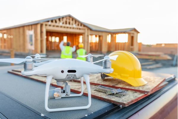
Introduction to Drone Safety The integration of drones into various sectors marks a significant shift in how businesses approach tasks like surveying, monitoring, and inspection. From the vast fields of agriculture where they monitor crop health to the intricate structures in construction and utility sectors where they inspect hard-to-reach areas, drones have become indispensable tools. Their application extends further into mining for exploration and mapping, and even in oil industries for pipeline inspections. This widespread adoption is driven by drones’ ability to enhance efficiency, reduce costs, and provide unique aerial perspectives. However, with this rapid integration comes a vital responsibility: ensuring the safe operation of these unmanned aerial vehicles (UAVs). This is where our Drone Safety Guide becomes an essential tool for every drone operator. Safety in drone operations encompasses a broad spectrum of considerations. Firstly, there’s the need for strict adherence to airspace regulations to prevent conflicts with manned aircraft, particularly in sectors like utilities and construction where operations often occur near urban areas. Secondly, privacy and data security are paramount, especially in sectors like mining and agriculture, where sensitive information is collected. Potential physical hazards to people, property, and critical infrastructure cannot be overlooked, requiring robust risk assessment and management strategies. Moreover, environmental considerations are crucial, particularly in sensitive areas where wildlife and habitat could be impacted. Training and certification of drone operators, along with ongoing education about evolving regulations and best practices, are fundamental to maintaining a safe operating environment. This comprehensive approach to drone safety ensures not only regulatory compliance but also fosters public trust and lays the foundation for the sustainable and responsible growth of drone technology across various industries. Delving deeper into these aspects, our Drone guide from a safety point of view offers an in-depth exploration of best practices, regulations, and innovative strategies to navigate the evolving landscape of drone usage. Identifying Key Risks in Drone Operation: A Detailed Perspective When it comes to operating drones, identifying and understanding the key risks is crucial for ensuring safe and efficient usage. Here’s the detailed perspective: Weather Hazards: Electronics and Flight Stability: Extreme weather conditions like strong winds, heavy rain, or intense heat can impact the drone’s electronic systems, leading to malfunctions. High winds, for example, can cause drones to drift off course or struggle to maintain altitude, while heavy rain can lead to short-circuiting of vital components. Visibility and Control: Poor weather conditions such as fog, heavy rain, or snow can severely limit visibility. This is particularly hazardous for visual line-of-sight (VLOS) operations, where the operator must keep the drone within their sight at all times. Pre-flight Planning: Implementing comprehensive pre-flight weather checks and having contingency plans for adverse weather are key. This includes monitoring weather forecasts and understanding the weather thresholds for safe operation of specific drone models. Operational Missteps: Visual Contact and Spatial Awareness: Maintaining constant visual contact is crucial to prevent disorientation. Operators may lose sight of their drones due to distance, lighting conditions, or obstructions, increasing the risk of accidents or unintended airspace intrusions. Navigational Errors: Entering restricted airspace, whether inadvertently or due to navigational errors, can have legal ramifications and pose safety risks. This is particularly critical near airports, military bases, or other sensitive areas. Distance and Altitude Misjudgments: Misjudging the drone’s proximity to obstacles, especially in urban or densely populated areas, can lead to collisions. Understanding the drone’s altitude in relation to surrounding structures is essential for safe operation. Technical Failures: Battery Life and Power Management: Unexpected battery drain or failure mid-flight can lead to a loss of control. Understanding and monitoring the drone’s battery health and having clear protocols for low-battery scenarios are critical. GPS Reliability: GPS glitches can misguide a drone, leading to incorrect positioning or flight paths. Ensuring that drones have reliable GPS systems and backup navigation options is vital. Routine Maintenance: Regularly scheduled maintenance checks and immediate attention to any technical anomalies can prevent unexpected failures. This includes firmware updates, hardware inspections, and calibration of sensors. Interference and Security Risks: Radio Frequency (RF) Interference: RF interference, whether from environmental sources or intentional jamming, can disrupt the communication link between the drone and the operator. Cybersecurity Threats: The risk of hacking or unauthorized access to the drone’s data transmission systems raises concerns about data integrity and privacy. Employing strong encryption and secure data storage practices is essential. Respecting Privacy: When operating in areas where individuals might have an expectation of privacy, it’s crucial to adhere to privacy laws and ethical guidelines to avoid intrusions and potential legal issues. By meticulously addressing these detailed aspects of weather hazards, operational missteps, technical failures, and interference/security risks, as outlined in our drone safety guide, drone operators and organizations can significantly enhance the operational safety and reliability of their drone programs. This level of detailed attention, as emphasized in the drone guide from a safety point of view, is not just about mitigating risks but also about establishing a culture of safety and responsibility in the burgeoning field of drone operations. Strategies for Mitigating Risks in Drone Operation To ensure safety and efficiency in drone operations, it is crucial to adopt a multifaceted approach to risk mitigation. The following strategies provide a detailed roadmap: Weather Preparedness: In-depth Weather Analysis: Operators should not only check general weather forecasts but also understand specific weather patterns that can affect drone flights, such as wind gusts, localized rainstorms, or temperature extremes. Understanding Drone Capabilities: Different drones have varying levels of tolerance to weather conditions. Operators must be familiar with the specific limitations and capabilities of their equipment, like maximum wind resistance and operational temperature ranges. Emergency Weather Protocols: Developing detailed emergency response plans for sudden weather changes, such as rapid wind speed increases or unexpected precipitation, is essential for safe operation. Operator Training and Guidelines: Extensive Training Programs: Training programs should cover a wide range of topics, including basic flight controls, advanced navigational techniques, emergency response, and scenario-based simulations to prepare for unexpected situations. Regulatory Knowledge: A deep understanding of local, national,
Drone Aircraft Price: How to Measure The Value for Your Company

Drone aircraft, you have probably noticed how prices can be high than their multirotor counterparts. We have touched on this in our chats about finding the right drone configuration for your business. The reason? Drone aircraft pack more sophisticated tech and there aren’t as many on the market. But don’t let the price tag deter you. There are moments when the standout features of drone aircraft truly align with your business needs, offering unmatched value. So, how do you figure out if the investment is worth it? It’s about looking beyond the initial cost to the broader picture: the unique benefits and any additional expenses. This way, you’re not just spending money; you’re investing in the future of your business, making sure every penny contributes to your success. The Reason Why Drone Aircraft Price is High In the dynamic world of Unmanned Aerial Vehicles (UAVs), drone aircraft stand out for their long-range and extended flight capabilities. Their enhanced flight endurance and faster cruising speeds, despite a slight trade-off in payload capacity, make them the preferred choice for surveying, mapping, and surveillance applications. A review of our previous guidelines reveals that drone aircraft excel in applications requiring prolonged flight times and extensive ranges. The endurance and speed of these drones result from meticulous engineering designed to maximize operational efficiency in the field. Several drone models, each with its unique price tag, offer varying degrees of flight endurance. Even the most basic and affordable electric battery-powered models can fly for about an hour, covering a significant area of up to 5 kilometers radius from the launch point. The more expensive models, however, push endurance to new heights, with flight times exceeding 10 hours, providing operators with greater freedom and significantly boosting productivity. For those in the surveying and mapping sectors, considering both capabilities and price, certain drones like the Quantum Systems Trinity Pro, Wingtra Gen II, and JOUAV CW-007 are known for their precision and reliability. Each model combines advanced features designed to produce accurate, high-resolution geographical data. Quantum Systems Trinity Pro The Quantum Systems Trinity Pro, tailored for professional surveying, features advanced safety measures. It includes a mini Lidar sensor for obstacle detection during landing and is weather-resistant with an IP 54 rating, ensuring rain protection. It also supports increased altitude transitions up to 60 meters. The drone’s flexibility in take-offs and landings, including remote and linear options, paired with the QBase 3D software, facilitates thorough pre-flight checks and adapts to varying terrain, making it ideal for challenging conditions. Wingtra Gen II WingtraOne GEN II is equipped with advanced predictive maintenance capabilities through intelligent algorithms that monitor all crucial flight components. The WingtraPilot software provides smart notifications to pre-empt potential issues, ensuring a safe flight experience. This drone is versatile, supporting various payloads like the oblique Sony a6100 camera, which is perfect for detailed 3D reconstructions of vertical structures. Each camera includes a built-in PPK GNSS receiver for centimeter-level accuracy, making it ideal for mapping everything from individual buildings to entire cities and producing high-resolution 3D meshes quickly and with unmatched precision. JOUAV CW-007 The CW-007 Drone, designed for easy transport as it weighs under 8 kg and features a quick-setup modular design with VTOL capabilities. It emphasizes automated operations with a one-button start, high precision, and extensive coverage in a single flight. Ongoing technical advancements enhance efficiency, safety, and cost-effectiveness, with dual GPS systems bolstering reliability. With its centimeter-level RTK and PPK capabilities, it represents a blend of convenience and cutting-edge technology. C-Astral SQA E-VTOL Developed by X-WORKS C-ASTRAL’s advanced laboratory, the SQA eVTOL is a compact, electric drone ideal for medium-range ISR operations up to 40 km. It features unique Blended Wing Body aerodynamics for exceptional stability and endurance. Leveraging C-ASTRAL’s vast flight experience, this drone incorporates the intuitive C 3 P software for mission planning, real-time control, and geospatial data integration. It also boasts advanced features, including STANAG 4609 compatibility and integration with various battlefield management systems. JOUAV CW-25E The CW-25E, a versatile, battery-powered UAV, is designed for efficient and safe data collection across various sites. It supports vertical takeoff/landing and can operate up to 6000m, with a flight duration of 120-240 minutes depending on the payload. Its modular design simplifies transport, and its automated system supports one-button takeoffs and landings. Equipped with high-precision sensors and dual-GPS, the drone can carry a range of sensors, from aerial cameras to LiDAR. Built for safety and adapt For multipurpose applications, gasoline-powered variants like the JOUAV CW-40 and UKRSPEC PD-2 offer a rare combination of robustness, extended flight time, and higher payload capacity, making them suitable for a variety of operational needs. JOUAV CW-40 CW-40 is a high-endurance, VTOL fixed-wing UAV powered by either gasoline or heavy oil, crafted for precision-heavy and expansive aviation tasks on both land and sea. Offering up to 8 hours of flight with a 6kg payload and a remarkable control link of 100km, this drone excels in long-range missions. Users gain a comprehensive experience with the integrated JOUAV EagleMap, which enables advanced mission planning, real-time surveillance, AI processing, and more. Apart from its notable payload capacity of 8kg, the CW-40 emphasizes safety and adaptability, flying seamlessly in diverse environmental conditions and catering to marine vessel operations. This UAV not only ensures optimal data collection but also guarantees operational safety and significant cost savings. In the surveillance domain, the electric battery-powered C-Astral SQA E-VTOL and JOUAV CW-25E stand out for their stealth, extended operational time, and broad area coverage, crucial for real-time monitoring and data acquisition. UKRSPEC PD-2 The PD-2 is a versatile UAS designed for both civil and military operations, boasting an impressive 8+ hour endurance, a service ceiling of 4700 m, and an extensive datalink reach of up to 180 km. With a generous 11 kg payload capacity and a 1300 km flight range, this UAV ensures efficiency and adaptability. Users benefit from two primary configurations: a VTOL setup ideal for takeoffs and landings in varied locations and a fixed-wing variant with landing
All You Need To Know About DJI Drone for Your Industry

Intro DJI Drone is a reputable drone brand used across various industries. Their drones cater to different needs, whether it’s for farmers monitoring crops, photographers taking aerial shots, or workers inspecting buildings. With a diverse drone range, DJI Drone has become a trusted choice for those looking to utilize drone technology in their work, showcasing how DJI’s innovation aids in practical ways across different fields. DJI offers a wide range of drones suited for various tasks and industries like aerial photography, terrain mapping, or industrial inspections. It’s crucial to understand the unique features and performance metrics of different DJI drones to choose the right one for your needs. This understanding will help you make an informed decision, aligning with your goals and improving operational efficiency. In this article, we’ll help you choose the right DJI drone for your industry. DJI’s range of drones cater to various needs, and understanding their capabilities will aid in selecting the one that aligns with your industry requirements. This guide aims to ease the selection process, ensuring you find the DJI drone that perfectly meets your operational goals. You can also explore about how to choose the right drone to buy for your business (fixed wings or Multirotor) The Story of DJI: From Start to Now Starting from the Flight Controller DJI was born in a college dorm room in 2006 with a mission to tackle the challenges of remote-controlled flight, which at the time, was a domain reserved for dedicated enthusiasts. The spark for this venture ignited when Frank Wang, the founder, envisioned a solution that could simplify the complexities inherent in unmanned aerial vehicles (UAVs). For a deeper dive into the story behind DJI’s success, you can read more on “DJI Developers Share the Secret of Our Success” During this period, the concept of drones as we know them today was non-existent; the arena was dominated by radio-controlled airplanes and helicopters, which were challenging to operate. The enthusiasts sought to mimic real flight, which demanded a skill set that was beyond the grasp of the average individual. The turning point came with the conception of the DJI XP Flight Controller, a compact, ready-made device that acted as the brain of the UAV. This gadget received the operator’s commands and translated them into actions, essentially functioning as an autopilot that significantly eased the task of flying. Prior to this innovation, maintaining a radio-controlled helicopter stable in the air required a seasoned hand, and existing flight controllers necessitated full assembly by skilled individuals – a time-consuming endeavor. The DJI XP Flight Controller, however, was ready-built, offering a reliable and stable performance that drastically lowered the barriers to entry in the realm of UAVs. This pioneering product opened up a new world of possibilities, marking the first significant milestone in DJI’s illustrious journey. Over time, this initial breakthrough paved the way for an expansive product line, with each drone model designed to cater to the varying needs of different industries. DJI’s evolution reflects a sustained commitment to innovation, continuously pushing the envelope to provide more refined, user-friendly, and industry-specific drone solutions. Successful Milestone With DJI Phantom 3 Drone Launched in April 2015, the DJI Phantom 3 Drone was a pivotal release for DJI, setting a new standard for affordable, top-tier drones. As a highlight of DJI’s third-generation Phantom series, it was noted for its immediate usability and impressive 4K/12-megapixel camera complemented by a 1/2.3″ Sony Exmor sensor, appealing strongly to aerial photography aficionados. For an in-depth review of the DJI Phantom 3 Drone, check out CNET’s review DJI Phantom 3 Drone redefined affordable, high-end drones. Part of DJI’s third-generation Phantom series, its plug-and-play usability and powerful 4K/12-megapixel camera with a 1/2.3″ Sony Exmor sensor made it a favorite among aerial photography enthusiasts. The Phantom 3 series’ success highlighted DJI’s dedication to combining quality and user-centric design at competitive prices. More than just a launch, it cemented DJI’s standing in the commercial drone industry. DJI’s Strategy: Integrating Renowned Brands for Vertical Growth DJI’s strategic acquisition of a majority stake in Hasselblad reflects a move towards vertical integration, resembling China’s Geely Motors’ acquisition of Volvo. This partnership aims to revitalize Hasselblad’s brand, drawing from DJI’s innovation in drone technology and Hasselblad’s extensive expertise in high-quality imaging. Their collaboration embodies a shared commitment to quality, design, and brand integrity, offering financial and engineering support to propel Hasselblad back to prominence. Further details about this significant acquisition can be found in The Verge’s in-depth article. The alliance has already borne fruit with the X1-D, showcasing the fusion of Hasselblad’s camera quality in a compact unit, symbolizing the innovative potential of this partnership. Through this venture, DJI aims to capture a higher-end market in photography and cinematography, leveraging Hasselblad’s rich history in optics and aerial imaging to fortify its position as a leader in integrating advanced camera technology with drone capabilities. DJI: Leading the Drone Industry Since 2006 DJI has soared to become a drone industry behemoth, boasting over 14,000 employees. A remarkable 25% of this workforce is channeled towards research and development, reflecting DJI’s unwavering commitment to drone technology innovation. The trajectory hasn’t been without its share of controversies. In December 2021, the U.S. government blacklisted DJI due to alleged surveillance ties in China’s Xinjiang region. Additionally, the use of its products on battlefields presents a facet of its technology’s diverse, albeit contentious, applications. Learn more about DJI Blacklisted on The US on CNBC News Despite these hurdles, DJI’s market dominance remains intact. The robustness and versatility of its drones cater to various industrial needs, affirming DJI’s leadership in the global drone market. Furthermore, with over 70% of the consumer drone market share as of 2022, DJI epitomizes innovation and resilience in the tech world, not just as a drone manufacturer but also as one of China’s most valued tech enterprises with a multi-billion-dollar valuation. DJI: Dominating the Skies with Superior Drones DJI continues to uphold its position as the most dominant player in the drone industry, setting standards that
Ultimate Guideline: How to Choose The Right Drone Camera

Intro With the ever-increasing usability and accessibility of drone cameras, they have gained immense popularity in recent years. From their humble beginnings in the early 20th century, when they were used primarily for military purposes during World War II, drone cameras have come a long way. Utilizing drone cameras can be highly beneficial for your company. From capturing stunning aerial shots for marketing materials to monitoring large construction sites, drone cameras provide a cost-effective and efficient solution to enhance business operations and productivity. Selecting the right drone camera for your company’s needs is crucial. With a variety of options available on the market, evaluating factors such as flight time, camera quality, range and specific features that align with your requirements is critical. If you are excited to explore the vast potential of drone cameras and how they can revolutionize your business, follow us along on this thrilling journey. Choosing the right drone camera for your business needs can be a confusing task. With numerous options available, each with varying specifications, it can become overwhelming to evaluate and make a decision. When it comes to choosing the right drone camera for your business, having a basic understanding of these specifications is essential. This knowledge helps you grasp details like camera quality, resolution and sensors allowing you to make a wise decision. By knowing what to look for, you can pick a drone camera that perfectly fits your needs, making your business operations smoother and more efficient. Apart from choosing the right drone camera for your business, another important consideration is selecting the right service provider. The service provider you choose plays a crucial role in ensuring the success of your drone operations. Look for a provider that offers comprehensive services such as drone maintenance, repairs, and training programs. Consider their expertise in the specific industry or field that your business operates in. It is also important to evaluate their customer support and responsiveness, as well as their ability to stay updated with the latest drone technology advancements. Understanding how to choose a drone camera tailored specifically for your company is crucial. Start by comprehending the purpose of the drone camera—whether it’s for capturing breathtaking aerial shots or for advanced surveillance. Delve into the technical aspects, familiarizing yourself with parameters, sensors, and camera features. In this article, you will learn about drone camera sensors and specifications, enabling you to make informed decisions. This knowledge equips you to ensure that the drone camera you select aligns perfectly with your company’s requirements. By grasping these essential elements, you not only enhance your understanding of drone technology but also empower your business with the right tools for success. Guideline: Understanding Drone Camera Generally, there are two categories of drones concerning cameras: drones with built-in cameras and drones with interchangeable cameras. Drones with Built-in Cameras: These cameras are specifically designed for the drone model and are optimized for its features and functionalities. Users of such drones have limited options for upgrading or customizing their camera setup since the camera is an integral part of the drone’s design. Characteristics: Cameras are integrated into the drone and cannot be replaced or upgraded. Optimized for specific drone models, ensuring seamless compatibility and performance. Limited options for customization or upgrading the camera setup. Designed for users who prioritize convenience and simplicity in their drone operations. Examples: DJI Mavic 3, Parrot Anafi, and Skydio 2+. Drones with Interchangeable Cameras: These drones offer the flexibility of swapping out the camera unit, allowing users to choose a camera that best suits their specific needs Characteristics: Cameras can be swapped out, allowing users to choose a camera that suits their specific needs. Offers flexibility in camera selection, catering to diverse professional requirements. Compatibility is crucial; manufacturers provide a range of compatible camera options. Ideal for users who require specialized cameras for specific tasks and value the ability to customize their drone’s imaging capabilities. Examples: DJI M350 RTK, Skyfront Perimeter 8,and Quantum Trinity F90+ Considerations: User Preferences: Choice depends on whether the user prioritizes convenience or customization options. Specific Requirements: Consider the exact imaging needs of the task or project at hand. Budget: Interchangeable camera drones might offer cost-effective solutions in the long run due to upgrade flexibility. Manufacturer Guidance: Adhere to compatible options provided by the drone manufacturer to ensure seamless integration and optimal performance. Understanding Key Technical Parameters of a Drone Camera When it comes to utilizing drones for data collection, understanding the pivotal role of sensors is key. Essentially, a drone functions as a vehicle designed to carry sensors, making these components absolutely crucial. Sensors act as the eyes and ears of your drone, enabling it to accurately perceive and respond to its surroundings. In this context, our primary focus lies on camera sensors. These sensors are paramount in determining the quality of the images and videos your drone captures, directly influencing the success of your data collection projects or missions. Although our discussion here is specific to camera sensors, it’s worth noting that there are other sensor types, such as GPS and temperature sensors, each serving significant roles in certain drone applications. However, for your visual data collection needs, understanding the nuances of camera sensors is indispensable. They are, after all, the primary components shaping your drone’s ability to gather accurate and high-quality visual data .In the realm of drone cameras, several technical parameters are pivotal in determining their performance and the quality of the images they capture: Resolution (in Megapixels): The resolution of a drone camera, measured in megapixels (MP), directly impacts the clarity and sharpness of the captured images. For instance, a 12MP camera captures images with 12 million pixels, creating a detailed representation of real-world objects in the photographs. Higher megapixel counts, such as 20MP or 42MP, ensure finer details and more vivid images, enhancing the overall visual quality. This parameter serves as a crucial factor in determining how accurately the drone can portray objects in the real world within the captured images. Focal Length: Focal length, measured
Ultimate Guideline: How to Choose The Right Drone for You

Intro Over the years, the phrase “drones” has evolved from just a fancy term to a widespread tool seen across the globe. Originally conceived for combat scenarios, these aerial devices now serve countless peaceful purposes. They’ve become increasingly affordable, thus making them accessible for many. Whether it’s for capturing breathtaking aerial photos or aiding farmers in monitoring vast fields, drones have become invaluable in numerous industries. As businesses tap into the potentials of these machines, they’re finding ways to cut costs, enhance efficiency, and even carve out new revenue streams. For those intrigued by the drone universe, this guide is your key. There’s a challenge, though. With so many drones available, how do you pick the right one? The market is full of choices. For a business wanting to make the most of drones, the sheer number of options can be overwhelming. And if drones are new for you or your team, making a wise choice can feel even harder. But choosing a drone isn’t something to rush. It’s a long-term decision. Going for a low-cost drone might seem tempting, but it could lack the features you need. On the other hand, a high-end drone might have great features but could be too costly for your budget. Every business wants value for their money, so finding the right balance is crucial. The key is to start with knowledge. By understanding the basics of drones – what they can do, the types of data they can collect, how to maintain them, and any other related details – you set a good foundation. Think about your needs and the problems a drone can solve for you. With that clarity, you can then focus on finding the drone that matches those needs in the market. Disclaimer : This guide focuses on regular drones, not the ones used by the military. The information provided is up-to-date as of August 2023. Guideline: Understanding Drones and Their Flight Categories Drones, as we know them, have evolved in design and capability. When it comes to selecting one, understanding how they fly can make all the difference. There are several categories based on this criterion, and each comes with its own set of advantages and drawbacks. Here’s a closer look: 1. Fixed-Wing Drones These drones have rigid wings like an airplane. They don’t have the hovering capability of multirotor drones, but they can cover longer distances. Advantages: Endurance: They can stay airborne for longer periods. Speed: They boast a higher cruising speed. Emergency Safety: If there’s a problem, they can glide without power. Disadvantages: Payload Limit: They can’t carry as much weight. Lack of Hover: They can’t stay in one place in the air. Space Requirement: They need a runway or open space to take off and land. Notes: The market for these drones isn’t as expansive. The design and engineering process is more demanding. Most fixed-wing drones are made for hobbyists or professionals, leaving a gap in the mid-tier market. Some well-known manufacturers include Delair and Sensefly. Many manufacturers, however, are transitioning to hybrid designs 2. Multirotor Drones These are perhaps what most people think of when they hear the word “drone”. They have multiple rotors, which give them the ability to hover in place. Advantages: Payload Flexibility: They can carry a reasonable amount of weight. Stationary Flight: Unlike fixed-wing drones, they can hover in a single spot. Space Flexibility: They can take off and land vertically, without needing a runway. Disadvantages: Flight Time: Their flight duration is typically shorter. Speed Constraints: They usually have a slower cruising speed. Emergency Safety: If there’s a malfunction, they can’t glide. Extra systems or parachutes may be needed for safety. Notes: Many major drone companies focus on these designs. Over 90% of the drones worldwide are multirotor drones. Popular brands include DJI, Autel, Parrot, and Skydio. 3. Hybrid Fixed-Wing VTOL (Vertical Take-Off and Landing) These drones try to combine the best of both worlds. They have fixed wings for long-distance flight and rotors for hovering. Advantages and Drawbacks: These drones aim to merge the benefits of both fixed-wing and multirotor drones. However, they may compromise slightly on performance. Notes: Typically aimed at professional usage. They’re gaining rapid popularity in the drone market. Their design and engineering are more advanced than the other types. Renowned brands in this category are JOUAV, Quantum Systems, and Wingtra. By understanding these categories, potential users can determine which type is best suited for their needs. Whether it’s hovering over a specific spot or covering vast distances, there’s a drone out there tailored for every purpose. Type of Payload that Drones Can Carry Based on Type of Activities Drones have evolved from basic flying machines to advanced devices capable of numerous tasks. The variety of payloads they can carry is a testament to this adaptability. Different payloads serve various purposes, ranging from collecting data to performing tangible actions or even transporting goods. Here’s a breakdown: a) Sensing & Remote Sensing (Camera/Sensor): i) RGB (Visual) Captures data in red, green, and blue wavelengths to produce images similar to standard cameras. Use Cases: Aerial photography, event filming, property monitoring. ii) Infra-red Detects data in the infrared spectrum to produce images indicating temperature differences. Use Cases: Search and rescue operations, monitoring crop health, detecting heat loss in buildings. iii) Multispectral Captures light in specific bands of the visible and near-infrared spectrums to produce detailed images. Use Cases: Monitoring crop health, forest health analyses, shoreline changes. iv) LiDAR Uses laser beams to measure distances, producing accurate 3D maps and models. Use Cases: Topographical mapping, elevation model creation, forest canopy research. v) Gas Sensing Detects specific gases in the atmosphere to determine concentrations. Use Cases: Gas leak detection, air quality monitoring, volcanic activity assessment. vi) Magnetic Measures magnetic fields to gather data on magnetic properties. Use Cases: Finding mineral deposits, locating buried structures, underwater investigations. vii) Hyperspectral Gathers information across many narrow bands of the electromagnetic spectrum. Use Cases: Mineral detection
Using Drone for Safety Violation Detection in Plants

Enhancing Safety from the Sky: Drones in Plant Operations Utilizing a drone for safety violation detection in plants is a burgeoning trend in industrial safety practices. With advanced imaging and sensor capabilities, drones can efficiently monitor plant operations, detect safety violations, and assist in creating a safer work environment. This article explores the benefits of drones in enhancing plant safety. Drones and Safety Violation Detection Drones provide an eye in the sky, enabling comprehensive monitoring of plant operations. Equipped with high-resolution cameras and sensors, they can identify potential safety violations that might be challenging to spot from the ground level. Whether it’s detecting equipment malfunctions, unsafe practices, or regulatory non-compliance, drones bring a new level of safety assurance to plant operations. Also Read: Sky-high Revolution: How Drone Innovation is Driving Industry Transformation The Impact of Drones on Safety Practices By identifying safety violations early, drones allow for immediate corrective actions, mitigating risks, and preventing potential accidents. Notably, drones also promote worker safety by performing inspections in hazardous or hard-to-reach areas, minimizing workers’ exposure to potential risks. Read More: Port of Antwerp: Drones must increase safety and efficiency The Future of Drones in Plant Safety As drone technology continues to evolve, their potential in plant safety is only set to increase. Future developments could see drones equipped with more advanced sensors and AI capabilities for better anomaly detection and predictive maintenance. As such, drones hold promise as invaluable safety tools in plant operations. In conclusion, drones are revolutionizing safety practices in plant operations. As we continue to leverage technology to enhance workplace safety, the role of drones as safety monitors and enforcers will only become more pivotal. See More: Public Safety adds drone technology to enhance service and campus safety