Drone aircraft, you have probably noticed how prices can be high than their multirotor counterparts. We have touched on this in our chats about finding the right drone configuration for your business. The reason? Drone aircraft pack more sophisticated tech and there aren’t as many on the market. But don’t let the price tag deter you. There are moments when the standout features of drone aircraft truly align with your business needs, offering unmatched value. So, how do you figure out if the investment is worth it? It’s about looking beyond the initial cost to the broader picture: the unique benefits and any additional expenses. This way, you’re not just spending money; you’re investing in the future of your business, making sure every penny contributes to your success.
The Reason Why Drone Aircraft Price is High
In the dynamic world of Unmanned Aerial Vehicles (UAVs), drone aircraft stand out for their long-range and extended flight capabilities. Their enhanced flight endurance and faster cruising speeds, despite a slight trade-off in payload capacity, make them the preferred choice for surveying, mapping, and surveillance applications.
A review of our previous guidelines reveals that drone aircraft excel in applications requiring prolonged flight times and extensive ranges. The endurance and speed of these drones result from meticulous engineering designed to maximize operational efficiency in the field.
Several drone models, each with its unique price tag, offer varying degrees of flight endurance. Even the most basic and affordable electric battery-powered models can fly for about an hour, covering a significant area of up to 5 kilometers radius from the launch point. The more expensive models, however, push endurance to new heights, with flight times exceeding 10 hours, providing operators with greater freedom and significantly boosting productivity.
For those in the surveying and mapping sectors, considering both capabilities and price, certain drones like the Quantum Systems Trinity Pro, Wingtra Gen II, and JOUAV CW-007 are known for their precision and reliability. Each model combines advanced features designed to produce accurate, high-resolution geographical data.
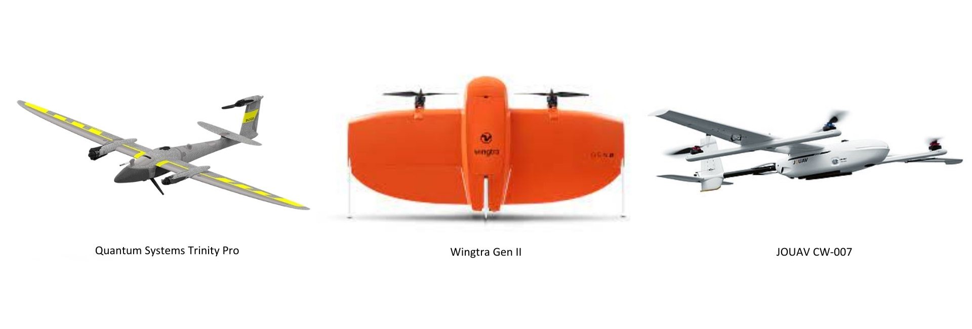
Quantum Systems Trinity Pro
The Quantum Systems Trinity Pro, tailored for professional surveying, features advanced safety measures. It includes a mini Lidar sensor for obstacle detection during landing and is weather-resistant with an IP 54 rating, ensuring rain protection. It also supports increased altitude transitions up to 60 meters. The drone’s flexibility in take-offs and landings, including remote and linear options, paired with the QBase 3D software, facilitates thorough pre-flight checks and adapts to varying terrain, making it ideal for challenging conditions.
Wingtra Gen II
WingtraOne GEN II is equipped with advanced predictive maintenance capabilities through intelligent algorithms that monitor all crucial flight components. The WingtraPilot software provides smart notifications to pre-empt potential issues, ensuring a safe flight experience. This drone is versatile, supporting various payloads like the oblique Sony a6100 camera, which is perfect for detailed 3D reconstructions of vertical structures. Each camera includes a built-in PPK GNSS receiver for centimeter-level accuracy, making it ideal for mapping everything from individual buildings to entire cities and producing high-resolution 3D meshes quickly and with unmatched precision.
JOUAV CW-007
The CW-007 Drone, designed for easy transport as it weighs under 8 kg and features a quick-setup modular design with VTOL capabilities. It emphasizes automated operations with a one-button start, high precision, and extensive coverage in a single flight. Ongoing technical advancements enhance efficiency, safety, and cost-effectiveness, with dual GPS systems bolstering reliability. With its centimeter-level RTK and PPK capabilities, it represents a blend of convenience and cutting-edge technology.
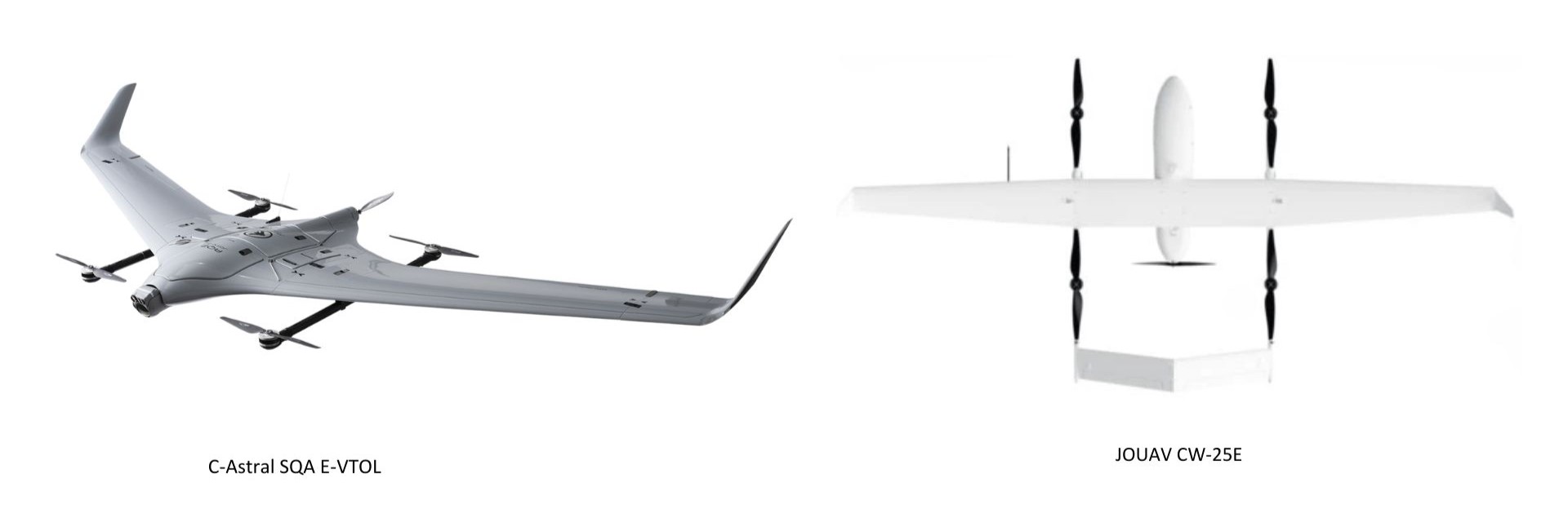 C-Astral SQA E-VTOL
Developed by X-WORKS C-ASTRAL’s advanced laboratory, the SQA eVTOL is a compact, electric drone ideal for medium-range ISR operations up to 40 km. It features unique Blended Wing Body aerodynamics for exceptional stability and endurance. Leveraging C-ASTRAL’s vast flight experience, this drone incorporates the intuitive C 3 P software for mission planning, real-time control, and geospatial data integration. It also boasts advanced features, including STANAG 4609 compatibility and integration with various battlefield management systems.
JOUAV CW-25E
The CW-25E, a versatile, battery-powered UAV, is designed for efficient and safe data collection across various sites. It supports vertical takeoff/landing and can operate up to 6000m, with a flight duration of 120-240 minutes depending on the payload. Its modular design simplifies transport, and its automated system supports one-button takeoffs and landings. Equipped with high-precision sensors and dual-GPS, the drone can carry a range of sensors, from aerial cameras to LiDAR. Built for safety and adapt
For multipurpose applications, gasoline-powered variants like the JOUAV CW-40 and UKRSPEC PD-2 offer a rare combination of robustness, extended flight time, and higher payload capacity, making them suitable for a variety of operational needs.
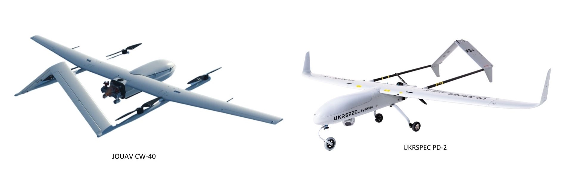
JOUAV CW-40
CW-40 is a high-endurance, VTOL fixed-wing UAV powered by either gasoline or heavy oil, crafted for precision-heavy and expansive aviation tasks on both land and sea. Offering up to 8 hours of flight with a 6kg payload and a remarkable control link of 100km, this drone excels in long-range missions. Users gain a comprehensive experience with the integrated JOUAV EagleMap, which enables advanced mission planning, real-time surveillance, AI processing, and more. Apart from its notable payload capacity of 8kg, the CW-40 emphasizes safety and adaptability, flying seamlessly in diverse environmental conditions and catering to marine vessel operations. This UAV not only ensures optimal data collection but also guarantees operational safety and significant cost savings.
In the surveillance domain, the electric battery-powered C-Astral SQA E-VTOL and JOUAV CW-25E stand out for their stealth, extended operational time, and broad area coverage, crucial for real-time monitoring and data acquisition.
UKRSPEC PD-2
The PD-2 is a versatile UAS designed for both civil and military operations, boasting an impressive 8+ hour endurance, a service ceiling of 4700 m, and an extensive datalink reach of up to 180 km. With a generous 11 kg payload capacity and a 1300 km flight range, this UAV ensures efficiency and adaptability. Users benefit from two primary configurations: a VTOL setup ideal for takeoffs and landings in varied locations and a fixed-wing variant with landing gear for traditional runway operations. Further enhancing its appeal are its low operational costs, short lead time, and lack of export restrictions. PD-2 offers the flexibility and efficiency that modern missions demand.
In summary, the evolution of drone aircraft, considering the various price ranges, is a testament to the relentless pursuit of extending the operational boundaries of UAV technology. As they continue to dominate the skies, their capabilities in surveying, mapping, and surveillance applications are set to reach new heights, making them an indispensable asset in a myriad of industrial and security domains.
Drone aircraft price: A Look at Different Tier
The advent of drone technology has undeniably revolutionized numerous sectors, from agriculture to surveillance, mapping, and beyond. The market structure of drone aircraft is often delineated into three distinct tiers: low-tier entry-level, mid-tier, and high-tier (semi-military). Each tier reflects a unique blend of price, performance, and support structures, tailored to meet varying operational demands and budgetary allocations.
Low-Tier Entry-Level Drones: A Leap into Aerial Exploration
Embarking on the aerial adventure is often marked by the acquisition of low-tier entry-level drones. Ranging from USD 10,000 to 25,000, these drones predominantly run on electric batteries. With a flight endurance hovering around an hour and an operational radius of 5 kilometers, they are an accessible gateway into the drone realm. However, the journey comes with its share of hurdles:
- Performance is often the first compromise, with these drones offering basic functionality.
- Support structures are sparse, making troubleshooting a daunting task for the uninitiated.
- Documentation and user communities are in nascent stages, offering limited guidance.
- Longevity is not a strong suit, given the non-industrial grade materials employed in their construction.
Mid-Tier Drones: Bridging Aerial Ambitions with Reality
As aspirations soar higher, mid-tier drones, priced between USD 25,000 to 60,000, emerge as a balanced rendezvous between cost and functionality. Offering a flight endurance of 1 to 3 hours and an operational radius extending between 5 to 15 kilometers, they are a popular choice for common applications like surveying and mapping. Their presence in the market is marked by:
- A commendable performance threshold, aligning with the operational demands of many commercial applications.
- Robust support and after-sales service structures, easing the operational learning curve.
- A well-documented user base, fostering a thriving community that facilitates knowledge exchange.
- Longevity, contingent on diligent operational and maintenance practices, making them a reliable investment.

High-Tier Semi-Military Drones: The Pinnacle of Aerial Mastery
The upper echelon is dominated by high-tier semi-military drones, with prices skyrocketing from USD 60,000 to a staggering USD 1,000,000. Their power source diversifies to include gasoline, alongside electric batteries, ensuring a minimum flight endurance of 3 hours and an operational radius of at least 15 kilometers. Their hefty price tags are justified by:
- Stellar performance, meeting the rigorous demands of high-stake operations, albeit with a narrower application scope.
- Exceptional support and after-sales service, mirroring the high operational stakes they are associated with.
- Exhaustive documentation, although the user base shrinks, reflecting the specialized nature of these drones.
- Durability that stands the test of time, dependent on stringent operational and maintenance practices.
In conclusion, the drone aircraft market is a diverse arena, offering a tiered pricing structure that encapsulates an expansive range of operational capabilities, support mechanisms, and community engagements. The investment in a particular tier should be a well-considered decision, aligning with the intended operational goals, the intricacies of the task at hand, and the budgetary constraints. The sky is indeed the limit, but the choice of the drone can either propel or hinder the journey towards aerial mastery.
Assessing the Real Cost of Drone Deployment
In recent years, drone technology has progressively been integrated into various sectors, notably in mining and oil & gas industries for tasks such as photogrammetry surveys and surveillance. This article dissects the actual cost of deploying drones by examining a couple of case studies, comparing multirotor and fixed-wing drones.
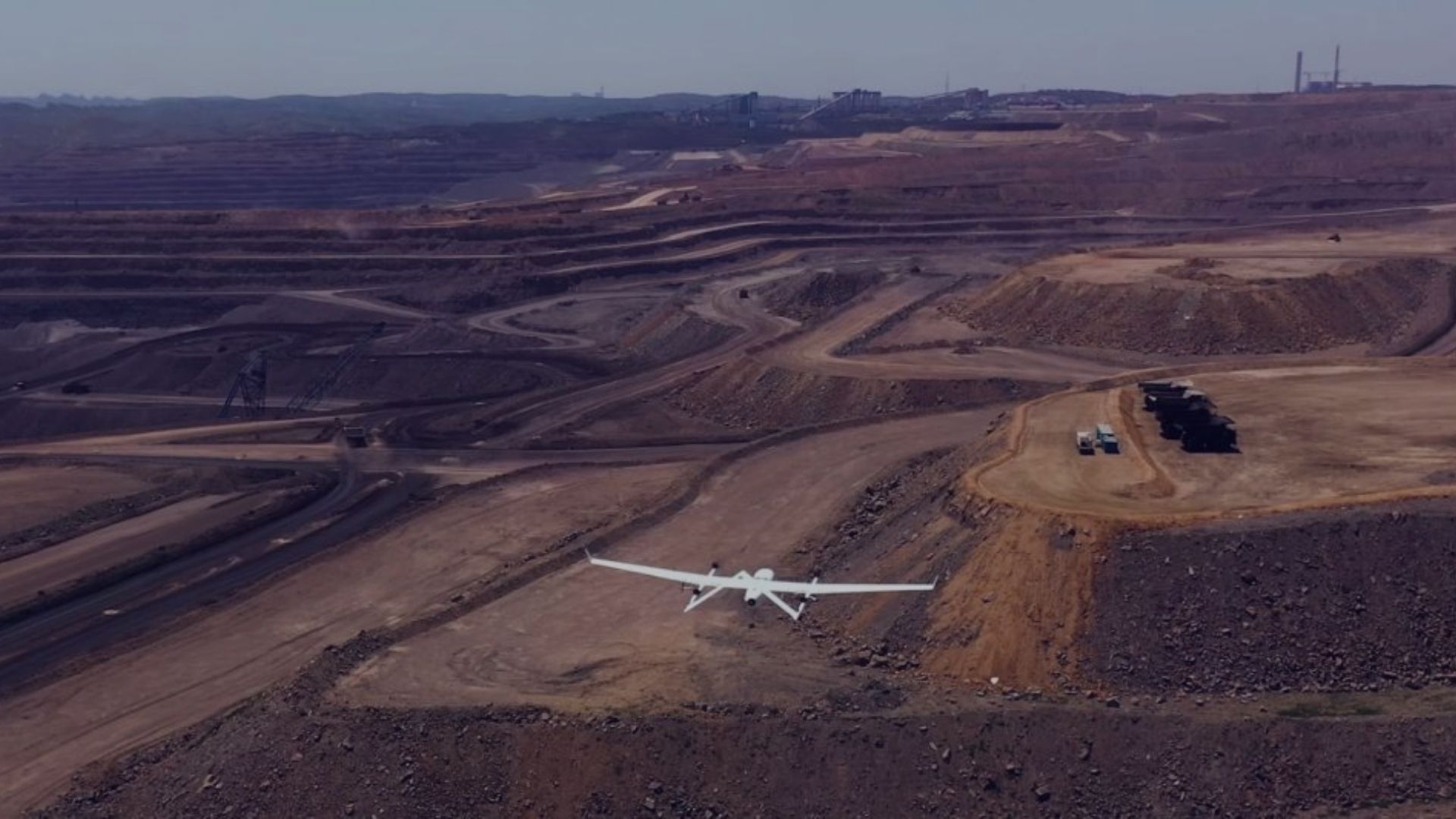
Case Study 1: Photogrammetry Survey in a Mining Site
A hypothetical mining company with a concession area of 1,000 hectares seeks to conduct photogrammetry surveys bi-monthly to monitor mining progress. They are considering the use of multirotor or fixed-wing drones and have narrowed down their choices to the DJI M350 RTK with Zenmuse P1 24mm and Quantum Trinity Pro with Sony Rx1Rii.
- Initial Investment:
- DJI M350 RTK: ~ USD 20,000
- Quantum Trinity Pro: ~ USD 50,000
- Life Cycle:
- DJI M350 RTK: 600 flight cycles
- Quantum Trinity Pro: 1,000 flight cycles
- Cost per Flight Cycle:
- DJI M350 RTK: USD 33.3
- Quantum Trinity Pro: USD 50
When deployed for mapping with a Ground Sampling Distance (GSD) of 5 cm/pixel and a frontlap/sidelap of 75%:75%, the drones exhibit the following productivity:
- DJI M350 RTK:
- Flight altitude: 275 m
- Cruising speed: 10 m/s
- Effective flight time: 35 minutes
- Productivity: 378 hectares/flight
- Quantum Trinity Pro:
- Flight altitude: 390 m
- Cruising speed: 17 m/s
- Effective flight time: 55 minutes
- Productivity: 981 hectares/flight
Therefore, the cost per operation is approximately USD 100 for three flights with DJI M350 RTK, and USD 50 for a single flight with Quantum Trinity Pro, making the latter 50% more cost-effective per operation due to its superior productivity.
Case Study 2: Surveillance of a 100-Kilometer Pipeline
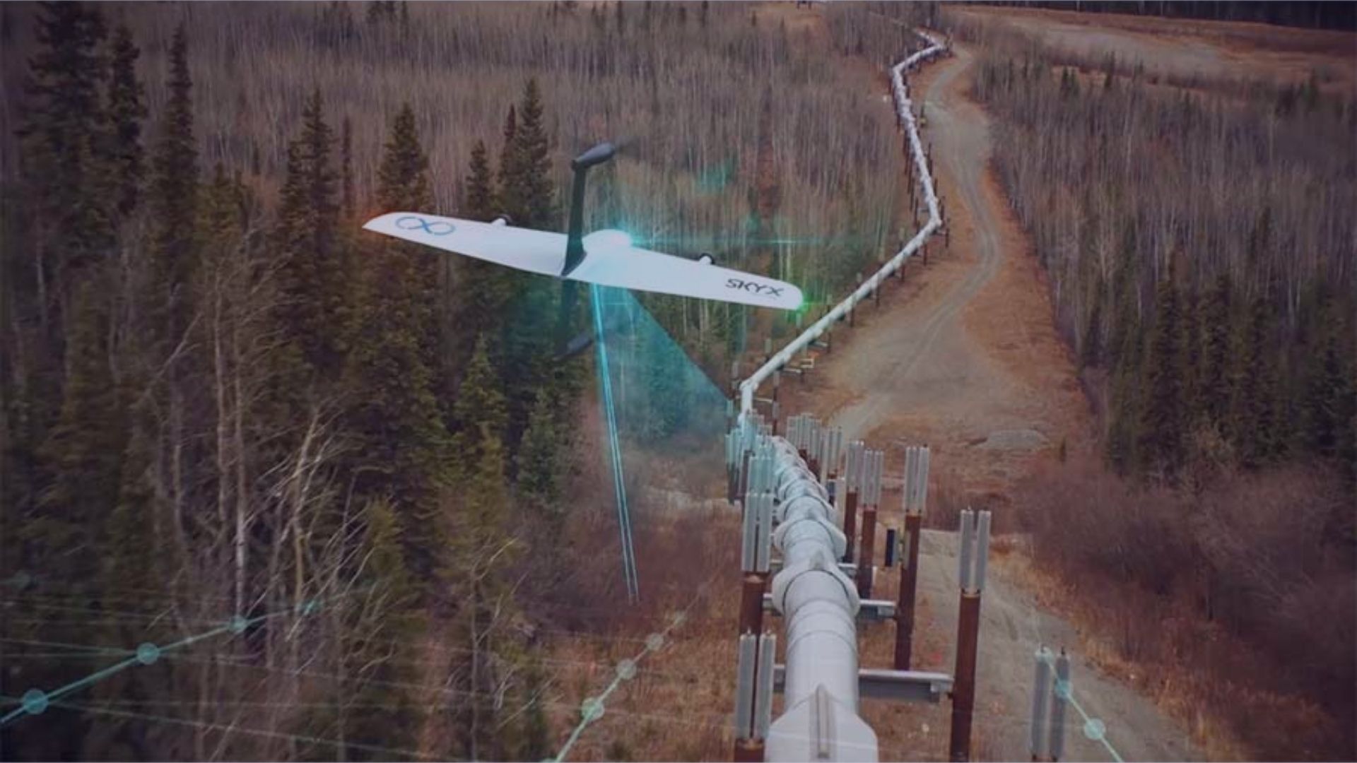
An oil and gas company aims to perform daily surveillance along a 100-kilometer pipeline to prevent illegal activities and detect oil leaks. They contemplate deploying either multirotor or fixed-wing drones, comparing DJI M350 RTK with Zenmuse H20T and C-Astral SQA eVTOL.
- Initial Investment:
- DJI M350 RTK: ~ USD 30,000
- C-Astral SQA eVTOL: ~ USD 150,000
The drones exhibit the following performance metrics:
- DJI M350 RTK:
- Effective coverage: 5-kilometer radius from one location
- Requires ten locations to cover the entire pipeline
- C-Astral SQA eVTOL:
- Effective coverage: 25-kilometer radius from one location
- Requires two locations to cover the entire pipeline
The initial investment to deploy enough drones to cover the entire pipeline is USD 300,000 for both options. However, the operational cost, maintenance, and the number of pilots required to operate ten multirotor drones considerably outweigh the costs of operating two fixed-wing drones, revealing a significant cost advantage in favor of fixed-wing drones.
These case studies underscore the importance of thoroughly evaluating both the upfront and operational costs when deciding between multirotor and fixed-wing drones. The selection hinges not only on the initial investment but also on the long-term operational efficiencies, which could lead to substantial cost savings over time.
Conclusion
In conclusion, the burgeoning aircraft drone market presents a wide array of options, each with its unique set of capabilities and price points. When considering the drone aircraft price, it’s imperative to shun the notion that the cost of a drone is directly proportional to its efficacy for every user or task. Instead, a meticulous analysis, encompassing the drone’s specifications, the requirements of the task, and the financial implications, is crucial to unearth the true value that a drone can bring forth. The essence of this process lies in transcending the initial drone aircraft price consideration and delving into an analysis of the return on investment that the drone can provide over time.
Terra Drone play a quintessential role in helping individuals and organizations navigate through these considerations to pinpoint the drone that best aligns with their needs. By leveraging their extensive experience and expertise, Terra Drone assists in both identifying the right drone and understanding the tangible value it can add to operations based on its price and capabilities. This holistic approach ensures that the investment in drone technology, in relation to the drone aircraft price, is well-justified, paving the way for optimized utility, enhanced operational efficiency, and a competitive edge in the evolving technological arena.

