

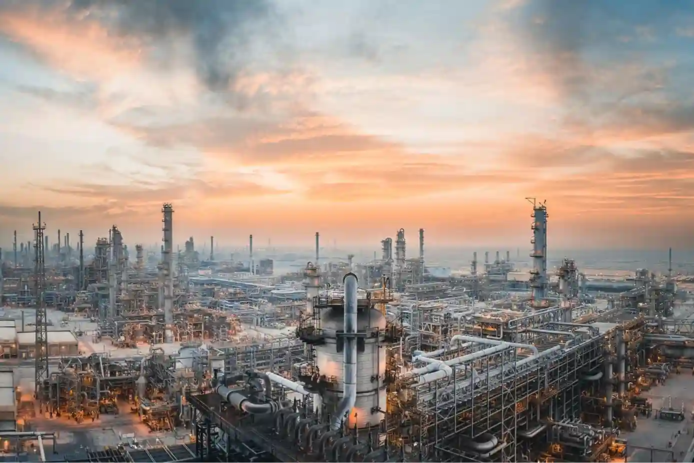
Industrial expansion across Saudi Arabia exemplified by the SAR 41.25 billion Amiral Petrochemical Complex integrated into the SATORP refinery in Jubail Industrial City requires rigorous oversight during engineering, procurement, and construction (EPC) execution.
Spanning 4.3 square kilometers, the complex houses a 1.65 million tonnes/year mixed-feed steam cracker, dual polyethylene lines, and associated derivative units.
Managing concurrent packages executed by major international contractors introduces complex site execution and safety challenges:
- Civil and Structural Progress Tracking: Tracking ground preparation, concrete pours, structural steel erecting, and pipe rack installation across multi-square-kilometer workfronts using ground site walks creates reporting lags between field teams and project leadership.
- Pre-Commissioning Asset Integrity Audits: Certifying hundreds of spherical storage tanks, high-pressure vessels, distillation columns, and flare stacks requires non-contact baseline testing before hydrotesting and chemical commissioning.
- Safety and Cost Bottlenecks: Traditional visual and structural inspections rely heavily on scaffolding, elevated work platforms, rope access, and manual tank entries. These methods expose inspection crews to high-elevation and toxic gas environments while inflating mobilization budgets.
Real-Time EPC Construction Progress Tracking
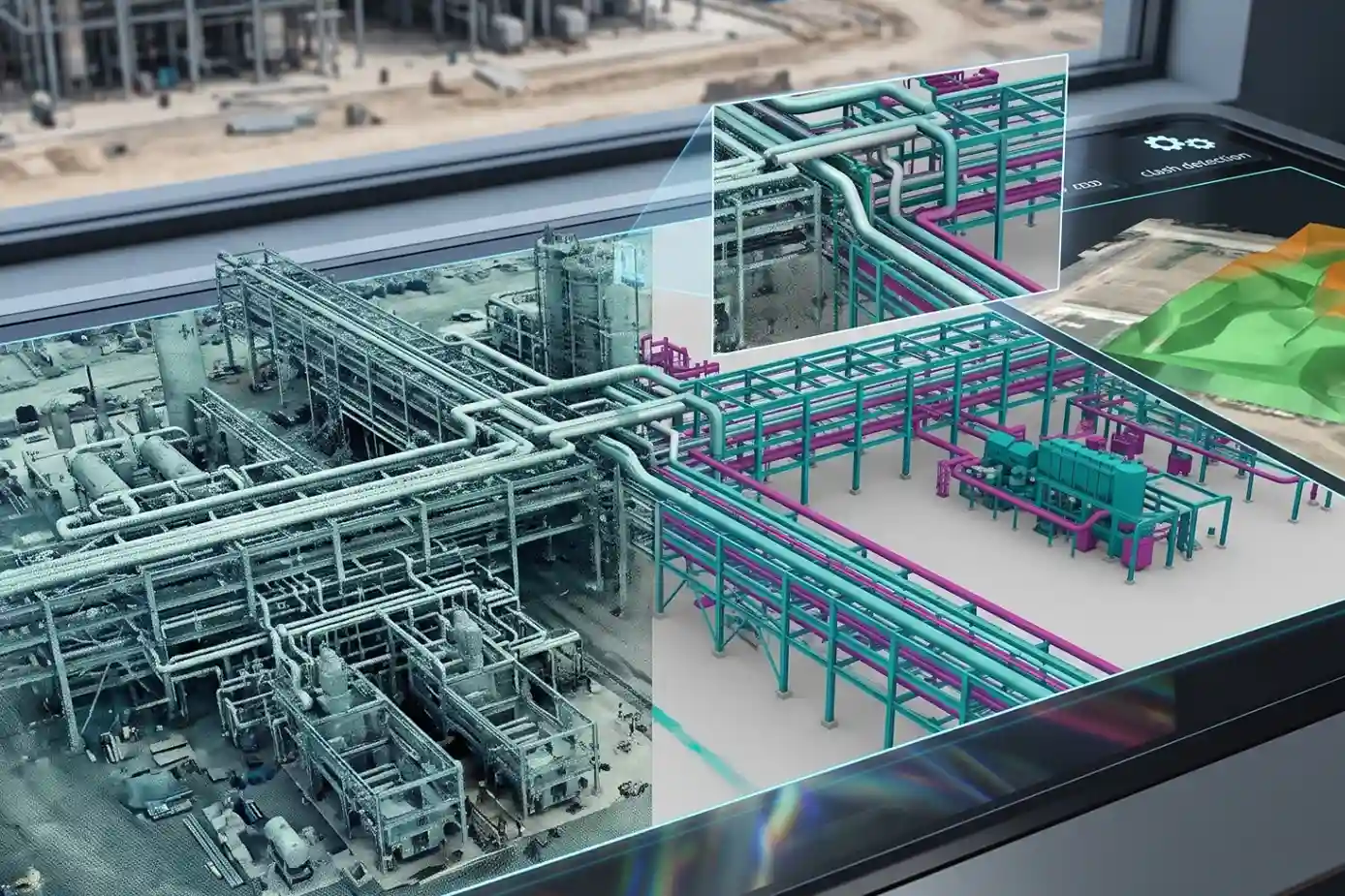
Deploying drone photogrammetry and aerial LiDAR using high-precision platforms like the DJI Mavic 3 Enterprise (M3E) captures centimeter-grade spatial datasets across active EPC packages without interrupting heavy equipment operations on the ground.
EPC Construction Progress Digital Twin Workflow:
- Aerial Photogrammetry: High-Overlap Mapping via DJI Mavic 3 Enterprise
- Spatial Alignment: RTK Centimeter Georeferencing & Base Control
- BIM Model Overlay: CAD Design Vector Clash Detection in Civil 3D
- Volumetric Auditing: DTM Extraction for Soil Cut-and-Fill Calculations
Aerial orthomosaics and high-density 3D point clouds import directly into Building Information Modeling (BIM) platforms.
Project managers overlay 3D CAD design vectors onto as-built drone models to identify structural clashes, check module alignment tolerances, and verify contractor progress milestones in real time.
Additionally, georeferenced Digital Terrain Models (DTMs) calculate exact cut-and-fill soil volumes (m3) moved across earthwork sectors, eliminating billing disputes between developers and civil contractors.
Adopting digital spatial intelligence is accelerating across downstream energy infrastructure. The digital twin market in oil and gas reached over SAR 36.7 billion in 2025 and is projected to hit SAR 129.8 billion by 2034 at a 15.1% CAGR, with downstream petrochemical refineries accounting for 32.7% of total digital twin spending to prevent unplanned downtime.
Non-Contact NDT Inspection and Pressure Vessel Integrity
Certifying mechanical integrity during facility pre-commissioning requires advanced Non-Destructive Testing (NDT) workflows that eliminate conventional access scaffolding.
Across downstream refining and chemical complexes, heavy pressure vessels, spherical gas storage tanks, distillation columns, and elevated pipe racks must undergo thorough structural integrity audits before hydrotesting and initial chemical introduction.
Integrating specialized robotic platforms and airborne sensors into NDT inspection routines replaces manual rope access, shortens inspection turnarounds, and provides sub-millimeter measurement accuracy across critical assets.
Airborne Contact-Based Ultrasonic Testing (UT) Mechanics
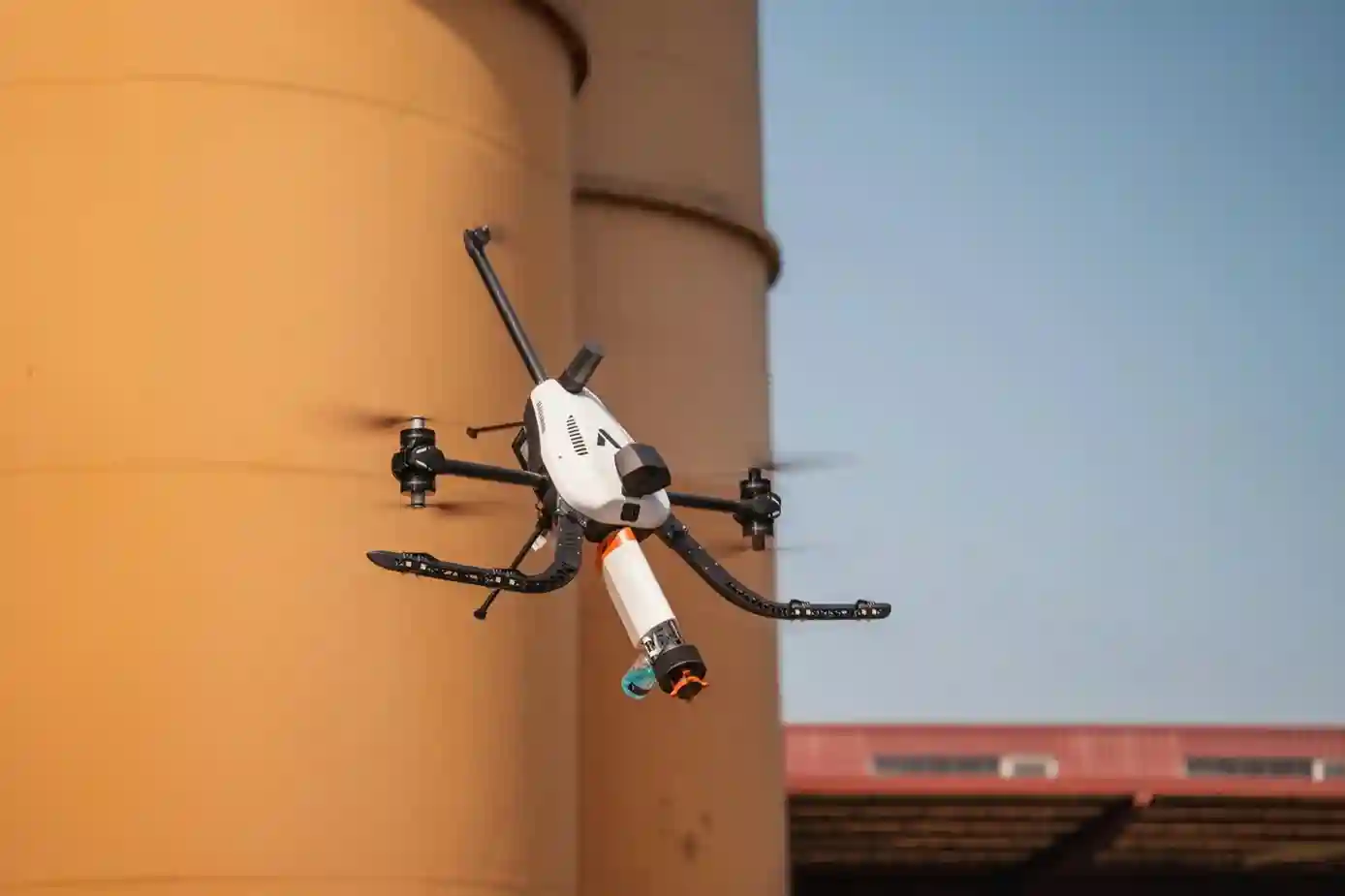
Executing thickness measurements on elevated steel structures historically required erecting extensive scaffolding or dispatching rope-access technicians.
Deploying specialized NDT drone platforms, such as the فوليرو تي, enables contact-based Ultrasonic Testing (UT) to be performed directly from the air.
Airborne Contact-Based UT Inspection Process:
- Active Force Control: Omnidirectional Rotor Thrust Drives Probe Against Steel Surface
- Couplant Dispensing: Automated Gel Application Ensures Acoustic Coupling
- Acoustic Waveform Capture: High-Frequency Transducer Emits Signals for Wall Measurement
- Signal Analysis: Real-Time A-Scan & B-Scan Conversion for Thickness & Corrosion Mapping
The physical operation relies on key technical mechanisms:
- Omnidirectional Thrust Vectoring: Unlike standard multi-rotor drones that must tilt to move horizontally, omnidirectional thrust architectures allow the aircraft to maintain a stable orientation while applying continuous physical force (up to 20 to 30 Newtons) against vertical, angled, or inverted metallic walls.
- Active Probe Coupling: An onboard couplant dispensing system applies ultrasonic gel to the target surface immediately before a flexible transducer probe makes contact. This eliminates air gaps between the sensor and the steel plate, ensuring high-fidelity signal transmission.
- Acoustic Signal Processing: The airborne transducer emits high-frequency sound waves (typically 2.25 MHz to 10 MHz) into the steel substrate. By measuring the time-of-flight of reflected acoustic echoes, the system calculates precise material wall thickness (mm) and generates real-time A-scan waveforms and B-scan profile cross-sections.
Airborne UT platforms measure wall thickness with sub-millimeter precision (±0.1 mm accuracy). Performing contact measurements at heights exceeding 50 meters without erecting scaffolding reduces turnaround times from weeks to hours while protecting field inspection personnel.
Pre-Commissioning Integrity Baselines and Weld Quality Auditing
Establishing structural baselines prior to chemical startup prevents catastrophic material failures, stress corrosion cracking (SCC), and pinhole leaks during high-pressure plant operation.
Pre-commissioning integrity checks focus on evaluating critical structural zones:
- Base Metal Thickness Mapping: Establishing initial wall-thickness profiles across newly fabricated pressure vessels, storage spheres, and chemical storage tanks creates a reference dataset for tracking operational corrosion rates over time.
- Heat-Affected Zone (HAZ) Auditing: High-stress structural welds along vessel seams and nozzle connections undergo targeted NDT checks to detect subsurface laminations, porosity, and volumetric weld flaws caused by thermal stresses during field assembly.
- Structural Deformation Checks: High-resolution visual sensors paired with LiDAR payloads audit tank sphericity and vertical alignment, confirming that storage vessels meet strict ASME (American Society of Mechanical Engineers) Section VIII manufacturing tolerances.
Demand for automated NDT methods is expanding across energy infrastructure. Ultrasonic Testing (UT) commands 28.9% to 36.4% of the overall non-destructive testing market (valued at SAR 14.25 billion in 2026), driven by mandatory wall-thickness measurement, corrosion mapping, and weld auditing across downstream petrochemical assets.
See more about it here: Grand View Research و Straits Research.
Radiometric Thermal Auditing Across High-Temperature Process Infrastructure
While contact-based UT probes inspect solid metal walls, non-contact thermal payloads evaluate insulation performance, fluid flow continuity, and thermal stress distributions across high-temperature process units.
Deploying radiometric thermal sensors mounted on multi-rotor aircraft such as the DJI Matrice 30T enables operators to inspect high-heat assets from safe standoff distances:
- Refractory Lining Degradation: Cracking furnaces, boilers, and high-temperature reaction vessels feature internal ceramic refractory linings to protect outer steel shells from extreme process heat (>1,000∘C). Radiometric thermal sensors measure absolute surface temperatures per pixel, detecting localized hot spots that indicate internal refractory breakdown before outer shell deformation occurs.
- Piping and Heat Exchanger Insulation Audits: Thermal imagery identifies missing or degraded thermal insulation along high-pressure steam corridors and heat-exchanger shells, quantifying convective heat loss and preventing energy wastage across plant networks.
- Flare Stack Burner Tip Inspection: Auditing flare stack tip geometry, pilot flame stability, and thermal distribution using optical zoom (up to 200$\times$ hybrid zoom) and thermal imaging eliminates the need to shut down active flare headers or place workers near hazardous gas exhaust plumes.
Hazardous Confined-Space Inspections and Cost Reduction
Inspecting enclosed petrochemical assets—such as crude storage tank interiors, pressure vessels, cracking boilers, and underground utility culverts—represents one of the most hazardous maintenance and pre-commissioning activities in industrial plants. Traditional confined-space inspection requires physical human entry, demanding extensive lower explosive limit (LEL) gas testing, continuous fresh-air ventilation, standby rescue teams, and labor-intensive scaffolding assembly.
Deploying specialized indoor collision-proof inspection drones and robotic crawlers transforms these high-hazard tasks into safe, remote operational workflows while drastically lowering inspection budgets.
Indoor Robotic Kinematics and Confined-Space Flight Mechanics
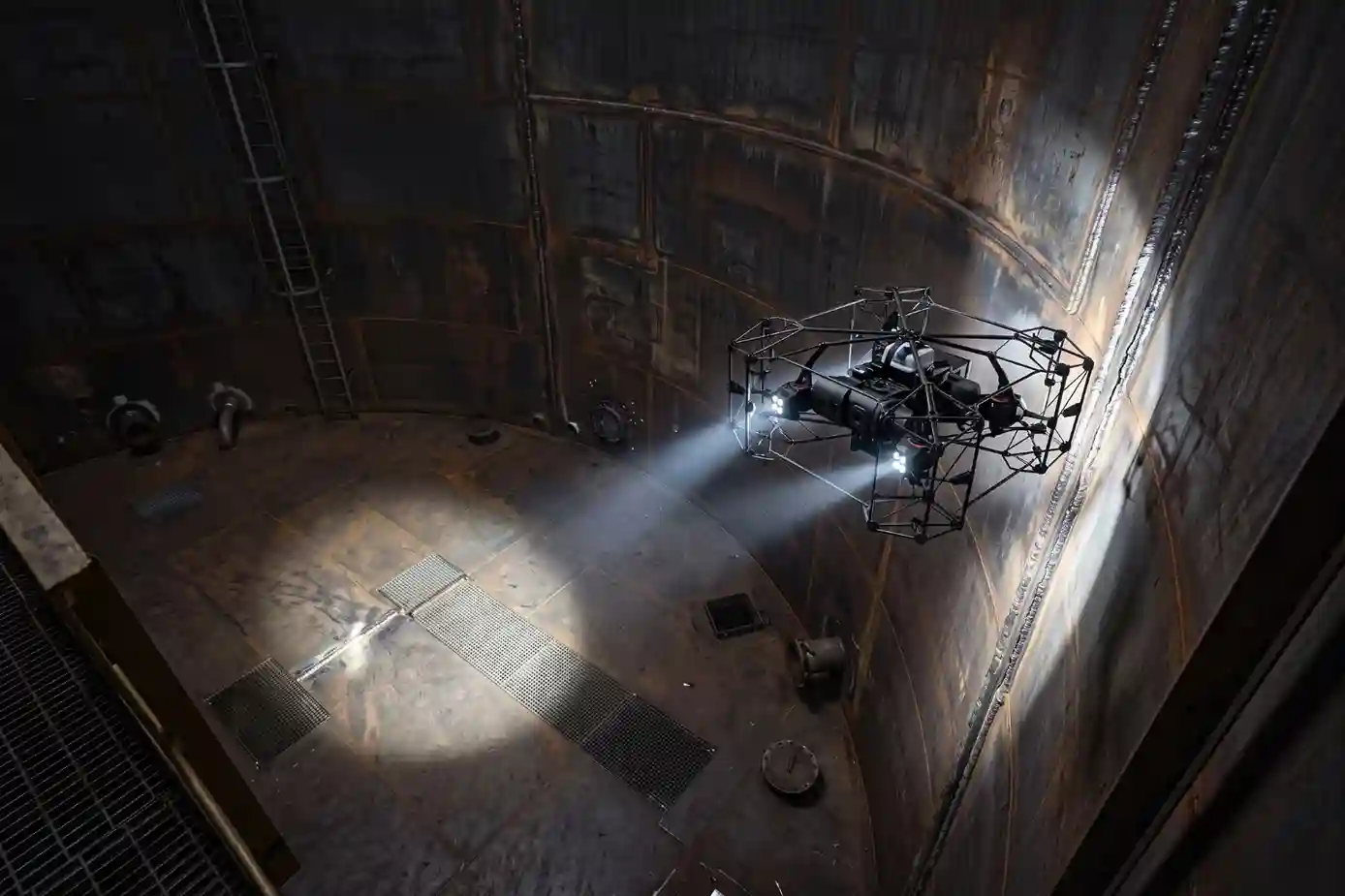
Navigating enclosed industrial environments presents severe operational challenges, including total GPS signal denial, complete absence of ambient light, airborne dust particles, and intense electromagnetic interference from surrounding steel structures.
Specialized indoor inspection drones, such as the Nolvis X1, overcome these physical constraints through dedicated mechanical and algorithmic features:
- Full 360-Degree Protective Caging: A lightweight, carbon-fiber spherical cage fully decouples the rotating propellers from external obstacles. When the aircraft makes contact with internal vessel walls, structural rebar, or tank baffles, the protective frame rolls freely along the surface while the internal camera platform maintains level flight stability.
- GPS-Denied SLAM Navigation: Optical flow sensors, 3D LiDAR, and time-of-flight (ToF) distance sensors feed real-time spatial data into Simultaneous Localization and Mapping (SLAM) algorithms. This sensor fusion enables precise autonomous hovering, altitude lock, and position stabilization without relying on external satellite signals.
- Oblique High-Lumen Lighting Arrays: Integrated multi-directional LED lighting systems deliver up to 10,000 lumens of continuous illumination. Oblique lighting controls eliminate harsh glare and reflections off polished metal walls, allowing high-resolution optical sensors to detect micro-cracks, pitting corrosion, and structural weld defects down to fractions of a millimeter.
Elimination of Scaffolding and Human Confined-Space Hazards
Physically entering industrial tanks exposes inspection personnel to severe atmospheric and structural hazards, including toxic gas accumulation (such as hydrogen sulfide, $H_2S$, and volatile organic compounds), oxygen deficiency, structural collapse, and falls from height inside large storage spheres.
Deploying remote robotic platforms replaces human physical presence inside unvented vessels:
- Workplace Exposure Incident Reduction: Deploying aerial inspection drones eliminates human exposure in hazardous high-elevation (>100 m) and toxic gas zones, reducing workplace exposure incidents by up to 95% and cutting workers’ compensation insurance premiums by 20% to 30% for facility operators (Dataintelo).
- Permitting and Safety Setup Streamlining: Remote inspection removes the requirement for continuous human-entry permits, dedicated breathing air lines, and standby emergency rescue squads during initial visual audits. Flight crews pilot the aircraft from outside the hazardous vapor boundary, watching live 4K video feeds from ground control stations.
Quantifiable Financial Savings and Field Labor Optimization
Transitioning from manual confined-space auditing to aerial and robotic workflows directly lowers capital expenditures and operational downtime during plant construction and scheduled maintenance turnarounds.
Confined-Space Inspection Method Comparison:
- Traditional Manual Inspection: 12-Person Crew, 5–7 Days Duration, Heavy Scaffolding Setup | High Human Risk
- Drone Robotic Workflow: 4-Person Crew, 2–3 Days Duration, Zero Scaffolding Needed, Zero Human Entry Risk
The financial impact operates across three main drivers:
- Scaffolding Cost Elimination: Erecting interior staging inside a single 50,000 m3 storage tank can cost hundreds of thousands of Saudi Riyals and require several weeks of manual assembly and dismantling. Substituting heavy scaffolding, rope access, and elevated work platforms with aerial inspection solutions reduces operational inspection expenses by 30% to 60% across complex oil, gas, and petrochemical infrastructure packages.
- Accelerated Field Execution: Multi-rotor drones equipped with visual and thermal sensors cut visual inspection times by up to 70% compared to traditional scaffolding. Storage tank inventory and integrity audits that traditionally take 5 to 7 days with a 12-person crew are completed in 2 to 3 days with a 4-person drone team.
- Minimized Asset Outage Downtime: Completing internal visual audits days ahead of standard schedules allows plant engineers to approve hydrotesting, seal vessel manways, and return storage tanks to active service faster, preventing costly operational bottlenecks across downstream refining lines.
Construction Handover to Operational Asset Management
Centralizing aerial surveys, NDT thickness logs, and 3D point clouds into a georeferenced digital twin creates a single source of truth across the facility lifecycle.
Linking these datasets directly into Enterprise Asset Management (EAM) systems and GIS dashboards streamlines pre-commissioning handover, verifies contractor delivery, and secures long-term operational reliability.
Consult with Our Experts
Streamline your EPC construction progress tracking, NDT asset inspections, and 3D digital twins. Talk to our specialist to deploy advanced aerial and robotic solutions for your infrastructure projects.

 العربية