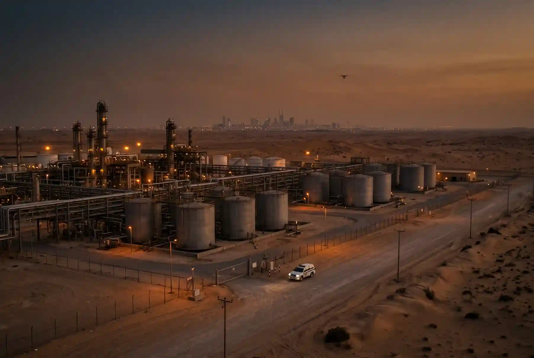
In April to June 2026, the FAA logged 601 drone sightings near US airports, up from 320 in the previous three months. These are reported sightings, not confirmed incidents. The FAA says it receives more than 100 drone reports near airports every month.
Most of these sightings are harmless. A review by the Foreign Policy Research Institute found that the overwhelming majority of drone incidents are accidents or innocuous events, and most happen near airports. A hobby flyer loses signal. A drone drifts off course.
But a security lead can’t assume that. You need to know, within seconds, whether a drone is a mistake, a camera or a threat.
That’s the job of a drone detection system in Saudi Arabia. It tells you what’s in your airspace, where it came from and where it’s going. It doesn’t stop the drone. It gives your team the facts to act.
This article covers three things. First, the drone threats at energy sites, industrial cities and airports. Second, how passive detection (RF, radar and EO/IR) differs from active mitigation, and what the law limits in Saudi Arabia. Third, how to decide if a system is right for your site.
A quick note on terms. A drone is also called an unmanned aircraft system (UAS). Systems that detect or stop drones are called counter-UAS systems.
Why Industrial Sites Need Drone Detection Now
Fences, guards and CCTV cover the ground. They don’t cover the air above your tanks, runways or substations. A drone can cross your fence line in seconds, and your team may never know it was there.
Buyers have noticed. The global market for counter-drone systems at critical infrastructure and airports was about SAR 10.5 billion in 2025 and is forecast to reach about SAR 36 billion by 2034, a growth rate of 14.7% a year. Energy and utilities held about 22% of that market in 2025, and airports held about 31%.
The threat is also close to home. In late July 2026, Saudi Arabia’s Ministry of Defense said its air defenses intercepted and destroyed several drones that tried to target oil facilities in Riyadh and the Eastern Region.
Air defenses handle attacks at that level. A site still needs to see the smaller drones that fly below them, such as camera drones and modified commercial drones. That’s where site-level drone detection fits.
Threat Scenarios by Site Type
Not every drone is a threat, and not every threat looks the same. Three scenarios matter most for energy sites, industrial cities and airports: accidental intrusion, reconnaissance and payload risk.
Accidental intrusion
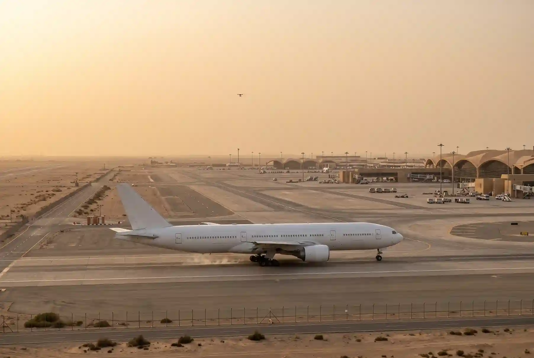
This is the most common case. A hobby flyer loses control. A survey drone drifts past its boundary. A pilot doesn’t know a restricted zone exists.
The drone isn’t hostile, but the cost can still be high. On 22 September 2025, drone sightings closed Copenhagen Airport for nearly four hours, and 109 flights were cancelled and 51 were diverted.
An industrial site may not close for four hours. The same logic applies, though. If a drone hovers over a live process unit, your team has to decide whether to pause work. Without detection data, every decision is a guess.
Reconnaissance
Drone surveillance of a site can look like normal flying. The signs are in the pattern. Watch for the same route, the same time of day, or long pauses over gates, tanks and control rooms. Dusk and night flights deserve extra attention.
One flight proves nothing. Repeated flights can show intent. You can only see that pattern if your system logs every flight, with time, route and signal data.
Industrial cities face a wider version of this problem. They have many tenants, many gates and long perimeters. A drone can survey one area, then move to the next, and no single tenant sees the full picture.
Payload risk
Payload risk is the hardest to measure and the most serious. A drone can carry a camera, a signal device or something heavier. Even an empty drone is dangerous near aircraft.
At airports, drones were involved in nearly two-thirds of reported near midair collisions with passenger planes at the 30 busiest US airports in 2024, the highest share since 2020, according to an Associated Press analysis.
At energy sites, the worst case is an attack. Bloomberg counted 120 drone attacks on Russian energy facilities in 2025, and 81 of them hit refineries. Insurance broker Mains estimates direct damage above about SAR 4.8 billion and total losses above about SAR 48.4 billion when lost profits and indirect losses are included.
This is a wartime case and a worst case. It’s not a typical risk for a site in Saudi Arabia. It does show how much damage drones with payloads can do to refineries and storage tanks.
| Site | Most likely scenario | What’s at risk |
| Energy sites | Reconnaissance, payload | Tanks, pipelines, people |
| Industrial cities | Reconnaissance, accidental intrusion | Many tenants, daily operations |
| Airports | Accidental intrusion, collision | Flights, passengers, revenue |
Use this table to rank the scenarios for your own site. Your highest risk should decide which sensors you buy first.
Detection vs Mitigation: What’s the Difference?
Detection means finding, identifying and tracking a drone without affecting it. Mitigation means doing something to the drone, such as jamming its signals, taking over its control link or stopping it physically.
The two work under different rules, carry different risks and often belong to different organizations. Detection comes first. No one should make a mitigation decision without detection data.
A note on terms. In this article, “passive” means detection that doesn’t interfere with the drone. Radar sends out radio waves, so engineers call it an active sensor, but it doesn’t change what the drone does. “Active” here means mitigation.
The cost of not seeing a drone is real. The German Aerospace Center (DLR) counted 226 reported drone incidents in 2025, and 116 of them affected flights at 25 German airports. DLR estimates the loss at at least EUR 60 million (about SAR 253 million), and up to EUR 160 million (about SAR 675 million) once delay effects are counted. Der Spiegel reported the same estimate for Germany’s aviation sector.
You can’t manage a cost you can’t see. Early drone detection gives your team time to alert security, the control room and the right authorities.
Passive Drone Detection: RF, Radar and EO/IR
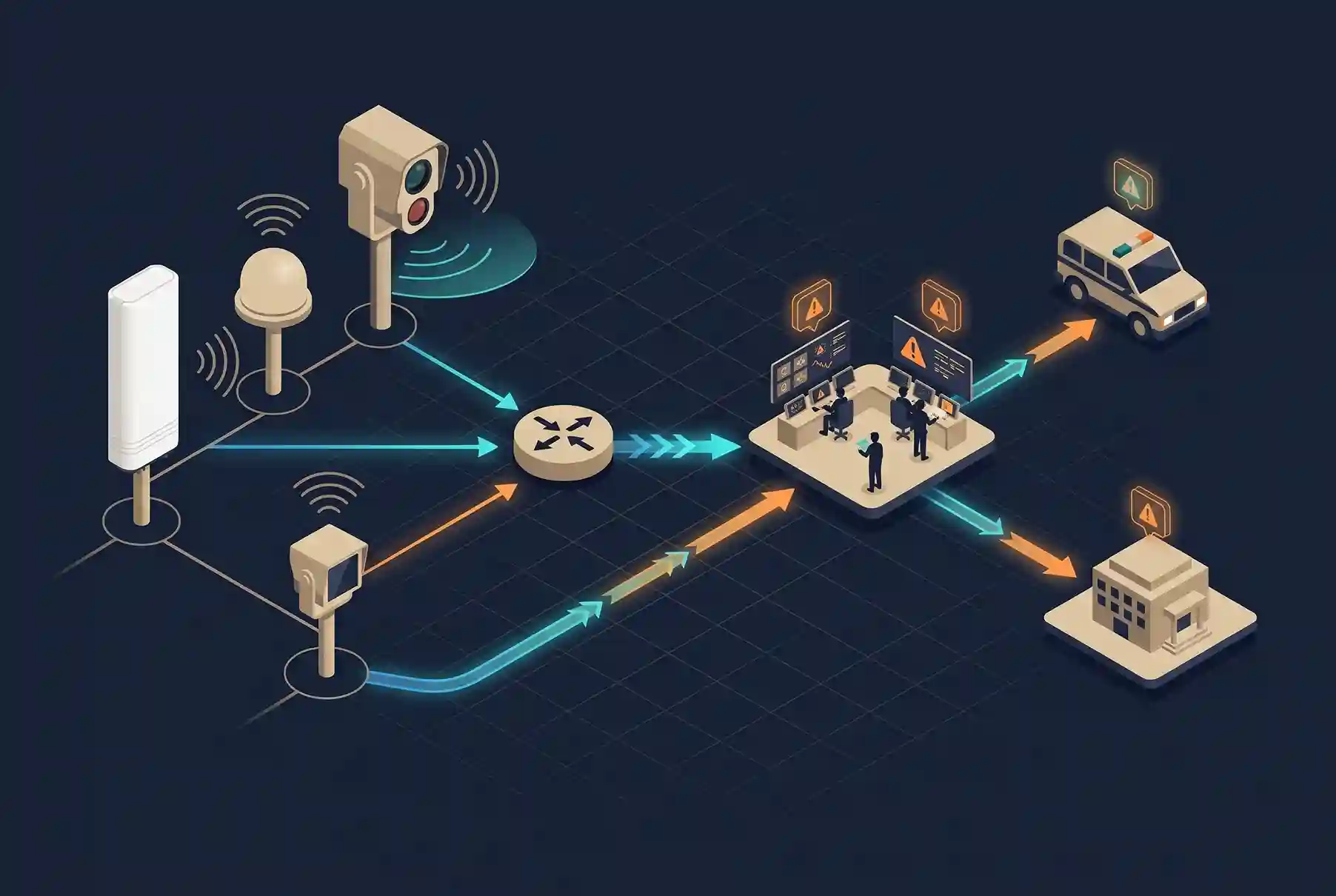
There are three main ways to detect a drone. Each has a clear strength and a clear limit.
RF drone detection
Most drones talk to the pilot’s controller over radio. An RF sensor listens for those signals, matches them against known drone types and shows the direction they come from. It’s called passive because the sensor only listens.
With several sensors, you can find where a signal comes from by comparing arrival times. This is called time difference of arrival (TDOA). It can locate the pilot, which matters when you need to send security to the right place. Terra Drone Arabia describes these methods on its pages for الكشف السلبي عن الترددات الراديوية و تحديد الموقع الرائد باستخدام TDOA.
RF drone detection has one clear limit. If a drone flies a pre-programmed route with no radio link, there’s nothing to hear. Industrial sites also have a lot of radio noise, so sensors need careful placement and tuning.
Radar
A radar sends out radio waves and listens for the echo. It can find any drone in range, whether or not the drone uses a radio link. It also tracks speed, height and direction. That makes it the main sensor against drones that fly on their own.
Radar’s limit is clutter. Small, slow drones can look like birds. Buildings, tanks and moving vehicles add false returns. A good radar setup needs tuning for your site, and you should test it there.
EO/IR
Electro-optical and infrared (EO/IR) sensors are cameras. A day camera and a thermal camera sit on a pan-tilt unit. They don’t search the sky well on their own. Once RF or radar points them at a target, they show what it is. A security officer can see whether it’s a drone, what type it is and whether it carries something. Thermal works at night.
The limits are line of sight and weather. Dust, haze and heat shimmer reduce image quality, and the field of view is narrow. In Saudi Arabia, plan for all three.
| Method | What it finds | Strength | Limit | Best use |
| RF | Drone and controller signals | Can locate the pilot, doesn’t interfere | Misses drones with no radio link | Early warning, pilot location |
| Radar | Any moving object in the air | Sees drones with no radio link | Birds and clutter can raise false alarms | Wide-area tracking |
| EO/IR | Visual and heat image | Confirms what the object is, day and night | Needs line of sight, affected by dust and haze | Verification |
No single sensor is enough. In a layered setup, RF gives early warning and the pilot’s location, radar tracks the drone, and EO/IR confirms it. Each layer covers the blind spots of the others.
Active Mitigation and What Saudi Law Limits
Active mitigation is any action that changes a drone’s flight or control. It includes drone jamming, which blocks the signals a drone uses to receive commands or navigate. It also includes taking over the control link and stopping a drone physically.
Mitigation is sensitive for good reasons. Jamming signals don’t stop at your fence. They can affect nearby radio links, GPS used by aircraft, and equipment on your own site. A drone that loses control may also fall on a plant, a road or people.
The legal side matters just as much. GACA announced in 2015 that operating a drone of any size in the Kingdom’s airspace without a permit is illegal, and that it works with other government agencies to enforce the rule.
In Saudi Arabia, mitigation is limited to authorized bodies. GACA regulates drones. It has said that operating any drone without a permit is illegal and that it works with other government agencies to enforce the rule. When drones are used in attacks, the armed forces respond. In late July 2026, the Ministry of Defense said its air defenses intercepted and destroyed drones aimed at oil facilities in Riyadh and the Eastern Region.
Mitigation is a different step from detection. Jamming and takeover tools interfere with radio signals, so they can affect other systems nearby. A site operator should not use them without written approval from the responsible Saudi authority. The safe workflow is the one in this article: detect the drone, record the evidence and alert the authorized body.
For a site operator, that sets a clear workflow:
- Detect the drone.
- Record the evidence: time, route, signal data and images.
- Alert the authorized body.
Terra Drone Arabia offers RF mitigation and neutralization to authorized bodies.
Where FTD1 Fits
Terra Drone Arabia’s counter-drone services cover passive RF detection, TDOA pilot localization, and RF mitigation and neutralization for authorized bodies. You can see the full range on its counter-drone solutions page.
FTD1 is a passive RF sensor. It listens to the video and control signals between a drone and its pilot, and it matches them against a database of DJI, non-DJI, DIY, WiFi and racing drones, so a single unit can detect and identify a drone on its own. When several units are networked, they compare signal arrival times (TDOA) to locate and track the drone. This solves a common problem at industrial sites: most systems can say a drone is there, but not where it is or where it’s heading.
| Item | Detail |
| What FTD1 is | Passive RF unit that identifies drones alone and locates and tracks them when networked |
| Role in the stack | RF detection layer |
| Method | Passive RF sensing, TDOA positioning with networked units |
| Detection target | Drone video and control link signals |
| Detection range | 2 to 6 km radius (varies by environment and drone model) |
| Frequency bands | 100 ميجاهرتز إلى 6 جيجاهرتز |
| Drones tracked at once | 35+ |
| False alarms (manufacturer-stated) | Average of less than once per day |
| Refresh time | Under 1 second on average |
| Drone database | Updatable, with whitelist and blacklist |
| Deployment | Fixed, all modules in one compartment |
| Pairs with | Radar, EO/IR, TDOA pilot localization |
FTD1 is the RF layer in a layered setup. Each FTD1 node covers a 2 to 6 km detection radius, depending on the drone model and the site. It listens across 100 MHz to 6 GHz and sends no signal. A mesh of four or more nodes gives TDOA-ready coverage, which locates and tracks the drone. Pair it with تحديد الموقع الرائد باستخدام TDOA to find the pilot. FTD1 helps most with reconnaissance. It logs every flight, shows repeat routes and points security to where the pilot is. It also gives early warning of accidental intrusion at refinery and airport perimeters. It can’t see a drone with no radio link. For those, add radar, and use EO/IR to confirm what you’re tracking.
FTD1 Table Values I Could Confirm
| Item | Detail |
| Role in the stack | RF detection layer |
| Method | Passive RF, TDOA with 4+ nodes |
| Detection range | 2 to 6 km per node |
| Frequency bands | 100 ميجاهرتز إلى 6 جيجاهرتز |
| Deployment | Mesh of nodes, from a 4-node site to a city-wide network |
| Pairs with | TDOA pilot localization, radar, EO/IR |
Is a Drone Detection System Right for Your Site?

Before you choose a drone detection system, check three things: coverage area, false-alarm rate and integration.
Coverage area
Detection range sets your warning time. A drone flying at 50 km/h covers about 14 meters a second. With a detection range of 2 km, you get about 2 minutes 24 seconds of warning. With 500 meters, you get about 36 seconds.
Now compare that with your response time. If your team needs three minutes to verify and respond, a 2 km range isn’t enough for a drone at that speed.
Datasheet range is a best case. Ask for the range at your site, with your dust, heat and buildings. Then map coverage to your fence line and critical assets, not to a perfect circle.
False-alarm rate
Drone activity is common. The FAA alone receives more than 100 reports a month near US airports, and most sightings are harmless. A system that raises a false alarm for each one trains your team to ignore it.
Ask how many false alarms to expect per day at a site like yours. Ask for results from a live site, not a lab. Ask how the system tells a drone from a bird, a kite or a passing vehicle’s radio signal.
Integration with existing security
A drone detection system that lives on its own screen will get ignored. Ask whether it can send alerts to your video management system (VMS), your access control and your security command room.
Ask what it records. Time-stamped logs with flight paths, signal data and images give you evidence you can hand to the authorized body. Also ask who will watch the screen at 3 a.m.
Six questions to ask any vendor
- What’s the detection range at my site, not on the datasheet?
- What’s the false-alarm rate at a live site like mine?
- Can it find drones with no radio link?
- Can it locate the pilot?
- Which of my security systems does it connect to?
- What does it record, and who can access the records?
خاتمة
Drone activity near airports and industrial sites is rising, and the costs are real. In Germany alone, DLR puts the 2025 loss at up to EUR 160 million (about SAR 675 million) once delay effects are counted.
The path is simple. See the drone first. Confirm what it is. Then hand off to the right authorized body. A layered drone detection system with RF, radar and EO/IR gives you the evidence for each step.
If you’re planning drone detection for an energy site, an industrial city or an airport, Terra Drone Arabia can help you map your risks and test coverage on your site. Contact the team to book a site assessment.

 العربية