

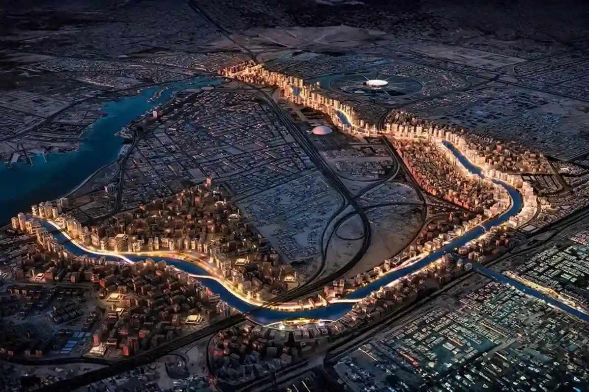
Expanding across low-lying coastal plains along the Red Sea, Jeddah 2nd and 3rd Industrial Cities managed by the Saudi Authority for Industrial Cities and Technology Zones (MODON), house essential manufacturing, chemical processing, and logistics facilities.
The geographic positioning of these industrial zones exposes broad land parcels to periodic torrential rainfall and rapid surface water runoff originating from adjacent eastern mountain wadi catchments.
Managing stormwater drainage networks across spread-out industrial corridors requires high-precision elevation models to prevent channel overflow, localized flooding, and structural asset damage.
Hydrologic Dynamics and Wadi Catchment Runoff in Jeddah Industrial Zones
The coastal topography of Jeddah features steep inland mountain slopes that drain westward into flat coastal plains before reaching the Red Sea.
During intense seasonal thunderstorm events, surface runoff travels rapidly through dry wadi channels, descending into urban and industrial basins.
As industrial development expands across Jeddah 2nd and 3rd Industrial Cities, natural soil absorption is replaced by impermeable surfaces, such as asphalt logistics yards, concrete foundations, and metal factory roofs.
This high proportion of impermeable land cover increases surface runoff volume and accelerates peak flow velocities across primary transport avenues.
Traditional static drainage ditches and underground box culverts frequently struggle to handle unmodeled water surges, leading to localized ponding near high-value manufacturing plants and electrical substations.
To mitigate recurring flood risks, municipal planners and civil engineers require dynamic, high-density elevation models that accurately simulate surface flow paths across entire industrial drainage basins.
Accelerating Global Investments in Digital Stormwater Management
Modernizing drainage infrastructure relies on transitioning from reactive flood repairs to proactive, data-driven spatial management.
As industrial expansion accelerates nationwide, market analysis from Market Reports World showing the global stormwater management market reaching SAR 72.83 billion in 2025 and is projected to reach SAR 141.53 billion by 2034 at a 7.6% CAGR reflects a global shift toward automated flood risk mitigation and digital drainage infrastructure.
MODON aligns with this global market direction by establishing digital baselines across Saudi Arabia’s industrial cities.
Deploying high-precision spatial technologies allows industrial park operators to monitor drainage channel capacity, track sediment accumulation, and evaluate flood risk across thousands of industrial plots in real time.
Digitalizing drainage management ensures long-term operational continuity for manufacturing tenants and protects national supply chain hubs from severe weather disruptions.
Capital Cost Savings and Low Impact Development (LID) Spatial Planning
Integrating high-resolution elevation data into early drainage design delivers substantial cost savings during civil construction phases.
Traditional stormwater engineering often relies on over-designed concrete culverts and deep underground piping to handle unknown flood volumes, increasing capital expenditure.
Utilizing precise 3D spatial models allows civil engineers to design Low Impact Development (LID) solutions, such as bio-retention swales, permeable pavement zones, and natural detention basins that optimize natural site hydrology.
Furthermore, engineering analysis published on ResearchGate showing that integrating high-precision spatial modeling into Low Impact Development (LID) stormwater infrastructure plans reduces capital construction costs by an average of 19% compared to conventional grey infrastructure solutions highlights the economic value of early, accurate spatial planning.
High-density terrain models allow project teams to align drainage paths with existing ground topography, minimizing expensive earthwork cut-and-fill operations while maintaining full hydraulic efficiency.
High-Density Drone LiDAR and Digital Terrain Modeling
Conducting conventional ground surveys across active industrial parks introduces severe field bottlenecks, safety hazards near heavy vehicle traffic, and line-of-sight obstructions across Jeddah 2nd and 3rd Industrial Cities.
Expanding industrial facilities, container yards, and high-voltage distribution networks restrict ground survey access along critical drainage paths.
Traditional optical total stations and static GNSS RTK rovers require survey crews to navigate active logistics roads, cross high-pressure utility lines, and negotiate security perimeters around private factory plots.
Transitioning to heavy-lift flight platforms, such as the دي جي آي ماتريس 400 (إم 400) paired with the DJI Zenmuse L3 payload, allows engineering teams to map wide drainage basins, open channels, and concrete culverts rapidly from safe flight altitudes.
Hardware Mechanics and Multi-Return Airborne LiDAR Performance
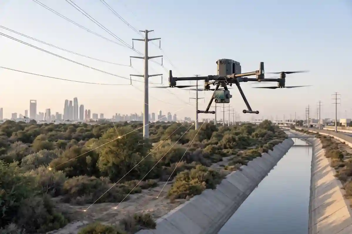
The heavy-lift DJI Matrice 400 flight platform provides the payload capacity, extended flight endurance, and redundant avionics required to cover long linear utility corridors and wide industrial sectors in single flight missions.
Mounting the DJI Zenmuse L3 payload on the M400 creates an integrated airborne laser scanning system capable of collecting dense 3D point clouds and high-resolution RGB photogrammetry simultaneously.
The Zenmuse L3 sensor incorporates specialized mechanical and optical subsystems tailored for complex terrain modeling:
- Multi-Return Laser Pulse System: The LiDAR sensor emits pulses at a laser pulse frequency up to 2000 kHz, generating point cloud collection rates up to 2,000,000 points per second. Supporting up to 16 returns per pulse allows laser beams to pass through sparse desert scrub, security mesh, dust layers, and overhead utility cables to reach the true ground surface underneath.
- High-Precision Positioning and Inertial Navigation: An integrated high-precision Inertial Measurement Unit (IMU) works alongside real-time kinematic (RTK) GNSS positioning (1 cm} + 1 ppm horizontal RTK accuracy) to record exact sensor orientation and spatial coordinates for every emitted laser pulse.
- Ranging Accuracy and System Precision: The sensor delivers high ranging accuracy and sub-decimeter system precision across standard flight altitudes above ground level (AGL), ensuring reliable vertical elevation measurement over long linear drainage paths.
- Dual 100 MP RGB Mapping Cameras: Integrated dual 4/3 CMOS sensors with mechanical shutters capture ultra-high-resolution true-color images at the same time as the laser scan. This RGB imagery colorizes the 3D point cloud in real time (by elevation, intensity, or true RGB color) and generates high-resolution orthomosaic maps for asset identification.
Collecting high-density point clouds from the air eliminates the need to position ground survey crews on active road shoulders, near heavy machinery, or inside steep drainage ditches, lowering human safety risks during baseline data collection.
Field Lead-Time Reduction and Occupational Safety in Industrial Zones
Navigating active industrial logistics zones like Jeddah 3rd Industrial City presents operational challenges for ground survey crews.
Heavy container haulers, constant truck traffic, and restricted industrial sites slow down manual survey walks.
Halting traffic or securing site access permits across dozens of private industrial parcels creates project delays and increases survey costs.
Airborne LiDAR surveys overcome physical land restrictions by acquiring high-resolution spatial data from above open rights-of-way.
Operational benchmarks published by the Washington State Department of Transportation demonstrating that replacing traditional manual ground survey teams with airborne LiDAR mapping across linear transportation and drainage corridors reduces field survey lead times by 60% to 80% while eliminating worker exposure to heavy site traffic and environmental hazards highlight the practical efficiency of drone surveys.
Rapid aerial data collection allows civil engineering teams to complete large-scale corridor audits in days rather than months.
Eliminating physical site walk-throughs prevents factory operational disruptions and keeps field personnel out of hazardous work environments along busy transport avenues.
Bare-Earth DTM Extraction and Hydrodynamic Elevation Accuracy
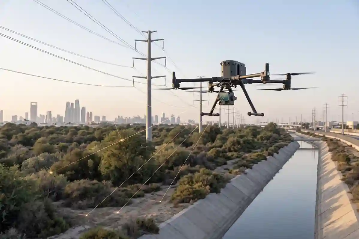
Raw 3D point clouds captured over industrial zones contain ground elevation points mixed with non-ground objects, such as parked freight trailers, industrial machinery, security walls, overhead powerlines, and desert scrub vegetation.
To perform accurate hydraulic flow simulations, geospatial engineers must strip away non-ground features to isolate the true ground surface.
Processing raw Zenmuse L3 point cloud files through processing platforms like DJI Terra applies automated point-cloud classification routines, such as Progressive Morphological Filtering and Cloth Simulation Filtering.
These algorithms separate surface objects from bare-earth terrain, producing high-resolution Digital Terrain Models (DTMs) and Digital Elevation Models (DEMs).
Sub-decimeter vertical accuracy is essential when modeling stormwater flow across flat coastal basins.
Environmental research published on ResearchGate demonstrating that utilizing 1-meter airborne LiDAR Digital Elevation Models (DEMs) for urban flood simulations eliminates severe elevation errors found in conventional 1:5000 topographic maps which exhibit a Mean Absolute Error of 56.9 cm and a Root Mean Square Error (RMSE) of 76.4 cm, delivering sub-decimeter surface precision required for narrow drainage channels proves the necessity of high-density laser data for hydraulic modeling.
Fine elevation models allow civil engineers to map subtle slope gradients, pinpoint channel low-points, and identify localized elevation drops along open stormwater canals.
Accurate terrain data prevents errors in hydraulic surcharge calculations, helping municipal planners design drainage capacity that handles peak runoff during heavy rainfall events across Jeddah Industrial Cities.
Combining Drone Topography with Subsurface Inspection Data
Complete stormwater drainage auditing across Jeddah 2nd and 3rd Industrial Cities requires linking surface terrain profiles with subsurface water conveyance structures.
While airborne LiDAR maps open drainage channels, retention basins, highway culvert entrances, and surface slopes, closed underground pipe networks and concrete box culverts remain hidden from aerial sensors.
Relying solely on surface elevation data leaves critical gaps in understanding how water moves through subsurface infrastructure during severe storm events.
To build an accurate spatial model of the entire drainage network, surveying teams integrate high-resolution surface Digital Terrain Models (DTMs) captured by airborne LiDAR with internal physical inspection data collected inside underground pipes and culverts.
Combining above-ground laser scans with subsurface inspection records creates a continuous 3D digital model that connects ground-level surface runoff paths directly to subsurface pipe networks.
Multi-Domain Sensing: Linking Airborne LiDAR with Subsurface Robotic Inspection
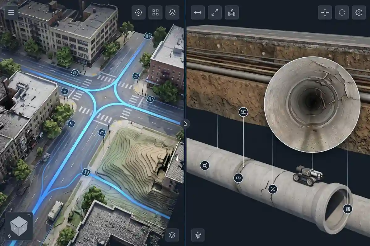
Connecting surface topography to underground pipe networks requires matching aerial spatial data with subsurface robotic inspection tools.
Surveying teams deploy heavy-lift flight platforms, such as the DJI Matrice 400 (M400) carrying the DJI Zenmuse L3 payload, to capture high-density surface point clouds across industrial sectors.
This aerial scan establishes absolute spatial coordinates (X, Y, Z) for all visible surface infrastructure, including manhole covers, storm inlet grates, curb openings, and outfall structures.
Once surface ground control is established, specialized subsurface inspection devices map the internal condition of enclosed drainage lines:
- Motorized CCTV Crawler Robots: Remote-controlled crawler vehicles equipped with pan-tilt optical cameras navigate active sewer and stormwater pipes. These crawlers record continuous video logs, measure internal pipe slope gradients, and log exact chainage distances from manhole entry points.
- Terra SewerX Defect Grading Platforms: Inspection footage collected by CCTV crawlers is processed through reporting platforms like Terra SewerX. The software tags specific structural defects, such as pipe cracks, joint displacement, heavy root intrusion, and sediment accumulation and assigns severity ratings based on standardized municipal inspection codes.
- Caged Indoor Inspection Drones: For large, unvented concrete box culverts, underground storm storage vaults, or dark drainage shafts where ground crews cannot enter safely, caged inspection drones (such as the Nolvis X1) fly inside enclosed structures to collect high-definition visual and thermal condition data.
Surveyors anchor subsurface inspection logs to absolute ground coordinates by linking manhole rim elevations (RIM) recorded by the Zenmuse L3 LiDAR sensor directly to internal pipe invert elevations (INV) measured by subsurface crawlers.
This multi-domain approach creates a unified spatial database bridging surface and underground infrastructure.
Data Fusion Protocols for Hydrodynamic and Hydraulic Surcharge Modeling
Raw inspection data collected from separate aerial and subsurface sensors must be processed through data fusion workflows to support predictive hydraulic modeling.
Surface DTMs define how rainfall moves across factory roofs, asphalt parking lots, and open desert soil toward drainage inlets.
Subsurface inspection logs define internal pipe diameters, wall roughness coefficients (n-values), slope gradients, and localized cross-sectional flow restrictions.
Merging these datasets into hydraulic modeling software (such as EPA SWMM or InfoWorks ICM) allows civil engineers to simulate complex urban flood scenarios.
Technical research published on ResearchGate establishing that fusing aerial surface terrain models with subsurface pipe defect inspection data reduces Root Mean Square Error (RMSE) in hydraulic surcharge and urban flood predictions by 18% compared to single-sensor monitoring baselines confirms the analytical necessity of multi-sensor data integration.
Accurate data fusion eliminates baseline errors during flood simulations.
In conventional hydraulic modeling, missing subsurface pipe data forces engineers to assume uniform pipe slopes and clean internal conditions.
Fusing real-world CCTV defect locations with high-density airborne LiDAR surface models ensures that hydraulic models account for physical flow resistance, pipe sags, and structural blockages, delivering realistic predictions of pipe surcharge levels and surface water pooling during heavy rainfall.
Subsurface Defect Bottlenecks and Structural Vulnerabilities
Fusing aerial surface models with internal pipe inspection records allows municipal engineers to locate hidden structural bottlenecks across Jeddah 2nd and 3rd Industrial Cities before seasonal storm events occur.
Heavy industrial activities, constant freight transport, and ground settlement can compromise subsurface drainage pipes over time.
Integrated spatial auditing identifies specific structural vulnerabilities along industrial corridors:
- Localized Pipe Sags (Reverse Slopes): Combining airborne elevation baselines with crawler inclinometer logs highlights pipe segments that have settled unevenly, creating low points where water pools and sediment settles during dry periods.
- Structural Cracking Under Heavy Traffic Corridors: Overlaying subsurface CCTV defect logs onto surface transportation maps reveals structural cracks and wall deformation in pipes located directly beneath heavy truck haul roads and logistics yards.
- Sediment Accumulation and Capacity Reduction: Fusing internal cross-sectional scans with surface inlet profiles pinpoints pipe segments where sand, gravel, and industrial debris have reduced internal flow capacity by 20% to 50%.
- Culvert Headwall Scour and Outfall Erosion: High-density LiDAR scans around open channel outfalls identify soil erosion, headwall displacement, and concrete degradation caused by high-velocity storm discharges.
Identifying these hidden structural defects early allows MODON facility managers and municipal maintenance teams to schedule targeted pipe cleaning, trenchless lining repairs, or structural replacements.
Proactive maintenance prevents catastrophic pipe collapses, avoids costly open-trench road excavations along busy freight avenues, and ensures uninterrupted stormwater discharge across Jeddah’s industrial sectors.
Predictive Asset Maintenance and Digital Twin Lifecycle Value
Exporting georeferenced point clouds, 3D meshes, and elevation profiles into MODON enterprise GIS environments (such as ArcGIS Pro) establishes an immutable spatial baseline across industrial drainage networks.
Centralizing aerial photogrammetry, thermal inspection logs, and subsurface pipe records replaces disconnected field reports with a shared digital twin accessible to municipal authorities and O&M contractors.
Predictive maintenance strategies rely on continuous spatial baselines to monitor channel erosion, culvert settling, and slope movement over time.
Infrastructure research published on ResearchGate proving that implementing digital twin frameworks and automated spatial sensor integration across urban drainage networks reduces long-term infrastructure lifecycle costs by up to 25% and lowers operational risk exposure by 30% demonstrates the financial return of aerial LiDAR digital twin workflows.
Routine aerial re-surveys allow facility managers to audit drainage channel clearance, confirm contractor cleaning work, and prioritize maintenance spending based on objective spatial evidence across Jeddah’s expanding industrial sectors.
Consult with Our Experts
Streamline your stormwater network audits, airborne LiDAR terrain mapping, and 3D drainage digital twin workflows.
Contact our specialist to deploy advanced aerial and robotic solutions for your municipal infrastructure projects.

 العربية