


ROSHN Group’s landmark MARAFY development encompasses over 9.4 million square meters of integrated waterfront districts in northern Jeddah.
The central centerpiece of this master plan is Saudi Arabia’s first navigable urban water channel, extending 11 kilometers in length and over 100 meters in width to connect Obhur Creek inland.
Executing a civil project of this magnitude requires extensive earthmoving operations. Ground engineering crews have completed 80% of Phase 1 excavation along the initial 2.5-kilometer canal section, displacing approximately 2.45 million cubic meters of soil and rock along the coastal corridor.
To manage this civil phase, ROSHN awarded a SAR 690 million contract to PC Marine Services to handle primary canal trenching, marine structures, and bridge installations.
Mass Earthworks Workflow
- Initial Excavation: 2.45 Million m³ Soil & Rock
- Aerial Data Capture: Matrice 350 RTK + Zenmuse L2 / P1
- 3D Processing: Digital Elevation Models (DEMs) & Point Clouds
- Volumetric Auditing: Cut/Fill Calculations vs. CAD Design Models
Earthwork Tracking Challenges in Mega-Civil Engineering
Managing earthwork volumes across multi-kilometer linear corridors introduces complex logistical and financial challenges for project managers:
- High Material Volumes: Tracking millions of cubic meters of soil cut, backfill placement, and temporary stockpiles requires rapid data collection to keep site work on schedule.
- Limitations of Manual Ground Surveys: Traditional surveying using total stations or handheld GNSS rovers is slow, labor-intensive, and presents safety risks for survey crews walking near active excavation pits and heavy equipment.
- Financial and Billing Disputes: Inaccurate soil volume estimations lead to contractor billing disputes, unverified earthmoving claims, and project delays across adjacent developments—such as the adjoining 4 million square meter ALAROUS community, where ROSHN has finalized land sub-development agreements valued at SAR 115.9 million.
Drone Photogrammetry and LiDAR
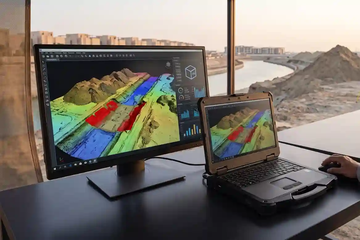
Implementing drone survey systems provides a fast, non-contact method for measuring site topography and calculating exact soil volumes across active construction zones.
Generating High-Density 3D Terrain Models
By flying pre-programmed grid patterns over canal excavation zones, survey drones capture high-resolution aerial imagery and laser return points. Photogrammetry and LiDAR processing software convert these raw inputs into high-density 3D point clouds, Digital Elevation Models (DEMs), and Digital Surface Models (DSMs). These digital terrain models represent exact ground conditions at the time of flight.
Automated Cut and Fill Volume Calculations
Volumetric software compares current 3D terrain surfaces against baseline pre-construction models or original CAD design profiles. By overlaying the two digital surfaces, the software automatically calculates net cut and fill volumes across specific project sectors. This automated comparison allows site engineers to verify how much earth has been removed against design specifications within hours rather than weeks.
Non-Contact Stockpile Volume Measurement
Soil and rock stockpiles excavated from the canal trench often feature irregular shapes that make manual rod measurements imprecise. Aerial LiDAR and photogrammetry map the entire surface of every stockpile, capturing micro-contours without requiring surveyors to climb hazardous piles. The software establishes a base plane beneath the pile and calculates absolute volume metrics ($\text{m}^3$) with high spatial precision.
Seamless BIM and GIS Integration
Georeferenced volumetric datasets export directly into standard CAD, GIS, and Building Information Modeling (BIM) platforms. This digital workflow provides project owners, main contractors, and sub-contractors with transparent, auditable records of daily earthmoving progress, streamlining monthly progress billing and material tracking.
Drone Technical Execution
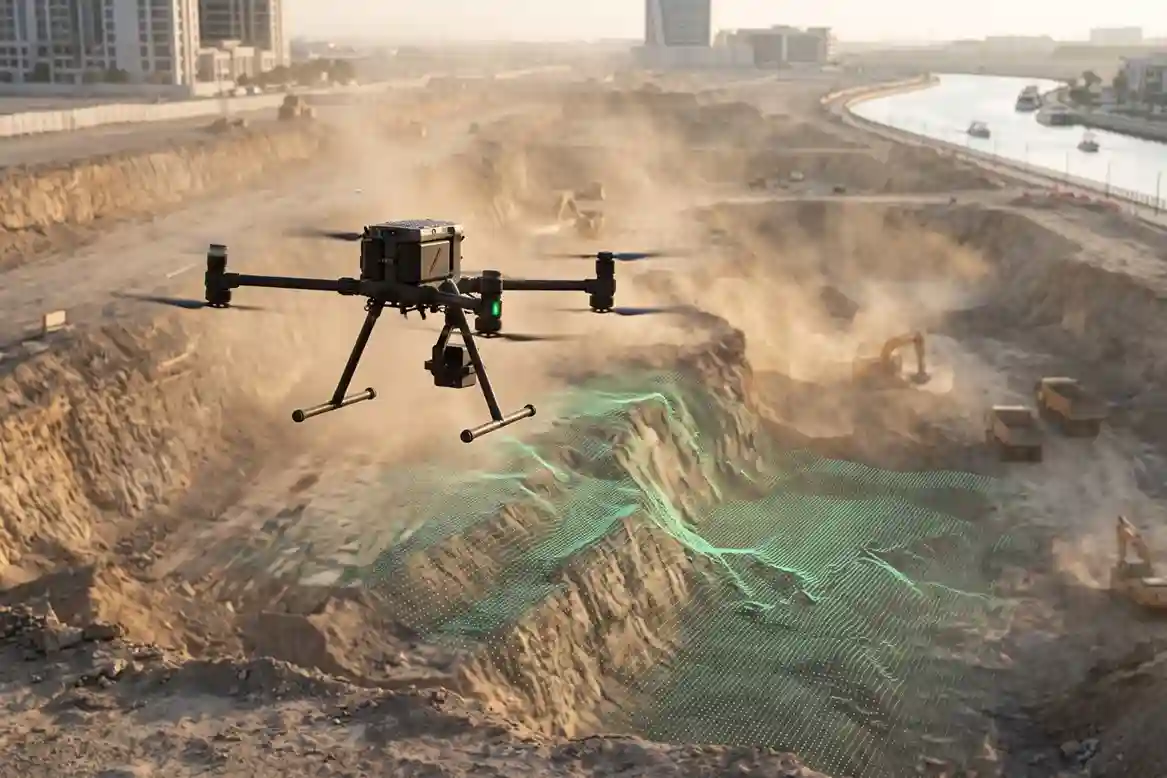
High-precision volumetric tracking requires an industrial flight platform paired with specialized geospatial payloads capable of operating in dusty desert environments.
Aircraft Performance and Reliability
The DJI Matrice 350 RTK serves as the primary survey flight platform. Built with an IP55 ingress protection rating, the aircraft operates reliably in high temperatures, wind, and airborne coastal dust along the Red Sea.
The platform offers up to 55 minutes of flight time and features a dual-battery system with hot-swapping capabilities, allowing continuous survey coverage over extended linear corridors.
Laser Scanning via the Zenmuse L2
The DJI Zenmuse L2 integrates a high-accuracy frame LiDAR module, a custom-developed IMU system, and a 4/3 CMOS RGB mapping camera.
Operating at up to 240,000 points per second with a detection range up to 250 meters, the L2 captures fine ground topography even through dust or sparse vegetation along unexcavated canal boundaries.
The integrated IMU requires no warm-up time, ensuring stable elevation data collection immediately upon takeoff.
Photogrammetric Mapping with Zenmuse P1
For high-resolution orthomosaic mapping and visual documentation, the DJI Zenmuse P1 integrates a 45-megapixel full-frame sensor with interchangeable fixed-focus lenses on a 3-axis stabilized gimbal.
The P1 utilizes a mechanical shutter to eliminate rolling shutter distortion, capturing millimeter-level Ground Sample Distance (GSD) imagery for precise 3D surface mesh generation.
Centimeter-Level RTK Positioning
The Matrice 350 RTK utilizes dual-antenna Real-Time Kinematic positioning receivers. By receiving real-time differential corrections, the aircraft embeds centimeter-level coordinate data 1 cm + 1 ppm horizontal, 1.5 cm + 1 ppm vertical directly into image geotags and LiDAR point cloud files.
This spatial accuracy minimizes the need for extensive Ground Control Point (GCP) networks along the 11-kilometer canal route.
Integrated Site Oversight and Interlinking
A comprehensive drone survey strategy combines volumetric earthwork tracking with structural health monitoring to provide complete civil asset intelligence.
While LiDAR and photogrammetry verify excavation depths and earthmoving volumes, aerial thermal imaging ensures that exposed structures remain stable.
For an in-depth analysis of how aerial remote sensing protects completed canal structures, read it here.
That analysis details how radiometric thermal payloads detect subterranean water seepage behind precast quay walls and monitor deep dewatering systems along active excavation modules.
Integrating 3D volumetric tracking with thermal leak detection enables civil engineering teams to verify contractor earthmoving progress while protecting structural stability.
Utilizing automated drone survey workflows safeguards project budgets, reduces field survey risks, and maintains construction schedules on world-class infrastructure developments.
Consult with Our Experts
Are you looking to optimize your site excavation tracking, stockpile volume calculations, and contractor progress audits? Talk to our geospatial expert to implement aerial surveying solutions for your civil infrastructure projects.

 العربية