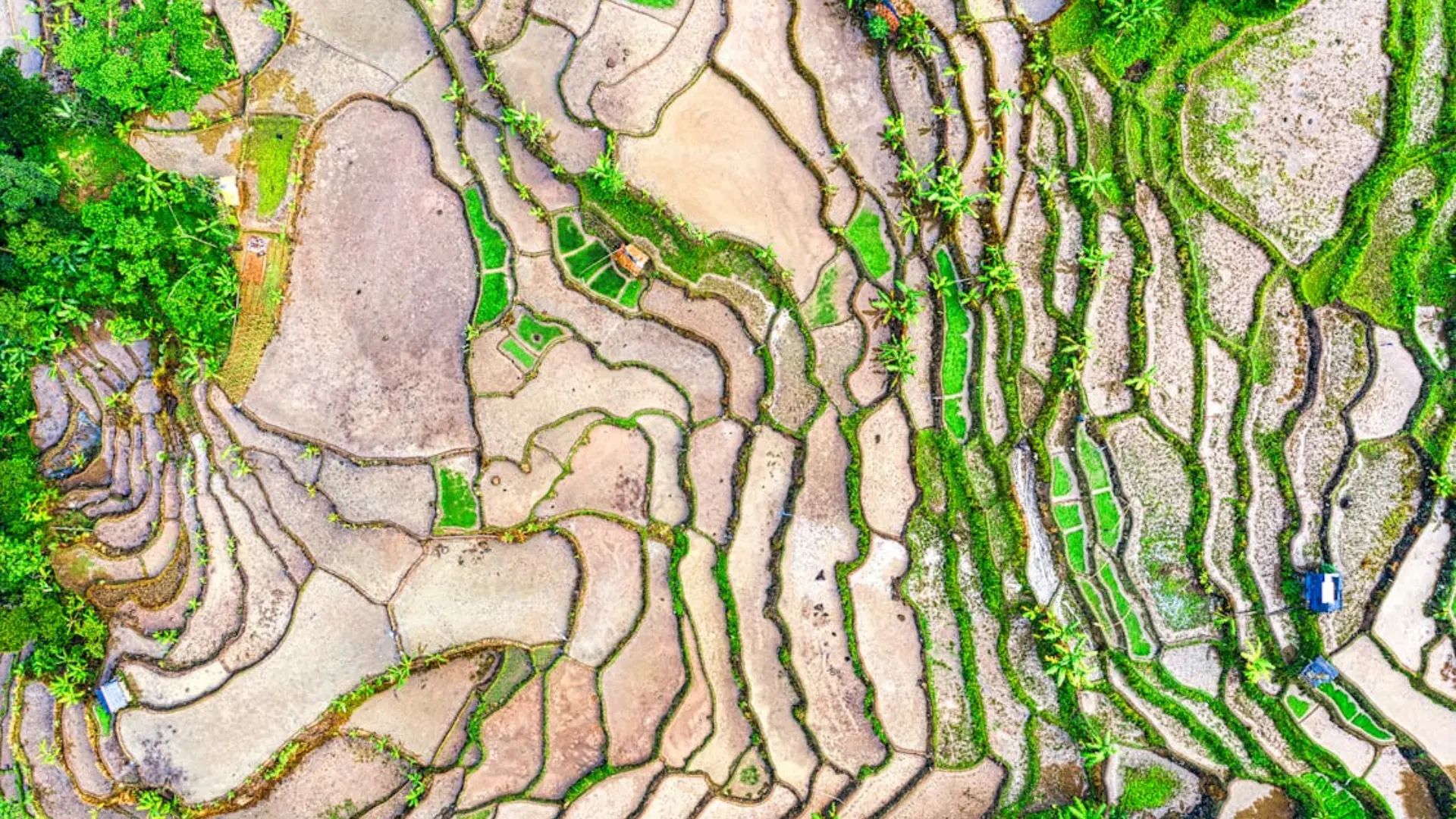
Satellite imagery in agriculture revolutionizes how farmers address today’s challenges while meeting the growing demand for food security and sustainability. Agriculture, one of the oldest and largest industries in history, remains the backbone of global populations and economies. Yet, despite its importance, many regions still rely on traditional practices with low adoption of modern technologies.
With climate change intensifying unpredictability in farming and the rising demand for efficient, sustainable practices, transformation is essential. Satellite technology emerges as a catalyst, enabling innovation and precision to meet these urgent needs.
Challenges in Modern Agriculture

The agricultural industry faces various challenges, ranging from climate unpredictability to resource overuse and food security concerns. To begin with, unpredictable weather patterns, rising temperatures, and water scarcity are making farming increasingly difficult. These changes directly impact crop yields, forcing farmers to adapt their practices quickly.
Moreover, over-reliance on water, fertilizers, and pesticides has created inefficiencies and environmental damage. Farmers often struggle to identify specific problem areas within their fields, which frequently leads to unnecessary waste.
In addition, soil erosion, deforestation, and biodiversity loss further complicate the task of sustaining fertile lands. To address these issues, adopting sustainable practices is essential to ensure long-term agricultural productivity.
Finally, the rapidly growing global population places immense pressure on agriculture to boost productivity. However, with limited arable land available, farmers face the challenge of maximizing yields while preventing further environmental degradation.
Role of Satellite Imagery in Agriculture

Satellite imagery is revolutionizing agriculture by providing precise and actionable insights that address critical challenges faced by modern farmers. These insights empower smarter decisions across a variety of agricultural operations, enabling better resource management, improved productivity, and enhanced sustainability.
Satellite imagery offers high-resolution data to monitor soil health and field conditions, addressing foundational aspects of farming. By analyzing patterns of soil compaction, erosion, and nutrient levels, farmers can pinpoint problem areas within their fields. For example, variations in soil moisture or organic matter can be detected through satellite data, enabling targeted interventions. This precision minimizes overuse of fertilizers, water, and other inputs, reducing costs while improving overall field productivity.
Multispectral and hyperspectral imaging technologies bring significant advancements in crop health monitoring. These technologies analyze light reflectance from crops, revealing subtle changes that indicate stress before they are visible to the naked eye. By identifying diseases, water stress, or nutrient deficiencies at an early stage, farmers can take prompt corrective measures. For instance, areas with chlorophyll deficiencies can be flagged, allowing farmers to address nutrient issues proactively. This not only protects the crops but also ensures healthier and more consistent yields.
Water is one of agriculture’s most precious resources, and satellite data excels in mapping water availability and usage. By monitoring water consumption, irrigation patterns, and drought conditions, satellites enable farmers to optimize irrigation schedules with unparalleled accuracy. This is particularly crucial in arid regions where every drop of water counts. Additionally, satellites provide insights into watershed conditions, helping farmers make informed decisions on water allocation and conservation practices.
Another vital contribution of satellite imagery is its ability to forecast crop yields with precision. By analyzing historical data, weather patterns, and current crop conditions, satellites generate yield predictions that help farmers plan harvests and align supply chain operations. Accurate yield forecasts minimize waste by ensuring timely harvesting and storage, while also supporting market readiness. These insights enable farmers to maximize profitability by aligning production with market demands.
Satellite imagery also provides real-time updates on extreme weather events such as floods, droughts, or storms. This data helps farmers mitigate risks by taking preventive measures or adjusting their plans to minimize potential losses. For example, in regions prone to flooding, satellites can monitor water levels and alert farmers to potential risks, allowing them to safeguard equipment, crops, and infrastructure. Similarly, early warnings about drought conditions enable farmers to plan for alternative water sources or adjust crop selections.
In the face of climate change, satellite imagery offers tools that support long-term resilience in farming practices. By tracking changes in weather patterns, soil conditions, and crop health, satellites help farmers adopt adaptive strategies. For instance, identifying areas prone to desertification or soil degradation enables the implementation of regenerative agriculture techniques such as cover cropping or reduced tillage. These approaches contribute to sustainability while maintaining productivity in changing climatic conditions.
In summary, satellite imagery in agriculture delivers a comprehensive toolkit that addresses critical challenges across soil health, crop monitoring, water management, yield forecasting, and climate resilience. By integrating these technologies, farmers can ensure that their operations are not only efficient and profitable but also aligned with sustainable agricultural practices that meet the demands of a growing global population.
Practical Applications of Satellite Imagery in Agriculture

Satellite imagery is reshaping farm management by introducing precise, data-driven approaches that revolutionize resource allocation, sustainability, and productivity. By offering actionable insights at every stage of the farming lifecycle, satellites are equipping farmers and agricultural stakeholders with advanced tools to optimize operations effectively.
Satellites play a pivotal role in dividing farmland into distinct zones based on soil and crop variability. This zoning approach enables farmers to adopt site-specific management practices, addressing each area’s unique conditions. For instance, satellites can detect differences in soil fertility, moisture levels, or vegetation density. Farmers can then tailor irrigation schedules, fertilization plans, or seeding densities accordingly. This precision reduces input waste, boosts yields, and ensures the land is used more efficiently.
For example, in large-scale farms, where soil variability can be significant across fields, zoning allows farmers to avoid uniform application of resources, which often leads to inefficiencies. Instead, farmers can focus their efforts on areas that need intervention the most, saving costs while improving productivity.
Satellite imagery is invaluable in identifying pest activity and disease hotspots early, enabling precise pesticide application. Using multispectral data, satellites can detect subtle changes in vegetation reflectance, which may indicate stress caused by pests or diseases. For instance, unusual patterns in the normalized difference vegetation index (NDVI) can signal infestations before they spread across an entire field.
This early detection minimizes the need for blanket pesticide applications, which are often costly and environmentally harmful. By targeting only affected zones, farmers can save resources, reduce chemical runoff, and protect surrounding ecosystems. This approach aligns with integrated pest management (IPM) practices, promoting sustainability and healthier farming environments.
In today’s agriculture, tracking environmental impact is just as important as boosting productivity. Satellite imagery allows farmers to monitor carbon sequestration, greenhouse gas emissions, and land-use changes. By assessing these metrics, farmers can adopt eco-friendly practices, such as reduced tillage or agroforestry, which improve soil health and reduce carbon footprints.
Furthermore, these insights help farmers comply with local and international sustainability regulations. For example, certification programs for organic or regenerative farming often require data on carbon storage and biodiversity. Satellite imagery provides verifiable evidence to support these certifications, enhancing marketability and building trust with consumers who prioritize sustainability.
Satellite technology also provides reliable yield forecasts, a critical factor in optimizing supply chain operations. By analyzing crop health, weather conditions, and historical trends, satellites can predict harvest quantities with remarkable accuracy. This information helps farmers plan logistics, storage, and distribution efficiently, ensuring that crops are market-ready at the right time.
For example, accurate yield predictions enable agribusinesses to align their supply chains, avoiding bottlenecks and reducing post-harvest losses. Retailers and distributors also benefit from this data, as it allows them to meet demand more effectively, enhancing overall efficiency in the agricultural value chain.
Beyond operations, the broader impact of satellite imagery lies in balancing productivity with sustainability. By reducing unnecessary resource use, preventing environmental degradation, and aligning with market demands, farmers can ensure their operations remain both profitable and responsible. Satellite imagery empowers farmers to achieve these dual goals, fostering resilience in a rapidly changing agricultural landscape.
From zoning and pest control to sustainability monitoring and logistics optimization, the practical applications of satellite imagery in agriculture are transformative. This technology is not only helping farmers maximize their land’s potential but also contributing to a more sustainable and efficient global agricultural system.
Benefits for Different Stakeholders
Satellite imagery is a powerful tool that creates value for all stakeholders in agriculture, transforming how they approach challenges and opportunities. By providing actionable data, this technology fosters innovation, sustainability, and resilience across the entire agricultural ecosystem.
Farmers are perhaps the most direct beneficiaries of satellite imagery, as it enables precise resource allocation. High-resolution data helps farmers identify the exact areas where inputs like water, fertilizers, and pesticides are needed. For instance, satellite-derived vegetation indices can highlight zones experiencing nutrient deficiencies or water stress, allowing for targeted interventions.
This precision not only optimizes input use but also significantly reduces waste, which can otherwise inflate costs. Farmers experience higher productivity and profitability, as they achieve better yields with fewer resources. Additionally, real-time satellite updates provide farmers with the tools to adapt quickly to unforeseen changes, such as droughts or pest outbreaks, ensuring more stable operations.
For agribusiness companies, satellite imagery provides a competitive edge by improving supply chain efficiency. With accurate yield forecasts and crop health data, these companies can better plan logistics, ensuring smooth operations from farm to market. This capability is particularly valuable in avoiding bottlenecks during peak harvest seasons, reducing delays, and minimizing post-harvest losses.
Furthermore, satellite data enables agribusinesses to offer value-added services such as remote crop monitoring and predictive analytics. These services strengthen relationships with farmers and other stakeholders, positioning companies as indispensable partners in the agricultural value chain. Improved efficiency and customer satisfaction ultimately lead to enhanced market operations and stronger business outcomes.
Governments and policymakers use satellite imagery to address some of the most pressing agricultural challenges, from food security to climate resilience. For example, satellite data helps map vulnerable areas at risk of drought or flooding, enabling proactive disaster preparedness and resource allocation.
In addition, this technology supports data-driven policy development. Governments can track agricultural productivity, monitor land use, and evaluate the effectiveness of subsidy programs. These insights ensure that resources are allocated effectively, policies align with sustainability goals, and risks are mitigated before they escalate. By fostering a stable and productive agricultural sector, policymakers contribute to national food security and economic growth.
Environmental organizations also rely heavily on satellite imagery to promote sustainability and conservation efforts. By monitoring biodiversity, tracking carbon sequestration, and assessing greenhouse gas emissions, satellites help protect fragile ecosystems from the adverse effects of agriculture.
For example, satellite imagery can detect deforestation or soil erosion in real time, allowing organizations to take swift action to prevent further degradation. These insights also support regenerative agricultural practices, such as agroforestry or no-till farming, which enhance soil health and reduce carbon footprints. By aligning agricultural practices with global conservation goals, satellite data enables a more sustainable future for the planet.
One of the most transformative aspects of satellite imagery is its ability to align diverse stakeholder goals. Whether it’s helping farmers increase profitability, enabling agribusinesses to improve efficiency, or supporting policymakers and environmentalists in their missions, satellite data serves as a unifying tool. This technology bridges gaps, ensures transparency, and fosters collaboration across the agricultural ecosystem.
In summary, satellite imagery benefits all stakeholders by offering tailored insights that address their unique needs. From enhancing profitability and efficiency to supporting sustainability and resilience, this technology is redefining how agriculture operates in an increasingly complex and interconnected world.
Combining Satellite and Drone Imagery for Maximum Impact
Satellites and drones complement each other by combining their unique strengths, creating a powerful synergy in agricultural monitoring. While satellites provide broad, long-term oversight of vast areas, drones offer detailed, high-resolution imagery for localized zones. Together, these technologies deliver comprehensive insights that neither could achieve alone.
By integrating satellite and drone data, stakeholders can generate detailed maps, monitor crop health across multiple scales, and enhance precision agriculture practices. This seamless combination ensures both macro and micro-level analysis, enabling more efficient and informed decision-making.
Will How We Plant Be Data-Driven?
Yes, satellite imagery is transforming agriculture by addressing critical challenges, enhancing productivity, and fostering sustainability. To harness these benefits for your operations, contact us today to explore tailored solutions designed to meet your agricultural needs. Take the first step toward smarter, more efficient farming practices with our cutting-edge technology.
What We Can Do
Terra Drone Arabia delivers high-resolution, multispectral satellite data specifically tailored to meet agricultural needs. By offering advanced GIS tools and actionable insights, we empower stakeholders to optimize both productivity and sustainability in their operations.
Contact Terra Drone Arabia to get the best of cutting-edge solutions with proven results, making us a trusted partner in driving innovation within the agricultural sector.

