The EMAT Test: High-Precision NDT Without the Mess
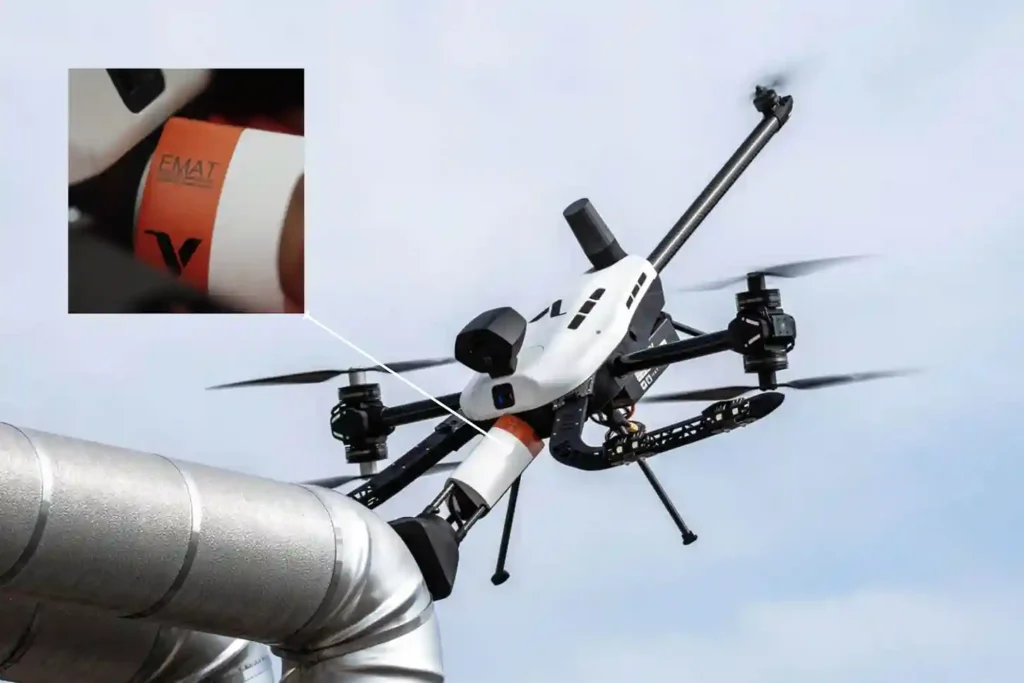
For decades, Ultrasonic Testing (UT) has been the gold standard for verifying asset integrity, yet it remains plagued by operational “friction”. Traditional piezoelectric transducers require a liquid coupling medium, such as water or gel o transmit sound waves into a material. This necessitates extensive surface preparation, including the removal of coatings, rust, and dirt, followed […]
Voliro T: Redefining Structural Integrity Inspections through Aerial NDT
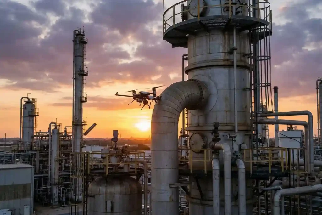
For years, industrial drones have been celebrated as the “eyes in the sky,” providing invaluable visual and thermal data from a safe distance. However, for asset integrity managers, a significant “last mile” remained: the inability to perform physical, contact-based testing without expensive scaffolding, risky rope access, or heavy machinery. Enter the Voliro T. This is […]
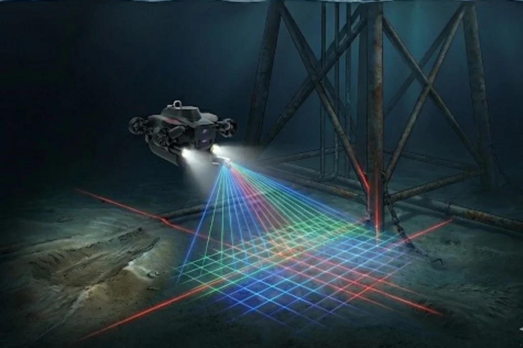
FIFISH E-Master: The Seafloor Mapping Revolution
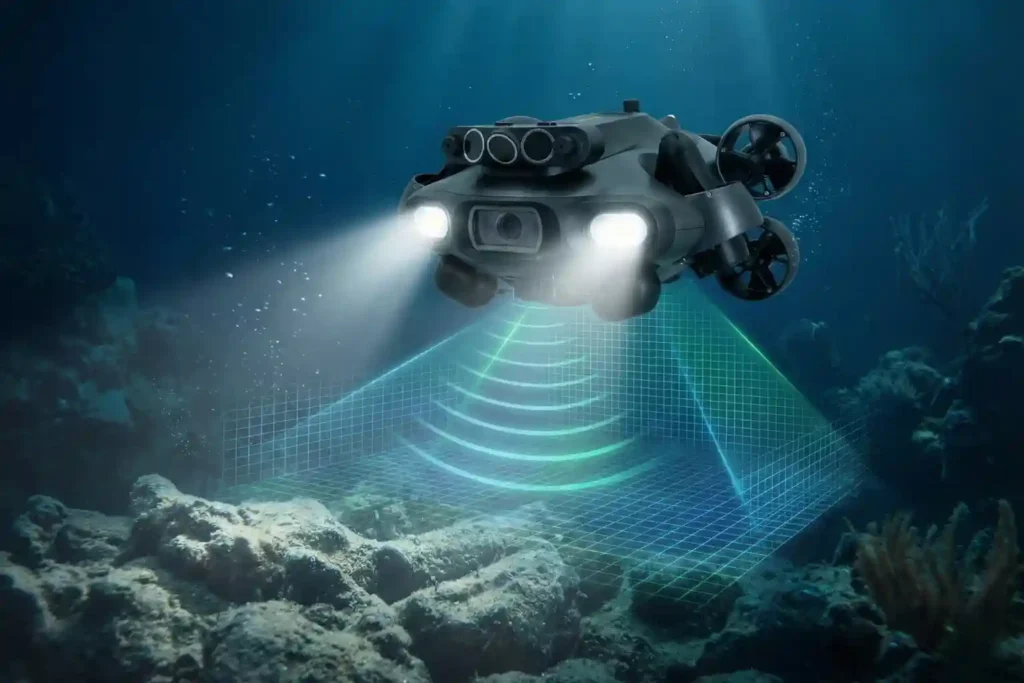
Navigating the Industrial Abyss The Complexity of 2026: Subsea operations have evolved beyond simple visual checks to requiring high-precision data, physical interaction, and deep-water endurance. The Multi-Disciplinary Challenge: No single tool fits all tasks, aquaculture requires agility, while offshore energy demands heavy-duty payloads and millimetric metrology. The Solution: Introducing the QYSEA FIFISH ROV Lineup, an […]
The QYSEA ROV: Intelligence for the Subsea Era

Navigating the Industrial Abyss The Complexity of 2026: Subsea operations have evolved beyond simple visual checks to requiring high-precision data, physical interaction, and deep-water endurance. The Multi-Disciplinary Challenge: No single tool fits all tasks, aquaculture requires agility, while offshore energy demands heavy-duty payloads and millimetric metrology. The Solution: Introducing the QYSEA FIFISH ROV Lineup, an […]
Major Update on GACA Regulation Part 107 Operation of UAS V5

The publication of GACAR Part 107 Version 5 represents a watershed moment for the Kingdom’s aviation sector. This update signifies a transition from a reactive, case-by-case regulatory model to a sophisticated, risk-based regulatory framework. By aligning Saudi Arabia’s General Authority of Civil Aviation (GACA) protocols with international best practices most notably the European Union Aviation […]
Integrating Real-Time Data Acquisition and GIS Processing in Industrial Intelligence

In the traditional era of drone mapping, the capture of aerial imagery was only half the battle. For years, the bottleneck was the processing, loading thousands of high-resolution images onto local workstations that would churn for days to produce a single orthomosaic. This fragmented approach led to data silos, inconsistent results, and a lack of […]
Securing Marine Assets with ROV Inspection and Subsea NDT.
While the world marvels at the soaring skyscrapers of Riyadh and the mirrored walls of NEOM, a second, equally ambitious infrastructure revolution is taking place beneath the waves. Saudi Arabia’s maritime infrastructure, spanning the Red Sea and the Arabian Gulf is home to a vast, invisible network of subsea lifelines, including oil and gas pipelines, […]
The 2025 Recap from Terra Drone Arabia

As the curtain falls on 2025, the industrial landscape of Saudi Arabia stands fundamentally altered. What was once a horizon dominated by traditional manual labor and terrestrial surveying has transitioned into a high-velocity, data-driven domain known as the Low Altitude Economy (LAE). At the heart of this revolution is Terra Drone Arabia (TDSA). This Terra […]
Quantifying the Invisible: Autonomous Equipment for Total Environmental Oversight.
The Regulatory Squeeze Offshore energy operators today face a dual threat that is often invisible to the naked eye. The first threat is leaking methane gas in the air, a potent greenhouse gas. The second is ecological damage on the seabed beneath the platform. For decades, these impacts were estimated using calculations or infrequent spot […]
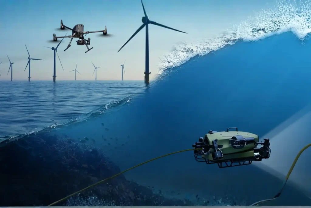
The Involvement of the UAV and ROV in Offshore Industry
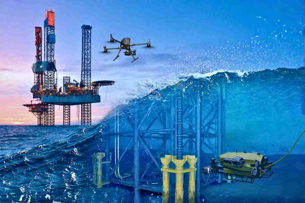
Offshore Operations in a High-Risk, Data-Driven Era The offshore energy sector operates on the edge of what is physically possible. Platforms stand isolated in the middle of the ocean, battered by saltwater, high winds, and unpredictable currents. In this hostile environment, the challenge of maintaining infrastructure is immense. Steel corrodes faster, structural fatigue sets in […]
