Cliffside Risk and Moving Components Mapping at the New Qiddiya Stadium

The construction of the Prince Mohammed bin Salman Stadium represents a significant architectural shift in global sports infrastructure. It stands as a crown jewel of the Qiddiya gigaproject, built directly atop a breathtaking, vertical 200-meter-high Tuwaiq cliff edge that overlooks the Qiddiya entertainment district. Designed to serve as a premier venue for the 2027 AFC […]
Surveillance Unit For Smart Cities: Saving Lives in 90 Seconds
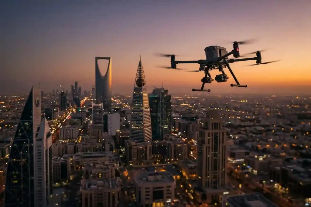
The “7-minute gap” is a major problem for emergency services in modern smart cities. While ground teams try to reach an emergency in 7 minutes, rising traffic and massive construction projects in cities like Riyadh and Jeddah make this almost impossible. The need for better monitoring is a global trend. Recently, the Sindh police in […]
GACA Drone Regulations: The 2026 Permit Guide
In 2026, Saudi Arabia’s drone industry is a core part of the Kingdom’s digital transformation and Vision 2030 goals. Operating a drone professionally requires more than just a controller; it requires a multi-step legal framework. Following GACA regulations ensures that your business objectives are recognized as part of a safe and integrated airspace. This guide […]
How an Anti Drone System Finds Hidden Threats

Modern industrial sites face a serious risk from low-altitude drones that avoid traditional radar. These unauthorized drones can reach sensitive areas like oil refineries or power plants without being noticed. To stop them, an anti drone system must find these targets as early as possible. This requires moving away from loud sensors and using silent […]
Shahed-136: Affordable Protection for Strategic Sites

The modern battlefield is undergoing a rapid and permanent transformation. The Shahed-136 has transitioned from a niche experimental tool into what experts call a “single reliable weapon” for asymmetric warfare. These slow-moving loitering munitions are designed for one purpose: to strike deep into enemy territory with high precision. They have moved the front lines away […]
Real-Time Traffic Management With Drones to End Road Jams
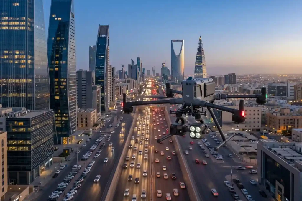
In rapidly growing cities like Riyadh and Jeddah, traffic congestion is more than a simple daily annoyance. It represents a significant drag on economic productivity and a hurdle to improving the general quality of life. The primary issue with current infrastructure is that most traffic lights operate on static, fixed timers. These systems are unable […]
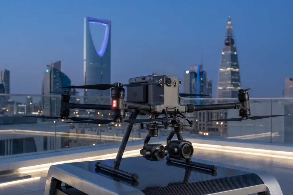
The Complete DJI Enterprise Software Guide: From Data to Intel

Drones alone are no longer enough for operational purposes. While a high-performance aircraft is the “muscle” of the operation, it is merely a vehicle for sensors. To truly unlock value, reliable software is needed to process large amounts of data acquired during field missions. The complexity of modern infrastructure means that “one size fits all” […]
How TDOA Technology Secures Airport Airspace Passively

In modern aviation, a single unauthorized drone sighting can paralyze an entire airport in minutes. Unauthorized UAV intrusions lead to grounded flights, diverted passengers, and millions of dollars in operational losses, not to mention the catastrophic safety risks to aircraft during takeoff and landing. However, airports face a unique technical dilemma: many traditional active radar […]
Securing The Energy Asset: Why Active Anti-Drone Defense is Essential in 2026

The Middle East has long been a region defined by complex tensions and volatile geopolitics that threaten global social and economic stability. In such an unstable environment, the active protection of vital national assets, ranging from military installations and government hubs to critical energy infrastructure is no longer a luxury, but a prerequisite for national […]
Beyond Human: The 24/7 Operations in Extreme Industrial Environments

As we move into 2026, the robotics landscape has shifted from experimental prototypes to indispensable industrial assets. Deep Robotics has emerged as a cornerstone of this transition, bridging the gap between digital AI and physical labor. With the release of the flagship X30 and the CES 2026 Innovation Award-winning LYNX M20, the industry is no […]
