شعار TDSA إيجابي طويل

Precision Underwater ROV Inspection

Deploy tethered industrial ROVs (Remotely Operated Vehicle) for visual inspection, ultrasonic thickness testing, and 3D modeling across subsea pipelines, offshore structures, and port berths, delivering inspector-reviewed integrity reports without diver risk.

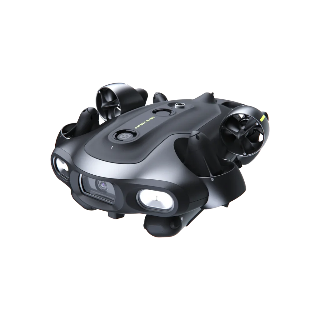
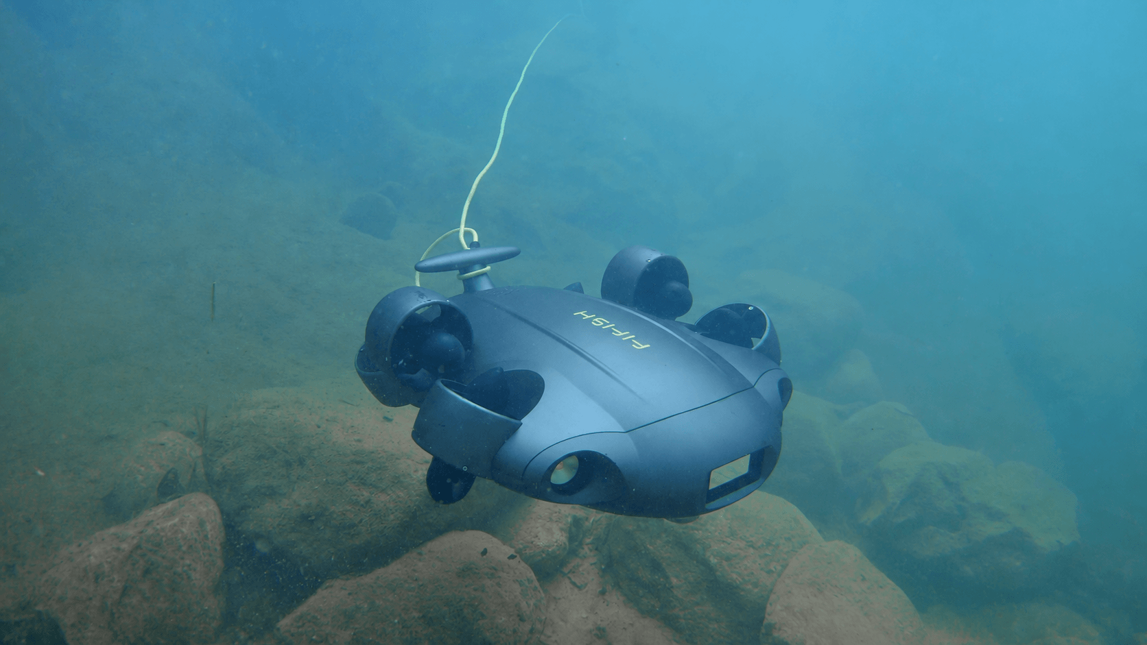
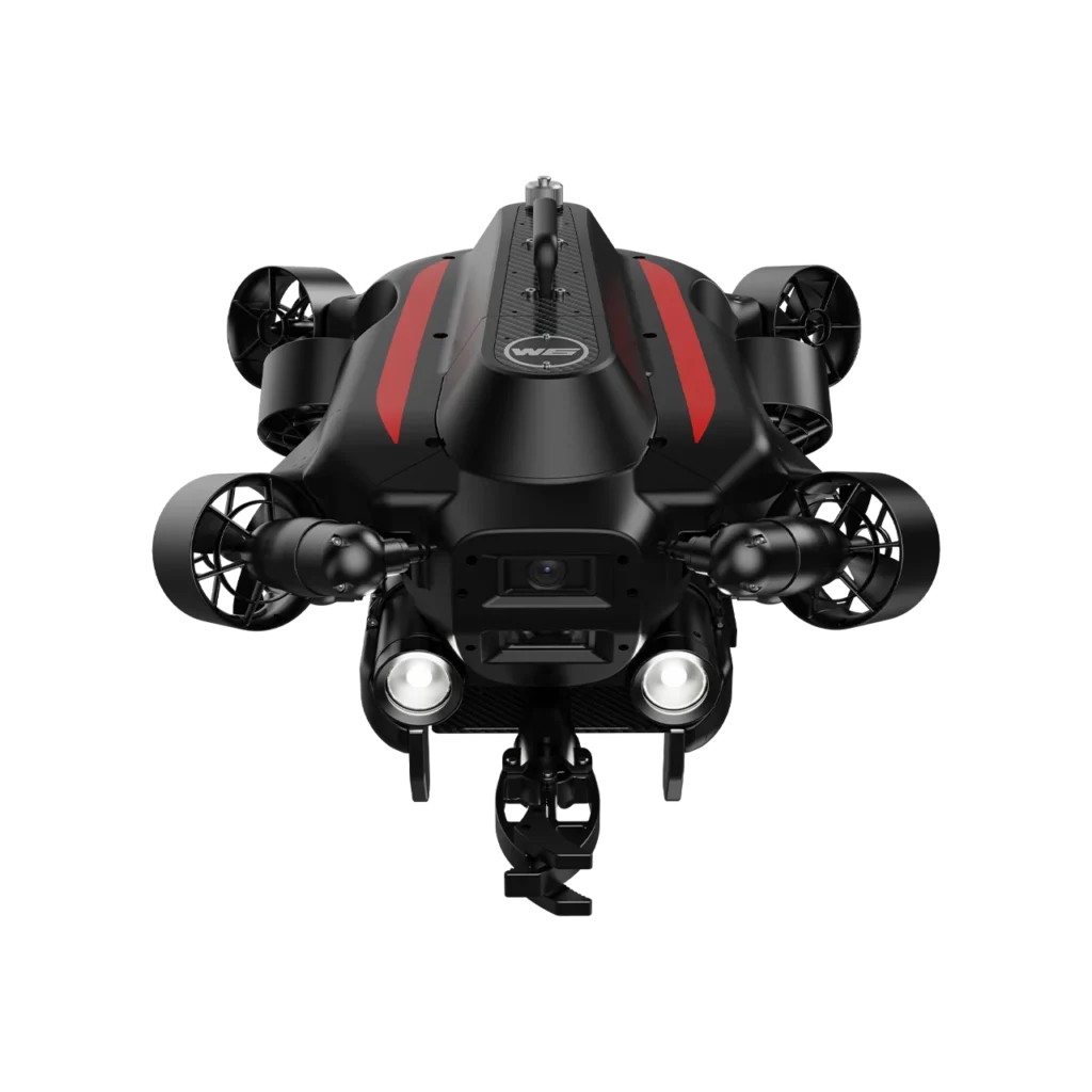
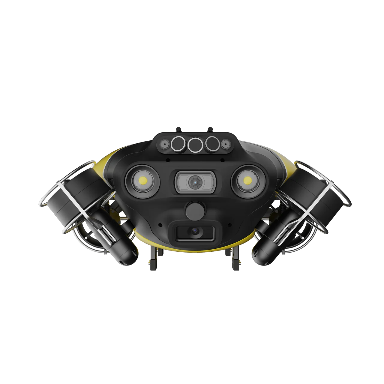
Underwater ROV inspection Saudi Arabia: FIFISH V6 EXPERT underwater ROV performing subsea inspection

WHY CHOOSE US

Smarter Underwater ROV Inspection Solutions

Safer and faster than diver-led inspection in current and turbid water, with ISO-aligned procedures and structured, NDT-reviewed reporting built for Saudi Arabia’s offshore, port, and marine infrastructure operators.

No Diver Exposure in Hazardous Current

FIFISH ROVs operate from vessel or dock with tethered live video, keeping personnel out of strong current, zero-visibility, and contaminated water for most visual and NDT assignments.

Live 4K Subsea Video and Sonar

W6 NAVI provides live high-resolution video and stable navigation, while optional 2D imaging sonar supports work in turbid or low-visibility water. Mission evidence is retained for technical review.

Subsea UTG and CP Without Drydock

Ultrasonic thickness gauge (UTG) and cathodic protection (CP) modules measure wall loss and anode condition on hulls, jackets, and pipelines while assets remain in service at berth or offshore.

Rapid 3 to 5 Minute Deploy

Compact FIFISH platforms deploy in 3 to 5 minutes with one to three operators, versus multi-day dive spreads and heavy work-class ROV mobilization for routine inspection windows.

Structured Subsea Reporting Workflow

Initial subsea inspection report with annotated findings and measurement highlights, followed by full UTG, CP, QY-MT, and QY-BT data packages, both built to the deliverable formats your asset integrity, class society, and marine operations teams already use.

Structured Subsea Inspection Record

Reviewed findings can carry a location or chainage, depth, evidence frame, defect code, severity, and confidence in our inspection reporting platform. Project teams receive an approved report and can securely access retained project records through a project-specific account.

THE HIDDEN COSTS

The Risks of Traditional Inspections

Commercial dive teams, drydock schedules, and heavy ROV spreads struggle with cost, weather windows, and incomplete data on Saudi Arabia’s offshore pipelines, platforms, and port fleets.

Diver Safety in Current and Depth

Saturation and air diving in offshore current above 2 knots increases entanglement, DCS risk, and standby cost. Operators defer subsea surveys until weather improves, delaying integrity decisions.

Zero Visibility and Turbid Water

Ports, estuaries, and stirred seabed conditions blind diver visual inspection. Without 2D sonar and stabilized ROV hover, teams miss defects on hull plating and pipeline spans.

Drydock and Off-Hire Cost

Class society hull surveys often require drydock or raft arrangements, taking vessels off hire for weeks. Port-time ROV inspection at berth avoids revenue loss when conditions allow.

Subsea NDT Access Gaps

Handheld UTG on divers is slow on jacket nodes and pipeline spans. Without modular ROV-mounted UTG and CP, wall-loss and anode data arrive late or incomplete.

Weather and Mobilization Delays

Dive spreads and large work-class ROVs need calm sea states and support vessels. A missed weather window pushes turnaround and regulatory submission by weeks.

Manual Subsea Logs

Diver sketch sheets and disconnected video folders break the link between subsea findings and asset integrity workflows, slowing maintenance updates and repair prioritization.

التقنيات و الأساليب

Innovative Subsea Inspection Services

Visual, NDT, bathymetry, and search methods matched to asset type and water conditions. Need external aerial, contact shell NDT, or internal tank entry? See Aerial Drone Inspection, Drone-Based NDT Inspection, and Robotic & Confined Space Inspection.

Precise Subsea Pipeline Scans

Live 4K video along subsea pipelines and flexible flowlines with Q-DVL station hold in current (resistance 3 to 4 knot, model dependent), U-INS mission track, and defect annotation for leak indicators, freespan, coating damage, and marine growth.

Subsea UT and CP Testing

For suitable steel assets, specialist payloads support ultrasonic thickness readings and cathodic protection testing. FIFISH X1 is deployed when scopes require specialized high-capacity tooling and multi-sensor configurations.

Visual and Sonar 3D Modeling

Overlapping visual or sonar observations can be processed into a 3D representation of submerged structures, coral reefs, and selected marine assets for condition review and spatial documentation.

Bathymetry and Seabed Mapping

QY-BT and sonar configurations support bathymetric surveys, seabed mapping, and scour documentation around foundations, berths, pipelines, and environmental survey areas.

Confined Underwater Inspection

The compact FIFISH E-GO supports visual access in submerged tanks, narrow galleries, culverts, and other confined underwater areas where a larger ROV is impractical.

Underwater Water Jetting

A water-jet tool removes localized marine growth or surface deposits before visual inspection or measurement. Heavy-duty platforms such as FIFISH X1 support intensive hydrodynamic cleaning scopes.

Subsea Asset Integrity & Reporting Platform

Built specifically for marine infrastructure, offshore jackets, subsea pipelines, and port berths, Terra ROVX connects georeferenced ROV telemetry, AI-assisted defect tagging, mandatory inspector sign-off, and deterministic reporting into a unified auditable record.

Interactive Defect Mapping

Every defect is plotted by severity against the survey baseline or structural distance-and-depth grid, linking directly to the high-resolution source frame.

Configurable Defect Catalogues

Enforces your organization's defect classification vocabulary, multi-tier severity levels (Grade 1–5), and confidence ratings across every dive and operator.

Deterministic PDF Reports

Export comprehensive multi-page inspection deliverables on demand, complete with photo defect cards, ROV telemetry specs, named approvals, and revision history.

RTK Finding & Sensor Import

Seamlessly ingest external RTK-measured coordinates, UT wall-thickness readings, and CP potential data into the same unified section record.

Self-Hosted Data Sovereignty

Operates on self-hosted infrastructure ensuring client subsea inspection data never leaves authorized control, with full project exportability.

Historical Record Retention

Completed survey visits and sections are archived intact, preserving uncompressed footage and coded defect registries for multi-year integrity baseline

QYSEA AI Vision Station Lock underwater ROV object stabilization

محطة رؤية الذكاء الاصطناعي قفل

Enables intelligent locking onto subsea assets with a single touch. Coupled with six-axis vector thrusters, stability is actively maintained against strong currents for steady, risk-free visual inspection.
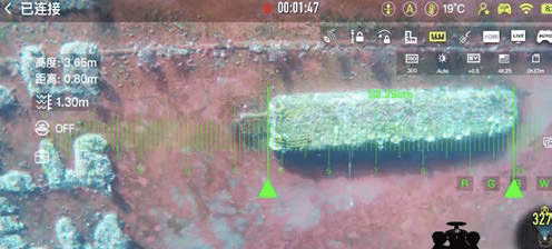
Machine Vision AR Ruler for real-time subsea measurements

مسطرة الواقع المعزز بالرؤية الآلية

Delivers millimeter-precision dimensional measurements in real time directly on the live inspection feed. Intelligently adapts to structural distance and surface depth, producing verifiable visual data.
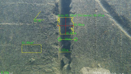
QY-MT precision measurement tool for underwater crack and defect profiling

QY-MT Precision Tool

Engineered for rigorous defect profiling on subsea structures. Accurately measures crack length, width, area, perimeter, and surface angles with millimeter accuracy for asset integrity evaluations.
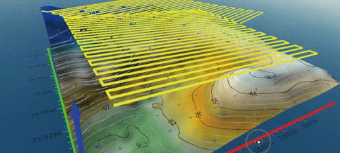
QY-BT bathymetric depth measurement and 3D seabed contour mapping

QY-BT Bathymetric Tool

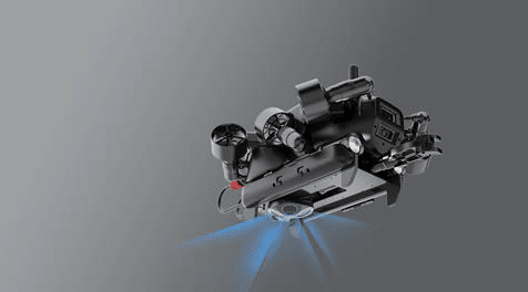
Integrates proprietary depth algorithms, Q-DVL sensors, and 3D path planning to produce high-density seabed topography, bathymetric contours, and scour documentation around piles and berths.
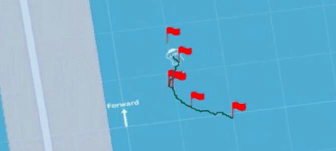
U-INS and U-QPS underwater inertial navigation and trajectory tracking

U-INS & U-QPS Navigation

Combines accelerometers, gyroscopes, magnetometers, and acoustic positioning to log subsea POIs, record 3D survey paths, and execute return-to-base navigation even in deep-sea currents.
المخرجات

ما الذي تتلقاه

Structured, integrity-ready subsea outputs in the formats your marine, offshore, and asset-integrity teams already use, with no reformatting overhead.

Live and Archived 4K Subsea Video

Annotated Defect Log with Severity Grading

Subsea UTG Thickness Measurement Log

Cathodic Protection (CP) Survey Report

QY-BT Bathymetry and Scour Map

QY-MT Dimensional and Crack Measurement Report

2D Imaging Sonar Mosaic (Where Deployed)

Terra ROVX Defect Map and Findings Index

NDT-Reviewed Subsea Inspection Report with Prioritised Anomaly List

Retained Terra ROVX Project Record and Approved Report

المنصات والتطبيقات

Tailored Platforms for Every Asset

We purposefully equip our advanced ROVs to conquer your specific subsea challenges, whether handling open-sea pipelines or confined port hulls.

Oil & Gas and Subsea Pipelines

We conduct thorough underwater ROV inspection on subsea pipelines, submerged berth piles, and marine foundations, ensuring maximum safety for oil & gas operators.

Renewable Energy and Offshore Wind

Reliably monitor subsea cable routes and monopile foundations to support large-scale offshore renewable energy programs efficiently.

Ports, Maritime, and Marine Shipping

Conduct rapid port asset inspection on hulls and propellers at berth. We save fleet operators time and avoid drydock delays. For port guidance, see Saudi Ports Authority (Mawani).

Dams, Infrastructure, and Construction

Safely assess reservoir intakes and bridge foundations. We deliver precise underwater structural insights for major civil infrastructure projects.

RELEVANT EXPERIENCES

ROV Project Experience in Saudi Arabia

Selected underwater inspection and marine-mapping assignments across sewer networks, port structures, and environmental survey areas.

SANITARY SEWER NETWORK

36 km CCTV Inspection with ROV

In 2024, we inspected 36 km of Jeddah's sanitary sewer network for NWC / Saud Consult using an ROV-mounted CCTV workflow, producing structured footage records and inspection findings.

CLIENT

NWC / Saud Consult

METHOD

CCTV inspection with ROV

Project Scope

36 km sanitary sewer network

DELIVERABLE

CCTV inspection record and findings

PORT BERTH & QUAY WALL

Port Berth and Quay Wall Visual Inspection

For a confidential port client, we used ROV visual inspection to document submerged berth and quay-wall surfaces, producing reviewable evidence and localized condition findings.

CLIENT

Confidential

METHOD

ROV visual inspection

Project Scope

Port berth and quay wall

DELIVERABLE

Visual inspection record and findings

mARINE BIODIVERSITY

Coral Reef and Seabed Mapping

For a confidential marine client, we combined ROV visual and sonar mapping to document biodiversity, model coral reefs, and map seabed conditions.

CLIENT

Confidential

METHOD

ROV visual and sonar mapping

Project Scope

Marine biodiversity and seabed

DELIVERABLE

Coral reef model and seabed map

SUBSEA INSPECTION ANSWERS

أسئلة متكررة

Yes for most visual, UTG, and CP scopes on pipelines, jackets, and hulls. ROVs remove diver exposure in current and extend inspection windows. Critical node confirmation or class-mandated diver witness may still apply per contract.
W6 NAVI is rated to 350 m with Q-DVL station hold in strong current (vendor-dependent, typically up to 3 to 4 knots on selected models). Mission depth and sea state are scoped per asset, location, and client safety procedures before mobilization.
Yes. UT and CP payloads can be configured for suitable ROV scopes on hulls, quay walls, subsea structures, and pipelines. Reviewed findings can be recorded in Terra ROVX with location or chainage, depth, evidence imagery, defect code, severity, and an approved report.
Compact FIFISH systems deploy in 3 to 5 minutes with one to three operators once on site. Initial annotated subsea findings, followed by full UTG, CP, QY-MT, and QY-BT data packages, are delivered to the formats your operations team already uses. Specific reporting timelines are scoped per asset, campaign, and contract.
We deliver all ROV campaigns through Terra ROVX, our purpose-built subsea asset integrity platform. An optional AI vision model pre-screens footage to suggest defect codes, severity grades, and bounding boxes strictly from your configured catalogue. Crucially, every suggestion requires authorized inspector verification before inclusion, giving asset owners interactive georeferenced defect maps, audit-ready PDF reports, and direct campaign visibility via a scoped client login.
ROV underwater inspection covers subsea and port-submerged scopes. For external aerial visual and thermal, see Aerial Drone Inspection. For Voliro UT/EMAT on external steel, see Drone-Based NDT Inspection. For internal tank and boiler entry, see Robotic & Confined Space Inspection.

From pipeline to hull: underwater ROV inspection, no dive team

Ready to Inspect Your Next Subsea Asset?

Aerial drone view of Riyadh skyline in Saudi Arabia

Get the Drone & Geospatial Brief, Saudi Arabia

Real project breakdowns, GACA regulatory updates, and field-tested case studies from oil and gas, mining, and infrastructure operations. Used by engineering and procurement teams at Saudi Arabia’s largest operators. 

Joined by 2K+ industry professionals in Saudi Arabia.