شعار TDSA إيجابي طويل

Drone Geophysical Survey Services in Saudi Arabia

GACA-certified drone geophysical survey in Saudi Arabia. Aeromagnetic, GPR, and electromagnetic data for mineral exploration and subsurface mapping.

المزايا

See What Is Under the Ground Before You Commit

Aeromagnetic, GPR, and electromagnetic surveys map what lies beneath the surface, so drill targets and foundation designs are set from measurements.

Subsurface Answers Before You Break Ground

Magnetic and electromagnetic sensors map geological structure and mineral targets from the air, so you learn what is below before committing to excavation or drilling.

Reach Terrain Ground Crews Cannot Cover Safely

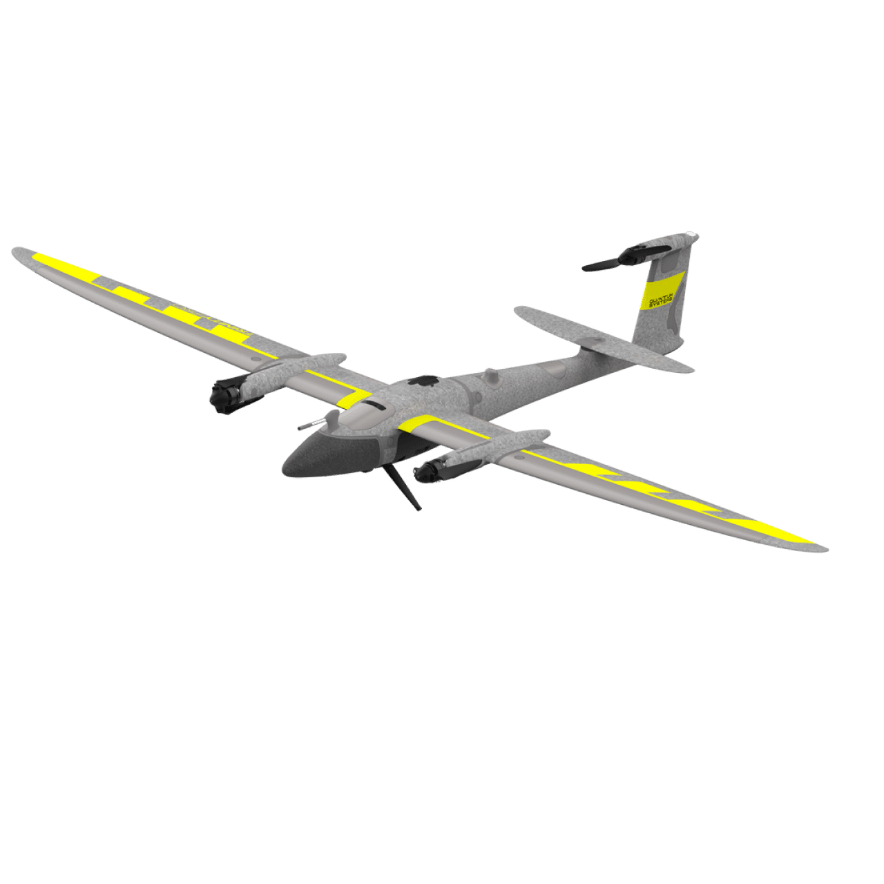
Fixed-wing and multirotor platforms survey wadis, escarpments, and open desert from the air, closing the data gaps that steep or remote ground normally leaves behind.

Permits Cleared Before Mobilisation

Terra Drone Arabia holds GACA certification and files GACAR Part 107 authorisation directly, so survey windows are scheduled around your programme, not around paperwork.

One Subsurface Model, Not Three Datasets

Magnetic, radar, and conductivity data are co-registered into a single georeferenced subsurface model, so your geologists interpret one picture instead of reconciling three.

Straight Into Your Geoscience Workflow

Grids, radargrams, conductivity maps, and interpreted layers arrive in standard GIS formats referenced to KSA-GRF17, ready to import without reprojection or rework.

Your Exploration Data Stays in the Kingdom

Processed outputs are delivered through Terra MapX on organisation-controlled storage inside Saudi Arabia, aligned to the PDPL, with project-level access isolation.

تحديات

Where Subsurface Programmes Lose Time and Certainty

Large survey blocks, hazardous ground, and fragmented datasets slow exploration and leave planning decisions running on assumption.

Regional Coverage Takes Weeks on Foot

Ground magnetometer and electromagnetic crews cover a limited area per day, so reconnaissance a fixed-wing drone flies in days can take weeks across a large block.

Hazardous Ground Leaves Data Gaps

Steep escarpments, wadis, and remote desert are unsafe or unreachable on foot, leaving blank areas in exactly the terrain most likely to host structural targets.

Drilling Without a Target Map Is Expensive

Exploration budgets are consumed by boreholes placed on surface geology alone, when magnetic and conductivity data could have ranked the targets before the rig moved.

Planning Without Subsurface Context

Corridor and geotechnical decisions taken without shallow subsurface characterization risk meeting unexpected geology, faults, or voids once construction is under way.

Disconnected Survey and Geoscience Data

Hiring separate firms for magnetic, radar, and base mapping produces mismatched coordinate frames and interpretation layers that never quite line up across teams.

Permitting Friction Delays Aerial Programs

Aerial geophysical flights require GACAR Part 107 authorisation and operator coordination, which can stall a survey window that the drilling programme is already waiting on.

التقنيات و الأساليب

Airborne and Ground Methods, One Survey Programme

Aeromagnetic, GPR, and electromagnetic data collected, processed, and interpreted as one co-registered, GIS-ready programme.

مسح مغناطيسي جوي

High-resolution aeromagnetic survey maps variations in the Earth's magnetic field to reveal geological structure, lithology contacts, and mineral targets across a survey block.

مسح الرادار الأرضي (GPR)

GPR profiles the shallow subsurface to resolve voids, karst features, layer boundaries, and depth to bedrock ahead of foundation and geotechnical decisions.

Electromagnetic (EM) Conductivity Survey

Electromagnetic survey measures ground conductivity to characterise soil and rock composition, moisture, salinity, and alteration zones relevant to exploration.

Terrain-Following Survey Design

Line spacing, survey height, and terrain-following flight paths are designed to the target depth, because magnetic resolution is set by sensor-to-source distance.

Magnetic Processing & Target Interpretation

In-house processing applies gridding, reduction-to-pole, residual separation, and analytic signal, then our geoscience team ranks anomalies as drill-ready targets.

Ground-Based Survey Option

Where flight is restricted or a schedule cannot wait on permits, the same magnetic, GPR, and conductivity data is acquired from the ground, for the same deliverables.

المخرجات

Geophysical Data Formatted for Geoscience Teams

Magnetic grids, radargrams, conductivity maps, interpreted layers, and ranked drill targets in standard GIS formats.

Total Magnetic Intensity (TMI) Maps & Grids

Reduced-to-Pole, Residual & Analytic Signal Grids

GPR Radargram Profiles & Depth Slices

Soil & Rock Conductivity Maps (Electromagnetic)

Interpreted Geological, Fault & Lineament Layers

Ranked Subsurface Targets for Drill Planning

Shallow 3D Subsurface Model & Depth Estimates

Survey Design, Flight Line & Coverage Plan

Base-Station & Diurnal Correction Log

Geodatabase & GIS Derivatives in KSA-GRF17 (GeoTIFF / .SHP / .GeoJSON)

Survey Specification & Quality Control Report

Geophysical Interpretation Report (EN/AR)

المنصات والتطبيقات

Mission-Matched Geophysical Survey Fleets

Each survey is matched to the aircraft, payload, and flight pattern its target and terrain actually require.

Mining & Mineral Exploration

Aeromagnetic and conductivity reconnaissance for geological characterization, mineral target identification, and drill-target ranking across Saudi Arabia.

Construction & Geotechnical

Pre-construction GPR and shallow subsurface survey resolves voids, karst, and depth to bedrock, de-risking excavation and foundation design.

Corridors & Linear Infrastructure

Geological characterization, fault mapping, and corridor assessment ahead of pipeline, road, or transmission line construction across long alignments.

النفط والغاز والصناعة

Shallow subsurface and ground-condition mapping around existing facilities to support geotechnical investigation and expansion planning.

Soil, Salinity & Ground Conditions

Electromagnetic conductivity mapping of soil and moisture conditions, contamination extent, and salinity across sites and project footprints.

Quarry & Aggregate Resource Definition

Structural and lithology mapping to define aggregate resource extent, overburden thickness, and bench planning inputs for quarry operators.

USE CASES & CAPABILITY

What a Geophysical Survey Finds, and What That Changes

What each method detects below the surface, and which decision it changes before a rig or excavator moves.

Multi-Sensor Survey for Subsurface Characterization

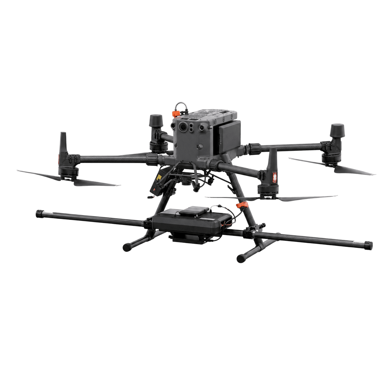
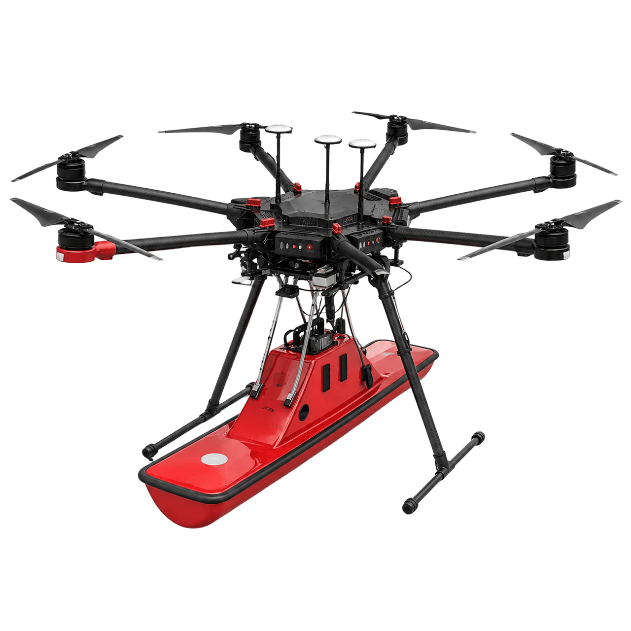
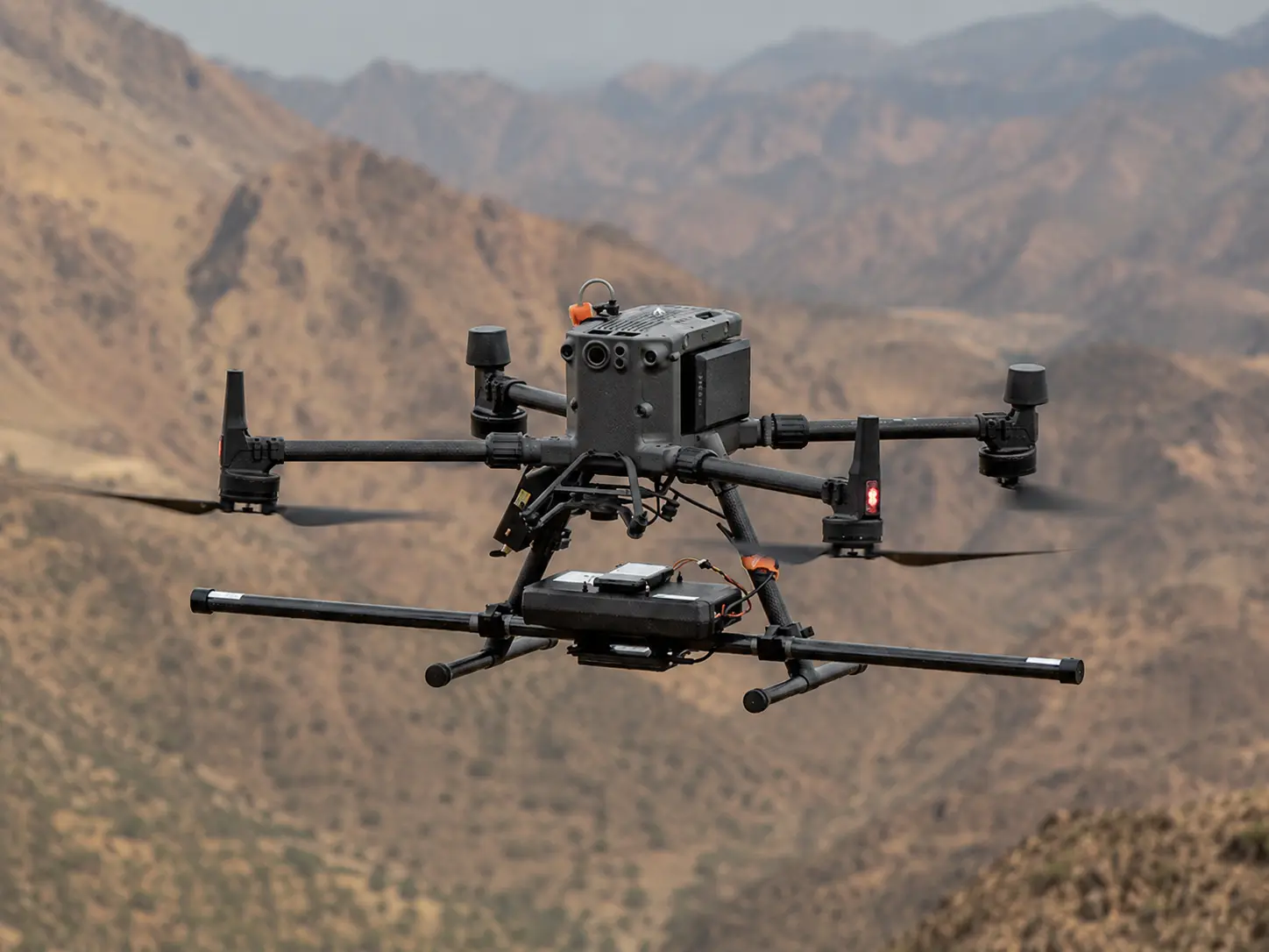
Airborne magnetometer, GPR, and electromagnetic conductivity methods map structure, lithology, voids, and ground conditions, so drill targets are ranked and foundation designs are set before a rig or excavator moves.
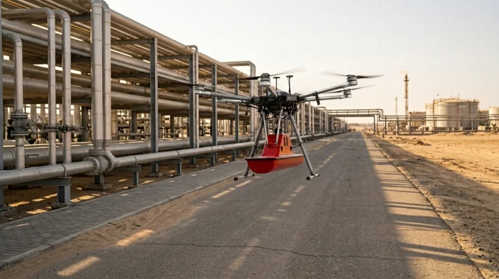
طائرة بدون طيار صناعية تحمل حمولة رادار اختراق الأرض للكشف عن خطوط الأنابيب والكابلات المدفونة ورسم خرائط لها لأعمال المسح تحت سطح الأرض في المملكة العربية السعودية.

GACA-CERTIFIED DRONE GEOPHYSICAL SURVEY IN SAUDI ARABIA

أسئلة متكررة

A drone geophysical survey uses drones carrying geophysical sensors to map subsurface conditions from the air. Aeromagnetic surveys map variations in the Earth’s magnetic field to identify geological structure and mineral targets; ground penetrating radar profiles the shallow subsurface for voids, layer boundaries, and depth to bedrock; and electromagnetic systems measure ground conductivity for exploration and geotechnical characterization.
It depends on the method and the ground. Aeromagnetic survey responds to magnetic contrast in rock, so it maps structure, lithology contacts, and mineralised bodies at depth, with resolution set by survey height and line spacing. GPR resolves the shallow subsurface only, and its penetration falls sharply in wet or highly conductive ground. Electromagnetic survey measures conductivity rather than imaging objects. For locating buried pipes, cables, and ducts specifically, that is a separate underground utility survey service, which uses ground-coupled GPR and dedicated cable and pipe locators rather than an airborne sensor.
Yes. All commercial drone operations in Saudi Arabia, including geophysical survey flights, require civil aviation authorization from the General Authority of Civil Aviation (GACA) under GACAR Part 107. Terra Drone Arabia holds active GACA certification and coordinates all flight permits directly before deployment.
Aeromagnetic survey measures variations in the Earth’s magnetic field to map geological structure and identify mineral targets. Electromagnetic survey measures ground conductivity and subsurface composition, which supports mineral exploration, salinity and contamination screening, and geotechnical characterization. Geophysical survey is an established Terra Drone Arabia service line covering ground penetrating radar, aeromagnetic, and electromagnetic methods, and the two are often flown or walked as complementary methods on the same project.
Standard deliverables include Total Magnetic Intensity (TMI) maps and grids, reduced-to-pole, residual and analytic signal grids, GPR radargram profiles and depth slices, soil and rock conductivity maps, interpreted geological, fault and lineament layers, ranked subsurface targets for drill planning, a shallow 3D subsurface model, survey design and QC records, and GIS derivatives referenced to KSA-GRF17 in GeoTIFF, SHP, and GeoJSON.
Surface geology alone tells you where rock is exposed, not where a body continues at depth. Magnetic and conductivity data respond to physical property contrasts through cover, so anomalies can be gridded, filtered, and ranked before a rig is mobilised. That turns a drill programme from a spread of exploratory holes into a prioritised sequence, and it gives early-stage field decisions a dataset to argue from. We deliver ranked targets alongside the grids they came from, so your geologists can audit the reasoning rather than accept a list.
We quote both options. Where the airspace is open and the block is large, the airborne survey is faster. Where flight is restricted, or your schedule cannot wait on an authorization window, the same magnetic, GPR, and conductivity measurements are acquired from the ground, and the deliverables are the same. Ground geophysics is the classical form of these methods, not a downgrade, and we already run ground penetrating radar in the field on survey projects in the Kingdom. The choice is about access and schedule, not about data quality.

GACA-Certified · ISO-Aligned · GIS-Ready Subsurface Data

Scope Your Next Geophysical Survey with Confidence

Aerial drone view of Riyadh skyline in Saudi Arabia

Get the Drone & Geospatial Brief, Saudi Arabia

Real project breakdowns, GACA regulatory updates, and field-tested case studies from oil and gas, mining, and infrastructure operations. Used by engineering and procurement teams at Saudi Arabia’s largest operators. 

Joined by 2K+ industry professionals in Saudi Arabia.