

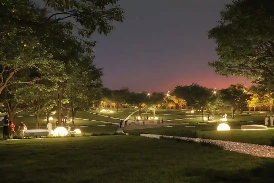
Urban greening in desert environments requires active monitoring to ensure long-term plant survival. Under Saudi Vision 2030, the Green Riyadh project represents a massive effort to build sustainable urban spaces.
A central part of this initiative is the construction of three new city parks in the Al Munsiyah, Al Rimmal, and Al Qadisiyah neighborhoods, covering a combined landscape of over 550,000 square meters.
To create a balanced microclimate, contractors are executing an intensive landscaping plan to plant more than 585,000 trees and shrubs across 65% of the park layout.
The broader municipal goal dictates the strategic planting of 7.5 million trees across Riyadh by 2030, raising the capital’s overall green cover to 9% and expanding green space to 28 square meters per capita.
However, managing hundreds of thousands of newly planted saplings in extreme desert heat creates a serious operational bottleneck.
Traditional ground-based visual surveys are slow and often fail to spot plant stress until leaves turn dry and brown.
To protect young tree canopies, project managers need automated aerial tools to evaluate plant health before visible damage occurs.
Beyond Visual Sight: Multispectral Sensing
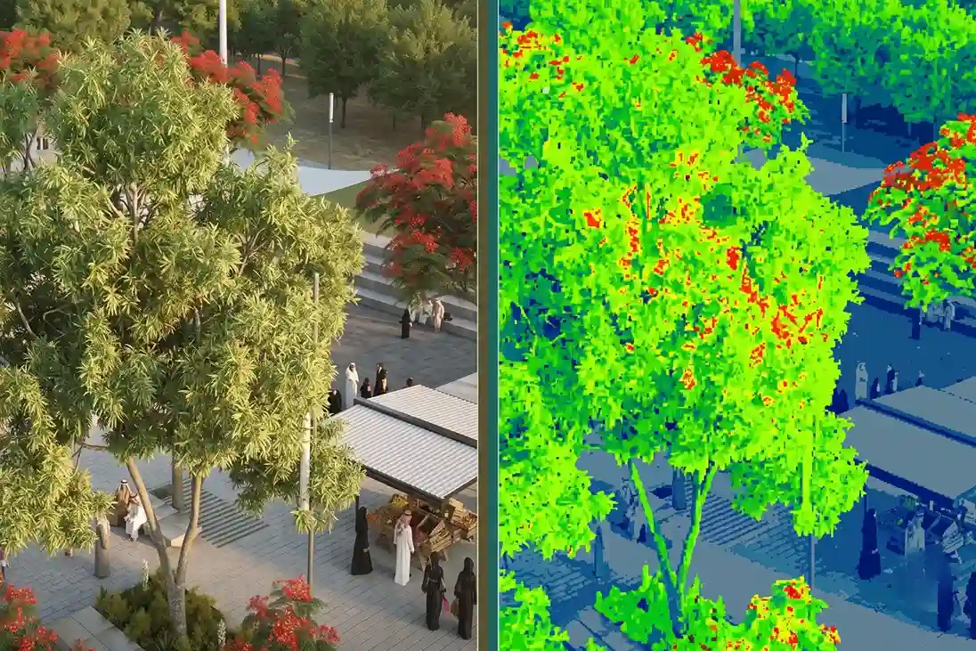
Standard RGB visual cameras only capture what the human eye can see. By the time a tree leaf turns yellow or brown in a standard photo, internal cellular damage has already occurred, making recovery difficult.
Multispectral remote sensing solves this problem by capturing light beyond the visible spectrum. Healthy plants absorb red light for photosynthesis and strongly reflect Near-Infrared (NIR) light off their internal leaf structure.
When a plant experiences water shortage, soil salinity, or disease, its internal cell structure collapses, causing NIR reflection to drop immediately.
Healthy Leaf ➔ High NIR Reflection + High Red Light Absorption ➔ High NDVI Score Stressed Leaf ➔ Low NIR Reflection + Low Red Light Absorption ➔ Low NDVI Score
By calculating ratios between reflected light bands, specialized mapping software generates diagnostic vegetation indices:
- Normalized Difference Vegetation Index (NDVI): Measures overall greenness and canopy vigor.
- Normalized Difference Red Edge (NDRE): Analyzes changes in leaf chlorophyll content to detect early-stage physiological stress weeks before leaves show physical symptoms.
The Solution: DJI Mavic 3 Multispectral (M3M)
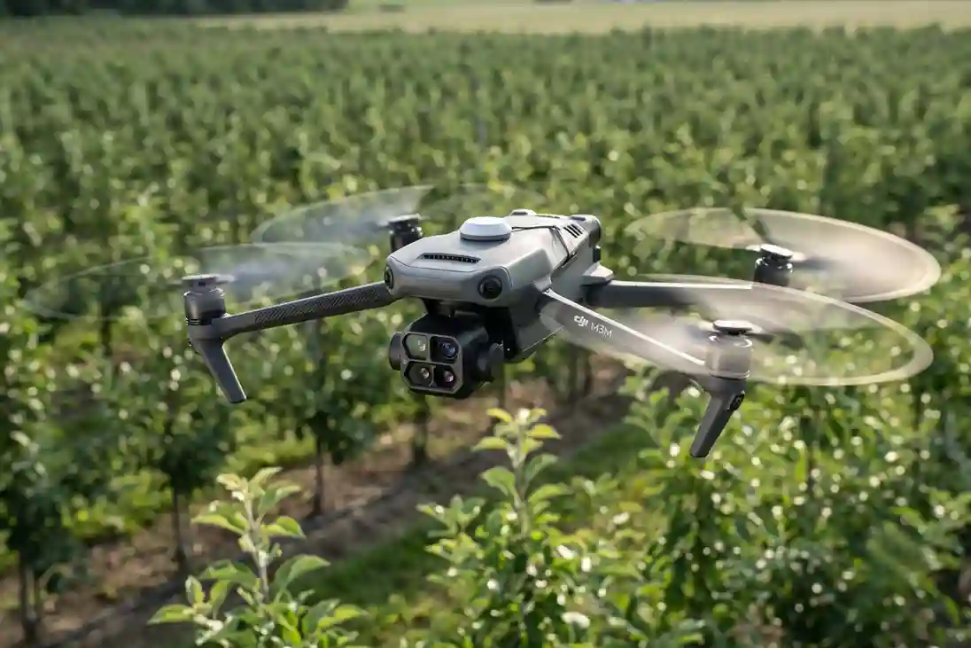
To execute high-frequency canopy health surveys over large park layouts, operators deploy the DJI Mavic 3 Multispectral (M3M) enterprise drone platform.
Mavic 3M:
- 43-Min Max Flight Time ➔ Covers up to 200 Hectares per Mission
- Lightweight (~951 g) ➔ Foldable, Rapid Field Deployment
- RTK Module ➔ Centimeter-Level Spatial Accuracy
- Omnidirectional Sensing ➔ Safe Operations Near Trees & Obstacles
Payload Capabilities: Integrated RGB + 4-Band Multispectral Sensor Array
The DJI Mavic 3M features a single payload system that combines a high-resolution visual camera with a four-band multispectral camera array.
Houses a 20MP 4/3 CMOS sensor with a fast 1/2000s mechanical shutter. It captures sharp visual maps to count individual tree saplings and establish exact coordinates for every plant asset. Four discrete 5MP cameras record specific light wavelengths:
- Green (560 ± 16 nm): Measures chlorophyll content and general leaf greenness.
- Red (650 ± 16 nm): Measures primary chlorophyll absorption for standard NDVI maps.
- Red Edge (730 ± 16 nm): Detects early-stage plant stress and changes in leaf cellular structure.
- Near-Infrared (860 ± 26 nm): Evaluates leaf biomass, plant density, and canopy structure.
It captures real-time sunlight levels during flight and automatically adjusts the image files during processing.
This light compensation guarantees that NDVI health scores remain accurate and repeatable across different hours of the day or changing cloud cover.
Economic & Ecological Returns
Shifting from uniform field management to data-driven precision forestry yields significant financial and environmental returns.
Rather than watering or fertilizing entire park sectors equally, operators use multispectral health maps to apply water and nutrients only to stressed tree clusters.
Implementing multispectral remote sensing in large-scale vegetation projects reduces input waste by up to 35%, delivering an average return on investment of $12 per acre.
This shift matches global market trends, as the drone data services market expands at a 31.63% CAGR through 2031 driven by automated canopy analysis and precision forestry tools.
When a multispectral survey flags a cluster of stressed trees, site teams can cross-reference the canopy data with subsurface utility inspections.
If the canopy stress corresponds to a subterranean water drop, engineers can deploy thermal drone platforms, such as those detailed in our guide on Managing Irrigation With Drone-based Leak Detection to inspect underground supply lines for hidden pipe breaks.
Conclusion
Combining compact multispectral drones with automated NDVI processing transforms visual plant inspections into a data-driven science.
By detecting canopy stress before visual leaves dry out, project managers can protect multi-million dollar afforestation investments in harsh desert conditions.
Ready to optimize your afforestation project? Contact our expert to set up your multispectral canopy monitoring program.

 English