

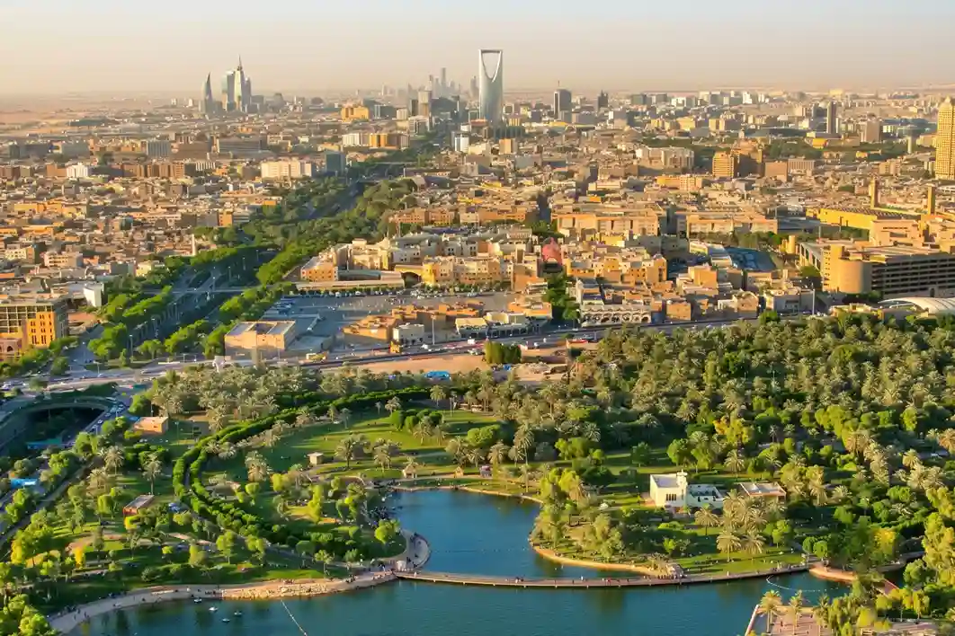
Urban modernization inside arid climates requires robust resource management to sustain newly built environmental projects.
Under the economic development mandates of Saudi Vision 2030, the Green Riyadh initiative represents a major municipal effort to transform the desert capital into an ecologically balanced urban space.
A primary focus of this initiative is the construction of three new large-scale city parks across the Al Munsiyah, Al Rimmal, and Al Qadisiyah neighborhoods, which encompass a combined landscape of over 550,000 square meters.
To establish a sustainable microclimate, engineering groups are executing a dense landscape plan intended to plant more than 585,000 trees and shrubs covering 65% of the total park footprint.
The broader municipal initiative dictates the strategic planting of 7.5 million trees across Riyadh by 2030, raising the capital’s overall green cover to 9%.
This extensive urban development plan is designed to drive a 16-fold increase in urban green space per resident, expanding the allocation from a baseline of 1.7 square meters up to 28 square meters per capita.
Ultimately, the afforestation master plan is estimated to generate a total economic return of SAR 71 billion for the city by 2030, driven by real estate value improvements, energy savings, and healthcare cost reductions.
Optimizing a project of this scale requires modern, automated management workflows. Relying on traditional ground checks across huge multi-hectare spaces leads to massive delays and missed information.
To solve this problem, engineering teams deploy specialized drone fleets and geospatial software tools.
These systems allow operators to track soil conditions, map structural components, and check vegetation assets in real time, keeping the green infrastructure optimized and cost-effective.
Specialized Drone and Geospatial Solutions
1. Site Mapping & Zoning
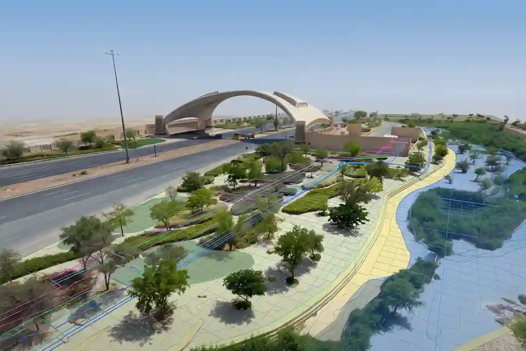
Before any trees are planted or pipeline networks are dug, drone fleets perform wide-area topographic land surveys across the park locations.
The aircraft carry high-resolution color photogrammetry sensors and aerial LiDAR mapping payloads to build detailed 3D digital terrain models.
These accurate maps allow engineers to divide the land layout into clear zones for specific forest areas, recreational paths, and critical utility corridors.
Proper zoning ensures that deep tree roots are kept at a safe distance from buried high-voltage cables, storm drains, and communication lines, preventing structural design clashes and reducing construction errors before ground crews arrive on-site.
2. Agriculture Irrigation & Vegetation Optimization
Managing thousands of plants in an arid environment requires precision asset tracking, building directly upon methodologies established in regional agricultural projects.
For instance, in southwestern Saudi Arabia, remote sensing workflows were deployed during the Saudi Coffee development initiative to evaluate canopy distribution, track land terracing layouts, and monitor plant tree populations across mountain farms.
By adopting the exact same precision agriculture approach for the Green Riyadh city parks, field managers can treat urban afforestation like a smart farm.
Drones map the position of every single newly planted tree sapling, track seasonal growth patterns, and help plan targeted fertilizer applications, ensuring high survival rates for native plant species under tough desert conditions.
3. Utility & Infrastructure Mapping: Irrigation Network Expansion
To support the massive tree-planting quota, contractors are building an extensive, city-wide 1,350-kilometer irrigation pipeline network.
This large layout is built to supply 1 million cubic meters of 100% treated wastewater daily for active plant watering, keeping the parks green without draining scarce natural groundwater reservoirs.
Drones map this expanding infrastructure network by creating highly detailed as-built visual records.
As utility crews lay down new pipe segments, the aircraft capture precise geographic coordinates of the open trenches.
This data is converted into digital maps that are integrated directly into the city’s Computerized Maintenance Management System (CMMS), ensuring utility managers have an exact spatial record of every valve, joint, and connection point for future maintenance.
4. Vegetation Health Monitoring via Thermal Imaging
Checking plant health using manual ground walks is slow and often fails to catch early signs of plant disease.
To automate this asset check, drones carry specialized radiometric thermal sensors over the tree canopies.
Saturated, healthy leaves undergo active transpiration, which naturally keeps them cooler than the surrounding desert air.
If a group of trees develops a root disease or experiences a drop in water supply, their leaf transpiration slows down, causing their canopy surface temperature to rise.
The drone’s thermal camera spots these localized temperature changes instantly, creating a clear map of heat anomalies.
This early warning system allows arborists to treat stressed trees weeks before visible leaf drying occurs.
The Right Companion: DJI Matrice 400
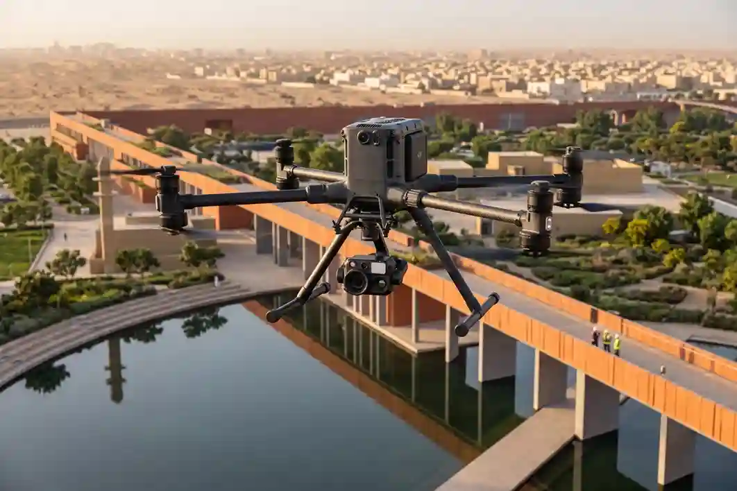
To overcome the challenges of manual inspections over massive infrastructure layouts, project operators use specialized drone fleets to collect automated geospatial data.
The operational foundation for this non-shutdown inspection routine is the DJI Matrice 400 enterprise drone platform.
Transitioning from manual ground monitoring to automated aerial tracking requires an industrial-grade flight vehicle built to withstand high structural stress, maintain long flight windows, and remain stable under volatile environmental conditions.
Aerodynamic Resilience and Battery Efficiency in Desert Heat
Operating an aircraft over active park construction sites in an arid climate introduces serious mechanical and thermal strains.
The desert landscape creates strong thermal updrafts, rising columns of hot air caused by the intense heat differential between dry sand, asphalt, and concrete structures.
These updrafts, combined with sudden wind changes common in open valley terrains, force standard commercial quadcopters to constantly adjust their motor speeds, which quickly drains batteries and shortens flight times.
The flight platform overcomes these physical constraints through a robust propulsion system and an advanced thermal management system.
The vehicle supports a maximum flight time of 59 minutes per battery set, providing the extended flight windows needed to survey large areas without frequent battery swaps.
For projects like the three city parks in eastern Riyadh, which span a large 550,000 square meters footprint, this long battery life ensures that pilots can map extensive areas in single, continuous flight paths.
By reducing the need to land, swap batteries, and recalibrate sensors, the platform maintains steady data collection speeds and protects the workflow from operational downtime.
Linear Corridor Mapping Speed and Coverage Throughput
Mapping a buried utility network requires an aircraft that can cover long distances quickly without sacrificing image resolution or data accuracy.
Because the project includes an extensive 1,350-kilometer city-wide irrigation pipeline network, traditional ground surveys using handheld sensors are completely impractical due to the massive scale.
- Manual Walkthrough: Covers ~1-2 kilometers of pipeline per day per crew
- M400 Drone Platform: Achieves up to 25 m/s speed to cover massive linear grids per hour
The enterprise drone addresses this issue by operating at a maximum horizontal cruise velocity of 25 m/s.
This high cruise speed allows the drone to follow long pipeline routes rapidly, completing wide-area surveys in hours rather than weeks of manual field labor.
Cruising at a steady speed and constant altitude ensures the sensors record overlapping images evenly.
This precise spacing prevents data gaps and provides the high-quality files needed to build accurate digital maps of the underground assets.
Structural Load Capacity and Sensor Redundancy Management
The primary operational advantage of the flight vehicle lies in its expanded total payload capacity of 6 kg, allowing it to carry multiple heavy tracking instruments simultaneously.
Standard mapping drones can typically only support one lightweight camera at a time, forcing crews to fly separate missions to collect visual photos, topographic data, and thermal maps.
The heavy-lift airframe uses a multi-gimbal configuration to mount multiple high-end payloads under the aircraft at the same time.
Engineers can position a high-resolution visual mapping camera right next to a heavy radiometric thermal payload.
This multi-sensor configuration optimizes data collection during limited field testing windows.
Even when carrying maximum sensor weight, the quadcopter maintains excellent flight stability.
The robust airframe works alongside internal sensor backups, including dual Inertial Measurement Units (IMUs), duplicate barometers, and redundant satellite antennas.
This system instantly isolates component failures, keeping the aircraft stable and on track even near high-voltage power grids or metal construction scaffolding.
By keeping the payload completely stable, the drone eliminates camera vibration and motion blur, ensuring every pixel is recorded with clear geographic data.
Diagnostic Subsurface Tracking via Zenmuse H30T Payload
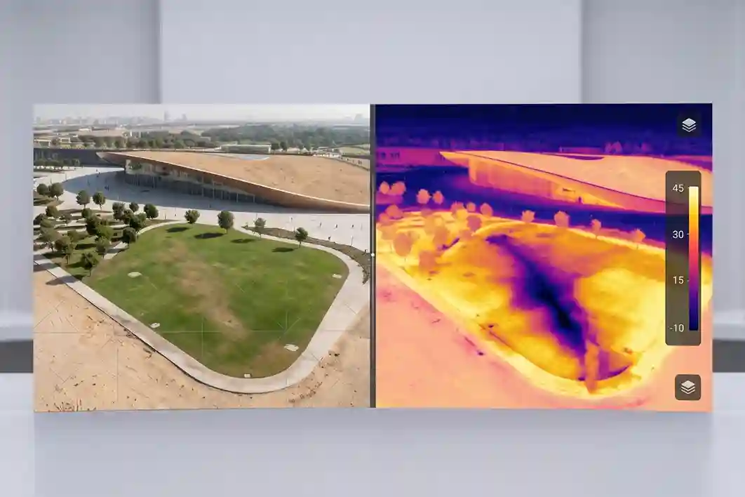
While the airframe provides long flight times, finding buried water leaks requires highly sensitive remote sensors.
Equipping the quadcopter with the DJI Zenmuse H30T multi-sensor payload transforms the drone into an advanced diagnostic tool for subsurface tracking.
Underground Irrigation Leak
- Wet Soil Holds Heat Differently Than Dry Sand
- Surface Temperature Variance Formed
- Zenmuse H30T Radiometric Core (1280×1024) Flags Anomaly
- Laser Rangefinder Stamps Exact GPS Coordinates
The sensor core houses an uncooled radiometric infrared thermal camera that records data at a sharp 1280×1024 pixel resolution.
This high resolution is essential for finding hidden line failures. When a buried pipeline breaks, the escaping water saturates the surrounding ground, changing how the soil absorbs and releases heat.
Because wet dirt holds heat differently than dry sand, the radiometric sensor instantly identifies the problem by highlighting subtle surface temperature differences from the air.
To safely inspect adjacent high-voltage connections or hard-to-reach park features, the sensor includes a hardware zoom system supporting 34x optical zoom and up to 400x digital zoom.
Furthermore, the payload features an integrated laser rangefinder that tracks targets from a distance of 3 to 3,000 meters away.
When the thermal sensor flags a moisture abnormality, the system immediately stamps the exact spot with precise GPS coordinates, allowing ground repair crews to target the leak without slow, manual troubleshooting.
Securing Green Infrastructure
Manual ground checks and adopting automated water leak detection systems protects massive urban landscaping investments from sudden water loss and soil erosion.
This approach matches global utility trends, as the broader remote leak detection solutions market continues to expand at a steady 11.65% CAGR through 2031.
By combining long-endurance flight vehicles with high-resolution thermal tracking, operators ensure the long-term success of municipal green spaces.
Ready to secure your project’s water lines? Contact our expert today to set up a customized drone inspection workflow for your green infrastructure assets.

 English