Rapid urban expansion, economic industrial cities, and national infrastructure corridors require fast, accurate topographic baselines before engineering design begins.
Traditional land surveying using optical total stations and GPS rovers creates severe logistical delays, captures only sparse spot elevations, and exposes field personnel to hazardous terrain.
To overcome these physical limitations, infrastructure authorities and engineering consultants are transitioning to integrated aerial and terrestrial survey services.
Modern survey operations replace slow ground pacing with automated reality-capture workflows that deliver dense, continuous surface models and visual asset inventories.
The financial value of establishing accurate digital baselines early is documented on a global scale: as shown in an infrastructure economic report by ABI Research, global cities will accumulate SAR 1,050 billion in cost savings by 2030 by integrating multi-sensor reality capture and digital twins into urban planning, enabling municipal authorities to eliminate costly design interferences and reduce reactive infrastructure emergency repairs by 30% to 50%.
Delivering verified engineering-grade data across multi-district developments depends on three interdependent pillars: The Device (integrated air-to-ground sensors), The Platform (cloud analytics via Terra MapX), and The Professional Team (geodetic rigor, regulatory compliance, and large-scale workforce capacity).
Pillar 1: The Device (Advanced Aerial Reality Capture)
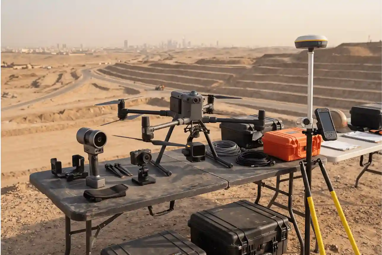
Surveying large urban parcels requires matching the right tool to each physical terrain condition.
Aerial drones cannot capture blind spots beneath highway flyovers or inside dense facilities, while ground crews cannot match the speed of aerial sensors over open landscapes.
Professional survey operations address this by deploying an integrated air-to-ground equipment fleet.
Aerial Survey: DJI Matrice 400 with Zenmuse L3 and P1
The DJI Matrice 400 (M400) multi-rotor serves as the primary aerial workhorse for wide-area corridors and master-planned parcels.
Built with dual-battery redundancy, long flight endurance, and high wind resistance, the platform operates reliably across desert plateaus and coastal corridors.
Its onboard Real-Time Kinematic (RTK) system tags every data point with centimeter-level coordinates:
- DJI Zenmuse L3 (Aerial LiDAR): Emits high-frequency, multi-return laser pulses that penetrate sparse scrub, dry vegetation, and loose surface debris. Processing secondary and tertiary returns allows teams to strip away non-ground obstacles and extract a clean bare-earth Digital Terrain Model (DTM) with sub-decimeter vertical accuracy.
- DJI Zenmuse P1 (Full-Frame Photogrammetry): Houses a 45-megapixel sensor that captures visual orthomosaics at a Ground Sampling Distance (GSD) under 1.5 cm/pixel. These true-color rasters provide the clarity required to identify road markings, manhole covers, property boundaries, and visible surface utilities.
Pillar 2: The Platform (Cloud-Based Geospatial Intelligence via Terra MapX)
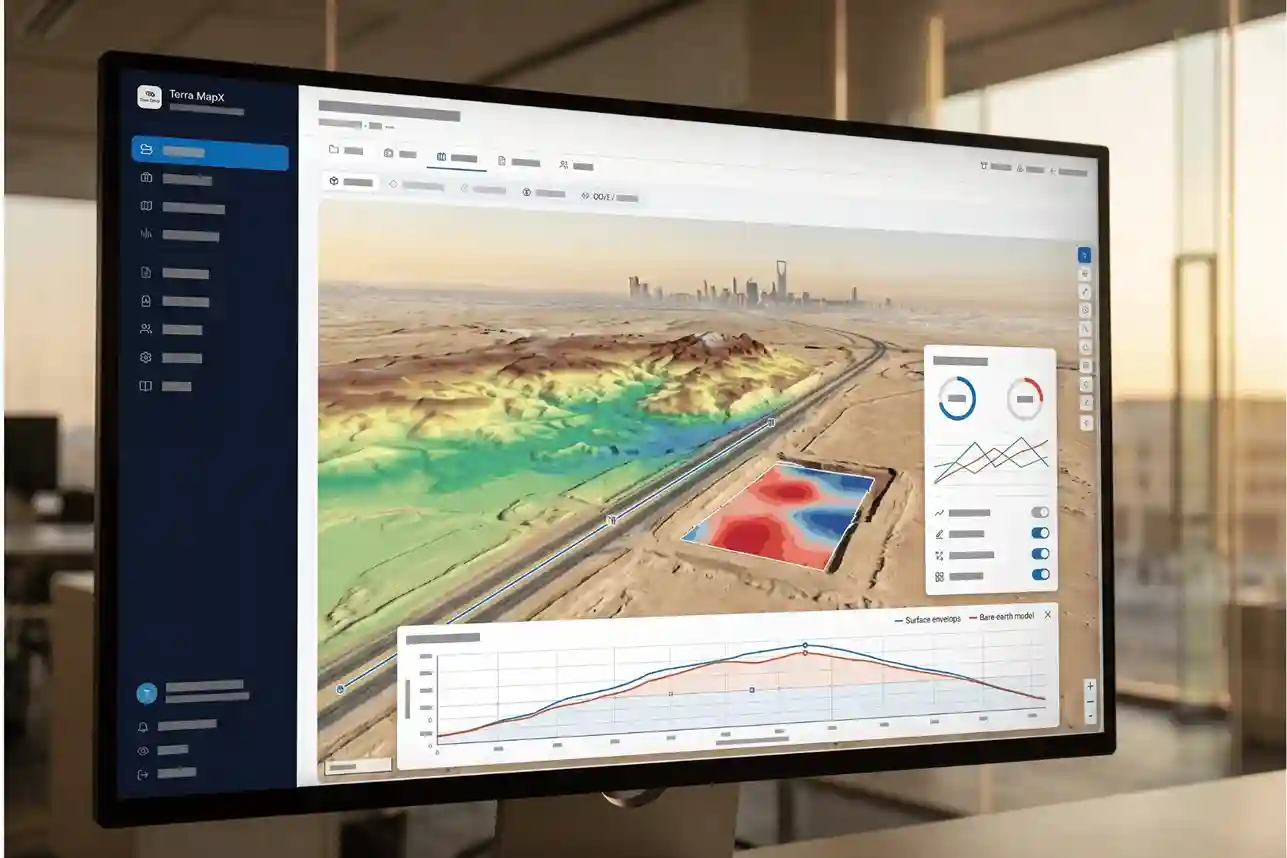
Distributing hundreds of gigabytes of raw point clouds (LAS) and high-resolution rasters (GeoTIFF) typically creates severe technical bottlenecks for non-surveyors.
Terra MapX eliminates local workstation dependencies by operating as a browser-based geospatial analysis platform.
- Projects & Jobs Pipeline: Tracks data processing stages, including PPK trajectory solving, aerotriangulation, GCP optimization, and ground point classification with attached QA/QC validation reports.
- Files Repository: Streams web-ready layers without file downloads, including Cloud Optimized GeoTIFFs, visual orthomosaics, and classified LAS point clouds.
- Interactive Terrain Profiling: The Map Viewer features a dynamic Elevation Profile tool that graphs vertical cross-sections across polylines in real time. Users can compare the Digital Surface Model (DSM) against the bare-earth DTM to evaluate slopes, identify water-ponding risks, and check subgrade design elevations.
- Volumetric Earthwork Engine: Users draw boundary polygons around excavation pits or stockpiles to calculate net, cut, and fill volumes. The tool fits triangulated base planes to irregular stockpiles or references imported design surfaces (LandXML) for progress billings.
- Multi-Discipline BIM & Clash Detection: The dedicated 3D Model environment displays trade models, including Structural, Mechanical, and Plumbing. Activating the clash engine highlights spatial interferences between proposed equipment and surrounding utility networks before construction begins.
Pillar 3: The Professional Team of Geodetic Rigor, Regulatory Compliance, and Workforce Scale
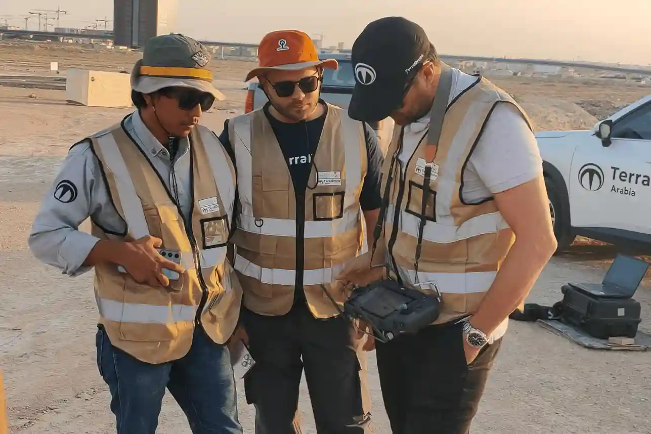
Advanced hardware and cloud software cannot produce engineering-grade accuracy without qualified human oversight.
Highlighting this industry bottleneck, industry data published by Fortune Business Insights reports that the global aerial survey services market is valued at SAR 34.39 billion in 2026 and is projected to expand to SAR75.49 billion by 2034 at a 10.3% CAGR, noting that while high-precision sensors achieve centimeter-level accuracy, the primary industry bottleneck remains a shortage of licensed geomatics personnel, certified remote pilots, and data analysts capable of navigating strict civil aviation regulations and transforming raw spatial point clouds into engineering-grade deliverables.
Professional survey operations resolve this talent shortage by maintaining an extensive technical workforce and strict operational controls:
Large In-House Team and Multi-Crew Mobilization
One of the largest risks in mega-infrastructure surveying is project bottlenecking caused by limited crew availability.
Professional survey providers maintain a large in-house team of licensed geomaticians, civil survey engineers, CAD/BIM modelers, and GACA-certified remote pilots.
Having an extensive personnel pool allows the company to mobilize multiple flight and ground survey crews simultaneously across separate districts or regions.
Rather than surveying a 100-square-kilometer parcel sequentially over many months, coordinated teams execute parallel flight missions and ground control setups, completing large-scale data collection within weeks without sacrificing QA/QC standards.
Geodetic Ground Control and Datum Alignment
Airborne RTK and PPK systems provide exceptional relative positioning, but absolute accuracy requires ground verification. Field teams deploy dual-frequency GNSS base stations over established benchmarks to record long static observations.
They distribute high-contrast Ground Control Points (GCPs) across the project area to anchor aerotriangulation, alongside Independent Check Points (ICPs) that serve as a blind audit to calculate true Root Mean Square Error (RMSE) values.
All elevation models are transformed from raw ellipsoidal heights to orthometric elevations tied directly to the Saudi Arabian National Spatial Reference System (SANSRS / KSA-GRF17) mandated by GEOSA.
National Aviation Authorizations and Certified Management Systems
Operating enterprise drones in populated urban districts and industrial corridors requires full compliance with national aviation laws:
- GACA Part 107 Certifications: Every remote pilot holds commercial pilot credentials issued by the General Authority of Civil Aviation.
- GEOSA Survey Permits: All aerial photography, LiDAR scanning, and mobile mapping activities are formally permitted by the General Authority for Survey and Geospatial Information.
- SANS Airspace Coordination & NOTAMs: Using mission planning tools like Terra AirspaceX, flight dispatchers coordinate directly with Saudi Air Navigation Services to secure active Notice to Air Missions (NOTAM) approvals across controlled airspaces.
These field workflows operate under an Integrated Management System certified to ISO 9001 (Quality Management), ISO 45001 (Occupational Health & Safety), and ISO 22301 (Business Continuity).
Furthermore, compliance with National Cybersecurity Authority (NCA) regulations and Saudi Aramco Cybersecurity Compliance Certificate (CCC) standards guarantees that sensitive infrastructure data remains secure throughout collection, cloud hosting, and handover
Combining advanced enterprise devices, browser-based cloud analytics via Terra MapX, and certified geomatics expertise transforms land surveying into a reliable, repeatable digital twin framework for large-scale urban development.
To evaluate these capabilities across your infrastructure projects, schedule a pilot assessment through our specialized team in drone survey and mapping solutions.
 English