Precise Prediction: Low Altitude Economy Aerial Data for Digital Twin Infrastructure.

The Urban Data Gap Smart cities like NEOM or Riyadh are not just collections of concrete and glass. They are complex, living systems that breathe, move, and consume energy. Managing such complexity requires real-time intelligence. Yet, many city planners still rely on static ground surveys and outdated maps. They cannot see how a new skyscraper […]
Economy under 1,000 Feet: The Rise of LAE in Smart Cities
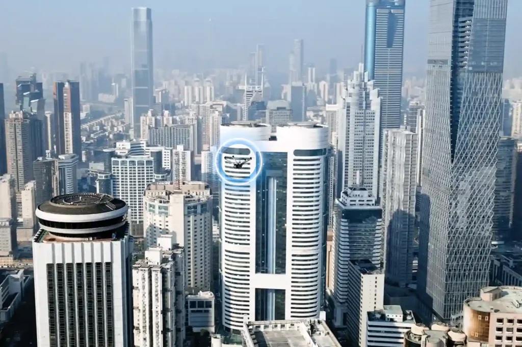
The Next Industrial Airspace Layer We often look at the sky and see empty space. However, a quiet revolution is happening just above our heads. This is the rise of the low altitude economy (LAE). This term refers to a new economic and operational domain occupying the airspace below 1,000 feet. It represents the next […]
Quadruped Ground Robot with Zero Human Risk For Hazardous Industrial Inspections.
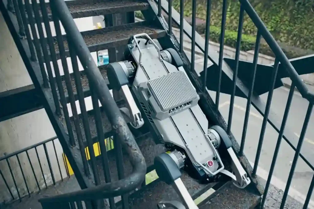
The Unsolved Risk in Industrial Ground Inspection Industrial facilities, power plants, pipeline corridors, deep tunnels, and vast construction sites demand continuous oversight. This oversight traditionally falls to human patrol inspectors. These workers face constant, severe hazards: exposure to toxic gases, extreme heat, high voltage, complex obstacles, and unstable terrain. This manual ground patrol method creates […]
Integrated Aerial, Terrestrial, and Marine Inspection Framework for Industrial Asset Integrity
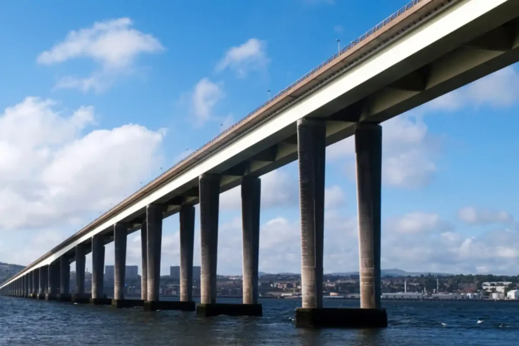
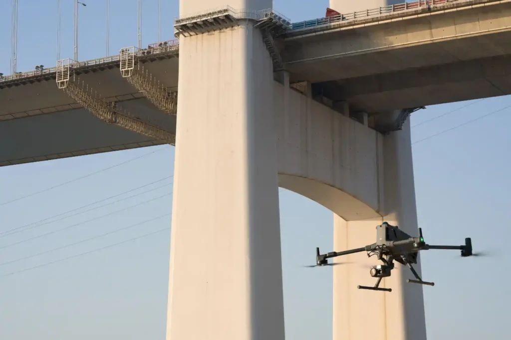
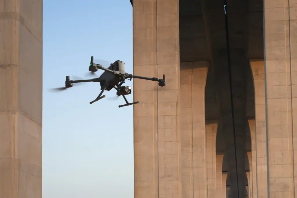
The Three-Dimensional Integrity Challenge Managing major infrastructure from long-distance pipelines and highways to offshore oil facilities, is a massive task. Asset owners in the MENA region face the immense challenge of maintaining structural health across all three major environments: air (high-altitude assets), land (linear corridors), and sea (submerged foundations). The traditional approach to managing these […]
ROV-Based Monitoring for Marine Infrastructure and Coastal Inspection Assets
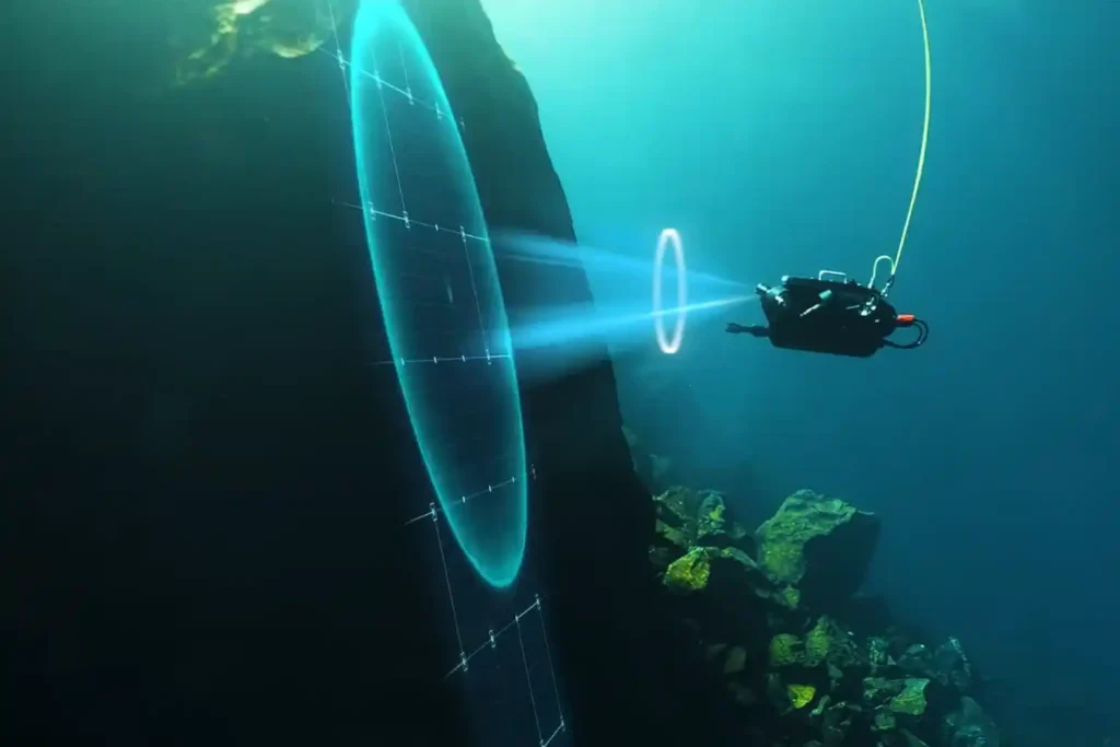
The Challenge Beneath the Surface The foundations of the MENA economy—jetties, bridges, seawalls, port facilities, and offshore energy platforms—rely on submerged infrastructure. These assets face a brutal, unseen enemy: the marine environment. Constant exposure to seawater, which is highly corrosive, leads to material loss. This structural decay is worsened by biofouling—the rapid growth of marine […]
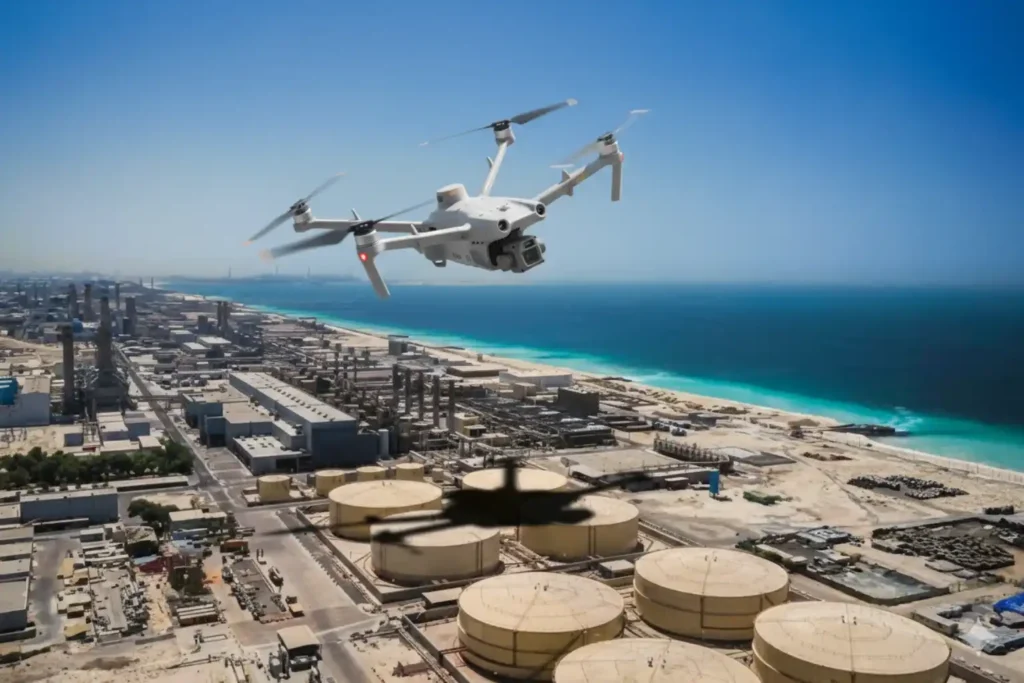
Save 95℅ Time with Drone-Based Corrosion Inspection for Assets
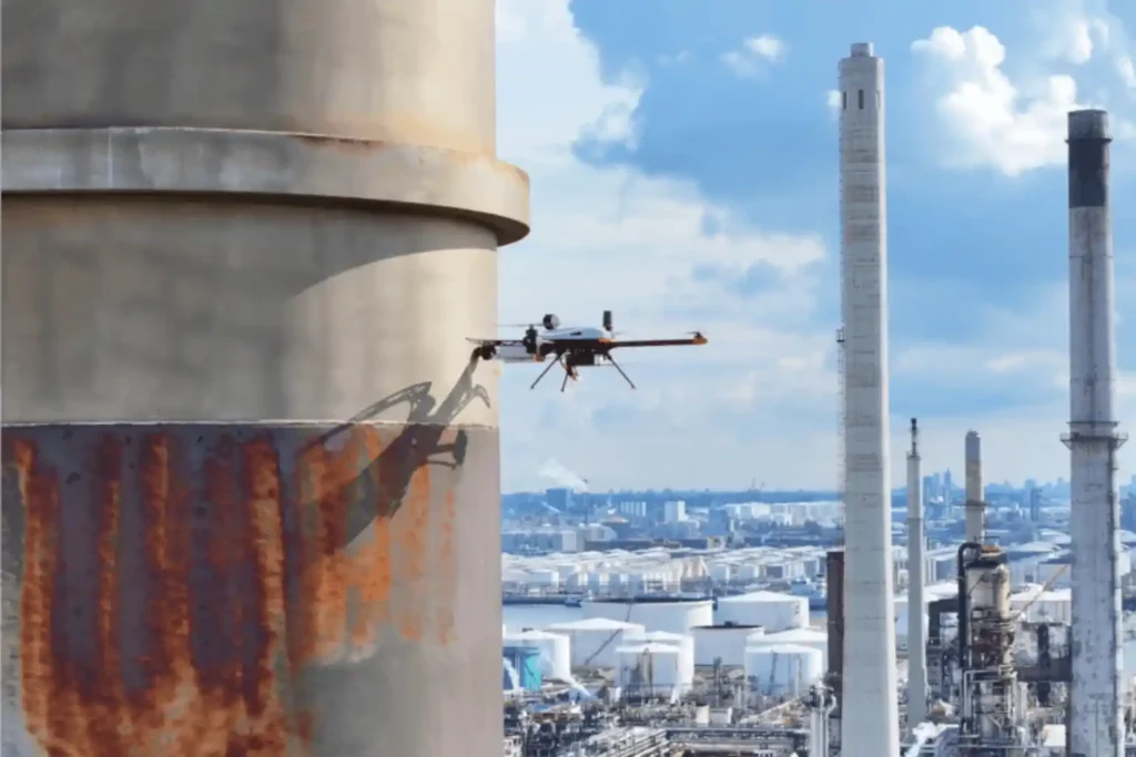
The Corrosion Inspection Challenge Corrosion is the silent and relentless enemy of metal assets—it remains the leading cause of unplanned shutdowns, containment failures, and devastating safety risks across the oil & gas, petrochemical, and heavy industrial sectors. In the demanding environments of the MENA region, assets like storage tanks, pipelines, and flare stacks face extreme […]
How Geospatial Intelligence Powers Predictive Asset Management
The Operational Imperative The moment infrastructure like highways, bridges, and industrial assets finish construction, they enter a critical new phase: operational risk. Managing maintenance is the single largest long-term cost, and reactive failure, waiting for a fault before fixing it is unacceptable for any modern smart city. The challenge lies in inspection. Traditional integrity checks […]
Precision Mapping: The Technical Core of High-Speed Highway Design
The foundational task of building or improving any major road, rail, or highway in the swiftly developing MENA region is topographic mapping. This process, which creates a three-dimensional model of the land’s surface, is not just a preliminary step; it dictates the engineering viability, the budget, and the ultimate timeline of the entire project. Yet, […]
How Drones 2x Fastened Survey for Large Areas
Executive summary We delivered a coastal topographic map to support mangrove planning and environmental impact assessment across 102 km² split into 13 shoreline blocks in Jubail and Ras Al Khair. Field data collection finished in 1 month. Processing took 2 months. The program concluded in under 3 months end-to-end, significantly faster than a traditional coastal […]
How Drone Topographic Mapping Captured 124 km² in 1 Month
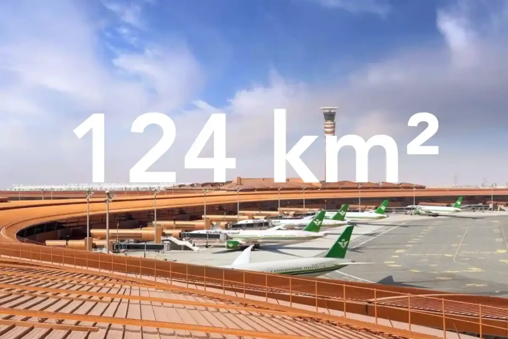
Every decision in a sewer upgrade or drainage expansion depends on the fidelity of the ground surface you hand to designers. In a dense urban corridor next to an international airport, conventional total station and GNSS traverses face line-of-sight gaps and obstruction bias that create uneven accuracy and patchy coverage. That risk is real in […]
