The QYSEA ROV: Intelligence for the Subsea Era
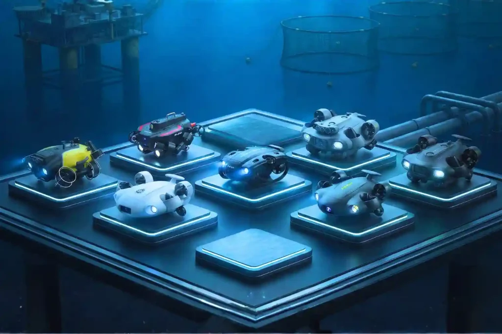
Navigating the Industrial Abyss The Complexity of 2026: Subsea operations have evolved beyond simple visual checks to requiring high-precision data, physical interaction, and deep-water endurance. The Multi-Disciplinary Challenge: No single tool fits all tasks, aquaculture requires agility, while offshore energy demands heavy-duty payloads and millimetric metrology. The Solution: Introducing the QYSEA FIFISH ROV Lineup, an AI-powered fleet designed to provide modular, scalable, and intelligent solutions for every underwater industrial sector. Specialized Tools for Specialized Missions The shift toward autonomous subsea auditing requires more than just a camera on a tether; it requires a specialized workforce of robotic agents. QYSEA’s lineup is engineered to bridge the gap between raw data collection and actionable engineering intelligence. 1. FIFISH V-EVO: The High-Frame-Rate Visual Metrology Standard The FIFISH V-EVO is the premier choice for visual-first inspections where motion clarity and environmental realism are critical. High-Speed Imaging Architecture: The V-EVO features a 4K UHD camera capable of 60 frames per second (fps). This higher frame rate is essential for capturing smooth footage of fast-moving turbine blades, propeller shafts, or moving biological stock in aquaculture, preventing the “motion blur” that plagues standard 30fps ROVs. Adaptive AI Plankton Filtering: One of the primary barriers to underwater clarity is “marine snow” suspended particles and plankton that reflect light and obscure details. The V-EVO utilizes an Adaptive AI filtering algorithm to digitally remove these visual obstructions in real-time, restoring clarity to images even in nutrient-rich or turbid coastal waters. Optics and Illumination: With a 166° ultra-wide field of view (FOV) and 5,000-lumen LED lights (5500K color temperature), the V-EVO maximizes situational awareness, allowing pilots to see structural contexts that narrower lenses miss. AI Vision Station Lock: Using machine vision, the V-EVO can lock onto a specific underwater subject, maintaining its relative position and focus with a single touch, which is critical for long-term observation of slow-growing corrosion or biological samples. 2. FIFISH E-GO: Biomimetic Agility for Industrial Productivity Designed with a “Hammerhead” shark-inspired form factor, the E-GO focuses on hydrodynamic efficiency and rapid operational switching. Ring-Wing Motor Propulsion: The E-GO utilizes a patented ring-wing motor system that provides a 30% power increase over traditional designs. This allows the drone to maintain speeds of 3+ knots even when fighting strong lateral currents common in open-water cage farming. The 9-Second Modular Ecosystem: To minimize site downtime, the E-GO features a quick-release accessory system allowing for tool installation in under 9 seconds. This enables a single ROV to transition from a net-repair mission to a water-quality sampling mission in seconds. Hot-Swappable Dual Power: The E-GO’s dual-battery architecture supports hot-swapping, meaning the ROV can stay powered on and connected to the station while batteries are replaced, enabling continuous “infinite” workflows without restarting missions. Macro Precision: A focused 10cm macro range allows the E-GO to perform extreme close-up inspections of welds, bolts, and delicate marine life that would be out of focus for standard industrial cameras. 3. FIFISH V6 PLUS: The Expert in Millimetric Structural Metrology The V6 PLUS is the enterprise benchmark for non-destructive testing (NDT) and precision measurements. Machine Vision AR Ruler: Moving beyond simple visual estimation, the V6 PLUS features a patented AR Ruler system. By combining machine vision with a laser scaler, it achieves a measurement precision of ±1cm, allowing engineers to accurately measure the length, width, and area of structural defects directly through the FIFISH App. Sonic Distance & Altitude Lock: Dual sonar sensors provide real-time distance and altitude tracking. The “Distance Lock” maintains a fixed stand-off distance from a hull or wall, while “Altitude Lock” maintains a fixed height above the seabed, ensuring the ROV does not drift during delicate NDT scans. Deep-Water Operational Envelope: Rated for 150 meters, the V6 PLUS is built for the deeper inspection requirements of hydropower dams, reservoir gates, and bridge pilings. 4. FIFISH V6 EXPERT: The Multi-Tool Platform for Complex Intervention The V6 EXPERT is the “Swiss Army Knife” of the lineup, designed to carry heavy payloads and diverse sensor arrays. Q-IF Interface Expansion: The V6 EXPERT features a heavy-duty Q-Interface that supports the simultaneous integration of up to 20+ professional tools. These include water samplers (100ml to 1500ml), pH/salinity/turbidity sensors, retrieval hooks, and underwater dozers. Onshore Power Supply System (OPSS): For missions requiring days of continuous monitoring, the V6 EXPERT can be tethered to an onshore power system, removing battery limitations and allowing the drone to stay submerged indefinitely for long-duration infrastructure audits. Enhanced 6000 Lumen Illumination: Dual 3000-lumen headlights provide the ultra-bright lighting necessary for the V6 EXPERT to perform manipulation tasks in the absolute darkness of deep-sea tunnels or silt-heavy environments. 5. FIFISH E-MASTER: The Vessel Hull and Bathymetric Specialist The E-MASTER is a revolutionary industrial AI ROV engineered for hull inspections and seabed mapping. Q-DVL Stabilized Hovering: The E-MASTER integrates both forward and downward Q-DVL (Doppler Velocity Log) modules. This allows for Station Lock Hovering against vertical hulls or moving currents, ensuring the drone remains perfectly steady while measuring biofouling or coating degradation. Integrated Bathymetric Mapping (QY-BT): By fusing data from the Q-DVL and echosounders, the E-MASTER can perform automated 2D and 3D seafloor mapping. Operators can generate topographic maps and calculate reservoir capacities with a single click. AI Measurement Accuracy: Using the QY-MT system, the E-MASTER can analyze underwater objects and fractures with a staggering 99.7% measurement accuracy, providing the high-fidelity data required for class-certified hull inspections. 6. FIFISH X1: The Heavy-Duty Offshore Intervention Powerhouse The X1 is a mission-class ROV designed to handle the most demanding conditions in the offshore energy sector. Heavy Payload and Propulsion: The X1 supports an massive 15kg payload capacity and is powered by the Q-Motor Pro system, which allows it to hold its position and operate in currents up to 4.0 knots. U-INS Plus Inertial Navigation: This system fuses data from the Q-DVL, accelerometers, gyroscopes, and magnetometers to enable precise 3D route planning. The X1 can autonomously navigate complex “jackets” and oil rig structures, following preset paths while the operator focuses on data collection. Tri-Directional Collision Avoidance: To protect the
Major Update on GACA Regulation Part 107 Operation of UAS V5
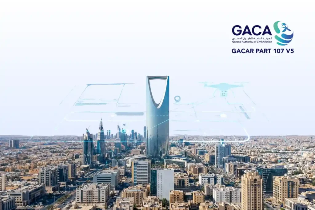
The publication of GACAR Part 107 Version 5 represents a watershed moment for the Kingdom’s aviation sector. This update signifies a transition from a reactive, case-by-case regulatory model to a sophisticated, risk-based regulatory framework. By aligning Saudi Arabia’s General Authority of Civil Aviation (GACA) protocols with international best practices most notably the European Union Aviation Safety Agency (EASA) standards. V5 provides the legal certainty required for massive industrial investment. I. The Core Regulatory Architecture: Risk-Based Categorization The most fundamental change in GACA 107 V5 is the formalization of UAS operations into two primary categories based on the risk they pose to third parties on the ground and other aircraft in the sky: the open category and the specific category. The Open Category (Low Risk): This category is reserved for basic, low-risk operations. It does not require a prior “Operational Authorization” from GACA, provided the pilot adheres to strict standard operating limitations. Subcategory A1 (Fly Over People): Restricted to ultra-light drones typically < 250 g. Pilots must avoid flying over “assemblies of people”. Subcategory A2 (Fly Near People): For drones up to 2 kg or 4 kg (depending on class markings). Requires a high level of pilot competency and a safe distance of at least 30 meters from uninvolved persons. Subcategory A3 (Fly Far from People): For larger drones up to 25 kg. Operations must be conducted at least 150 meters away from residential, commercial, or industrial areas. The Specific Category (Moderate Risk): This is the domain of industrial and commercial drone services. Any operation that falls outside the Open Category, such as flying a 10 kg drone over a populated site or flying beyond visual line of sight (BVLOS) requires a formal Authorization. II. The Technical Mechanics of Standard Scenarios (STS) V5 introduces the GACA standard scenarios (STS), which serve as “pre-defined risk assessments.” Instead of an operator spending months conducting a SORA (Specific Operations Risk Assessment), they can now declare compliance with a specific STS template. GACA STS-V1 (VLOS Populated): This scenario allows for Visual Line of Sight (VLOS) operations at a maximum height of 120 meters (400 ft) over a controlled ground area in populated environments. Technical Drone Requirements: Drones must bear a specific class identification label (C5 or equivalent). This requires a Flight Termination System (FTS), a redundant kill-switch independent of the primary flight controller, and a low-speed mode to mitigate kinetic impact risk. GACA STS-B1 (BVLOS Sparsely Populated): This scenario enables Beyond Visual Line of Sight (BVLOS) operations, a game-changer for long-range asset monitoring. The drone can fly up to 1 km (or 2 km with visual observers) from the pilot. Technical Drone Requirements: Typically requires a C6 class drone. These aircraft must include Direct Remote Identification (Remote ID), which broadcasts the drone’s position, altitude, and serial number in real-time to law enforcement and airspace managers. III. Institutional Requirements: The Three Pillars of Compliance To operate legally under GACA 107 V5, a commercial entity must establish a triad of technical documentation and organizational controls. The Operations Manual (OM): This is the organization’s “geospatial bible.” It must detail the organizational structure, pilot training records, maintenance schedules, and technical specifications for every drone in the fleet. Safety Management System (SMS): GACA now requires a proactive approach to safety. Organizations must implement a system for identifying hazards, analyzing risks, and reporting “near-misses” or incidents back to the GACA UAS department within 72 hours. Emergency Response Plan (ERP): An ERP must be established and “drilled” regularly. It outlines the technical steps to be taken in the event of a link loss (C2 link failure), fly-away, or airspace incursion by a manned aircraft. IV. Remote Pilot Competency and Certification V5 elevates the status of the “Remote Pilot” to that of a certified aviation professional. The certification process is now modular: Fundamental Training: All commercial pilots must pass a GACA-approved theoretical exam covering airspace classification, aviation weather, and radio communication. STS-Specific Accreditation: For advanced missions, pilots must undergo Practical Skill Training and Assessment. This involves demonstrating proficiency in abnormal and emergency maneuvers, such as landing safely after a motor failure conducted by a GACA-recognized training entity. V. Fleet Readiness and Technical Sovereignty Finally, GACA 107 V5 mandates that every UAS used for commercial purposes in the Kingdom be registered and technologically compliant. Digital Registration: Each aircraft must be registered via the GACA portal, receiving a unique nationality and registration mark that must be physically displayed on the airframe. Remote ID Implementation: By the 2026 deadline, all drones operating in the Specific Category must be equipped with remote ID hardware. This creates a “digital license plate” for every drone, ensuring accountability and facilitating the future of a high-traffic low-altitude economy. The transition from Version 4 to GACAR Part 107 Version 5 introduces a structured methodology for operational authorization through Standard Scenarios (STS). These scenarios are technically defined “safety envelopes” that allow operators to bypass the complex Specific Operations Risk Assessment (SORA) process by adhering to a set of pre-verified technical and operational mitigations. For industrial players, this means the difference between a three-month approval cycle and a near-instantaneous operational declaration. Understanding the Standard Scenarios (STS) I. GACA STS-01: Precision VLOS in Populated Zones GACA STS-01 is the primary regulatory pathway for urban and high-density industrial work. It allows for operations within Visual Line of Sight (VLOS) at altitudes up to 120 meters (400 ft) over controlled ground areas. Technical Hardware Requirements (C5 Class Equivalence): To be compliant with STS-01, a UAS must meet rigorous hardware safety standards: Flight Termination System (FTS): The aircraft must be equipped with a redundant, independent “kill-switch.” This system must be capable of terminating flight either by cutting power to the motors or deploying a parachute even if the primary flight controller or C2 (Command and Control) link fails. Low-Speed Mode: When operating in proximity to people (within the controlled area), the drone must have a selectable low-speed mode that limits the maximum horizontal velocity (typically to 5 m/s) to minimize kinetic energy in the event of an
Integrating Real-Time Data Acquisition and GIS Processing in Industrial Intelligence
In the traditional era of drone mapping, the capture of aerial imagery was only half the battle. For years, the bottleneck was the processing, loading thousands of high-resolution images onto local workstations that would churn for days to produce a single orthomosaic. This fragmented approach led to data silos, inconsistent results, and a lack of real-time collaboration. Today, we are witnessing a paradigm shift. Site Scan for ArcGIS, a cornerstone of the ArcGIS Reality suite, has transformed drone mapping into a seamless, end-to-end cloud-based workflow. By leveraging the unlimited scalability of the cloud, organizations can now handle massive datasets that were previously impossible to process locally. This is not just a change in software; it is an evolution of how we perceive and manage physical reality. From automated flight planning in the field to advanced AI analytics in the boardroom, the cloud is the engine driving the next generation of industrial intelligence. Autonomous Field Operations Technical excellence in drone mapping is not a product of chance; it is a meticulously engineered outcome that begins long before the drone ever leaves the ground. Within the site scan for ArcGIS cloud-based operations ecosystem, the ArcGIS Flight app serves as the sophisticated “tactical interface.” It shifts the paradigm from manual, pilot-dependent flight to a software-defined, repeatable mission architecture that ensures absolute data fidelity. I. Advanced 3D Mission Architectures and Photogrammetric Geometry Modern industrial assets, ranging from sprawling refinery complexes to complex bridge structures require more than a standard 2D “lawnmower” grid. To build a true Digital Twin, the system must capture the “verticality” and occlusion zones of an asset. Perimeter and Crosshatch Missions: For assets with significant vertical relief, such as telecommunications towers or high-rise construction sites, the system utilizes “Perimeter Scans.” The drone executes a series of concentric orbits at multiple altitudes, with the gimbal automatically adjusting its pitch to maintain a consistent angle toward the center. This ensures that every vertical face is captured with high overlap, typically maintained at 80% sidelap and 80% frontlap, providing the dense point cloud required for sharp, un-warped 3D meshes. Corridor Mapping and Vertical Inspection: For linear assets like pipelines or highways, the flight app utilizes corridor-specific algorithms that optimize the flight path to minimize battery consumption while maximizing coverage. In vertical inspection modes, the drone maintains a precise, fixed “stand-off” distance from a vertical face (like a dam wall or pylon), capturing high-resolution “flat” imagery that can be processed into specialized vertical orthomosaics. II. Intelligent Terrain Following and GSD Consistency One of the most critical variables in photogrammetry is the Ground Sample Distance (GSD), the physical distance on the ground represented by a single pixel. If a drone flies at a constant altitude above sea level while the terrain rises and falls, the GSD varies, leading to inconsistent resolution and measurement errors. Dynamic Altitude Adjustment via DEM Integration: ArcGIS Flight integrates high-resolution digital elevation models (DEMs). The drone dynamically adjusts its altitude in real-time to maintain a constant height above the ground surface. This results in a uniform GSD across the entire dataset, ensuring that a measurement taken on a mountain peak is as accurate as one taken in a valley. Automatic Overlap Recalculation: The software monitors ground speed and wind resistance in real-time. If the drone encounters a strong headwind, the system recalibrates the shutter trigger intervals. This ensures the required overlap is maintained perfectly, preventing “gaps” in the data that could lead to failures during the cloud-processing phase. III. Sensor Integration and Field-Level Georeferencing The accuracy of the final map is only as good as the metadata attached to each image. Site Scan supports advanced hardware integration to eliminate the need for traditional, time-consuming ground surveys. RTK and PPK Workflows: The flight app natively communicates with Real-Time Kinematic (RTK) and Post-Processed Kinematic (PPK) enabled drones. By receiving corrections from a base station or NTRIP network, the drone geotags each image with centimeter-level accuracy at the moment of capture. This minimizes, and often eliminates, the need for laying manual Ground Control Points (GCPs), saving hours of field labor. Multi-Sensor Support: Beyond standard visual (RGB) sensors, the framework supports multispectral and thermal payloads. This allows for the capture of specialized data layers. such as vegetation health indexes or thermal signatures for solar farm inspections. All managed within the same autonomous flight interface. IV. Pre-Flight Rigor and Field-to-Cloud Synchronization Custom Safety Checklists: To ensure enterprise-wide compliance, administrators can push mandatory pre-flight checklists to the field app. Pilots must verify everything from airspace authorization (LAANC) to battery voltage and signal strength before the “Take Off” button is enabled. Quick Tiling for Field Verification: One of the most powerful features of the cloud-based operation is Quick Tiling. Immediately after landing, the pilot can generate a low-resolution orthomosaic preview in the cloud while still on-site. This allows for instant verification: Did we cover the entire site? Are there any blurry images due to low light? If a gap is detected, the pilot can re-fly the specific segment immediately, preventing a costly return trip to a remote site. Transforming Pixels into Insight The true technical “engine” of site scan for ArcGIS cloud-based operations lies in its processing architecture. By decoupling data computation from physical hardware, Site Scan leverages the elastic power of the cloud to perform complex photogrammetric reconstructions that would overwhelm even the most advanced local workstations. This section explores the mechanics of how raw aerial imagery is transformed into a high-fidelity geospatial intelligence product. I. Elastic Computing and Massive Parallelization Traditional photogrammetry is a computationally “heavy” task that requires intense CPU and GPU resources. In a local environment, this creates a linear bottleneck: the more images you have, the longer you wait. Site Scan solves this through massive parallelization. Distributed Task Processing: When a dataset is uploaded to the Site Scan Manager, the cloud architecture breaks the project into thousands of discrete tasks. These tasks are distributed across an elastic cluster of server nodes. For instance, while one node calculates the internal orientation of a camera,
Securing Marine Assets with ROV Inspection and Subsea NDT.
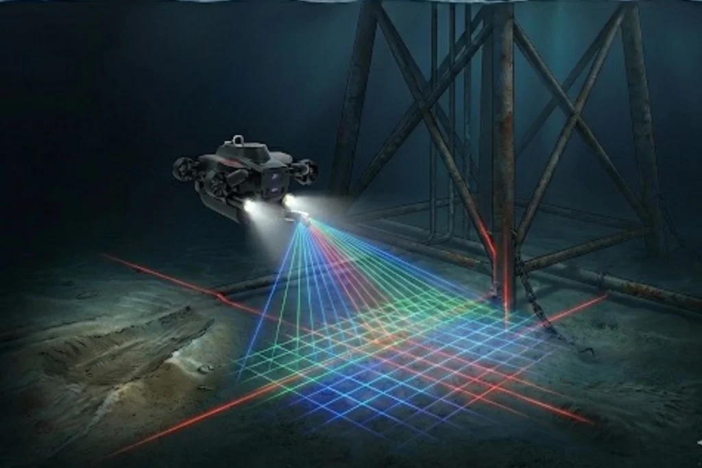
While the world marvels at the soaring skyscrapers of Riyadh and the mirrored walls of NEOM, a second, equally ambitious infrastructure revolution is taking place beneath the waves. Saudi Arabia’s maritime infrastructure, spanning the Red Sea and the Arabian Gulf is home to a vast, invisible network of subsea lifelines, including oil and gas pipelines, high-voltage power cables, and critical communication links. However, this underwater world is a hostile environment. In these harsh maritime zones, infrastructure faces constant threats from aggressive saltwater corrosion, intense pressure, and biofouling. Traditional manual diving, while historically necessary, cannot keep pace with the scale of Vision 2030’s coastal giga-projects. It is slow, limited by depth, and carries high physical risk to personnel. The high cost of failure in these zones, ranging from environmental disasters to billion-dollar energy shutdowns demands a technological shift. The transition from human-led diving to subsea robotics in Saudi Arabia is no longer just an upgrade; it is an essential requirement for the long-term integrity of the Kingdom’s offshore and coastal assets. The Technology of the Deep The core of this revolution is the Remotely Operated Vehicle (ROV). These inspection-class robots act as the eyes and hands of engineers in environments where humans simply should not go. From Divers to ROVs: Unlike human divers, ROVs can operate 24/7 at depths exceeding hundreds of meters, unaffected by the physiological limits of pressure or oxygen. Advanced Sensing and Vision: Modern ROVs utilize high-definition visual imaging and multibeam sonar to navigate and “see” even in the silty, low-visibility conditions of the seabed. Quantitative Corrosion Mapping: Specialized ROVs are equipped with Ultrasonic Thickness (UT) gauges and cathodic protection (CP) probes. These tools allow for precise, contact-based measurements of metal thickness and electrical potential, identifying thinning pipe walls long before a leak occurs. Integrated Frameworks: Terra Drone Arabia (TDSA) has pioneered a unified framework that merges subsea ROV data with aerial UAV and terrestrial scans. This provides asset owners with a single, holistic view of their infrastructure from the seabed to the sky. Securing Coastal and Offshore Assets The deployment of subsea robotics in Saudi Arabia serves as the primary defense for the Kingdom’s most valuable maritime investments. Offshore Oil & Gas Integrity: Routine monitoring of platform jackets, risers, and subsea production systems is vital. ROVs detect structural fatigue and weld defects early, ensuring compliance with global safety standards and preventing catastrophic failures in the Arabian Gulf. Coastal Giga-Projects (NEOM & The Red Sea): As the Red Sea project and NEOM expand, maintaining the integrity of underwater jetties, desalination intakes, and luxury coastal structures is paramount. ROVs monitor these assets while simultaneously conducting environmental surveys to protect the Kingdom’s precious coral reefs. Data-Driven Longevity: Every dive generates a digital trail. By building Digital Twins from ROV data, engineers can perform predictive maintenance. This allows operators to simulate structural degradation and extend the lifespan of multi-billion dollar assets through precisely timed interventions. Diving into the Digital Future The future of marine asset management in the Kingdom is undeniably robotic. The precision, safety, and scalability offered by subsea robotics in Saudi Arabia provide the foundation for the next decade of maritime development. Terra Drone Arabia is leading this transition, bringing global robotic expertise to the Kingdom’s local shores. We integrate cutting-edge ROV technology with advanced data analytics to ensure your subsea assets remain secure and compliant. Don’t complex your underwater inspection. Contact us for your marine infrastructure and experience the certainty of digital subsea integrity.
The 2025 Recap from Terra Drone Arabia
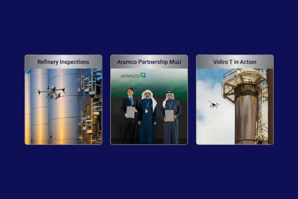
As the curtain falls on 2025, the industrial landscape of Saudi Arabia stands fundamentally altered. What was once a horizon dominated by traditional manual labor and terrestrial surveying has transitioned into a high-velocity, data-driven domain known as the Low Altitude Economy (LAE). At the heart of this revolution is Terra Drone Arabia (TDSA). This Terra Drone Arabia 2025 recap serves not just as a history of the past twelve months, but as a roadmap for how unmanned aerial systems (UAS) have become the bedrock of the Kingdom’s industrial. Throughout 2025, TDSA moved beyond the role of a simple service provider to become a strategic architect of the Saudi digital ecosystem. From the deep shafts of mineral exploration in the Hijaz mountains to the complex flare stacks of Eastern Province refineries, Terra Drone’s influence was ubiquitous. It was a year defined by three core pillars: localization, technical integration, and a relentless commitment to the goals of Saudi Vision. Q1: Localization and Standardization The year began with an aggressive focus on two sectors critical to the Kingdom’s diversification: energy and mining. In January, TDSA demonstrated its deep-rooted commitment to the Saudi workforce and supply chain at the 10th iktva Forum & Exhibition 2025. This event served as a public declaration that TDSA is not just operating in Saudi Arabia; it is of Saudi Arabia, focusing on local talent development and technological sovereignty. Simultaneously, the Future Minerals Forum 2025 showcased how drone solutions are no longer “optional extras” but are now the new industry standard in mining. By integrating satellite imagery with modern mining workflows, TDSA enabled explorations to move at a pace previously thought impossible, achieving results up to eight times faster than conventional. February shifted the focus toward the “City of the Future.” At the Al Ahsa Forum, TDSA unveiled how smart city drones are essential for the urban development of the East. The narrative of February was one of “Smart Urbanism,” where UAVs are used not just for mapping, but as the sensory nervous system of emerging smart. Q2: Strategic MoUs and Educational Initiatives If Q1 was about showcasing technology, Q2 was about institutionalizing it. March and April were dominated by a historic milestone: Terra Drone signing a Memorandum of Understanding (MoU) with Saudi Arabia. This agreement was a seismic shift in the regional tech landscape, designed to drive innovation and localization in drone technology specifically for the global energy. However, innovation is useless without a skilled workforce to operate it. In May, TDSA and the ITQAN Institute signed an MoU to launch specialized drone inspection training. This initiative ensured that the next generation of Saudi engineers is equipped to handle advanced assets like the Voliro T, a drone capable of performing Non-Destructive Testing (NDT) at heights, potentially saving operators millions in. By the end of the quarter, the conversation moved toward ESG (Environmental, Social, and Governance) excellence. TDSA began advocating for drone monitoring as the “fast-track” to achieving safety and environmental goals, emphasizing that a digitized asset is a safer and more sustainable. Q3: Scaling Infrastructure and Global Distribution As the summer months arrived, the scale of operations reached new heights. June and July saw TDSA positioning drones as a core pillar of Vision 2030’s infrastructure. The company proved that aerial surveillance could save up to 95% of traditional costs in large-scale monitoring. A major highlight of this period was the global rollout of the Terra Xross 1, a Japan-made indoor inspection. Through distribution agreements with partners in Taiwan, Chile, and beyond, TDSA’s influence as a global hub for indoor inspection technology was. This was not merely about international sales; it was about proving that technology vetted in the harsh industrial environments of Saudi Arabia is world-class. In August, TDSA tackled the challenge of renewable energy. By utilizing drone topographic surveys, the company demonstrated a reduction in renewable energy site preparation time by up to 90%. This speed is essential for the Kingdom as it races toward its ambitious green energy targets. Furthermore, the introduction of the DJI Dock solution showed city planners how to save 30% of surveillance budgets through automation and persistent aerial presence18. Q4: The Rise of Integrated Inspection Frameworks The final months of 2025 witnessed a shift from individual drone flights to holistic asset management. In October and November, TDSA moved the goalposts by introducing an integrated aerial, terrestrial, and marine inspection. This approach acknowledges that industrial asset integrity does not end at the waterline or the ground level; it requires a unified view of the entire. One of the most technically impressive feats discussed in November was the rise of ROV-based monitoring for marine. By combining subsea ROV data with aerial UAV data, TDSA created the ultimate “Digital Twin,” a 3D roadmap for highway construction, mining, and offshore energy that allows for near-real-time decision. The year concluded with a focus on safety and compliance. TDSA’s global group company, Unifly, completed trials on collision avoidance and safe flight separation, ensuring that as the skies of Saudi Arabia become more crowded with drones, they remain. This technical groundwork is what allows for the rise of the economy under 1,000 feet, turning the sky into a productive industrial. Technical Deep Dive: The Evolution of Autonomous Systems To understand why 2025 was so successful, one must look at the specific technologies that matured during this period. UTM (Unmanned Traffic Management): TDSA emphasized that UTM systems are the primary driver of flight safety and compliance, paving the way for scalable drone operations across the Middle. BVLOS (Beyond Visual Line of Sight): The ability to fly long-distance corridors for power transmission and pipelines became a reality, improving project timelines. LiDAR and Photogrammetry Integration: By revolutionizing land surveying with integrated LiDAR, TDSA enabled topographic mapping of 124 km² in just one month, a feat that would take traditional teams years to. NDT (Non-Destructive Testing): The shift to drone-based visual and ultrasonic thickness (UT) systems revolutionized corrosion inspection, allowing for inspections of live flare stacks and storage tanks without cost. The
Quantifying the Invisible: Autonomous Equipment for Total Environmental Oversight.
The Regulatory Squeeze Offshore energy operators today face a dual threat that is often invisible to the naked eye. The first threat is leaking methane gas in the air, a potent greenhouse gas. The second is ecological damage on the seabed beneath the platform. For decades, these impacts were estimated using calculations or infrequent spot checks. That era is over. Global regulations are tightening rapidly. Frameworks like the oil and gas methane partnership 2.0 (OGMP 2.0) now demand precise measurement of emissions, not just theoretical estimates. Operators must prove exactly how much gas is leaving their facility. Simultaneously, strict marine protection laws require concrete proof that drilling activities are not harming local coral reefs or sediment layers. This creates a high-stakes pressure cooker for asset managers. Failing to meet these standards can result in massive fines, legal action, and severe reputational damage. Traditional methods of environmental monitoring like handheld sniffers or large, expensive survey vessels are too slow and too costly to provide the continuous data required today. The industry needs a new strategy. It requires a continuous, quantified approach to offshore environmental compliance. This strategy must utilize advanced robotic systems to verify integrity from the top of the flare stack to the bottom of the ocean. The Technology of Verification To manage what you cannot see, you need the right tools. We deploy a coordinated system of aerial and subsea robotics to measure these invisible environmental factors with absolute precision. I. From Above: Aerial Methane Quantification Methane is a critical target for regulators because it traps heat far more effectively than carbon dioxide. Detecting it requires speed and sensitivity. Technology: We utilize specialized industrial drones equipped with TDLAS (Tunable Diode Laser Absorption Spectroscopy) sensors and highly sensitive “sniffers.” These drones are programmed to fly automated, repeatable patterns around flare stacks, processing units, and extensive piping networks. The Shift to Quantification: In the past, inspections often just asked, “Is there a leak?” Now, the question is, “Exactly how much is leaking?” Our drone systems provide this quantitative data. They map the concentration of the gas plume in parts per billion. This precise data allows operators to calculate their exact carbon footprint. Safety Benefits: Traditionally, a technician would have to climb high structures to sniff for leaks, exposing them to fall risks and hazardous gas. Drones perform this dangerous work remotely, keeping humans safe while ensuring strict offshore environmental compliance. II. From Below: Marine Impact Surveys The responsibility of an operator extends all the way to the seafloor. Drilling operations produce cuttings and disturb sediment, which can impact local marine life. The Technology: We deploy Remotely Operated Vehicles (ROVs) equipped with High-Definition (HD) cameras, precise sediment samplers, and multibeam sonar. The Mission: These robots act as underwater environmental auditors. They map the seabed to monitor the spread of drill cutting piles. They inspect the health of coral reefs or marine life living on the platform jacket. They also use robotic arms to take physical sediment samples, which are analyzed in a lab to test for toxicity levels. The Value: This comprehensive seabed mapping provides undeniable proof of responsible stewardship. It protects the operator’s “license to operate” by verifying that subsea activities are within legal ecological limits. Data-Driven Sustainability Adopting robotic systems for environmental monitoring delivers business value that goes far beyond just “following the rules.” III. Audit-Ready Data In the world of compliance, data is everything. Regulators and auditors trust objective, digital records far more than manual logs. Robotic inspections provide a pristine digital audit trail. Every methane reading and every seabed photo is automatically timestamped and geotagged. This creates a transparent record of offshore environmental compliance that stands up to the toughest scrutiny. IV. Safety and Cost Efficiency Sustainability should not come at the cost of safety or profitability. Reducing Human Risk: Using UAVs and ROVs removes humans from the most hazardous zones. No personnel need to enter gas clouds or dive into deep, high-pressure water. This directly improves Health, Safety, and Environment (HSE) statistics. Lowering Costs: Traditional marine environmental surveys often require hiring massive, specialized vessels that cost hundreds of thousands of dollars per day. Small, agile ROV teams can perform the same sampling work from the platform itself or smaller support boats, drastically reducing the cost of compliance. V. Reputation and Investment Investors are increasingly prioritizing Environmental, Social, and Governance (ESG) criteria. An operator that can prove with hard data that they are minimizing methane leaks and protecting the ocean floor becomes a more attractive investment. High-fidelity environmental data positions the operator as a leader in the green energy transition, securing long-term stakeholder trust. The Integrated Compliance Strategy Turn offshore environmental compliance from a challenge into a competitive advantage. By integrating aerial and subsea robotics, you move from rough estimates to real-time, precise visualization of your entire environmental footprint. Terra Drone Arabia is ready to deploy the advanced technology you need to protect your reputation and license to operate. Stop guessing and start verifying. Partner with us today and claim a FREE 3-month progress monitoring period, such as a methane baseline survey to experience the certainty of robotic precision.
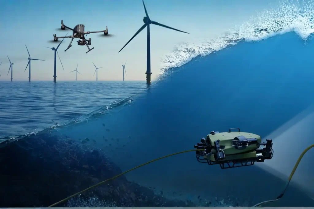
The Involvement of the UAV and ROV in Offshore Industry
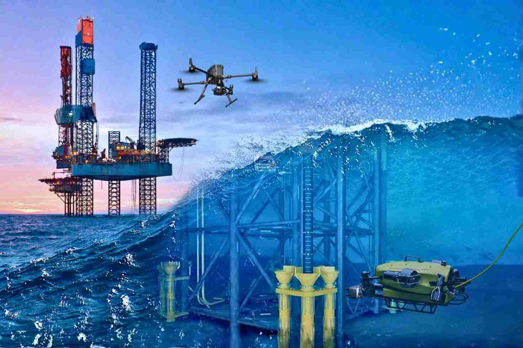
Offshore Operations in a High-Risk, Data-Driven Era The offshore energy sector operates on the edge of what is physically possible. Platforms stand isolated in the middle of the ocean, battered by saltwater, high winds, and unpredictable currents. In this hostile environment, the challenge of maintaining infrastructure is immense. Steel corrodes faster, structural fatigue sets in deeper, and the complexity of subsea networks makes monitoring a logistical nightmare. For decades, operators accepted high risk as the cost of doing business. Maintaining these assets meant sending rope-access technicians dangling from flare tips or deploying human divers into dark, crushing depths. These traditional methods are slow, incredibly expensive, and dangerously reliant on human physical endurance. Today, facing strict environmental regulations and the need for operational efficiency, these old ways are no longer sustainable. The industry requires a fundamental shift. This shift is defined by the role of UAV and ROV in offshore industry. Unmanned Aerial Vehicles (UAVs) and Remotely Operated Vehicles (ROVs) are no longer just supplementary tools; they are critical enablers. They act as the eyes and hands of the operator in environments where humans simply should not go. By adopting these robotic systems, offshore operators can finally meet modern requirements for speed, accuracy, and absolute risk reduction. How UAV and ROV Systems Transform Offshore Asset Management The transformation is comprehensive. It covers the asset from the tip of the flare stack in the sky to the pipeline buried in the seabed. I. Surface-Level Inspection with UAVs The topside of an offshore platform is a dense maze of piping, cranes, and high-voltage equipment. UAVs (drones) revolutionize how we inspect these diverse components. Visual and Thermal Precision: We use high-resolution cameras to capture millimeter-level details of rust or loose bolts on crane booms and drilling derricks. Simultaneously, thermal sensors detect insulation breaks or overheating electrical components without requiring a shutdown. Flare Stack Safety: Inspecting a live flare stack is one of the most dangerous jobs offshore. Drones can fly close to the flame, using zoom lenses and thermal imaging to check the tip’s condition while the facility remains in full production. This application alone saves millions in potential shutdown costs. Contact NDT: Advanced drones, like the Voliro T, go beyond looking. They can fly up to a vertical pipe or storage tank wall and press an ultrasonic probe against it. This allows for Non-Destructive Testing (NDT) at height, measuring wall thickness to detect internal corrosion without building a single scaffold. II. Subsea Inspection and Monitoring with ROVs Below the waterline, the environment is even more unforgiving. ROVs are the essential workhorses for subsea integrity. Structural Integrity: ROVs inspect the massive steel jackets and mooring chains that hold the platform in place. They clean off marine growth to inspect welds and check the status of sacrificial anodes, ensuring the cathodic protection system is working to stop corrosion. Pipeline and Riser Inspection: Subsea pipelines are the lifelines of the operation. ROVs travel kilometers along the seabed, using sonar and video to check for leaks, free spans (where the pipe is unsupported), or damage from anchors. Operational Support: During drilling operations, ROVs act as the “eyes” for the drill team, monitoring the blowout preventer (BOP) and subsea trees to ensure every connection is secure. III. Environmental Compliance and Emission Monitoring Regulatory pressure is increasing globally. Operators must prove they are not harming the environment. The role of UAV and ROV in offshore industry is central to this compliance. Aerial Methane Detection: Drones equipped with sensitive gas detectors fly autonomous patterns around the platform to sniff out methane leaks. They quantify Greenhouse Gas (GHG) emissions with a precision that handheld sensors cannot match, ensuring compliance with strict environmental standards like OGMP 2.0. Seabed Impact: ROVs perform environmental surveys of the seabed, taking sediment samples and mapping the area to ensure drilling activities are not damaging local marine ecosystems. IV. Operational Efficiency and HSE Improvements The most immediate impact of this technology is on Health, Safety, and Environment (HSE) metrics. Removing People from Harm: Every hour a drone spends inspecting a riser is an hour a human does not spend hanging over the water. Every hour an ROV spends checking a weld is an hour a diver does not spend under pressure. Reducing Logistics: Traditional inspections often require hiring specialized support vessels (DSVs) or accommodation barges for large crews. Robotic inspection teams are small and agile, drastically reducing the logistical footprint and cost of the campaign. Why Offshore Operators Are Accelerating UAV & ROV Adoption The move to robotic inspection is driven by hard data and financial reality. V. Improved Data Accuracy and Frequency High-Density Data: Drones do not just take photos; they capture LiDAR data. This laser scanning creates a dense 3D point cloud of the entire topside, allowing engineers to measure distances and plan modifications with centimeter accuracy. Sonar Clarity: In murky water, human divers are blind. ROVs use multibeam sonar to “see” through the silt, creating perfect acoustic images of subsea assets. Frequency: Because robotic inspections are cheaper and faster, operators can perform them more often. Instead of a major survey every five years, you can inspect critical nodes annually, catching problems before they become failures. VI. Lower Operational Cost and Downtime No Shutdowns: The ability to inspect live assets—like flares and operating risers—means production continues uninterrupted. The value of avoiding a single day of shutdown often pays for the entire inspection program. Speed: Drone inspections can reduce the time required for visual surveys by up to $50-$75 compared to rope access methods. This efficiency frees up bed space and resources on the platform for other critical maintenance tasks. VII. Enhanced Safety and Regulatory Compliance Zero Confined Space Entry: For internal inspections of tanks or vessels on FPSOs (Floating Production Storage and Offloading units), we use specialized caged drones like the Terra Xross 1. These fly inside the dark, hazardous tank while the pilot stays safely outside, completely eliminating the risk of confined space entry. Audit Trails: Robotic data is objective. It provides a
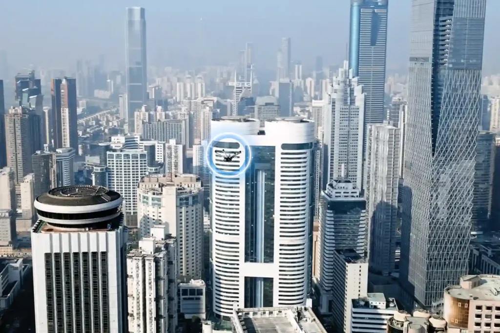
Autonomous Maintenance: How the low altitude economy Will Inspect NEOM’s The Line in 2026
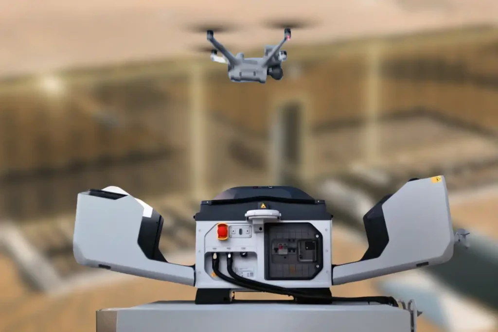
The Density Challenge When we talk about NEOM’s The Line, we are not discussing a standard skyscraper. We are talking about a continuous, 170km-long structure where structure and facilities are bound together in a straight, vertical line. Unlike traditional cities where utilities are spread out horizontally, The Line compresses everything from energy, water, transport, and structural beams into a tight, stacked footprint. This creates a unique maintenance nightmare: overlapped utilities and narrow, vertical corners that are impossible for humans to access safely. In this dense environment, a single pipe failure can cascade into critical electrical systems because they are “gathered” so closely together. Traditional maintenance methods like hanging platforms are too bulky and slow for these confined, high-tech corridors. The solution is not “more people.” It is a new layer of infrastructure. This is the low altitude economy, a dedicated digitized airspace where specialized autonomous robots navigate the tight gaps and vertical shafts to inspect, clean, and maintain the city without human intervention. The Invisible Maintenance Layer In 2026, the maintenance system of The Line will operate as a “Drone Hive,” seamlessly integrated into the building’s spine to handle the complex, gathered infrastructure. I. The Drone Hive (Advanced Docking Stations) Imagine a network of autonomous stations, such as the next-generation DJI Dock 3 (conceptually evolving from the current Dock 2), embedded directly into the utility layers of the megastructure. These compact, weather-proof stations act as home bases. At night or during low-traffic hours, drones automatically deploy to scan the narrow vertical shafts, creating a persistent cycle of monitoring that no human crew could match. II. Navigating the Narrow Corners The Line’s design creates deep, narrow recesses where utilities overlap. Standard drones cannot fly safely in these confined, GPS-denied zones. The solution is the Voliro T. Omnidirectional Flight: Unlike standard drones, the Voliro T uses tiltable rotors to fly in any orientation. It can hover sideways or upside down to navigate the tight corners between a water pipe and a structural beam. Contact Inspection: It can press a probe against a pipe buried deep in a vertical shaft to test for corrosion or sealant failure, ensuring integrity even in the most crowded utility zones. From Inspection to Intelligence The true power of this system isn’t just flight; it’s the ability to untangle the complexity of bound facilities. We are moving from simple inspection to predictive maintenance. III. Predictive Maintenance In a structure where facilities are gathered so tightly, you cannot wait for a leak to happen. The system uses predictive maintenance to analyze the “overlapped” layers of the building. Thermal Scanning: Drones fly the vertical corridors, using thermal sensors to “see” through the layers. They can detect a cooling leak behind a wall panel or an overheating cable tray hidden by a structural beam. The Digital Twin: Every byte of data feeds into NEOM’s Digital Twin. Because the structure and facilities are bound together, the Twin can predict how a vibration in the rail line might affect the plumbing stack next to it. It logs defects, identifies the exact replacement part for that specific narrow corner, and schedules the repair before a failure occurs. IV. Safety & Aesthetics By eliminating bulky external cranes, we preserve the sleek aesthetic of The Line. More importantly, using drones for these narrow, vertical corners removes the risk of sending personnel into confined, high-altitude utility shafts. It turns a high-risk job into a supervised digital workflow. Proving the Concept Today The technology to maintain the vertical cities of the future exists today. It just needs to be scaled. The low altitude economy is not science fiction; it is the operational standard for 2026. You can deploy these autonomous workflows on your current high-rise assets right now to reduce costs and risk and get a FREE 3-month progress monitoring period through talking to our expert.
Precise Prediction: Low Altitude Economy Aerial Data for Digital Twin Infrastructure.

The Urban Data Gap Smart cities like NEOM or Riyadh are not just collections of concrete and glass. They are complex, living systems that breathe, move, and consume energy. Managing such complexity requires real-time intelligence. Yet, many city planners still rely on static ground surveys and outdated maps. They cannot see how a new skyscraper might block airflow or how a road expansion will truly affect traffic until construction is finished. This data gap creates a blind spot that leads to costly errors. The solution lies in the sky. The low altitude economy, the active layer of airspace below 1,000 feet offers a continuous stream of high-resolution aerial data. This data is the fuel that builds the essential digital twin infrastructure for modern urban management. By moving from static maps to dynamic aerial insights, we can predict the future of our cities before we pour the first cubic meter of concrete. Capturing the City in High-Definition To manage a smart city, you must first measure it. Drones act as the sensory layer of the modern metropolis, capturing the physical world in minute detail. I. The Aerial Sensor Network We deploy drones equipped with advanced remote sensing toolkits. These are not just cameras; they are sophisticated instruments. LiDAR sensors shoot laser pulses to measure the exact height of buildings and trees. Thermal cameras detect heat leaks in pipelines and buildings. Multispectral sensors analyze the health of urban green spaces. This network captures the physical city with a level of detail that ground crews simply cannot match. II. 3D City Modeling and Integration This raw data is transformed into precise 3D models. We map every street corner, utility pole, and building facade. This creates the accurate geometric base of your digital twin infrastructure. But data alone is not enough. It must be organized. We build high-resolution maps and GIS databases to store this influx of information. The critical step is integration: ensuring data flows seamlessly from the drone to the database. This creates a “living” map that updates constantly, rather than a static snapshot that expires in a month. Simulating the Future When you have a living digital model, you gain the power of simulation. This is where data turns into decision-making power for city leaders. III. Urban Simulation and Planning Digital twin infrastructure allows planners to test ideas in a virtual world. You can simulate traffic flow during rush hour to test a new intersection design. You can model wind patterns to see how a new tower will affect pedestrian comfort. You can even simulate energy usage across a district to optimize the power grid. This predictive capability removes the guesswork from urban planning. IV. Environmental and Project Management The benefits extend to the environment. Drones monitor air quality sensors and detect urban “heat islands” areas that become dangerously hot. This data helps planners design cooler, healthier parks and living spaces. For the massive giga-projects driving Vision 2030, speed is everything. Aerial surveys track construction progress day by day. Project managers can overlay the digital plan onto the real-world progress to catch errors early. This keeps projects on schedule and saves millions in rework costs. Building the Digital Foundation The transition to a smart city requires a consistent, reliable data pipeline. The low altitude economy provides the speed and cost-efficiency needed to maintain a live digital twin infrastructure. It turns the sky into a digital asset that serves the city on the ground. Don’t plan your city on outdated maps. Partner with Terra Drone Arabia to build your digital foundation. We invite urban developers and government entities to claim a FREE 3-month progress monitoring period on a key development site. Experience the power of live aerial intelligence and start building your future today.
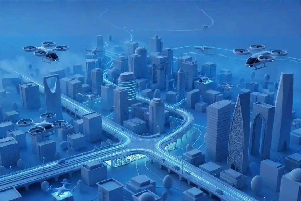
Economy under 1,000 Feet: The Rise of LAE in Smart Cities
The Next Industrial Airspace Layer We often look at the sky and see empty space. However, a quiet revolution is happening just above our heads. This is the rise of the low altitude economy (LAE). This term refers to a new economic and operational domain occupying the airspace below 1,000 feet. It represents the next frontier for industrial efficiency. Global industries are moving fast. They are digitizing their airspace and adopting unmanned systems to perform autonomous inspections. This shift is not just a global trend; it is a critical component of Saudi Arabia’s Vision 2030. The Kingdom is building smart cities and transforming its industrial base. These massive projects require accurate, safe, and continuous aerial operations. Traditional ground methods cannot support this scale. The low altitude economy and industrial applications provide the only viable solution to manage these large-scale assets efficiently. Core Technologies Enabling the LAE To make this new economy work, we need a robust technological foundation. The LAE relies on a stack of advanced systems that ensure safety and predictability. I. The Technological Stack for Safe Operations Unmanned Traffic Management (UTM): We cannot have drones flying blindly. UTM acts like air traffic control for drones. It coordinates airspace, ensures compliance, and prevents collisions. BVLOS Frameworks: Real value comes when drones fly Beyond Visual Line of Sight (BVLOS). This framework establishes safe corridors for drones to operate over long distances, such as along pipelines, utility grids, and coastal zones. Autonomous Drone Stations: Efficiency demands persistence. Autonomous docking stations allow drones to land, charge, and deploy 24/7 without a human pilot on site. Remote Sensing Toolkit: The drone is just the carrier. The value lies in the sensors. We use LiDAR for depth, thermal imaging for heat detection, multispectral sensors for vegetation analysis, and methane detectors for gas leaks. Geospatial Data Infrastructure: All this data must go somewhere. We build high-resolution maps and GIS databases. These form the basis of digital twins, allowing operators to manage physical assets in a digital space. These systems interact seamlessly. They create a predictable and scalable workflow that transforms low altitude economy and industrial applications from a concept into a daily operational reality. Transforming Critical Sectors The application of this technology transforms how we manage the three pillars of modern society: Energy, Utilities, and Urban Development. II. Energy Sector Applications The energy sector demands the highest level of safety and monitoring. Pipeline Integrity: Drones monitor the Right-of-Way (ROW) along vast pipeline networks. They detect leaks and security breaches instantly, protecting the environment and the asset. Flare and Tank Inspection: We replace dangerous manual climbing with drone inspections. Drones perform visual, thermal, and Ultrasonic Thickness (UT) checks on flare stacks and storage tanks. This assesses corrosion and wall health without shutting down operations. Sustainability: Specialized sensors quantify methane and Greenhouse Gas (GHG) emissions. This data helps energy companies meet strict regulatory compliance and sustainability goals. III. Utilities and Power Infrastructure Grid reliability is non-negotiable. Drones ensure the lights stay on. Powerline Inspection: Drones capture high-resolution visual and thermal images of powerlines. LiDAR sensors measure the sag of the lines with centimeter precision. Vegetation Management: Overgrown trees cause outages. Drones analyze vegetation encroachment, allowing utility companies to trim trees only where necessary. Renewable Assets: As the Kingdom adopts green energy, drones inspect solar PV panels for dead cells and wind turbines for blade damage, ensuring maximum energy output. IV. Urban Development and Smart Cities Smart cities like NEOM require smart construction data. Digital Twins: Drones capture data to build 3D city models. These Digital Twins allow planners to simulate traffic, weather, and energy usage before building anything. Progress Tracking: Megaprojects move fast. Aerial surveys track construction progress day by day. This helps project managers catch errors early and keep the project on schedule. Environmental Monitoring: Sensors on drones monitor air quality and heat islands in urban areas. This data helps city planners design cooler, healthier living spaces. Accelerating Efficiency and Adoption The shift to the low altitude economy and industrial applications is not just about technology; it is about business results. V. Why LAE Accelerates Efficiency Cost and Frequency: Automated drones inspect assets more frequently at a lower cost. You can inspect a site daily instead of monthly. Human Safety: We remove humans from high-risk environments. No more climbing towers or entering confined tanks. Real-Time Data: Reports arrive in near real-time. This integration with enterprise systems allows for faster decision-making. National Scale: This technology supports cross-sector interoperability. Data collected for a road project can also help utility companies, supporting national-scale digital initiatives. VI. Pathway to Adoption Governments and industry operators must act now to build this ecosystem. Establish Readiness: Organizations must prepare their technical systems for BVLOS and UTM-aligned operations. Deploy Autonomy: Install autonomous drone stations to enable routine, high-frequency missions. Centralize Data: Build repositories to unify survey and inspection data. Start Pilots: Conduct pilot programs with measurable KPIs to prove the value. Ready to transform your low altitude economy energy, utility, or urban development projects? Let’s realize it through advanced sensing, processing, and data management platforms.