

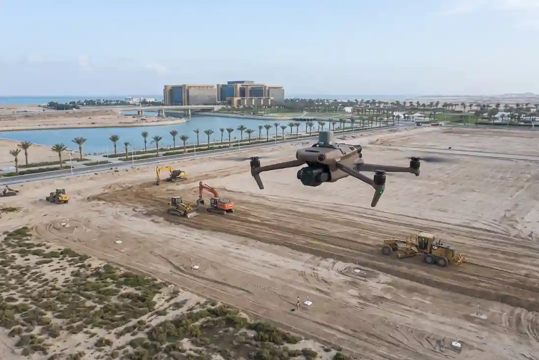
Saudi Arabia’s industrial strategy has pivoted away from speculative, broad-acre “Economic Cities” toward targeted, supply-chain-driven development.
Rather than constructing massive greenfield cities expecting tenants to follow, national planning now prioritizes disciplined regionalization, sector-specific industrial clusters, and targeted Special Economic Zones (SEZs).
Saudi Arabia SEZ Economic Footprint:
– KAEC SEZ: 60 km² Footprint (Advanced Manufacturing & Logistics)
– Jazan SEZ: 24.6 km² Footprint (Heavy Industry & Mineral Processing)
– Ras Al-Khair SEZ: 20 km² Footprint (Maritime & Offshore Rig Fabrication)
– Targeted FDI: SAR 84 Billion Direct Foreign Investment by 2040
– Economic Target: SAR 96.75 Billion GDP Contribution & SAR 352.87 Billion Exports
Saudi Arabia’s five designated Special Economic Zones, including King Abdullah Economic City SEZ (60 km²), Jazan SEZ (24.6 km²), and Ras Al-Khair SEZ (20 km²) are projected to contribute SAR 96.75 billion to national GDP and attract SAR 84 billion in direct foreign investment by 2040.
This strategic SEZ infrastructure is engineered to drive SAR 352.87 billion in regional exports while creating over 166,000 high-skilled industrial jobs.
Executing this focused industrial vision requires rapid site preparation. Civil developers must enable raw land, establish precise boundary surveys, and verify utility trenching to support incoming foreign manufacturers without schedule delays.
The Development of Special Economic Zone Land
Preparing multi-square-kilometer greenfield plots for heavy industrial construction requires extensive civil earthworks, ground leveling, and utility routing. Transforming raw, undeveloped terrain into tenant-ready industrial plots introduces critical civil engineering and project management bottlenecks during initial site enablement.
Topographic Data Capture Across Multi-Square-Kilometer Tracts
Establishing baseline terrain elevation maps across expansive Special Economic Zone (SEZ) plots ranging from 20 to 60 square kilometers presents immediate operational bottlenecks for field survey teams using traditional ground instruments:
- Field Coverage Limits: Manual surveying using terrestrial GNSS rovers and total stations requires field crews to physically walk uniform grid patterns over rough, unpaved ground. A single survey crew typically covers only 0.05 to 0.1 square kilometers per day, making site-wide baseline surveying take several months.
- Line-of-Sight and Access Hazards: Natural terrain features, steep embankments, soft ground, and scrub vegetation block optical total station lines-of-sight and restrict vehicle access, creating data gaps across inaccessible sections.
- Schedule Delays for Master Planning: Earthmoving contractors cannot begin major grading operations until baseline terrain surveys are complete and verified, causing delays in early-stage civil engineering schedules.
Drone Photogrammetry and Construction Digital Twins
Deploying Real-Time Kinematic (RTK) drone photogrammetry provides an active, high-efficiency remote sensing solution to map expansive civil enablement sites and generate 3D digital twins. Unlike traditional terrestrial surveying, aerial photogrammetry captures millions of georeferenced visual data points per flight, converting overlapping 2D photographs into high-density 3D spatial models.
Structure-from-Motion Mechanics and Photogrammetric Processing
Aerial photogrammetry relies on Structure-from-Motion (SfM) algorithms to reconstruct three-dimensional scene geometry from overlapping two-dimensional photographs. When a drone flies over a construction site, its onboard camera captures terrain features from multiple look angles.
The photogrammetric reconstruction workflow follows four primary steps:
- Feature Matching and Tie-Point Detection: Processing software identifies millions of unique visual features, such as rock textures, ground marks, and soil color changes across overlapping image sets.
- Bundle Block Adjustment: Using camera telemetry and RTK ground coordinates, software calculates the exact position, camera angle, and focal parameters for every photo taken during the flight.
- Dense Point Cloud Generation: Algorithms triangulate matched feature points in 3D space, producing a high-density point cloud where every point contains precise X, Y, ، و Z spatial coordinates and RGB color values.
- Orthorectification and Mesh Generation: Point clouds are transformed into a Triangulated Irregular Network (TIN) 3D mesh and an orthorectified 2D map. Orthorectification corrects for camera tilt and terrain perspective distortion, ensuring every pixel on the final orthomosaic represents an absolute, measurable ground coordinate.
Market Expansion and Commercial Adoption in Civil Engineering
Integrating unmanned aerial vehicles (UAVs) with high-precision RTK positioning reflects a global industrial shift toward automated spatial auditing across civil infrastructure projects.
Market data indicates that the global digital twin in construction market is estimated at SAR 215.28 billion in 2026 and is forecast to expand at a compound annual growth rate (CAGR) of 17.0% to reach SAR 402.86 billion by 2030.
Similarly, the global drone construction monitoring market is projected to grow from SAR 1.76 billion in 2026 to SAR 6.45 billion by 2036 at a 13.8% CAGR.
Within this sector, site surveying and progress auditing command 34% of total market demand. Rotary-wing drone platforms account for 68% of total inspection deployments due to their vertical takeoff capabilities, hovering precision, and ability to navigate tight spaces within active construction zones.
This sustained commercial growth highlights how civil developers rely on continuous aerial datasets to reduce project risks and verify contractor progress across large industrial sites.
Construction Digital Twin Integration
Converting raw aerial photogrammetry into an active construction digital twin requires separating bare ground from temporary site objects and linking 3D spatial data directly into CAD design platforms.
The digital twin auditing workflow operates through three core functions:
- Elevation Model Filtering (DSM to DTM Extraction): Classification algorithms filter out non-ground objects, such as park vehicles, temporary office cabins, and active excavators from the Digital Surface Model (DSM). This extracts a clean Digital Terrain Model (DTM) representing the true bare-earth elevation profile.
- CAD Vector Overlay and Design Comparison: Georeferenced DTMs and orthomosaics are imported directly into Civil 3D or GIS platforms. Project engineers overlay 2D/3D CAD design vectors over the drone data to check road centerlines, trench alignments, and plot boundary compliance.
Combining high-resolution aerial imagery with RTK satellite positioning delivers survey-grade accuracy.
Field tests confirm that RTK-enabled drone photogrammetry achieves horizontal Root Mean Square Error (RMSE) accuracy of 1.0 cm to 1.5 cm and vertical RMSE of 0.5 cm to 2.3 cm at Ground Sampling Distances (GSD) as fine as 1.1 cm/pixel.
SEZ Mapping with Drones
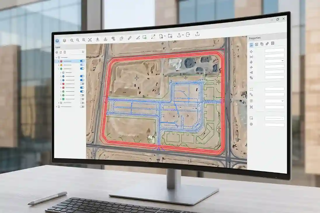
High-frequency site surveying across active civil construction zones requires a compact, rapidly deployable aerial platform capable of mapping large industrial sectors per flight.
Mechanical Shutter and High-Speed Area Coverage
الـ DJI Mavic 3 Enterprise (M3E) serves as the primary aerial photogrammetry platform for land enablement surveys:
- Sensor & Shutter Performance: The aircraft carries a 20 MP 4/3 CMOS wide camera equipped with a 0.7-second mechanical shutter interval. The mechanical shutter eliminates rolling shutter distortion during high-speed survey passes, enabling fast image capture without compromising pixel sharpness.
- Wide-Area Operational Range: Combining high battery efficiency with automated flight path software allows field crews to map up to 2 square kilometers in a single operational flight, drastically reducing site mobilization time compared to ground survey teams.
Centimeter-Level RTK Georeferencing and Digital Twin Generation
The M3E integrates an onboard RTK module compatible with D-RTK 2 mobile base stations or local NTRIP network corrections:
- Positional Precision: Embeds spatial coordinates directly into image EXIF metadata, achieving 1 cm + 1 ppm horizontal and 1.5 cm + 1 ppm vertical positioning accuracy.
- Digital Twin Output: High-overlap orthomosaic imagery processes into high-density 3D textured meshes, Digital Terrain Models (DTMs), and Digital Surface Models (DSMs).
Georeferenced DTMs export directly into CAD and GIS software, enabling civil engineering teams to verify contractor earthworks, calculate precise cut-and-fill soil volumes, and update the master digital twin model in real time.
Impact and Infrastructure Acceleration
Deploying RTK drone photogrammetry replaces manual site audits with automated 3D digital twins across Special Economic Zones.
This allows developers to verify contractor earthworks, prevent utility alignment errors, and shorten plot leasing cycles for incoming industrial investors.
Transitioning to aerial spatial workflows lowers engineering auditing overhead, safeguards capital expenditure, and accelerates national SEZ infrastructure delivery.
Consult with Our Experts
Streamline your land enablement, site surveys, and digital twin creation with advanced drone photogrammetry. Talk to our geospatial specialist to deploy high-precision aerial solutions for your infrastructure projects.

 العربية