Agriculture with satellite imagery is transforming how farmers manage resources and improve yields. By leveraging advanced satellite data, farmers gain a bird’s-eye view of their fields, enabling them to monitor soil health, optimize crop growth, and make data-driven decisions. This technology enhances productivity and addresses the growing demand for sustainable farming practices.
Key Benefits of Satellite Imagery in Precision Agriculture
Satellite imagery offers unparalleled insights into field conditions, helping farmers address challenges more effectively. By monitoring soil health, high-resolution images reveal patterns of soil compaction, erosion, or nutrient depletion. Consequently, farmers can pinpoint specific problem areas and apply resources such as fertilizers precisely, minimizing waste and enhancing efficiency.
Additionally, satellite data tracks crop development stages, providing valuable predictions about yield potential. This enables farmers to plan their activities better and allocate resources like water and pesticides more effectively. Together, these capabilities ensure smarter farming practices and improved outcomes.
Technical Applications of Satellite Imagery

Satellite imagery empowers farmers with advanced tools for making better decisions by providing critical insights across various aspects of agriculture. For instance, multispectral and hyperspectral analysis captures light reflectance data, enabling farmers to detect issues such as pest infestations, nutrient deficiencies, or water stress. By analyzing chlorophyll levels, multispectral imagery can highlight stressed crops, allowing for timely interventions.
In addition, satellite imagery addresses field variability by dividing fields into zones based on differences in soil and crop conditions. This zoning capability helps farmers develop tailored management plans for each area, significantly improving efficiency and reducing operational costs.
Furthermore, satellite data enhances water management by mapping water usage and availability. Farmers can optimize irrigation schedules, conserve valuable resources, and respond proactively to drought conditions. Together, these capabilities ensure that farmers can manage their operations more effectively and sustainably.
Integrating GIS and Remote Sensing

By combining Geographic Information Systems (GIS) with satellite imagery, farmers can visualize spatial data more effectively. This integration simplifies field analysis and enhances decision-making. For example, satellite imagery overlaid on GIS maps allows farmers to identify problem areas instantly and plan interventions with precision.
Practical Examples of Precision Agriculture
Satellite imagery plays a crucial role in real-world farming scenarios.
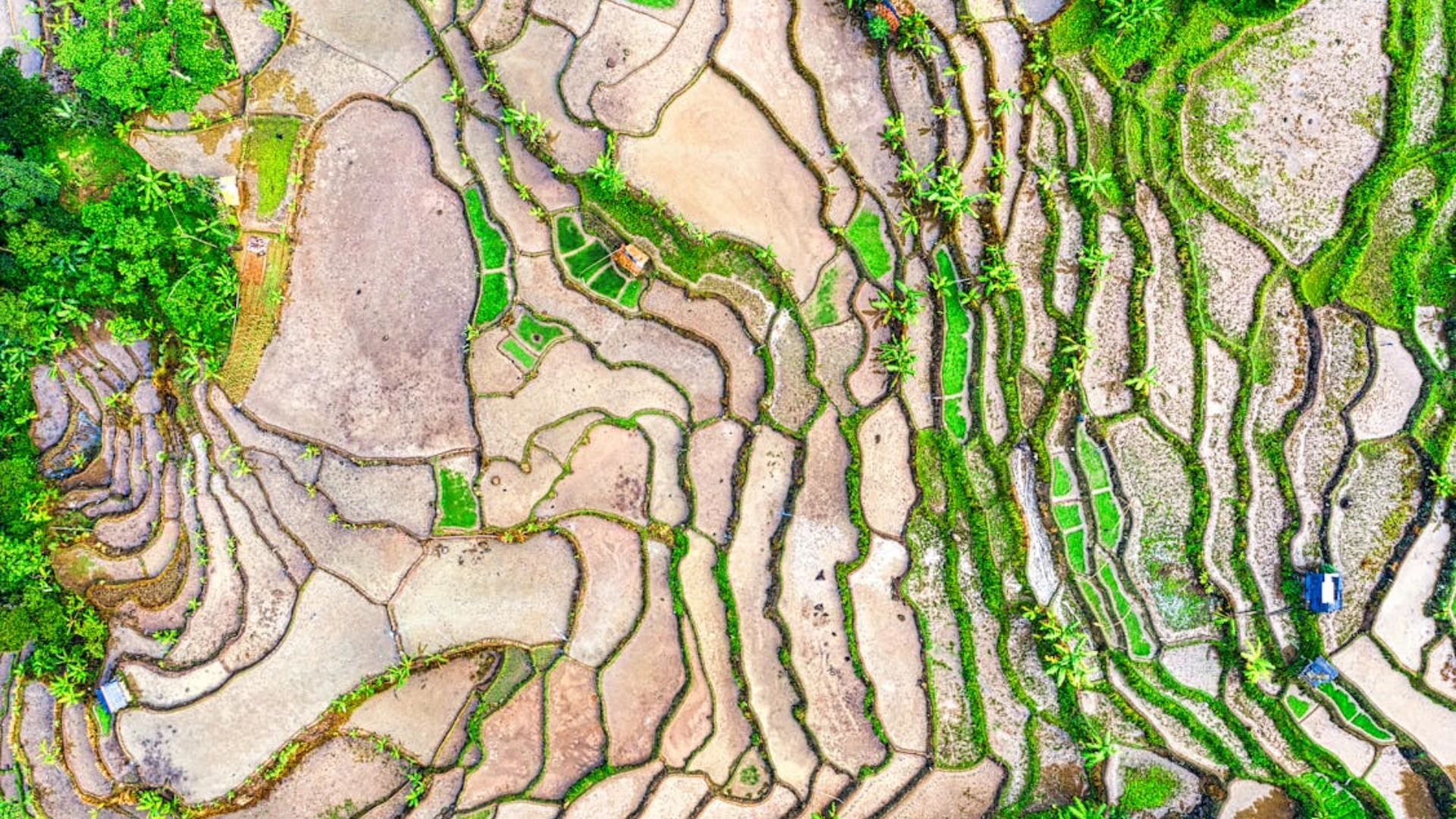
- Field Mapping: A rice farm in Asia used satellite data to divide its fields into zones, enabling precise water and fertilizer application. The result was a 15% increase in yield and a 20% reduction in costs.
- Pest Management: A cornfield in the U.S. identified pest hotspots through satellite imagery, allowing targeted pesticide use and reducing overall chemical applications.
Challenges and Future Trends
While agriculture with satellite imagery has brought revolutionary changes, challenges remain. Cloud cover can sometimes hinder data collection, and small-scale farmers may find the technology initially costly. However, advancements like nanosatellites and subscription-based services are making this technology more accessible.
The future holds exciting possibilities. Combining satellite data with IoT and drone technology can create a more interconnected farming ecosystem. Real-time updates and predictive analytics will further enhance precision agriculture, making farming smarter and more efficient.
What’s Next?
Satellite imagery is revolutionizing agriculture by offering actionable insights that address productivity, sustainability, and resource optimization challenges. By adopting this technology, farmers can embrace a smarter approach to farming, ensuring profitability and environmental stewardship.
Contact us today to learn more about integrating satellite imagery into your agricultural practices.

