

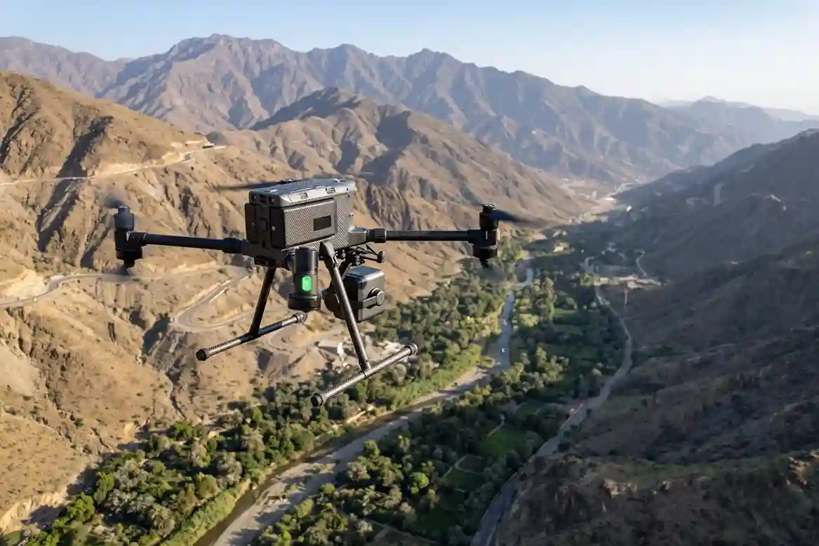
ARDARA’s flagship AlWadi development encompasses over 2.5 million square meters of connected urban and waterfront districts in Downtown Abha.
Designed to align with the objectives of Saudi Vision 2030, the master plan dedicates over 30% of its total footprint to green open spaces, pedestrian pathways, and public amenities.
AlWadi Master Plan Spatial Footprint:
- Total Site Area: 2.5 Million m²
- Open Green Spaces: >30% Dedicated Footprint
- Central Waterfront: 16 km Linear Abha Valley Corridor
- Active Mobility: 17 km Pedestrian & Cycling Tracks
- Economic Target: >SAR 19 Billion Non-Oil GDP Contribution by 2030
The defining feature of AlWadi is its 16-kilometer waterfront corridor stretching along the natural Abha Valley floor, complemented by 17 kilometers of walking and cycling trails.
The destination is projected to contribute over SAR 19 billion to Saudi Arabia’s non-oil GDP by 2030. Across five distinct character districts, Phase 1 delivers 2,000 residential units, 1,900 hotel rooms, and commercial hubs integrated directly into the surrounding riverbed geography.
Mountainous Hydrogeology and Flood Channel Risk
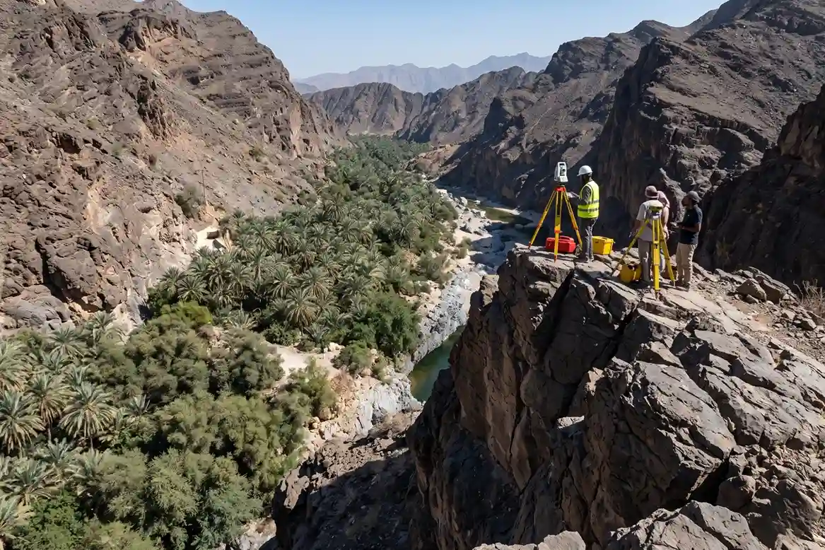
Constructing a multi-billion-Riyal urban waterfront destination along a natural mountain valley introduces severe civil engineering, hydrogeological, and hydraulic management demands.
Located in the high-altitude terrain of the Aseer region, the Abha Valley functions as a primary drainage corridor for surrounding mountain peaks, generating rapid surface runoff during seasonal rainfall events.
Hydrodynamics of the Aseer High-Altitude Catchment
The Abha Valley catchment area sits over 2,200 meters above sea level, characterized by steep rock gradients, thin soil cover, and low infiltration capacity.
When intense, short-duration monsoonal storms strike the Aseer mountains, rainwater cannot absorb into the rocky ground.
Instead, surface runoff accelerates down the mountain slopes and concentrates along the 16-kilometer valley floor within minutes.
This rapid concentration of water creates high-velocity flash floods carrying heavy sediment loads, boulders, and organic debris.
The resulting hydrodynamic forces exert immense shear stress on riverbed banks and foundation beds.
To build permanent residential districts, public promenades, and commercial hubs directly along this channel, civil engineers must map every elevation contour of the valley floor to predict exact water flow pathways, scour points, and inundation boundaries.
Infrastructure Integration for Riverbed Area
Rehabilitating an active mountain riverbed into a stable, multi-use waterfront corridor requires massive civil infrastructure enablement works.
Civil contractors must divert existing utility lines, build stormwater diversion networks, and install underground culverts to control water levels during extreme weather events.
Main civil contracts along the corridor include major packages for:
- Trunk Sewer Diversions: Relocating major municipal wastewater networks away from the primary flood channel to prevent contamination during high-water events.
- Stormwater Drainage Networks: Installing high-capacity concrete culverts and underground drainage channels designed to manage peak discharge volumes.
- Waterfront Edge Retaining Walls: Constructing engineered bank stabilization walls, artificial lakes, and stepped terraces to absorb hydraulic kinetic energy.
Integrating these structural assets requires precise elevation modeling. Sub-development packages along the valley, such as Sumou Holding’s SAR 4 billion investment spanning 300,000 square meters, depend on accurate flood channel design.
If channel capacity is under-calculated by even a few centimeters, extreme 100-year flood events could overtop retaining structures and inundate adjacent high-value real estate.
Limitations of Terrestrial Surveying in Steep Valley Corridors
Acquiring detailed topographical data across the 16-kilometer Abha Valley using traditional ground surveying methods presents severe operational bottlenecks:
- Inaccessible Terrain Profiles: Valley side slopes range from 30 to 50 degrees, making it hazardous for ground surveyors carrying GNSS rovers or total stations to walk uniform grid lines.
- Vegetation Canopy Interference: The valley floor is covered in thick acacia, scrub, and riparian vegetation. Optical survey tools and GNSS receivers cannot measure the ground surface beneath dense plant canopies, leaving critical elevation gaps in field surveys.
- Micro-Topography Blind Spots: Manual survey points spaced 25 to 50 meters apart often miss micro-features such as natural levees, narrow scour channels, and sudden rock outcrops. Missing these small features distorts hydraulic roughness calculations (n) and invalidates flood velocity simulations.
Because ground survey crews cannot gather continuous, high-density elevation data across dangerous, vegetation-covered terrain, project planners require wide-area remote sensing platforms capable of penetrating plant canopies to reveal the true bare-earth topography.
Aerial LiDAR Hydrological Mapping and Terrain Modeling
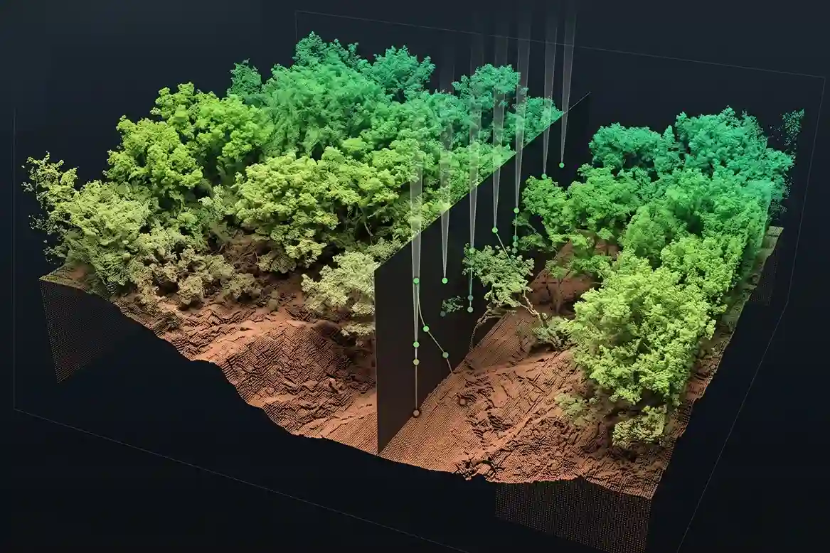
Deploying airborne Light Detection and Ranging (LiDAR) provides an active remote sensing solution designed to capture high-density topographical data across complex linear corridors.
Unlike passive optical photogrammetry, which relies on ambient sunlight and visual line-of-sight imagery, LiDAR sensors emit rapid laser pulses toward the ground surface and measure the exact time it takes for reflected light rays to return to the receiver.
Physics of Multi-Return LiDAR and Vegetation Penetration
Aerial LiDAR systems operate on active time-of-flight principles, emitting hundreds of thousands of laser pulses per second across a targeted survey corridor.
When a laser pulse travels downward toward a riverbed covered in plant canopy, the light beam splits as it strikes physical objects at varying elevation layers.
This beam splitting enables multi-return signal processing:
- First Return: Captures the highest physical surface, such as upper tree leaves, building roofs, or bridge superstructures.
- Intermediate Returns: Reflect from mid-tier obstacles, including lower branches, bushes, and riverbed scrub.
- Last Return: Passes through small gaps in the plant canopy to strike the bare ground surface below.
Because the Abha Valley floor contains thick riparian scrub and acacia vegetation, multi-return LiDAR capability is essential for accurate hydrological mapping.
Standard optical camera sensors can only photograph the top surface of leaves and bushes, creating artificial “hills” in visual digital elevation models. In contrast, multi-return LiDAR lasers penetrate canopy gaps to record true bare-earth elevations along the active river channel.
Market Growth and Commercial Adoption in Corridor Engineering
Integrating unmanned aerial vehicles (UAVs) with high-precision LiDAR sensors reflects a global industrial shift toward automated geospatial auditing.
Market data indicates that the global LiDAR drone sector is projected to expand at a compound annual growth rate (CAGR) of 19.31%, growing from SAR 1.12 billion in 2026 to reach SAR 2.72 billion by 2031.
Similarly, the broader global LiDAR market is forecast to grow from SAR 12.45 billion in 2026 to reach SAR 29.21 billion by 2031 at an 18.62% CAGR.
Within this industry, corridor mapping commands the largest application share at 37.60% of total market demand, while aerial platforms account for 37.45% of all LiDAR deployments globally.
This sustained commercial investment highlights the growing demand among civil authorities and infrastructure developers for wide-area aerial platforms capable of delivering precise terrain data for flood mitigation and asset protection.
Utilizing DJI Matrice 400 and Zenmuse L3
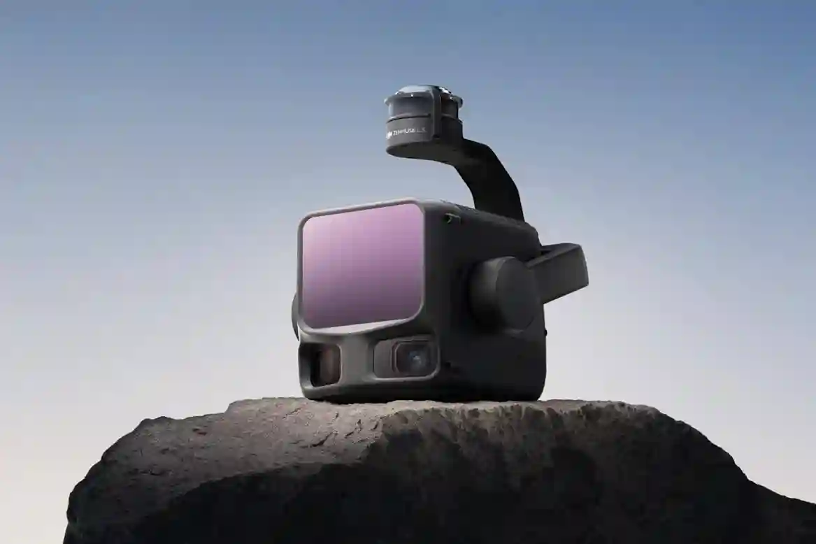
Executing continuous aerial LiDAR surveys across high-altitude mountain terrain requires a flight platform engineered to maintain signal stability, long flight ranges, and precise sensor alignment under severe environmental conditions.
Combining the heavy-lift capability of the DJI Matrice 400 with the multi-sensor architecture of the DJI Zenmuse L3 creates an automated aerial survey system tailored for complex riverbed corridors.
Aircraft Flight Performance and Environmental Resilience in Mountain Corridors
Executing linear corridor surveys along the 16-kilometer Abha Valley presents severe flight control challenges.
Located over 2,200 meters above sea level, the valley exhibits reduced air density, steep canyon side slopes, and unpredictable mountain wind gusts.
To maintain flight stability in these conditions, the DJI Matrice 400 features a maximum takeoff weight of 15.8 kg and supports payload capacities up to 6 kg.
Operating with an optimized battery flight architecture, the aircraft achieves up to 59 minutes of flight time when carrying the Zenmuse L3 payload.
This extended endurance allows field survey crews to map multiple linear kilometers of valley terrain per flight sortie, reducing battery swap intervals and operational downtime.
The aircraft is engineered with an IP55 ingress protection rating, safeguarding internal avionics against fine mountain dust, high humidity, and sudden rain showers along the valley floor.
Designed to operate across a temperature range of -20°C to 50°C, the platform maintains steady power output during high summer heat.
For safe navigation within narrow valley corridors and active construction zones where tall drill rigs, mobile cranes, and steep rock faces are present, the Matrice 400 integrates a multi-layered obstacle sensing system:
- 360° Rotating LiDAR: A horizontal rotating LiDAR unit capturing up to 520,000 points per second with a 100-meter detection range to build real-time 3D point-cloud maps of surrounding obstacles.
- Six-Directional mmWave Radar: All-weather millimeter-wave radar providing obstacle detection in low-visibility conditions such as morning valley fog, dust clouds, or mountain glare.
- Omnidirectional Vision Sensors: Full-color fisheye visual sensors providing spatial context to the flight controller.
Multi-Return LiDAR Mechanics and Sensor Integration via the Zenmuse L3
Capturing accurate ground elevations beneath dense riverbed vegetation requires a multi-sensor payload capable of penetrating plant canopies while recording true-color visual data.
The DJI Zenmuse L3 integrates a 1535 nm eye-safe long-range LiDAR module, an upgraded high-precision Inertial Measurement Unit (IMU) with POS synchronization, and a dual 100MP 4/3 CMOS RGB mapping camera system into a single 3-axis stabilized gimbal assembly.
The payload delivers technical capabilities suited for hydrological terrain modeling:
- Pulse Rate and Multi-Return Capabilities: The 1535 nm LiDAR sensor emits adjustable laser pulse frequencies (from 100 kHz up to 2000 kHz) and supports up to 16 target returns per pulse at 100 kHz and 350 kHz modes. Supporting up to 16 returns, the laser beam easily penetrates dense tree canopies, lower branches, and thick riverbed scrub to strike the bare ground below with high point density and minimal noise.
- Extended Detection Range: Operates across detection ranges up to 950 meters at 10% reflectivity and up to 2,000 meters at 80% reflectivity. This long-range capability allows the aircraft to maintain higher flight altitudes (300 to 500 meters above ground level) above steep valley cliffs while retaining strong return signal strength and enabling daily mapping coverage of up to 100 km².
- Spatial Elevation Accuracy: Achieves survey-grade vertical elevation accuracy of 3 cm and horizontal accuracy of 4 cm at a flight altitude of 120 meters (and 5 cm vertical accuracy at 300 meters altitude). The integrated high-accuracy IMU and positioning orientation system (POS) require no warm-up time upon power-up, allowing field crews to begin data capture immediately upon launch.
The integrated dual 100MP RGB mapping camera system features mechanical shutters, eliminating rolling shutter distortion during high-speed survey flights.
Capturing ultra-wide 107° horizontal FOV imagery with a Ground Sample Distance (GSD) as fine as 3 cm even at 300 meters altitude, this visual sensor records high-resolution orthomosaic imagery simultaneously with laser data, allowing post-processing software to assign vivid true-color RGB values to every individual point in the 3D point cloud.
Spatial Georeferencing and Cloud Data Integration
Converting raw aerial laser returns into actionable civil engineering data requires accurate geospatial positioning and centralized data management.
The Matrice 400 incorporates dual-antenna Real-Time Kinematic (RTK) positioning receivers compatible with GPS, GLONASS, Galileo, and BeiDou satellite constellations.
RTK corrections provide centimeter-level positional accuracy (1 cm + 1 ppm horizontal, 1.5 cm + 1 ppm vertical, embedding exact spatial coordinates into every laser point and image geotag.
This positioning accuracy reduces the need for survey crews to lay extensive Ground Control Point (GCP) networks across dangerous, flood-prone riverbed terrain.
Field survey data automatically synchronizes with central management systems using DJI FlightHub 2 cloud software via the aircraft’s O4 Enterprise video transmission system or optional 4G cellular modules.
Hydrological engineers and project managers located at central design offices can monitor real-time point cloud generation, review spatial annotations, and export georeferenced LAS and LAZ point cloud files directly into GIS and CAD engineering platforms.
This automated digital pipeline connects field flight operations with hydraulic modeling teams, accelerating channel design timelines along the Abha Valley corridor.
Strategic Impact and Economic Vision
Deploying aerial LiDAR establishes an accurate hydrological baseline across AlWadi’s 2.5 million square meter master plan.
Bare-earth terrain models paired with 3D hydraulic flow simulations allow civil engineers to design effective flood barriers, optimize channel excavation depths, and protect critical infrastructure across all five character districts.
Transitioning from manual surveying to automated aerial LiDAR eliminates field survey risks, lowers civil engineering overhead, and safeguards high-value waterfront assets.
Consult with Our Experts
Optimize your corridor mapping, hydrological modeling, and flood risk assessments with drones. Consult with our geospatial specialist to implement drone LiDAR solutions for your infrastructure projects.

 English