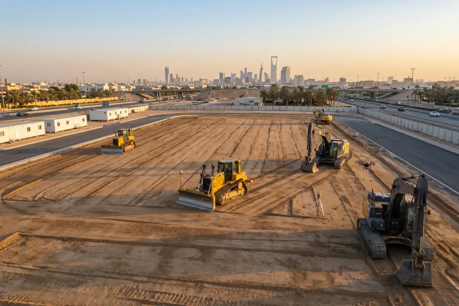
Preparing foundations for heavy industrial facilities involves extensive land preparation.
For instance, leveling a single industrial pad measuring 400 by 400 meters requires grading a continuous surface area of 160,000 square meters.
Managing earthwork at this scale introduces serious financial risks.
Industrial research shows that 98% of megaprojects face cost overruns that exceed 30%, with the average cost increase scaling up to 80% of the initial estimated value.
These overruns become even more damaging during volatile economic cycles, where construction input costs can skyrocket by up to 23%.
A single error in estimating the volume of soil that needs to be moved can quickly exhaust project contingency budgets.
Why Traditional Topographic Surveys Fall Short in Dynamic Landscapes
Project data shows that 73% of troubles in multi-billion-dollar developments are caused by planning and execution inefficiencies on-site, rather than external legal or political hurdles.
In rugged or desert terrains, unexpected changes in elevation are a primary source of these inefficiencies.
If an unmapped 5-meter elevation variance occurs across a site footprint, earthmoving crews must move tens of thousands of cubic meters of additional soil just to make the pad level.
Traditional ground-based topographic survey methods are often too slow to capture these shifting variations effectively.
Walking a site manually to record isolated points fails to build a continuous model of the moving terrain, which leads to major errors in calculating total soil volumes.
Implementing Precise Volumetric Audits to Prevent Execution Failures
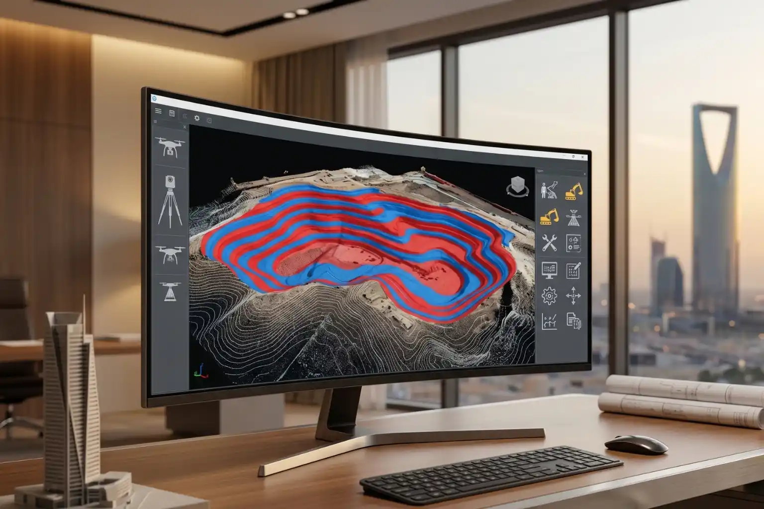
To eliminate grading risks and stay within budget, project managers are incorporating automated aerial data into their pre-construction pipelines.
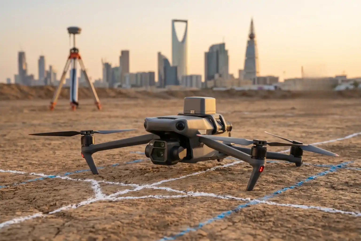
Field teams deploy the DJI Mavic 3 Enterprise drone to perform automated volumetric audits across the designated area of interest.
This specialized drone features its own built-in visual camera combined with an RTK Module.
This hardware combination gives the drone centimeter-level GPS accuracy, allowing engineering teams to calculate exact “cut-and-fill” soil volumes digitally before ground disruption begins.
Deploying this automated auditing data directly addresses the primary risks associated with large-scale industrial infrastructure developments:
- Bypassing Megaproject Cost Traps: Industrial data shows that 98% of megaprojects valued at $1 billion or more suffer cost overruns exceeding 30%, with the average cost increase scaling up to 80% of the original estimated value. Precise site pad grading calculations are vital for massive infrastructure developments to prevent falling into these typical project traps.
- Eliminating On-Site Inefficiencies: In multi-billion-dollar projects struggling with budget and timeline inflation, 73% of project troubles are caused directly by poor execution and planning inefficiencies on-site, rather than external factors like political or legal changes. Earthwork calculation errors are a preventable execution failure that can be entirely resolved using automated site auditing data.
- Mitigating Compounding Volumetric Costs: Inaccurate field estimates often stem from overlooking shifting market indicators. In volatile economic cycles, general consumer pricing can rise by 5.4% while construction input costs skyrocket by 23%. When earthwork crews make volume calculation errors on a massive 160,000 square meter pad, buying or moving extra material under these highly inflated input costs severely breaks project budgets.
Investing in advanced grid mapping before moving dirt heavily protects downstream capital.
Industrial reports confirm that prioritizing optimization and highly detailed site analysis during the pre-construction phase yields a Net Present Value (NPV) uplift of 20% or more of the total installed cost for asset owners.
Streamline Your Site Preparation
Relying on estimated earthwork volumes or slow ground surveys introduces unnecessary risks to large-scale infrastructure developments.
Transitioning to automated aerial volumetric tracking gives your engineering team complete geometric control over soil movements and site grading profiles.
This proactive data verification ensures your foundation pads are leveled accurately, protecting your downstream construction budgets and keeping your project timeline on track.
Consult with our expert to implement precise drone volumetric workflows and protect your project budgets from day one.

