How Geospatial Intelligence Powers Predictive Asset Management
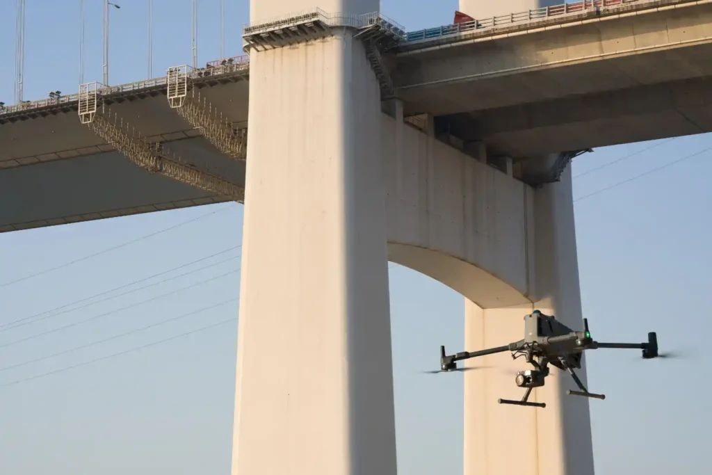
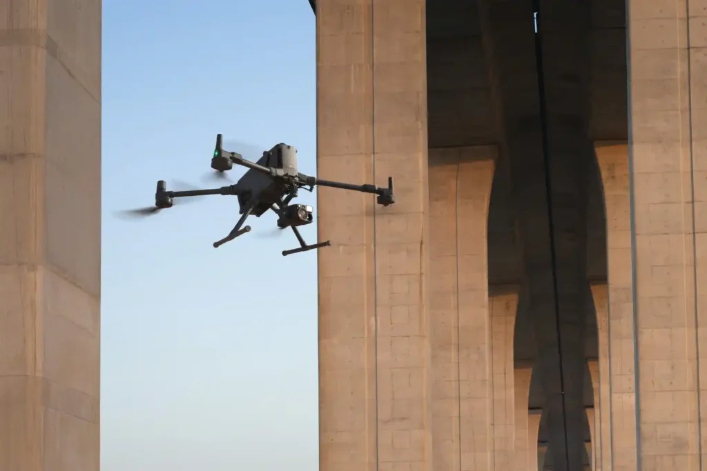
The Operational Imperative The moment infrastructure like highways, bridges, and industrial assets finish construction, they enter a critical new phase: operational risk. Managing maintenance is the single largest long-term cost, and reactive failure, waiting for a fault before fixing it is unacceptable for any modern smart city. The challenge lies in inspection. Traditional integrity checks […]
Precision Mapping: The Technical Core of High-Speed Highway Design
The foundational task of building or improving any major road, rail, or highway in the swiftly developing MENA region is topographic mapping. This process, which creates a three-dimensional model of the land’s surface, is not just a preliminary step; it dictates the engineering viability, the budget, and the ultimate timeline of the entire project. Yet, […]
Cut Survey Labor Costs by Up to 60% with High-Accuracy Drone Surveys
Precision from the Ground Up A High-Accuracy Drone Survey is the foundation for efficient solar and wind energy projects. In renewable development, the land beneath your infrastructure determines how much energy you generate and how much profit you keep. For solar farms, even small slope errors can reduce sunlight capture. A misalignment of just a […]
How a Drone Topographic Survey Cuts Renewable Energy Site Prep Time by Up to 90%
In renewable energy development, the efficiency of a solar farm or wind park begins long before the first panel or turbine is installed. It starts with the precision of the terrain data. Even minor errors in elevation, slope, or site orientation can lead to long-term energy losses, unnecessary maintenance costs, and reduced return on investment. […]
Why 16.5% Market Growth in MEA Demands Smarter Drone Ground Support Now

The commercial drone market in the Middle East & Africa (MEA) is entering a phase of rapid expansion valued at $1.60 billion in 2023 and projected to nearly triple to $4.65 billion by 2030, growing at a CAGR of 16.5% from 2024 onward. This surge reflects increasing reliance on drone technology across industries such as […]
Retail Drone Delivery: Solving Last-Mile Logistics

Retail drone delivery operations are transforming the last mile of the supply chain—a stage traditionally known for being the most expensive and inefficient. As e-commerce continues to expand, retailers face growing pressure to deliver goods faster while keeping costs low. Conventional delivery methods struggle to meet this demand due to road congestion, fuel costs, and […]
Drone Applications for Environmental: From Desertification to Disaster Response

Drone applications for environmental management are rapidly redefining how industries, governments, and conservation groups address pressing ecological challenges. As Saudi Arabia and the broader MENA region face accelerating climate risks from desertification to greenhouse gas emissions, there’s a critical need for scalable, technology-driven solutions. Drones now serve as force multipliers in this mission, combining aerial […]
Scaling Your Drone Fleet: Four Pillars for Pilots

Infrastructure managers often start small. One-off flights to inspect a bridge or survey an oil pipeline. Yet, when the time comes to expand, they encounter fragmented procedures, regulatory hurdles, and interoperability gaps. Scaling drone fleet capabilities provides the answer: a repeatable, secure, and high-impact program that spans dozens of assets without sacrificing quality or compliance. […]
Drones as a Pillar of Vision 2030’s Infrastructure Strategy

Drones as a pillar of infrastructure strategy are becoming increasingly vital in realizing Saudi Arabia’s Vision 2030. This ambitious plan aims to diversify the economy and develop public service sectors, with a significant focus on infrastructure. Integrating drone technology into infrastructure projects offers unprecedented efficiency, safety, and data insights, aligning with the Kingdom’s transformative goals. […]
UTM Systems: Enhancing Drone Flight Safety and Compliance

UTM Systems are rapidly becoming essential as drones increasingly populate our urban skies. With drones now applicable in many instances, from delivery and inspections to emergency response, their growth presents both opportunities and complex challenges. Among the most pressing are concerns around flight safety, airspace congestion, and regulatory enforcement, especially in cities where drones share […]
