Navigating the Future Air Transportation with Aerial Corridor Mapping
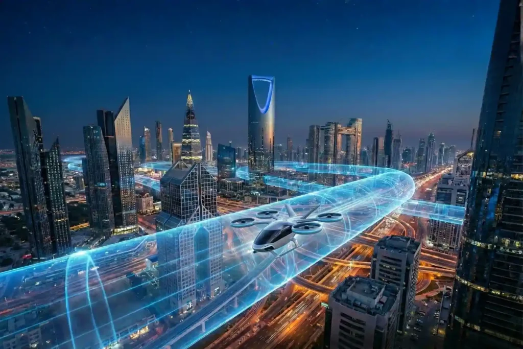
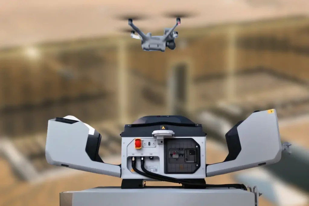
For decades, we have looked at the sky above our cities as an open, unstructured void. While our roads became congested and our ground-level infrastructure reached its physical limits, the airspace remained the “final frontier” for urban transport. However, as we move through 2026, that void is being filled. A quiet revolution is occurring just […]
Securing Marine Assets with ROV Inspection and Subsea NDT.
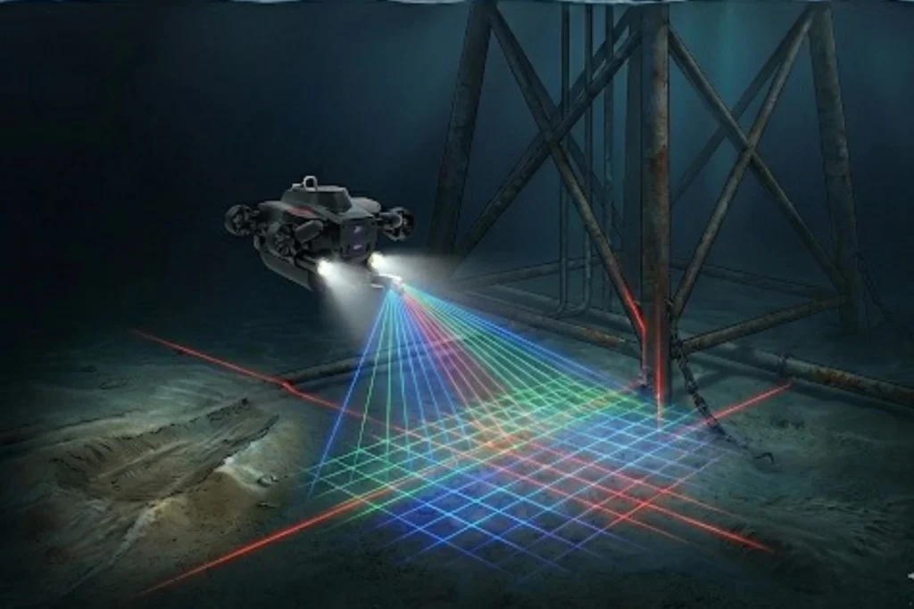
While the world marvels at the soaring skyscrapers of Riyadh and the mirrored walls of NEOM, a second, equally ambitious infrastructure revolution is taking place beneath the waves. Saudi Arabia’s maritime infrastructure, spanning the Red Sea and the Arabian Gulf is home to a vast, invisible network of subsea lifelines, including oil and gas pipelines, […]
The 2025 Recap from Terra Drone Arabia
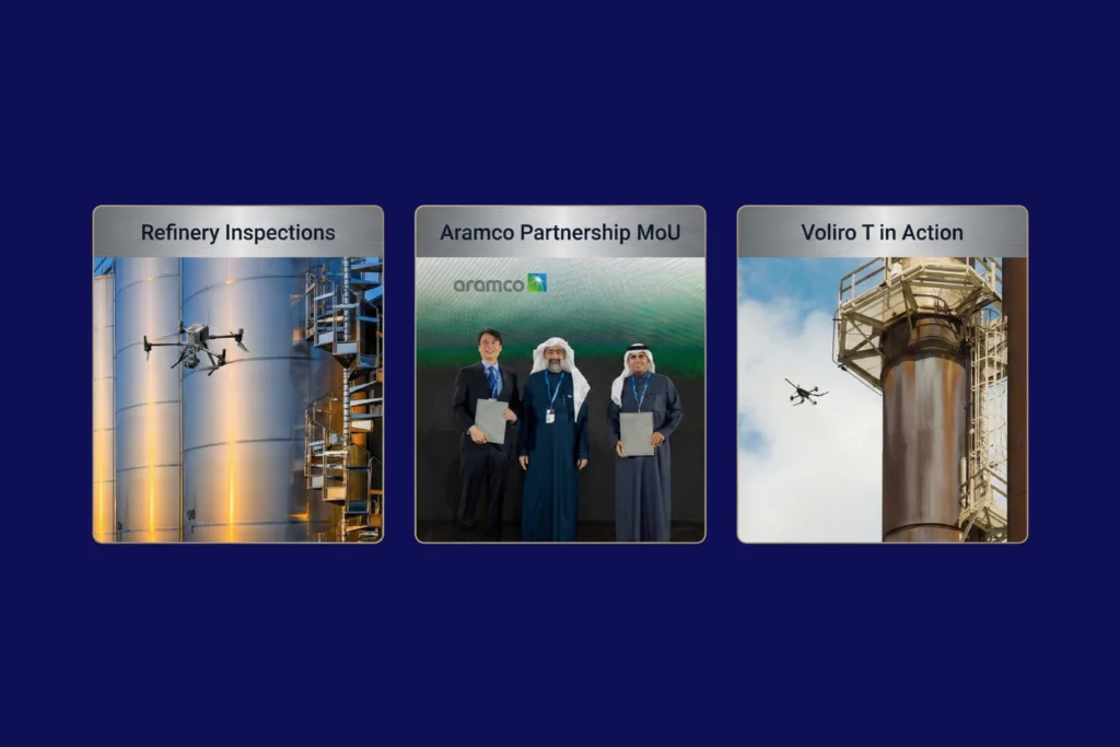
As the curtain falls on 2025, the industrial landscape of Saudi Arabia stands fundamentally altered. What was once a horizon dominated by traditional manual labor and terrestrial surveying has transitioned into a high-velocity, data-driven domain known as the Low Altitude Economy (LAE). At the heart of this revolution is Terra Drone Arabia (TDSA). This Terra […]
The Involvement of the UAV and ROV in Offshore Industry
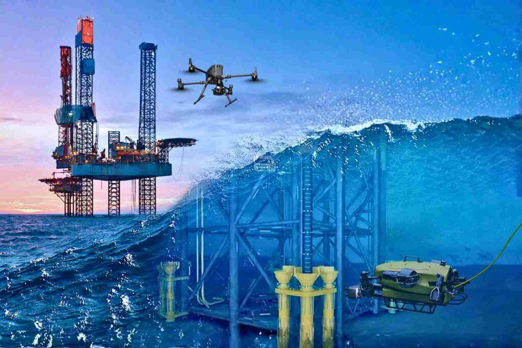
Offshore Operations in a High-Risk, Data-Driven Era The offshore energy sector operates on the edge of what is physically possible. Platforms stand isolated in the middle of the ocean, battered by saltwater, high winds, and unpredictable currents. In this hostile environment, the challenge of maintaining infrastructure is immense. Steel corrodes faster, structural fatigue sets in […]
Autonomous Maintenance: How the low altitude economy Will Inspect NEOM’s The Line in 2026
The Density Challenge When we talk about NEOM’s The Line, we are not discussing a standard skyscraper. We are talking about a continuous, 170km-long structure where structure and facilities are bound together in a straight, vertical line. Unlike traditional cities where utilities are spread out horizontally, The Line compresses everything from energy, water, transport, and […]
Milestones to Watch in 2026 as Saudi Arabia Advances Vision 2030
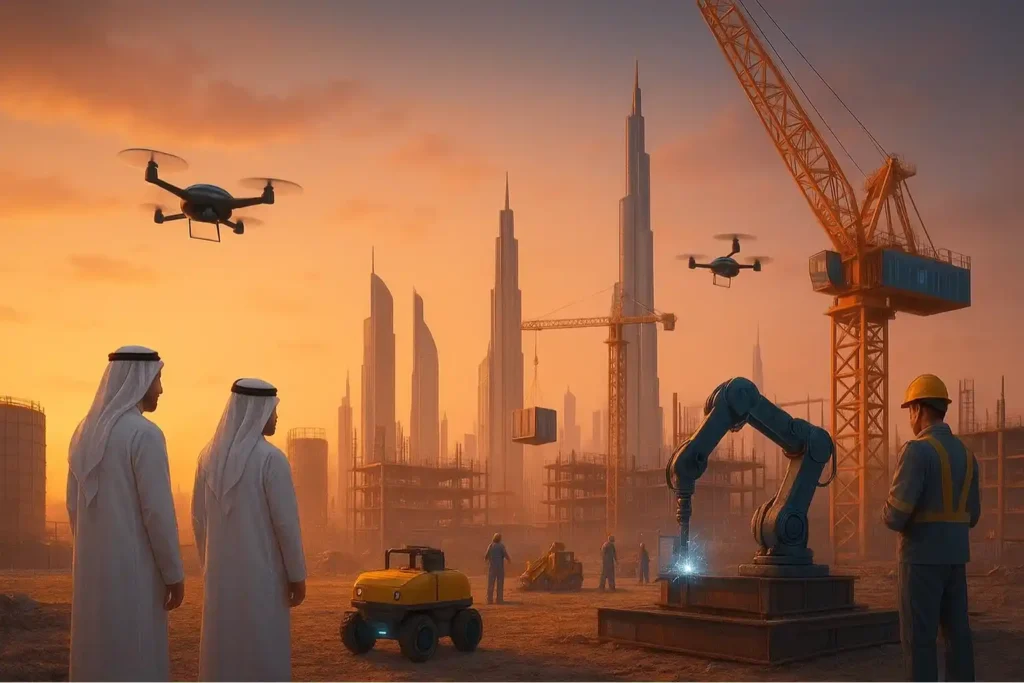
The Year of Realization For the past seven years, the world has watched Saudi Arabia move earth and sand on a scale never seen before. We have witnessed the largest construction sites in history, from the mountains of Trojena to the coasts of the Red Sea. But as we approach 2026, the narrative is changing. […]
Integrated Aerial, Terrestrial, and Marine Inspection Framework for Industrial Asset Integrity

The Three-Dimensional Integrity Challenge Managing major infrastructure from long-distance pipelines and highways to offshore oil facilities, is a massive task. Asset owners in the MENA region face the immense challenge of maintaining structural health across all three major environments: air (high-altitude assets), land (linear corridors), and sea (submerged foundations). The traditional approach to managing these […]
The Coastal Imperative: Why ROV-Based Monitoring is Essential for Maintaining Saudi Vision 2030’s Offshore and Port Infrastructure.
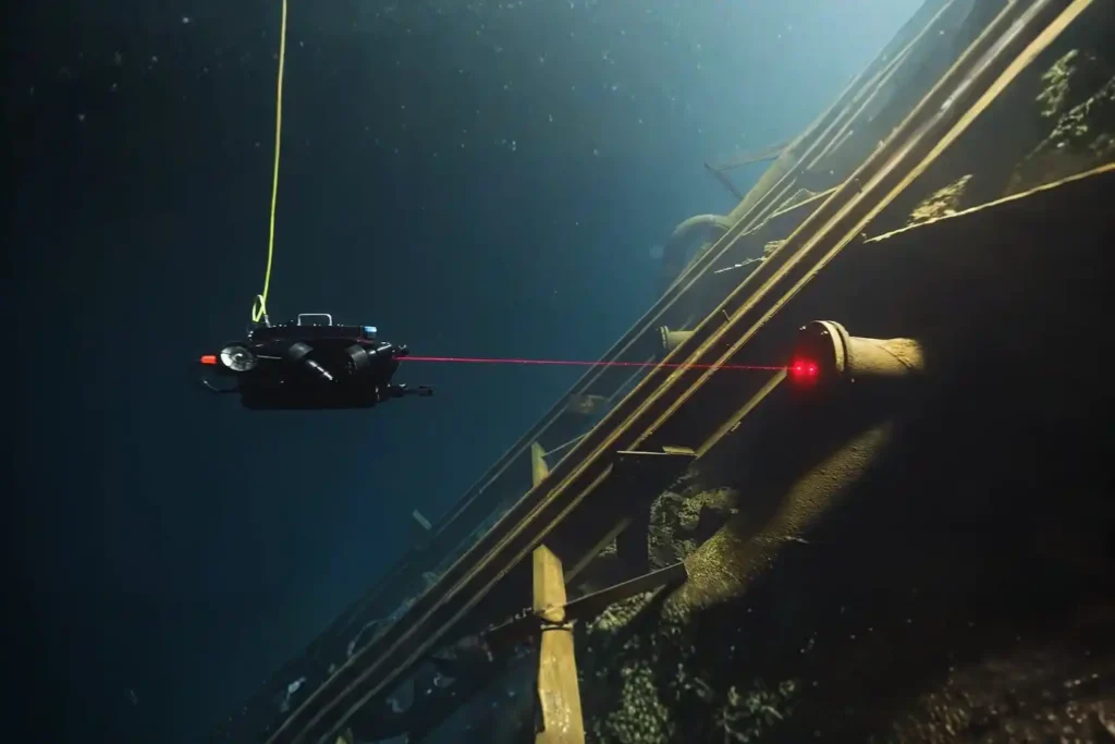
The Challenge Beneath the Surface The foundations of the MENA economy, jetties, bridges, seawalls, port facilities, and offshore energy platforms. They rely on submerged infrastructure. These assets face a brutal, unseen enemy: the marine environment. Constant exposure to seawater, which is highly corrosive, leads to material loss. This structural decay is worsened by biofouling, the […]
ROV-Based Monitoring for Marine Infrastructure and Coastal Inspection Assets
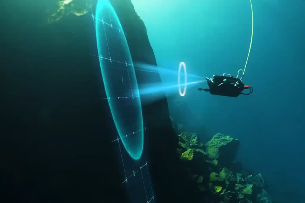
The Challenge Beneath the Surface The foundations of the MENA economy—jetties, bridges, seawalls, port facilities, and offshore energy platforms—rely on submerged infrastructure. These assets face a brutal, unseen enemy: the marine environment. Constant exposure to seawater, which is highly corrosive, leads to material loss. This structural decay is worsened by biofouling—the rapid growth of marine […]
Revolutionizing Corrosion Inspection With Drone-based Visual and UT Systems
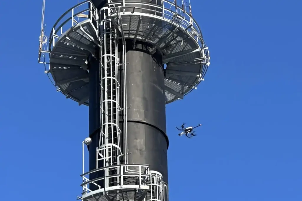
The Corrosion Inspection Challenge Corrosion is the silent and relentless enemy of metal assets—remains the leading cause of unplanned shutdowns, containment failures, and devastating safety risks across the oil & gas, petrochemical, and heavy industrial sectors. In the demanding environments of the MENA region, assets like storage tanks, pipelines, and flare stacks face extreme pressure […]
