The vast, intricate road and highway network is the undisputed backbone of the modern economy, especially across the swiftly developing MENA region. These vital transportation arteries, which stretch across great distances, face constant challenges: rapid material breakdown from harsh climates, ceaseless heavy traffic, and the severe safety risks tied to manual maintenance. Inspecting and caring for these complex, linear assets—like elevated bridges and long corridors is a monumental logistical and safety puzzle.
This immense responsibility calls for a fundamental shift: moving away from slow, expensive, and dangerous reactive maintenance toward intelligent, predictive asset care. The critical step in this transformation is the aerial perspective provided by Unmanned Aerial Systems (UAS) drones. Drones are now essential for modern infrastructure management because they offer unparalleled speed, high data accuracy, and enhanced personnel safety.
This comprehensive editorial explores how drone technology provides immediate and lasting value across the entire infrastructure lifecycle, establishing a new, safer, and faster benchmark for highway inspection.
The Infrastructure Imperative
The economic stability and long-term safety of the Kingdom and the wider region depend heavily on keeping the transportation network sound. However, managing this immense asset base using traditional, manual methods is no longer a viable option.
Manual inspection requires costly actions like closing traffic lanes, renting expensive equipment like scaffolding and cherry pickers, and, most critically, forcing human inspectors into high-risk zones, such such as elevated bridges or areas with heavy, fast-moving traffic. This old way is slow, dangerous, and extremely inefficient.
The solution is digital, objective, and non-contact. The drone’s core strength is providing a detailed, repeatable aerial view, transforming the slow, dangerous process of highway inspection into a fast, digital, and fully auditable workflow. The total benefit of drone use touches every phase of a highway’s life from the initial blueprint to decades of operation.
The Foundation and The Build
The application of drone technology begins the moment a new road is planned, guaranteeing that the project starts with a perfect, high-quality digital foundation.
I. Precision Mapping for New Design and Rehabilitation

The initial phase of any highway project—whether building new roads or overhauling existing ones is the most critical for budget and safety. Drones transform this process from a guesswork exercise into a fully transparent, digitally integrated workflow.
A. LiDAR for Digital Terrain Modeling (DTM) and Subsurface Integrity
- For linear infrastructure like highways, precise terrain data is non-negotiable. LiDAR systems provide the superior geometric accuracy needed for civil engineering design.
- The Technical Edge: Bare-Earth Penetration
- Pulse Technology: Our drone-mounted LiDAR systems are active sensors that emit millions of laser pulses per second, measuring distance by recording the time a pulse takes to return. This creates a high-density, three-dimensional point cloud.
- DTM Generation: The key technical advantage is the LiDAR’s ability to record multiple returns per laser pulse. This allows the system to effectively filter out surface features like scrub, trees, or construction debris, isolating the true ground elevation to create an accurate Digital Terrain Model (DTM). This DTM is the essential foundation for calculating road drainage, slope stability, and horizontal alignment.
- Corridor Integrity: This geometric data is used to identify precise gradient changes, define the critical right-of-way boundaries, and spot potential geological hazards along the lengthy highway corridor.
- Geometric Accuracy and Quality Assurance
- Centimeter Precision: High-end LiDAR and GNSS systems ensure the data is collected with centimeter-level accuracy, which is a requirement for 1:500 scale engineering surveys.
- Subsurface Modeling: The initial survey data is also essential for integrating follow-on data, such as utility maps created through Ground Penetrating Radar (GPR). This provides a complete 3D picture of any existing underground utilities (cables, pipelines) that could conflict with the new highway design.
B. Photogrammetry for Visual Accuracy and Design Integration
- While LiDAR provides the geometric skeleton, photogrammetry supplies the visual texture and facilitates crucial digital checks against the design.
- Creating the Auditable Orthomosaic
- RTK Geo-referencing: Drones capture thousands of high-resolution, overlapping images that are processed into a single, seamless Orthomosaic Map. This map is geometrically corrected and precisely aligned using RTK (Real-Time Kinematic) positioning, ensuring the visual data is just as accurate as the LiDAR geometry.
- Visual Documentation: The Orthomosaic Map becomes the primary visual record for the project, showing existing infrastructure, land use, and site conditions without distortion, which is key for engineering review.
- Digital Integration and Error Mitigation
- BIM/CAD Workflow Acceleration: The processed photogrammetry and LiDAR data are immediately converted into formats that integrate seamlessly into BIM (Building Information Modeling) and CAD software. This direct flow minimizes the manual transcription errors common in legacy surveying.
- Design Validation: Engineers use the high-fidelity aerial data to overlay the planned highway design model onto the actual terrain data. This Drone-BIM integration has been shown to reduce design errors by up to \mathbf{65\%}, allowing teams to catch conflicts and discrepancies early, which saves massive amounts of money and time during the earthwork phase.
- Volumetric Analysis: The accurate digital elevation models (DTMs) are used for precise cut-and-fill analysis and material stockpile measurements, ensuring material logistics are optimized and budgets are strictly controlled.
II. Quality Control and Earthwork Efficiency During Construction
Once construction is active, drones become the project manager’s most reliable auditing tool, ensuring work meets the required quality and safety standards.
A. Earthwork and Volumetric Analysis
Accurate earthwork calculation is fundamental to controlling costs and material flow in highway construction.
- Cut-and-Fill Analysis: Frequent, automated drone flights capture 3D models used for precise cut-and-fill measurements and stockpile analysis. This ensures material logistics are optimized and prevents expensive overages or material shortages.
- Rework Mitigation: This high-resolution data ensures that the ground surface is prepared perfectly and aligns with design specifications before expensive asphalt paving begins. By feeding this up-to-date aerial survey data into digital models, Drone-BIM integration has been shown to reduce design errors by up to $\mathbf{65\%}$, significantly cutting down on rework.
B. Real-Time Progress Monitoring and Safety
- Progress Tracking: Drones generate up-to-date 3D models to track physical progress against project milestones. This creates a reliable, objective, and visual timeline of the construction process.
- Site Safety: Drones quickly and safely inspect large, active construction areas, identifying hazards like unstable structures or unauthorized equipment placement without putting human workers in danger. This capability enhances compliance with health and safety regulations.
Operational Value and Intelligence
The greatest return on investment comes from using drone data during the long operational life of the highway, where small, undetected defects can quickly escalate into costly structural failures.
III. The Predictive Shift in Asset Management (Inspection & Maintenance)
Drones eliminate the need for traffic disruption and high-risk setups when inspecting complex highway structures.
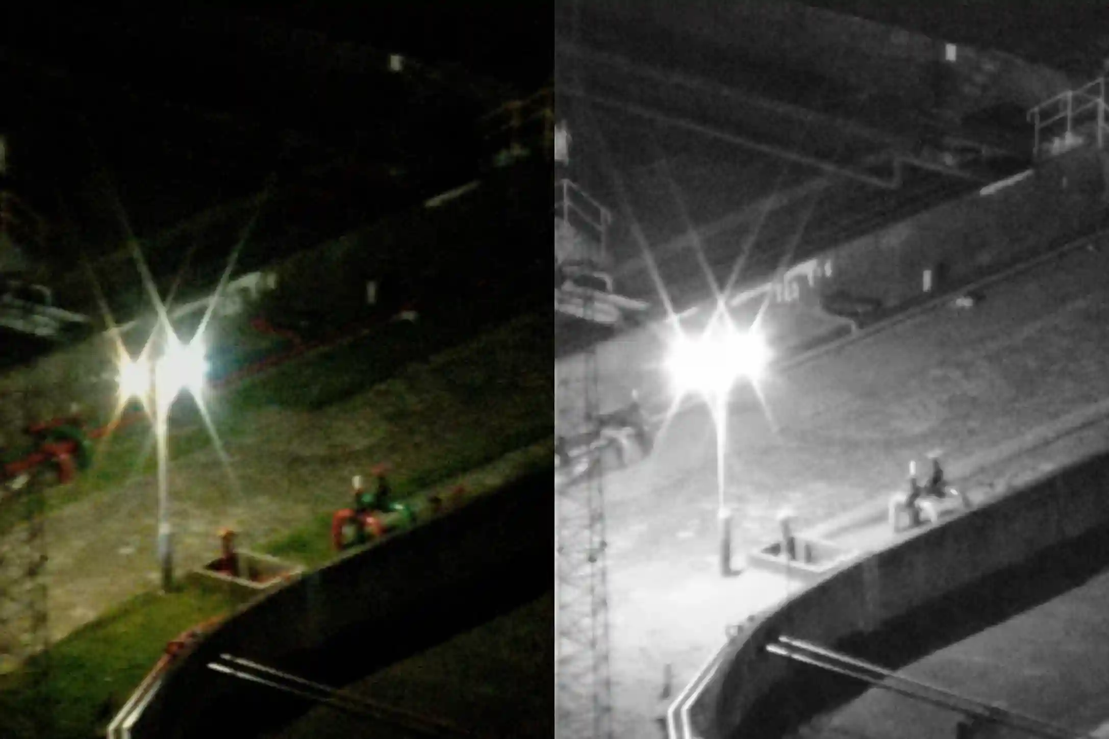
A. Critical Bridge and Pavement Inspection
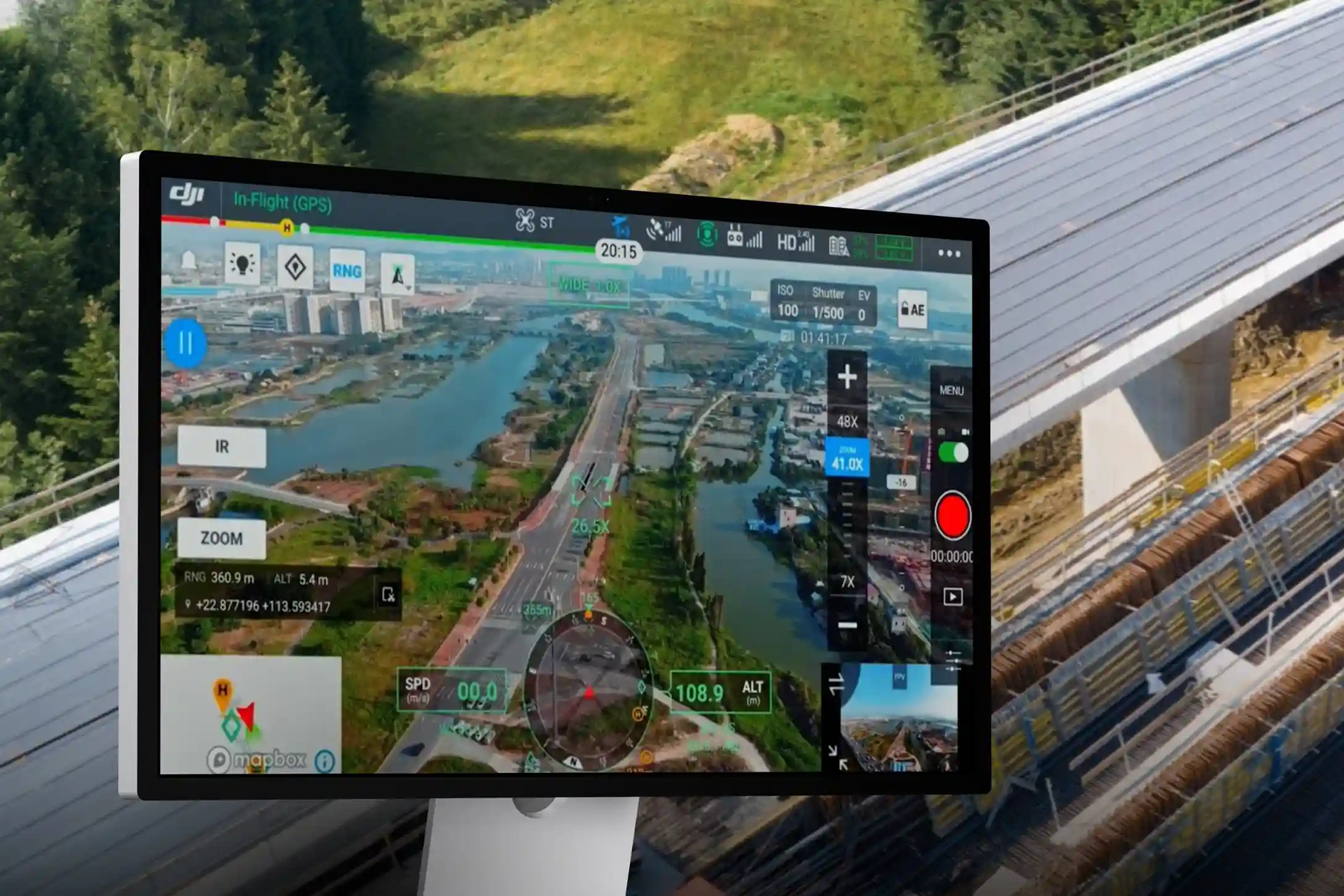
- Bridge Structures: Drones navigate precise, automated paths around bridge decks, columns, and substructures. They use high-resolution cameras to scan for tiny surface flaws like concrete cracks and corrosion. Crucially, drone inspections can reduce asset inspection times by $\mathbf{4\times}$ compared to traditional manual methods, enabling rapid and effective preventive maintenance.
- Pavement Condition: High-resolution drone cameras quickly collect data used to map and classify pavement damage, such as cracking and rutting. This accurate data allows agencies to prioritize repairs effectively.
B. Advanced Sensor Applications
- Thermal and Subsurface Analysis: Advanced payloads, including thermal cameras, detect temperature changes across pavement and bridge surfaces. These hidden anomalies often reveal subsurface issues like water intrusion or void spaces beneath the roadbed that human eyes cannot see. Early thermal mapping prevents small issues from growing into major structural failures.
- NDT Readiness: Drones perform the preliminary aerial assessment to visually identify high-risk areas (e.g., corroded joints or welding flaws). This efficient, non-contact assessment eliminates guesswork and directs specialized human NDT teams to the exact spot needing physical testing, maximizing efficiency.
IV. Beyond Infrastructure: Traffic, Safety, and the Smart Highway
The data acquired during a highway inspection is a valuable input for broader smart city management, making the road network a truly intelligent asset.
A. Real-Time Traffic Management and Safety
- Aerial Surveillance: Drones, often deployed for stable, long-duration monitoring, provide a consistent aerial perspective over intersections and high-traffic areas.
- Flow Analysis: AI algorithms process the drone video to automatically extract precise vehicle trajectories and speeds. This data is essential for Intelligent Transportation Systems (ITS) to optimize signal timing, manage lane distribution, and forecast congestion before it occurs.
- Accident Response: After an incident, drones are quickly launched to capture high-resolution imagery to reconstruct the accident scene accurately and quickly. This reduces site time and minimizes traffic disruption.
B. The Digital Twin Highway
- Data Chronology: All recurring data from LiDAR terrain models to monthly pavement reports is continuously updated in a master digital twin environment.
- Predictive Modeling: Asset managers use the Digital Twin to run simulations that predict which section of pavement will fail next under various conditions. This capability allows for highly sophisticated predictive maintenance planning, ensuring resources are used proactively and efficiently. The overall intelligence derived from highway inspection moves spending from reactive emergencies to planned, controlled projects.
The Future of MENA Transportation Network
The undeniable benefits of cost savings, time efficiency, and enhanced safety have made drone technology an indispensable tool for modern infrastructure management. This technology can reduce inspection times and eliminates the need for expensive, risky equipment.
As your trusted, certified local partner, providing the expertise required to transition to this aerial advantage. We possess the needed hardware and the local compliance knowledge to deliver objective, repeatable, and high-resolution data for every highway inspection mission.
Claim your FREE 3-month progress monitoring with no questions asked to accelerate your shift to predictive asset management and experience. Take action today to future-proof your critical transportation network.