How Drones Cut Oil & Gas Inspection Time from 2 Weeks to 4 Hours

Capturing the Inspection Challenge Oil and gas remain central to Saudi Arabia’s economy and are critical to achieving the ambitions of Vision 2030. But maintaining the sector’s massive infrastructure from refineries and pipelines to storage tanks has always been a time-consuming, expensive, and risky process. Traditional inspections often rely on scaffolding, cranes, and shutdowns that […]
Drones as a Pillar of Vision 2030: Integrating National Strategy and Unmanned Aerial Systems

Saudi Arabia’s Vision 2030 is one of the most ambitious transformation programs in the world, aiming to diversify the economy, empower new industries, and deliver smarter, more sustainable cities. Achieving these goals requires advanced digital technologies, and drones are quickly proving themselves to be a pillar of this national strategy. Globally, drones have reshaped industries […]
How DJI Dock 3 Saves City Surveillance Budget by 30%

Capturing the Smart City Challenge The growth of modern cities is accelerating at a scale that challenges traditional infrastructure. By 2050, over 68% of the global population is expected to live in urban centers, with cities like Riyadh, Dubai, and Jeddah already experiencing rapid expansion. This growth introduces a complex mix of challenges: Population Density: […]
8x Faster Your Minerals Exploration With Drone and Satellite Applications
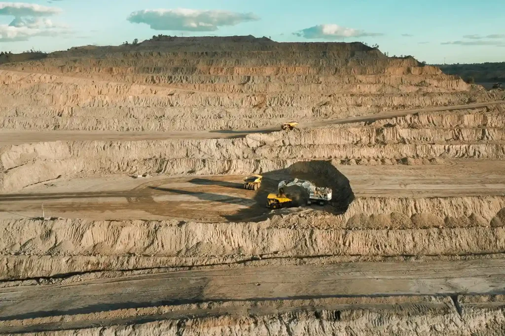
The Evolving Challenges of Mineral Exploration The race for critical minerals has intensified. Copper, lithium, cobalt, and rare earths are in unprecedented demand to power renewable energy, electric vehicles, and digital technologies. By 2040, lithium demand could reach 1,326 kt, copper 36,379 kt, and rare earths 169 kt. But traditional mineral exploration methods struggle to […]
Cut Survey Labor Costs by Up to 60% with High-Accuracy Drone Surveys

Precision from the Ground Up A High-Accuracy Drone Survey is the foundation for efficient solar and wind energy projects. In renewable development, the land beneath your infrastructure determines how much energy you generate and how much profit you keep. For solar farms, even small slope errors can reduce sunlight capture. A misalignment of just a […]
How a Drone Topographic Survey Cuts Renewable Energy Site Prep Time by Up to 90%

In renewable energy development, the efficiency of a solar farm or wind park begins long before the first panel or turbine is installed. It starts with the precision of the terrain data. Even minor errors in elevation, slope, or site orientation can lead to long-term energy losses, unnecessary maintenance costs, and reduced return on investment. […]
How Drones Cut 8 hours to 30 Minutes in Topographic Survey

Drone Topographic Mapping is rapidly redefining how utility providers and EPC firms approach transmission line surveys. In a region where megaproject timelines are non-negotiable, particularly in Saudi Arabia and across the MENA region, traditional methods simply can’t keep pace with modern demands. 1. Why Timelines Matter in Power Transmission Projects In Saudi Arabia’s ambitious energy […]
How Drone Topographic Surveys Improve Power Transmission Project Timelines

Drone topographic surveys are transforming how we map and deliver power transmission projects. With growing energy demands and infrastructure targets tied to Saudi Arabia’s Vision 2030, utility providers and EPC contractors face intense pressure to optimize construction schedules and reduce planning delays. Traditional ground-based survey methods, while accurate, are often slow, labor-intensive, and prone to […]
Why 16.5% Market Growth in MEA Demands Smarter Drone Ground Support Now

The commercial drone market in the Middle East & Africa (MEA) is entering a phase of rapid expansion valued at $1.60 billion in 2023 and projected to nearly triple to $4.65 billion by 2030, growing at a CAGR of 16.5% from 2024 onward. This surge reflects increasing reliance on drone technology across industries such as […]
Retail Drone Delivery: Solving Last-Mile Logistics

Retail drone delivery operations are transforming the last mile of the supply chain—a stage traditionally known for being the most expensive and inefficient. As e-commerce continues to expand, retailers face growing pressure to deliver goods faster while keeping costs low. Conventional delivery methods struggle to meet this demand due to road congestion, fuel costs, and […]