Powerline Inspection: Redefining How Its Utility Is Managed

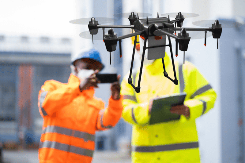
Powerline inspection visual data collecting can be a lengthy process for several reasons, even with a large team involved. Here are the key factors that contribute: Scale and Scope of Power Grids: Power grids cover vast areas, often extending over thousands of kilometers with multiple branches and components. Inspecting every line, pole, transformer, and other infrastructure component is inherently time-consuming due to the extensive network. Accessibility Challenges: Many powerlines are located in remote or hard-to-reach areas, such as mountains, forests, or across water bodies. Accessing these sites can be challenging and time-consuming, often requiring specialized equipment and vehicles. Data Quality and Detail: High-quality visual inspections involve not just a quick overview but a detailed check of each component. Inspectors look for cracks, corrosion, sagging, and other potential issues that might take time to be apparent. This level of detail requires time at each inspection site. Weather and Environmental Conditions: Inspections are often dependent on weather conditions. Adverse weather like rain, fog, or high winds can delay inspections because they not only make access more difficult but also impair the quality of visual data collected. Data Processing and Analysis: After collecting the visual data, significant time is required to process and analyze this information. With the volume of data collected, especially using high-resolution cameras or drones, processing and interpreting the data to identify issues and determine the health of the infrastructure can extend the timeline. Safety Protocols and Compliance: Ensuring the safety of the inspection teams and compliance with regulatory requirements also adds to the duration. Each inspection must be carried out with strict adherence to safety standards, which can limit the speed of work, especially in hazardous areas. Coordination and Logistics: Managing a large team and coordinating their tasks efficiently across a wide area involves substantial logistical efforts. Ensuring that all teams are equipped, in the right place, and working in sync is a complex task that impacts the overall timeframe. These factors combined mean that even with a substantial workforce, the process of comprehensively inspecting a power grid and analyzing the collected data can take a year or more. Furthermore, this practice is exposed to heightened risks while working on scaffolds or cranes, largely due to a complex interplay of various factors that compromise their safety. Firstly, the very act of working at significant heights inherently increases the likelihood of serious injury or death should a fall occur. Additionally, the stability of these high platforms can be compromised by improper setup, uneven terrain, or mechanical failures. The conditions under which these professionals operate can further exacerbate these risks. Adverse weather conditions, such as high winds, rain, or ice, can make the surfaces of scaffolds slippery and unstable, increasing the risk of falls. The physical condition of the equipment itself is equally critical; scaffolds and cranes that are worn out, damaged, or poorly maintained are prone to failure, which can precipitate accidents. Furthermore, the risks are compounded by human-related factors, such as improper use or assembly of the equipment. Using scaffolding or cranes on uneven surfaces, failing to utilize stabilizers correctly, or overloading the equipment can lead to unstable working platforms. Additionally, the lack of proper personal protective equipment (PPE) such as harnesses, lanyards, and helmets, or the improper use of these, can leave workers vulnerable to injuries. Human error also plays a crucial role in the safety of powerline inspectors. Mistakes made during climbing, overreaching, or failure to secure tools and materials can disrupt the balance or entangle the structure, leading to falls. The absence of adequate training and safety awareness concerning working at heights and equipment operation can lead to critical oversights. Moreover, fatigue and excessive workload contribute to impaired judgment and reduced physical capability, further heightening the likelihood of accidents. Thus, powerline inspectors must navigate a myriad of challenges that require strict adherence to safety protocols, proper equipment maintenance, and continuous training to mitigate the multifaceted risks associated with their high-altitude work environments. However, this inspection has been revolutionized by the advent of drone technology. Drones have transformed many industries, and powerline inspection is no exception. By leveraging advanced technology, drones, also known as utility inspection drones or powerline surveillance drones, are revolutionizing how we inspect and maintain powerlines. The traditional methods of powerline inspection have their limitations, and this is where drones come in, providing safer, more efficient, and cost-effective solutions. Regular inspection of powerlines is crucial to maintaining the integrity and reliability of electrical grids. Powerlines are the backbone of our electricity infrastructure, and any damage or faults can lead to significant disruptions and hazards. Therefore, ensuring that powerlines are in good condition is vital for both public safety and the continuity of electrical services. The integration of drone technology into powerline inspections marks a significant shift from traditional methods. Drones equipped with high-resolution cameras and sensors can quickly and efficiently inspect powerlines, providing detailed data that helps in the early detection of issues. This not only enhances the effectiveness of inspections but also reduces the risks associated with manual inspections. The Need for Powerline Inspection Maintaining the integrity of power through regular inspections has other numerous benefits. It helps in identifying potential problems before they escalate, ensuring uninterrupted power supply, and saving 30%-50% of money and time through several efficiencies and cost-saving mechanisms. Here is how they achieve these savings in both financial and temporal aspects: Saving Time: Increased Coverage Speed: Drones can fly quickly along powerlines and cover large distances in a fraction of the time it would take for ground crews or manned aircraft inspections. This rapid coverage means that more of the grid can be inspected in less time, leading to faster completion of inspection cycles. Immediate Data Acquisition: The data collected by drones is available in real-time or near real-time, which allows for immediate analysis and action. This immediacy reduces the cycle time from problem identification to decision-making compared to traditional methods that might require developing film or processing data from manual inspections. Reduced Setup Time: Drones eliminate the
Disaster Recovery Drones: Speeding Up Response Times

Disaster recovery drones are revolutionizing the rapid response protocols in the energy sector, especially following natural disasters. In the wake of such events, rapid response and efficient assessment are crucial for the recovery of energy infrastructure. Drones, or unmanned aerial vehicles (UAVs), are increasingly playing a pivotal role in these efforts, showcasing their capability to assess damage quickly and streamline the recovery process. Immediate Damage Assessment with UAVs When disasters strike, the initial challenge for energy companies is the rapid assessment of the damage inflicted on their infrastructure. Drones are uniquely suited for this task due to their ability to quickly cover large and often inaccessible areas. Equipped with high-resolution cameras and other sensors, they provide real-time images and data that are vital for assessing the extent of damage. This immediate aerial surveillance allows utility companies to prioritize their responses effectively, focusing resources where they are needed most to restore power swiftly and safely. The information gathered by drones helps in creating a clear picture of the disaster’s impact, which is crucial for coordinated recovery efforts. Enhancing Recovery Efforts and Service Restoration Drones not only assess the damage but also play a significant role in the actual recovery process. By providing detailed, accurate data, drones help energy companies deploy their recovery teams more effectively, ensuring that repairs are carried out promptly and efficiently. This capability is especially important in large-scale disasters where the quick restoration of services can prevent further economic losses and safety hazards. Drones reduce the downtime of critical infrastructure by allowing companies to address the most severe damages first, which speeds up the overall recovery process. Building Resilience for Future Disasters Looking forward, drones also offer the potential to enhance disaster preparedness and build more resilient energy infrastructures. Continuous drone monitoring can identify vulnerabilities in the energy grid before they are exacerbated by natural disasters, allowing for preemptive repairs and upgrades. Moreover, the data collected by drones can be used to simulate various disaster scenarios and improve disaster response strategies. This ongoing assessment and planning foster a more resilient infrastructure capable of withstanding future challenges. In A Nutshell Drones are transforming disaster recovery in the energy sector by providing fast, reliable assessments and aiding in efficient service restoration. As this technology continues to advance, its role in improving disaster preparedness and building resilient energy infrastructures is set to expand, promising enhanced safety and stability for the future.
Terra Drone Arabia Showcases Advanced Drone Solutions at the 2nd Asset Integrity & Process Safety Conference & Exhibition 2024

Bringing World-Class Drone Technology to Saudi Arabia’s Asset Integrity Sector Jubail, Saudi Arabia – Terra Drone Arabia, a leader in providing advanced drone and geospatial solutions, is proud to announce its participation as an exhibitor at the 2nd Asset Integrity & Process Safety Conference & Exhibition 2024. Hosted by the Royal Commission for Jubail & Yanbu, this pivotal event is set to take place from 23rd to 25th April 2024 at the King Abdullah Cultural Center in Jubail. The conference, under the theme “Obtaining Excellence by Aligning Asset Integrity & Process Safety Strategies with Business Objectives,” brings together industry leaders to explore critical trends and technologies. Terra Drone Arabia will feature its innovative drone technologies specially designed for the oil & gas, petrochemical, and refinery industries. With practical applications and best practices developed through global partnerships with industry giants such as Aramco, ADNOC, and ExxonMobil, Terra Drone Arabia aims to demonstrate how drone technology can significantly enhance asset integrity management. As a new player in the Saudi market, Terra Drone Arabia aims to establish its presence and showcase its capability to provide cutting-edge inspection services using drones. These services leverage the company’s extensive international experience and are supported by an R&D center in the Netherlands that focuses on innovative solutions for inspections and asset integrity. “Terra Drone is here and ready to support the Kingdom with practical use cases,” said Kota Kandori, Executive Director of Terra Drone Corporation and General Manager of Terra Drone Arabia. “Having secured all necessary licenses, we are introducing top-tier drone solutions to Saudi Arabia, including advanced drones for non-destructive testing (NDT) inspections and automated inspection data management platforms.” In an effort to integrate smoothly into the market, Terra Drone Arabia is offering free proofs of concept (POCs) and trials, allowing potential clients to firsthand experience the effectiveness of drone technology in boosting asset integrity management. Event Overview The oil, gas, and petrochemical sectors are pivotal in the Kingdom and rely heavily on maintaining optimal performance for profitability. The Asset Integrity and Process Safety Conference & Exhibition serves as a crucial platform, highlighting the interconnection of asset integrity and process safety. This year’s focus will enhance discussions on corrosion control, predictive and preventive maintenance, HAZOP, risk-based inspection (RBI), and digital transformation, with a special emphasis on piping, both above ground and buried, including FRP. The conference will provide a vital platform for professionals in asset integrity, process safety, pipeline management, reliability, inspection, NDT & NDE, corrosion control, and operations to share knowledge and showcase technological advancements to address the challenges faced by the industry. — About Terra Drone Arabia: Terra Drone Arabia aims to be the premier provider of drone and geospatial solutions in the Middle East and Africa. With a mission to empower businesses through advanced technologies, Terra Drone Arabia offers a wide range of services including land surveying, bathymetry, and data processing, among others. As part of Terra Drone Corporation, a globally recognized drone startup, Terra Drone Arabia leverages its international presence and expertise to deliver comprehensive solutions across various industries. The expansion into the KSA market underscores Terra Drone’s commitment to fostering innovation and supporting Saudi Arabia’s Vision 2030 objectives.
How BIM and Drones Elevate Efficiency of Building Smarter

BIM and drones in the evolving landscape of construction technology stand out as a game-changer. This powerful combination is revolutionizing construction workflows, leading to unprecedented levels of operational efficiency. For project managers, architects, engineers, and industry professionals, understanding this integration is key to driving success in modern construction projects. Synergy Between BIM Software and Drone Technology The integration of BIM and drone technology creates a robust framework for managing complex construction projects. Drones provide aerial data that BIM software uses to enhance the virtual construction environment, making it richer and more accurate. This synergy not only streamlines project phases but also ensures that they are executed with greater precision. Key Improvements in Construction Workflows Increased Accuracy and Reduced Errors High-resolution data captured by drones is seamlessly integrated into BIM systems, significantly reducing discrepancies and preventing costly errors. Frequent aerial updates ensure that BIM models remain accurate and reflective of real-world conditions, crucial for maintaining construction integrity and adherence to planned outlines. Improved Project Management Real-time insights provided by drones enhance decision-making and communication across teams. Project managers gain a bird’s-eye view of the site, helping them oversee operations more effectively and respond swiftly to any arising issues. This capability ensures that projects stay on track and within budget, boosting overall construction site productivity. Read why is this so: Drones in Construction: Why Project Managers are Using Them Cost Efficiency The speed and precision of drone surveys reduce the time and resources traditionally required for data collection, thus lowering operational costs. Moreover, the accuracy of drone data minimizes rework by catching potential issues early in the construction process, and optimizes resource allocation—each contributing to a more cost-effective project execution. In A Nutshell The collaboration between BIM and drone technology is not just enhancing construction project outcomes—it’s redefining them. By leveraging this integration, construction professionals can achieve higher accuracy, improved management efficiency, and greater cost savings. As we continue to embrace these advancements, the construction industry is set to become smarter, safer, and more sustainable.
Drones in Construction Transformative Power

In the dynamic field of drones in construction, they are playing an increasingly pivotal role. These versatile tools are reshaping traditional methodologies, bringing about significant improvements in accuracy, safety, and environmental management. This post explores the diverse benefits that drones bring to construction projects, catering to construction workers, site managers, and technology enthusiasts alike. Enhanced Data Collection and Mapping with Real-Time Results Drones are revolutionizing the way data is collected in construction sites. Equipped with high-resolution cameras and sophisticated sensors, UAVs offer unparalleled drone mapping and survey capabilities. This allows for the creation of accurate, real-time maps and models, significantly enhancing project planning and execution. Drones streamline the data collection process, offering a propeller platform that rapidly gathers and processes geographical and structural information. This capability is crucial for maintaining up-to-date site conditions, which is essential for the efficient management of construction projects. Improved Inspection and Quality Control The integration of drones in construction not only enhances project monitoring but also elevates the standards of quality control. Through thermal imaging, drones can detect hidden problems such as water leaks, structural faults, and insulation issues without the need for disruptive, time-consuming manual inspections. This technological advancement enables site managers and solution architects to maintain high standards of quality and safety, ensuring that every aspect of the project aligns with the desired specifications and regulatory requirements. Increased Safety by Eliminating the Need for Manual Inspections in Dangerous Areas One of the most significant impacts of drone technology in construction is the enhancement of safety. By employing drones for routine inspections, the need for manual site checks in hazardous conditions is greatly reduced. This not only safeguards the well-being of workers but also enhances overall site safety—a critical concern in construction management. Drones perform risk assessments and monitor ongoing activities without exposing personnel to potential dangers, thus fostering a safer working environment. This approach not only complies with health and safety regulations but also streamlines the workflow, reducing downtime and potential injury-related delays. Read more: Environmental Impact Assessments Drones contribute significantly to environmental conservation efforts within construction projects. They are used extensively for environmental impact assessments, monitoring areas for wildlife presence, vegetation boundaries, and other ecological elements that might be affected by construction activities. With the ability to survey large and inaccessible areas quickly, drones provide valuable data that helps in planning and implementing construction strategies that minimize environmental disruption. This responsible management of construction sites not only enhances community relations but also aligns with global sustainability goals. In A Nutshell The utilization of UAVs in construction represents a leap forward in how construction projects are managed and executed. From boosting data accuracy to enhancing safety and reducing environmental impacts, drones are integral to modern construction practices. As technology continues to advance, the integration of drones with systems like BIM will further revolutionize this industry, making it smarter, safer, and more sustainable.
The Integration of Drones and Building Information Modeling (BIM)

In the rapidly evolving world of construction technology, the integration of drones and Building Information Modeling (BIM) stands out as a pioneering advancement. This powerful combination enhances architectural planning, structural engineering, and project management, revolutionizing how projects are approached, managed, and executed. By marrying aerial insights with detailed 3D modeling, the construction industry is achieving unprecedented levels of precision and efficiency. The Evolution of Construction Technology The digitization of the construction industry has been significantly bolstered by advanced tools such as unmanned aerial vehicles (UAVs) paired with BIM technology. These innovations provide a dynamic platform for professionals to visualize, plan, and execute construction projects with enhanced accuracy and control. This section explores the historical development of both drones and BIM, explaining how their paths converged to form a symbiotic relationship in modern construction practices. Read more about design: Architecting from Above: The Use of Drones for Construction Design Drones: Aerial Efficiency on Construction Sites Unmanned aerial vehicles (UAVs), have transformed the construction industry by offering a unique perspective that can significantly enhance the efficiency of construction site operations. Here’s a deeper exploration of how drones contribute to aerial efficiency in construction sites: Real-Time Data Collection and Mapping Drones are equipped with high-resolution cameras and various sensors, which can gather comprehensive data from a construction site in real-time. This capability allows them to perform aerial surveys and create detailed maps much faster than traditional ground-based survey methods. Photogrammetry, a technique used by drones, involves capturing a series of photographs from the air and using them to generate topographic maps, 3D models, and volumetric measurements. These models are crucial for planning and verifying site conditions against project specifications. Enhanced Monitoring and Progress Tracking Drones can fly over a construction site multiple times a day, providing up-to-date imagery that helps project managers monitor ongoing work and track progress against the project timeline. This frequent monitoring helps in quickly identifying and resolving discrepancies from the project plan, ensuring that the construction stays on track. Moreover, the visual data collected can be integrated into BIM systems, allowing for a dynamic visual representation of progress that can be shared with stakeholders for better communication and collaboration. Improved Inspection and Quality Control The agility and maneuverability of drones make them ideal for inspecting hard-to-reach areas such as high roofs, tall buildings, and large-scale infrastructure. Drones can be used to conduct visual inspections for quality assurance, detecting issues like structural weaknesses, water pooling, and improper installations. Thermal imaging technology can also be attached to drones to detect leaks, insulation breakdowns, or electrical faults that are not visible to the naked eye. This proactive approach to maintenance and quality control can prevent costly repairs and delays later in the project. Safety Enhancements Using drones significantly reduces the need for manual inspections in dangerous or inaccessible areas. By employing drones for routine inspections, construction sites can minimize the risk of accidents and injuries associated with workers climbing scaffolds, navigating steep roofs, or traversing unstable structures. Drones can quickly provide a comprehensive view of a potentially hazardous situation, enabling safety managers to evaluate risks and implement safety measures effectively. Environmental Impact Assessments Drones can play a crucial role in monitoring the environmental impact of construction activities. They can be used to survey and monitor local wildlife, water bodies, and vegetation to ensure compliance with environmental regulations. UAVs can assess the site before construction begins and continue to monitor the area throughout the construction phase, providing data that helps minimize the project’s environmental footprint. Building Information Modeling: The Backbone of Modern Construction Building Information Modeling (BIM) is more than just software; it’s a process that provides a digital representation of the physical and functional characteristics of a facility. BIM serves as a comprehensive resource for decision-making throughout a building’s lifecycle, proving invaluable in modern construction practices. This segment delves into the components of BIM, its evolution over the years, and its role in streamlining construction operations. Synergistic Benefits of UAVs and BIM The convergence of UAV technology and BIM software creates a seamless, interactive, and highly efficient workflow that enhances various aspects of construction management. This section explains in detail the synergistic benefits of integrating these technologies, emphasizing improved accuracy, enhanced project management, and cost efficiency. Dive deep more: How BIM and drones help on the job site Enhanced Accuracy and Reduced Errors Drones are instrumental in capturing high-resolution images and precise measurements using sensors such as LiDAR (Light Detection and Ranging), GPS, and infrared. This data is critical in creating highly accurate BIM models. For example, LiDAR technology allows drones to produce point clouds, which are sets of data points in space that can be used to create 3D models of the terrain or built environment. Integrating these accurate measurements into BIM reduces discrepancies between planned models and actual site conditions, minimizing costly errors and rework. Moreover, UAVs provide the capability to frequently update the BIM process with current site conditions. This is particularly beneficial in dynamic construction environments where changes occur rapidly. By continuously feeding updated data into BIM systems, drones ensure that the BIM models remain reflective of the on-site reality, thereby enhancing the accuracy of the project workflow and reducing errors associated with outdated information. Improved Project Management Drones can provide real-time insights and aerial views that are invaluable for project management. By integrating these views with BIM, project managers can obtain a comprehensive understanding of the project status, resource allocation, and potential bottlenecks. This integration enables proactive management and decision-making, as it offers a visual documentation trail that can help in resolving disputes, verifying milestone completions, and adjusting project timelines effectively. The visual data and models generated from drone surveys can be shared across platforms, improving communication among architects, engineers, project managers, and clients. This real-time data ensures that all parties have access to the most current information, fostering a collaborative environment where decisions are made efficiently and transparently. Additionally, integrating drone data into BIM platforms facilitates easier annotations and modifications, which can be instantly accessed
How Can You Take Drone Photography To Another Level

Embarking on the journey of drone photography opens up a world of breathtaking perspectives and unparalleled creative opportunities. Whether you’re capturing the vast, undulating sands of the Empty Quarter in Saudi Arabia or the intricate architectural details of a historic monument, the key to exceptional aerial imaging lies in a blend of technical prowess, artistic vision, and ethical practice. Navigating the Skies with Precision Success in UAV photography begins with a deep understanding of your equipment. Familiarizing yourself with the drone’s capabilities and controls is paramount. Practice in varied conditions to master smooth navigation and steady framing, ensuring your aerial shots are as stable as they are stunning. Remember, the quality of your aerial photography is directly linked to your proficiency in piloting your drone. The Art of Composition from Above When composing your shots from the sky, start by envisioning the frame divided by two horizontal and two vertical lines, creating nine equal parts—a technique known as the rule of thirds. Position key elements of your scene along these lines or at their intersections to create a balanced and engaging image. For example, place the horizon on the bottom third line for a sky-dominated shot or on the top third line for a ground-focused perspective. Utilize natural leading lines—such as roads, rivers, or shadows—to guide the viewer’s eye through the image. Experiment with symmetry, especially in architectural shots, by centering the subject to highlight its geometric patterns. Harnessing the Golden Hour To capture the rich, warm tones of the golden hour, plan your drone flights to coincide with the first hour after sunrise or the last hour before sunset. During these times, the sun’s low position in the sky produces softer, more diffused light, reducing harsh shadows and highlighting textures in the landscape. Use your drone’s camera settings to adjust for the lower light conditions; slightly increasing the ISO or lowering the shutter speed can help capture well-exposed images without sacrificing detail. Be mindful of the direction of the light—shooting with the sun behind you can illuminate the scene evenly while flying toward the sun can create dramatic silhouettes or backlighting effects. Read more about it here: HOW TO GET A PERFECT DRONE PHOTO DURING THE GOLDEN HOUR Ethical Considerations in the Sky Flying a drone responsibly means respecting the privacy and peace of others. Avoid flying over private property, crowded areas, or sensitive locations without permission. Before launching your drone, research local regulations, especially if you’re flying in regions with specific guidelines, such as Saudi Arabia. If your drone captures identifiable individuals or private homes, seek consent before publishing or sharing the images. Additionally, be mindful of wildlife and natural habitats—avoid disturbing animals or flying in protected conservation areas to ensure your photography practice leaves no negative impact. See more if you live in Saudi Arabia: Taking Flight: Understanding Drone Regulations in Saudi Arabia Equipping Yourself for Excellence A successful drone photography session starts with the right equipment. Choose a drone with a high-quality camera and a gimbal stabilizer to ensure sharp, stable images. Invest in polarizing or ND filters to manage reflections and reduce glare, particularly useful during bright days or when shooting water surfaces. Carry multiple batteries to extend your flight time, allowing for more exploration and creativity. Don’t forget spare memory cards to store your captures without worrying about running out of space. Lastly, consider a reliable carrying case to protect your gear during transport, especially when venturing into remote or rugged landscapes. Exceptional aerial imaging lies in a blend of technical prowess, artistic vision, and ethical practice. In A Nutshell Mastering the art of drone photography is a journey of continuous learning and exploration. By honing your technical skills, embracing the principles of composition and lighting, and flying with ethical considerations at the forefront, you unlock the potential to capture the world’s beauty from a whole new perspective. Whether it’s the sweeping dunes of a desert or the intricate designs of urban architecture, aerial photography allows us to tell stories that inspire, connect, and enlighten us.
Drone Photography: The Fusion of Creativity and Technology

In the rapidly evolving realm of photography, drone photography has emerged as a revolutionary force, transforming the way we capture and perceive the world around us. By offering unparalleled vantage points and access to previously unreachable locales, drones have unlocked new horizons in visual storytelling. This comprehensive exploration delves into the intricacies of drone-based imaging, covering everything from essential regulations and best practices to the inspiring vistas it can unveil, particularly focusing on majestic landscapes and architectural wonders. Understanding Drone Photography The journey of drone technology from a niche hobby to a mainstay in the photographer’s toolkit is nothing short of remarkable. Initially conceived for military applications, drones have found their way into the civilian domain, where they’ve been eagerly adopted by photography enthusiasts and professionals alike. Here are a couple of things you need to know about drones before you start. Types of Drones for Photography Selecting the right drone is paramount to achieving the desired photographic outcomes. From compact, consumer-grade models perfect for beginners to more sophisticated units equipped with advanced imaging capabilities for professionals, the market offers a wide array of options. The choice hinges on factors like image quality requirements, flight stability, and budget constraints. See your options here: The Best Drones for Photos and Video Drone Photography Equipment Beyond the drone itself, a photographer’s arsenal may include an array of additional gear. High-resolution cameras and stabilizing gimbals ensure crisp, clear images, while extra batteries and memory cards allow for extended shooting sessions. Accessories like filters and remote controllers further enhance the shooting experience. Mastering the Art of Drone Photography Besides the equipment you need, becoming adept at drone photography demands a fusion of technical skill and artistic insight. This section aims to guide aspiring aerial photographers through the intricacies of capturing compelling images from the skies, emphasizing the importance of technical proficiency, creative composition, and an understanding of natural lighting. Technical Skills and Precision in Flight Flight Proficiency: Achieving stability and precision in drone flight is foundational. It’s crucial to become proficient with the drone’s controls and understand how to maneuver the drone smoothly to achieve the desired framing and composition. Practice in various conditions to master control, especially in challenging weather or wind conditions. Understanding Drone Capabilities: Familiarize yourself with your drone’s specific features, such as its camera specs, flight duration, altitude limits, and any automated flight modes that can assist in capturing stable footage or images. This knowledge allows for maximizing the drone’s potential in various photographic scenarios. Safety and Precaution: Always prioritize safety by conducting pre-flight checks and ensuring your drone is in optimal condition. Be mindful of your surroundings to avoid accidents, and always keep your drone within the line of sight. Crafting the Perfect Shot: Composition and Creativity Creative Framing: Unlike traditional photography, drone photography offers a three-dimensional canvas. Explore different altitudes and angles to find unique perspectives. Look for patterns, textures, and contrasts that are only visible from above, and use these elements to add depth and intrigue to your compositions. The Rule of Thirds from Above: The rule of thirds remains a cornerstone of composition, even in aerial photography. Place key elements of your scene along the grid lines or at their intersections to create a balanced and engaging image. This technique can help guide the viewer’s eye through the photograph, creating a more immersive experience. Leading Lines and Symmetry: Utilize natural and man-made features to lead the viewer’s eye into the composition. Aerial views can reveal surprising symmetries and patterns in the landscape, from winding rivers to geometric cityscapes, which can become the focal point of your images, such as its camera specs, flight duration, altitude limits, and any automated flight modes that can assist in capturing stable footage or images. This knowledge allows for maximizing the drone’s potential in various photographic scenarios. Safety and Precaution: Always prioritize safety by conducting pre-flight checks and ensuring your drone is in optimal condition. Be mindful of your surroundings to avoid accidents, and always keep your drone within the line of sight. Lighting and Time: The Golden Hours Harnessing Natural Light: The quality of light can dramatically alter the mood and aesthetic of your aerial shots. Early morning and late afternoon, known as the golden hours, offer soft, warm light that can add a magical quality to landscapes. Shadows and Highlights: Pay attention to how the interplay of light and shadow during these times can accentuate features in the landscape or architecture, adding depth and dimension to your images. Long shadows can create dramatic effects and highlight textures that are not visible during the midday sun. Weather Considerations: Beyond the time of day, weather conditions play a significant role in aerial photography. Overcast days can provide diffuse, even lighting that minimizes harsh shadows, while post-rain scenes can offer saturated colors and clear air for crisp images. Time of Day and Weather Considerations Chasing the Light: Timing your drone flights can significantly impact the quality of your images. The soft, diffused light of golden hours not only enhances the landscape’s natural beauty but also minimizes the camera’s exposure challenges, such as harsh shadows or overexposure. Weather Wisdom: Understanding weather patterns and planning shoots accordingly can lead to capturing stunning aerial imagery. For instance, just after a rainstorm, you might find clearer skies and more vibrant landscapes, while fog can add a mysterious or ethereal quality to your shots. By focusing on these aspects of drone photography, from mastering technical skills and understanding your equipment’s capabilities to exploring the artistic elements of composition and lighting, you can elevate your aerial imagery from simple overhead shots to captivating works of art. As with any form of photography, patience, practice, and a creative eye are key to capturing images that resonate and inspire. Navigating the Legal Landscape The popularity of drone photography has necessitated the formulation of specific regulations to ensure privacy, safety, and security. These regulations often encompass no-fly zones, altitude limits, and privacy considerations, varying significantly from one jurisdiction to another.
Drone LiDAR and Its Groundbreaking Applications

With rapid advancements in technology, drones are no longer just flying devices; they’re smart machines that can carry out complex tasks. One such advancement is drone LiDAR. This technology has transformed drones into powerful tools capable of providing unprecedented insights, especially in surveying and mapping. But what is drone equipped with LiDAR, and how does it work? What is LiDAR? LiDAR, or Light Detection and Ranging, is a remote sensing method that uses light in the form of a pulsed laser to measure variable distances to the Earth. When mounted on drones, this technology allows for rapid data collection over large areas with exceptional accuracy, making LiDAR equipped in a drone to be a go-to solution for many industries. Also Read: Taking Flight: Unraveling the Drone Market Size and Its Potential How Does It Work? LiDAR equipped to a drone operates by emitting pulses of laser light towards the ground from a device mounted on a drone. The time it takes for each pulse to bounce back is recorded and used to calculate distance, creating a detailed, three-dimensional representation of the area below. Read More: LiDAR in Drone Survey Where is it Used? Drone with LiDAR has found use in a myriad of industries. In agriculture, it aids in crop management and soil analysis. In construction and engineering, it’s used for surveying and planning. Even archeologists use it to unearth hidden historical sites, showcasing the technology’s diverse applications. Also See: Yield from Above: The Role of Drone in Agriculture Practices The future of this system is expansive, with potential applications in climate change studies, disaster management, and urban planning. As the technology continues to evolve, it promises to open up even more possibilities. Read More: Multispectral and LiDAR drones deployed to protect the Monarch Butterfly In conclusion, drone equipped with a LiDAR is not just an advanced technology; it’s a groundbreaking tool that’s shaping how we perceive and interact with the world. With its ability to capture high-resolution, three-dimensional data, it is poised to be a game-changer in numerous sectors.
How Drone Innovation is Driving Industry Transformation
The advent of drone innovation has sparked a revolution across numerous industries. Drones, once seen merely as recreational gadgets, are now powerful tools that drive efficiency, safety, and productivity. Let’s delve into the key sectors that are experiencing a transformative impact due to the innovation. Innovation in Agriculture In agriculture, drones equipped with advanced sensors can monitor crop health, optimize irrigation, and manage pest control. This allows farmers to make more informed decisions, improve yields, and reduce resource wastage. Drone brings innovation in agriculture which has essentially reshaped traditional farming practices, making them more sustainable and efficient. See Also: Planting Mangrove Using Drone Technology to Combat Climate Change Innovation in Logistics Sector In the logistics sector, drone provide innovation in redefining last-mile delivery. Drone delivery services promise faster delivery times, reduced carbon emissions, and access to remote areas. While regulatory and technological hurdles persist, the potential of drone delivery services is undeniable, and it signifies a paradigm shift in logistics and e-commerce. Read More: Supply chain innovation: drone corridor unlocks pilotless future The Future of Drone Drone is not limited to agriculture and logistics. From disaster response and environmental conservation to construction and filmmaking, the applications are endless. As drone technology continues to advance, we can anticipate a wider adoption across various sectors, further driving industry innovation and transformation. In conclusion, innovation provided by drone is a powerful catalyst for industrial transformation. As we continue to harness the potential of drones, we can look forward to a future where these aerial devices play a crucial role across various sectors. Read More : Top 10 innovations in drone that caught our attention in 2022