Establishing complex healthcare facilities in hyper-arid desert landscapes requires an extreme level of spatial precision before any ground is broken.
In April 2026, the official agreement between Qiddiya Investment Company (QIC) and King Faisal Specialist Hospital & Research Centre (KFSH&RC) was finalized to establish a new specialized sports medical center.
Developing a world-class clinical facility requires meeting the highest international standards of engineering accuracy, especially given that KFSH&RC enters the project ranked 12th globally and 1st in the Middle East and North Africa (MENA) among the top 250 Academic Medical Centers for 2026.
This highly specialized infrastructure must be integrated cleanly into the broader landscape of Qiddiya City.
The physical scale of this megaproject is unprecedented.
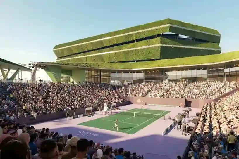
The entire Qiddiya City master plan spans over 360 to 376 square kilometers, which will comprise multiple districts, including 43 separate sports facilities.
Designing a reliable medical facility within this layout means preparing for massive, long-term human transit patterns.
Once fully operational, the city is designed to support and attract 48 million visits annually by 2030, which will place a massive ongoing strain on the area’s localized utility and medical infrastructure.
To protect the diagnostic machinery and clinical rehabilitation wings from extreme external stress, developers must move past slow, traditional ground surveying methodologies.
Cost and Energy Risks in High-Stakes Construction
Navigating Healthcare Project Overruns
Executing advanced civil engineering projects in remote desert environments introduces deep operational risks.
Industry data indicates that over 30% of large-scale healthcare construction projects historically face critical budget extensions or regulatory timeline delays.
These delays are frequently caused by design discrepancies discovered only after heavy construction equipment has already arrived on-site.
Addressing the National Grid Demands
Mechanical engineering plans for large structures must account for the immense regional load on utility networks.
Data shows that the broader building construction sector in the Kingdom of Saudi Arabia (KSA) consumes roughly 75% of the country’s total electrical energy.
This high baseline demand is caused primarily by continuous air conditioning use during peak summer seasons, where ambient temperatures regularly exceed 45°C.
The strain on municipal grids is further amplified by historical building vulnerabilities.
Industrial research indicates that up to 70% of existing buildings in Saudi Arabia lack sufficient thermal insulation.
This insulation deficit forces HVAC systems to run at maximum capacity, inflating long-term operational budgets and shortening equipment lifespans.
Saudi Arabian Healthcare Infrastructure
| Total Market Value (2026) | SAR 570.5 billion |
| Targeted Smart Tech Capital | SAR 10 billion |
| Historical Project Delay Rate | Over 30% of Major Facilities |
With the broader Saudi Arabian healthcare market valued at SAR 570.5 billion as of 2026 and a targeted investment of SAR 10 billion dedicated to smart hospital technologies by 2030.
Therefore, developers must utilize advanced pre-construction data pipelines to protect capital and guarantee baseline efficiency.
Deploying 5D BIM Integration and Digital Twins
Generating the Site’s Digital Twin
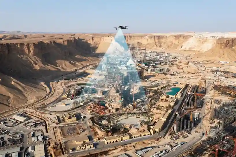
To eliminate measurement errors across the site’s layout, project managers are deploying enterprise drone platforms like the DJI Mavic 3 Enterprise (M3E) before earthworks begin.
These low-altitude aircraft fly automated, high-precision grid patterns across the unbuilt desert plot.
Equipped with advanced visual arrays and sensors, these platforms capture overlapping high-resolution imagery to generate an absolute pre-construction digital twin of the terrain.
This three-dimensional digital replica maps out every slope change, loose soil boundary, and rocky canyon outline with centimeter-level precision.
Quantifying the Benefits of 5D BIM Workflows
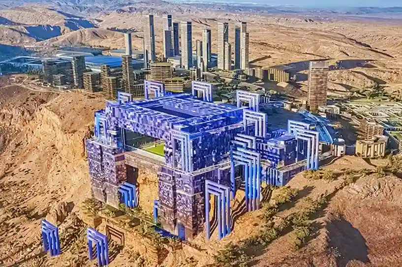
This rich geospatial data ports directly into engineering platforms for automated BIM integration.
Rather than drawing blueprints on isolated flat files, a 5D building information model combines the physical layout, project timelines, and real-time cost estimations into a single master engineering file.
Industrial research indicates that using these integrated workflows for complex hospital structures eliminates manual measurement variations, lowering structural calculation errors to 1% to 2%.
By resolving spatial design clashes virtually before concrete is poured, development teams can cut total structural construction costs by up to 9.25%.
Utilize the As-Built BIM
While pre-construction modeling protects budgets before groundbreaking, maintaining the long-term operational integrity of a facility requires strict post-construction verification.
Once physical construction is finalized, development teams deploy As-Built BIM solutions to audit the completed structure.
This process utilizes comprehensive 3D laser scanning to capture the exact physical dimensions of the finished building.
The collected scan data is compiled into a highly detailed As-Built BIM model, allowing engineers to compare the final physical asset directly against the initial design master plan.
This digital comparison accurately identifies any structural differences, spatial deviations, or unauthorized changes made by field crews during construction.
For highly specialized infrastructure assets, this precise verification ensures that the physical building perfectly matches the approved engineering specifications, providing an accurate, updated digital twin for long-term maintenance and facility operations.
Streamline Your Project
The difference between initial design blueprints and the final physical structure can create major hidden costs during future renovations, maintenance, and equipment installations.
Transitioning from pre-construction digital twins to post-construction as-built verification provides complete geometric control over your infrastructure throughout their operational lifespan.
Consult with our expert to implement digital twin, BIM integration, and as-built 3D scanning workflows to ensure the absolute structural accuracy.

