- ENERGY & UTILITIES
Accelerated Transmission Line Planning by 3 Weeks
Client
Al Arrab Engineering
Scope
Survey & Mapping
Year
2024
The Challenge
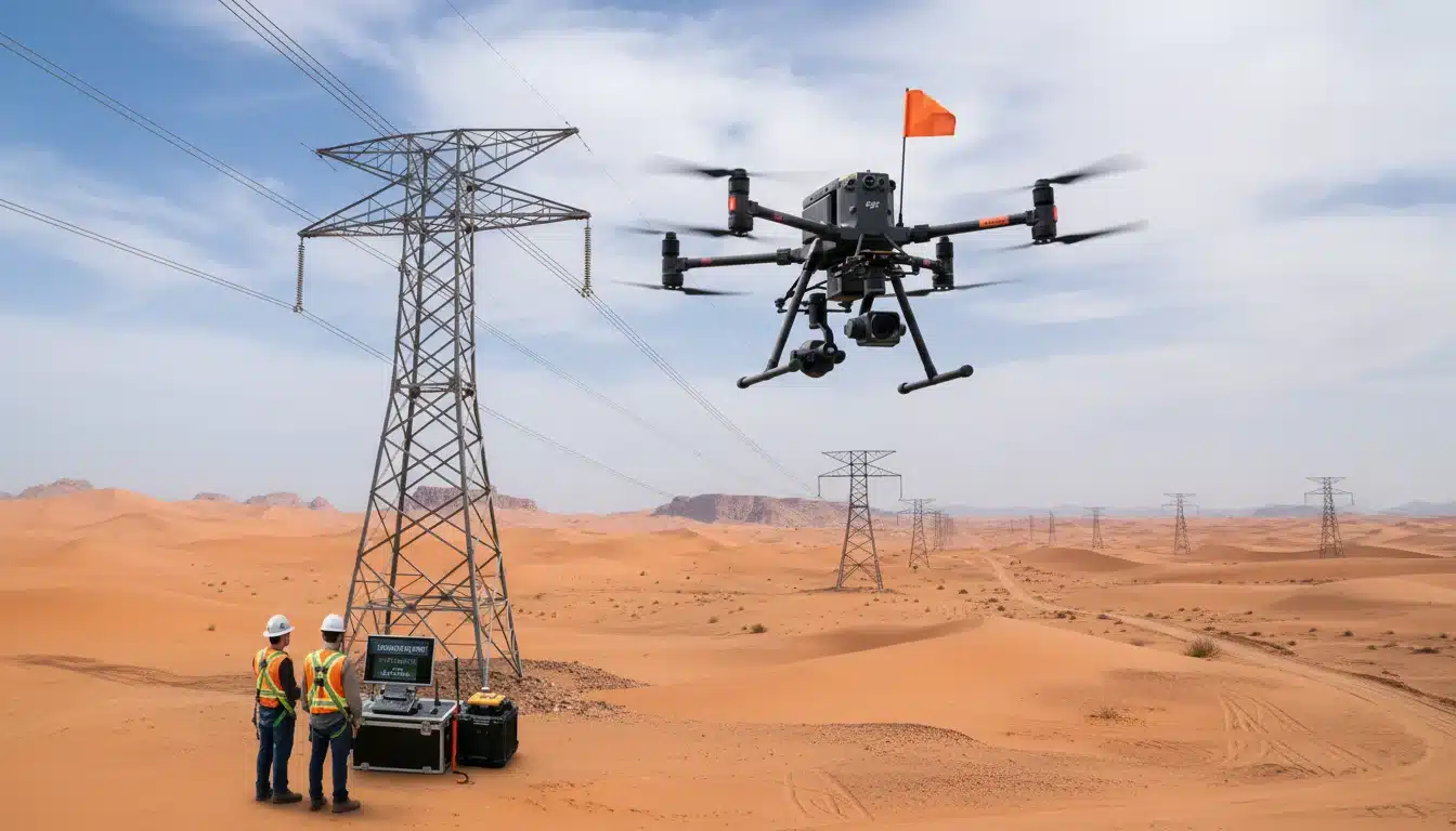
Saudi Electricity Company (SEC) needed to survey a 40 km transmission line corridor in record time to meet expansion milestones. Traditional ground surveys would have taken over 6 weeks and required significant manpower in harsh desert terrain, posing both safety risks and logistical delays.
The objective was to obtain high-precision topographic data and clearance analysis to identify potential vegetation encroachment and structural clearance issues along the entire route before construction could begin.
Our Solution
Terra Drone Arabia deployed high-density drone LiDAR across the 40 km corridor. Using RTK-enabled platforms, we captured over 500 points/m² with centimeter-grade accuracy. This allowed us to generate a highly detailed 3D model of the terrain, existing structures, and nearby obstacles.
Data was processed in-house into a classified point cloud and a Digital Terrain Model (DTM). We then performed an automated clearance analysis, identifying critical points of interest and integrating the final datasets directly into SEC’s ArcGIS environment for immediate planning use.
The Result
The survey was completed 3 weeks ahead of schedule, delivering actionable intelligence far faster than conventional methods. By replacing ground crews with autonomous drone operations, the project achieved a 100% safety record in difficult terrain and reduced overall costs by approximately 40%.
SEC now utilizes this precise dataset for ongoing corridor management, vegetation monitoring, and as a baseline for future infrastructure maintenance, establishing a new standard for their survey workflows.

Riyadh
Prince Saud bin Abdullah bin Jalawi st, Al Qirawan, Riyadh 13533, KSA
Dhahran
Dhahran Techno Valley 8783 Ibn Al Haitham St, Dhahran 34464, KSA
Newsletter
© 2026 All rights reserved.
Privacy Policy | Terms and Conditions