The coastal ecosystems of the Arabian Gulf have historically faced immense ecological pressure, particularly following the significant environmental disruptions of the early 1990s. Recognizing the critical need for sustainable recovery, we conducted a coastal restoration drone LiDAR survey to provide the high-fidelity data necessary for environmental remediation. This mission was not merely about mapping; it was about creating a digital foundation for the restoration of over 414 square kilometers of vital coastal habitats north of Jubail.
The Precision of LiDAR and Photogrammetry Fusion
The technical ambition of the project rested on the fusion of two advanced aerial technologies to capture the complex coastal landscape.
- LiDAR Prowess: The survey deployed Light Detection and Ranging (LiDAR) to generate high-density 3D point clouds with a targeted accuracy of 4–8 points per m2.
- Terrain Penetration: This technology proved essential for its ability to penetrate coastal vegetation and capture ground surface details that traditional methods often missed.
- Visual Fidelity: Simultaneously, photogrammetry was utilized to achieve a Ground Sampling Distance (GSD) of 6–10 cm, providing the high-resolution visual textures required for detailed 3D modeling.
- Global Standards: Every data point collected adhered to the SANSRS geospatial reference standard, ensuring engineering-grade reliability across all four project zones.
Engineering Excellence for Harsh Coastal Zones
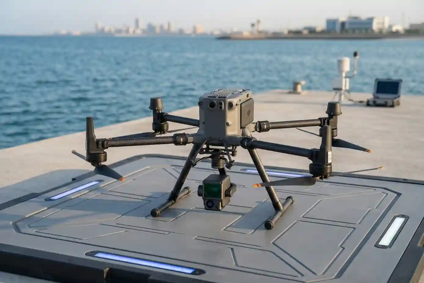
Executing a survey of this magnitude required a sophisticated hardware fleet designed to withstand the environmental extremes of the Eastern Region.
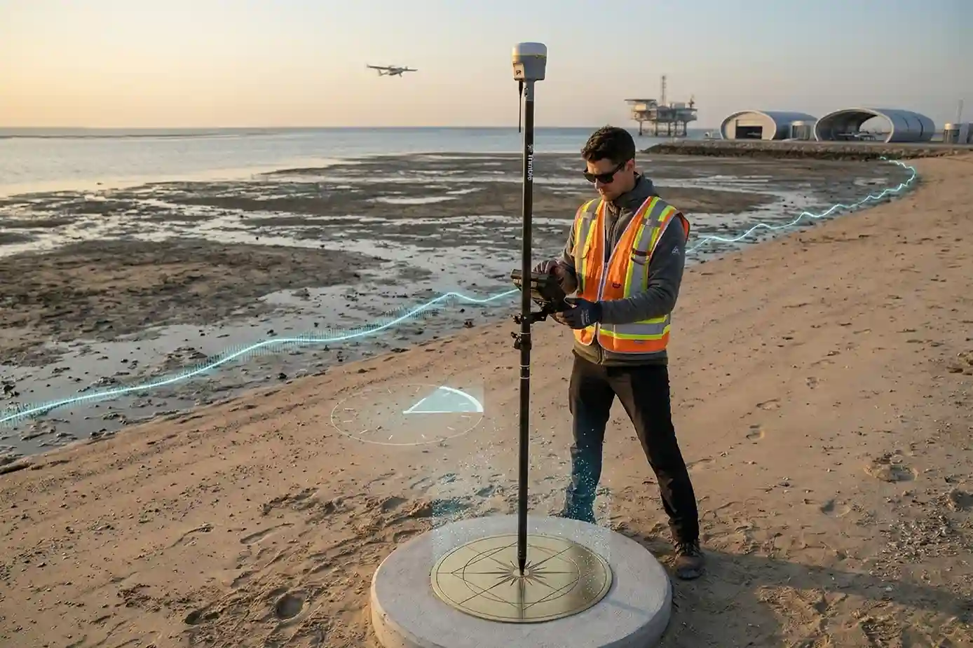
- The Fleet: We deployed a dual-platform strategy using the DJI M350 RTK multirotor for high-precision targeting and the Trinity Pro VTOL fixed-wing system for broad-area efficiency.
- Sensor Sophistication: The mission utilized the Zenmuse L1 and Qube 240 sensors, capable of delivering system accuracies of less than 3 cm.
- Ground Truth: To anchor the aerial data, the team established a network of Permanent Reference Markers (PRMs) and benchmarks linked directly to the national geodetic network.
- Tidal Orchestration: In a display of meticulous operational planning, flight schedules were synchronized with tidal cycles to ensure remediation areas were visible and accessible for maximum data quality.
Delivering Actionable Environmental Intelligence
The raw data was transformed into a suite of sophisticated deliverables that now serve as critical decision-making tools for the restoration effort.
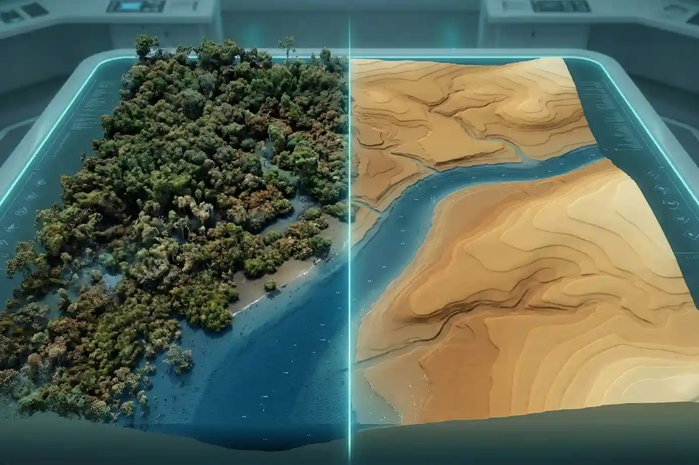
- Classified Point Clouds: Point cloud data was processed and classified into categories such as vegetation, ground, and man-made structures for targeted analysis.
- Topographic Models: The survey resulted in highly accurate Digital Surface Models (DSM) and bare-earth Digital Terrain Models (DTM), which were essential for hydrological and geological studies.
- Final Blueprint: The production of orthophoto mosaics and precise contour lines provided the comprehensive map layouts required for ongoing rehabilitation activities.
Through this coastal restoration drone LiDAR survey, we successfully demonstrated that “Embodied AI” and advanced aerial sensing are the vital components needed to protect and restore the Middle East’s most fragile ecosystems.
Based on the technical scope and environmental significance of the Coastal Restoration Drone LiDAR Survey, here are four visual suggestions designed to illustrate the complexity and precision of the mission executed north of Jubail.