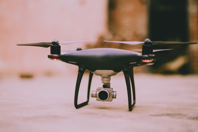
Drone LiDAR and Its Groundbreaking Applications

With rapid advancements in technology, drones are no longer just flying devices; they’re smart machines that can carry out complex tasks. One such advancement is drone LiDAR. This technology has transformed drones into powerful tools capable of providing unprecedented insights, especially in surveying and mapping. But what is drone equipped with LiDAR, and how does it work? What is LiDAR? LiDAR, or Light Detection and Ranging, is a remote sensing method that uses light in the form of a pulsed laser to measure variable distances to the Earth. When mounted on drones, this technology allows for rapid data collection over large areas with exceptional accuracy, making LiDAR equipped in a drone to be a go-to solution for many industries. Also Read: Taking Flight: Unraveling the Drone Market Size and Its Potential How Does It Work? LiDAR equipped to a drone operates by emitting pulses of laser light towards the ground from a device mounted on a drone. The time it takes for each pulse to bounce back is recorded and used to calculate distance, creating a detailed, three-dimensional representation of the area below. Read More: LiDAR in Drone Survey Where is it Used? Drone with LiDAR has found use in a myriad of industries. In agriculture, it aids in crop management and soil analysis. In construction and engineering, it’s used for surveying and planning. Even archeologists use it to unearth hidden historical sites, showcasing the technology’s diverse applications. Also See: Yield from Above: The Role of Drone in Agriculture Practices The future of this system is expansive, with potential applications in climate change studies, disaster management, and urban planning. As the technology continues to evolve, it promises to open up even more possibilities. Read More: Multispectral and LiDAR drones deployed to protect the Monarch Butterfly In conclusion, drone equipped with a LiDAR is not just an advanced technology; it’s a groundbreaking tool that’s shaping how we perceive and interact with the world. With its ability to capture high-resolution, three-dimensional data, it is poised to be a game-changer in numerous sectors.
How Drone Innovation is Driving Industry Transformation
The advent of drone innovation has sparked a revolution across numerous industries. Drones, once seen merely as recreational gadgets, are now powerful tools that drive efficiency, safety, and productivity. Let’s delve into the key sectors that are experiencing a transformative impact due to the innovation. Innovation in Agriculture In agriculture, drones equipped with advanced sensors can monitor crop health, optimize irrigation, and manage pest control. This allows farmers to make more informed decisions, improve yields, and reduce resource wastage. Drone brings innovation in agriculture which has essentially reshaped traditional farming practices, making them more sustainable and efficient. See Also: Planting Mangrove Using Drone Technology to Combat Climate Change Innovation in Logistics Sector In the logistics sector, drone provide innovation in redefining last-mile delivery. Drone delivery services promise faster delivery times, reduced carbon emissions, and access to remote areas. While regulatory and technological hurdles persist, the potential of drone delivery services is undeniable, and it signifies a paradigm shift in logistics and e-commerce. Read More: Supply chain innovation: drone corridor unlocks pilotless future The Future of Drone Drone is not limited to agriculture and logistics. From disaster response and environmental conservation to construction and filmmaking, the applications are endless. As drone technology continues to advance, we can anticipate a wider adoption across various sectors, further driving industry innovation and transformation. In conclusion, innovation provided by drone is a powerful catalyst for industrial transformation. As we continue to harness the potential of drones, we can look forward to a future where these aerial devices play a crucial role across various sectors. Read More : Top 10 innovations in drone that caught our attention in 2022
The Role of Drone in Digital Transformation for Industry
Drone in digital transformation are making waves, revolutionizing how businesses operate and innovate. By providing real-time data, enhancing efficiency, and opening up new operational possibilities, drones are proving to be an indispensable tool in the digital transformation journey. Let’s explore how drones are driving this transformation. Drones and Data-Driven Decision Making One of the key aspects of digital transformation is data-driven decision making. Drones, equipped with advanced sensors and cameras, can capture and relay real-time data, aiding in analysis and decision making. Be it monitoring crop health in agriculture, inspecting infrastructure in construction, or detecting gas leaks in oil and gas fields, drones are enabling a data-centric approach in various industries. Read More: How Drone Innovation is Driving Industry Transformation Drones and Automation Automation is another cornerstone of digital transformation, and drones are playing a significant role here. From automated delivery services to conducting routine inspections, drones are reducing human intervention and enhancing efficiency. This not only reduces costs and errors but also contributes to safety, particularly in hazardous environments. Read More: Bayer Starts Commercial Usage of Drone Services for Farmers as part of its Digital Transformation Initiative The Future of Drones in Digital Transformation As drone technology continues to advance, its role in digital transformation is set to expand. With improvements in AI and machine learning, drones will be able to handle more complex tasks and deliver more nuanced data. This will further accelerate digital transformation across various sectors, highlighting the ongoing importance of drones in this evolving landscape. In conclusion, drones are not just a part of digital transformation; they are one of its driving forces. As we embrace the digital future, drones will continue to play a pivotal role in shaping it. See Also: AI, Drones to Rapidly Transform Indian Economy: WEF C4IR
How Drone for Oil Spill Combat is Changing the Game
The use of drone for oil spill detection and management is emerging as a revolutionary tool in environmental protection. Drones, equipped with advanced sensors and imaging capabilities, offer unique advantages in combating oil spills. This article explores how drones are reshaping the approach to oil spill management. Drone for Oil Spill Detection Timely detection of oil spills is critical in minimizing environmental damage. Drones are playing a pivotal role in this aspect. They provide aerial surveillance over vast ocean areas, identifying oil spills in real-time with remarkable accuracy. Such early detection allows for quicker response and containment measures, reducing the impact of oil spills. Also Read: Skies of Change: Exploring the Rising Trend of Drone Use in the Middle East How Drones Can Help Drones also contribute significantly to oil spill management. Not only can drones map the extent of a spill accurately, but they can also deliver oil spill dispersants over the affected area. This targeted application helps minimize the spill’s spread and reduces its environmental impact, showcasing the power of drone technology in oil spill combat. Read More: Drones are Revolutionizing Oil Spill Response: Here’s How The Future of Oil Spill Combat As drone technology continues to evolve, its role in combating oil spills promises to expand. Future drones could be equipped with more sophisticated sensors for better detection and might even have the capacity for oil spill cleanup, pointing to an exciting future for drone technology in environmental protection. In conclusion, drones are proving to be a game-changer in oil spill combat. They offer a new perspective, literally and figuratively, on how we detect and manage oil spills, underlining the significant potential of drones in environmental protection. Read More: The Role of Drones in Offshore Oil Spill Response
Ultimate Guideline: How to Choose The Right Drone for You
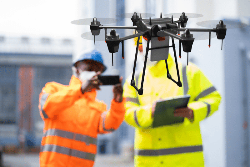
Intro Over the years, the phrase “drones” has evolved from just a fancy term to a widespread tool seen across the globe. Originally conceived for combat scenarios, these aerial devices now serve countless peaceful purposes. They’ve become increasingly affordable, thus making them accessible for many. Whether it’s for capturing breathtaking aerial photos or aiding farmers in monitoring vast fields, drones have become invaluable in numerous industries. As businesses tap into the potentials of these machines, they’re finding ways to cut costs, enhance efficiency, and even carve out new revenue streams. For those intrigued by the drone universe, this guide is your key. There’s a challenge, though. With so many drones available, how do you pick the right one? The market is full of choices. For a business wanting to make the most of drones, the sheer number of options can be overwhelming. And if drones are new for you or your team, making a wise choice can feel even harder. But choosing a drone isn’t something to rush. It’s a long-term decision. Going for a low-cost drone might seem tempting, but it could lack the features you need. On the other hand, a high-end drone might have great features but could be too costly for your budget. Every business wants value for their money, so finding the right balance is crucial. The key is to start with knowledge. By understanding the basics of drones – what they can do, the types of data they can collect, how to maintain them, and any other related details – you set a good foundation. Think about your needs and the problems a drone can solve for you. With that clarity, you can then focus on finding the drone that matches those needs in the market. Disclaimer : This guide focuses on regular drones, not the ones used by the military. The information provided is up-to-date as of August 2023. Guideline: Understanding Drones and Their Flight Categories Drones, as we know them, have evolved in design and capability. When it comes to selecting one, understanding how they fly can make all the difference. There are several categories based on this criterion, and each comes with its own set of advantages and drawbacks. Here’s a closer look: 1. Fixed-Wing Drones These drones have rigid wings like an airplane. They don’t have the hovering capability of multirotor drones, but they can cover longer distances. Advantages: Endurance: They can stay airborne for longer periods. Speed: They boast a higher cruising speed. Emergency Safety: If there’s a problem, they can glide without power. Disadvantages: Payload Limit: They can’t carry as much weight. Lack of Hover: They can’t stay in one place in the air. Space Requirement: They need a runway or open space to take off and land. Notes: The market for these drones isn’t as expansive. The design and engineering process is more demanding. Most fixed-wing drones are made for hobbyists or professionals, leaving a gap in the mid-tier market. Some well-known manufacturers include Delair and Sensefly. Many manufacturers, however, are transitioning to hybrid designs 2. Multirotor Drones These are perhaps what most people think of when they hear the word “drone”. They have multiple rotors, which give them the ability to hover in place. Advantages: Payload Flexibility: They can carry a reasonable amount of weight. Stationary Flight: Unlike fixed-wing drones, they can hover in a single spot. Space Flexibility: They can take off and land vertically, without needing a runway. Disadvantages: Flight Time: Their flight duration is typically shorter. Speed Constraints: They usually have a slower cruising speed. Emergency Safety: If there’s a malfunction, they can’t glide. Extra systems or parachutes may be needed for safety. Notes: Many major drone companies focus on these designs. Over 90% of the drones worldwide are multirotor drones. Popular brands include DJI, Autel, Parrot, and Skydio. 3. Hybrid Fixed-Wing VTOL (Vertical Take-Off and Landing) These drones try to combine the best of both worlds. They have fixed wings for long-distance flight and rotors for hovering. Advantages and Drawbacks: These drones aim to merge the benefits of both fixed-wing and multirotor drones. However, they may compromise slightly on performance. Notes: Typically aimed at professional usage. They’re gaining rapid popularity in the drone market. Their design and engineering are more advanced than the other types. Renowned brands in this category are JOUAV, Quantum Systems, and Wingtra. By understanding these categories, potential users can determine which type is best suited for their needs. Whether it’s hovering over a specific spot or covering vast distances, there’s a drone out there tailored for every purpose. Type of Payload that Drones Can Carry Based on Type of Activities Drones have evolved from basic flying machines to advanced devices capable of numerous tasks. The variety of payloads they can carry is a testament to this adaptability. Different payloads serve various purposes, ranging from collecting data to performing tangible actions or even transporting goods. Here’s a breakdown: a) Sensing & Remote Sensing (Camera/Sensor): i) RGB (Visual) Captures data in red, green, and blue wavelengths to produce images similar to standard cameras. Use Cases: Aerial photography, event filming, property monitoring. ii) Infra-red Detects data in the infrared spectrum to produce images indicating temperature differences. Use Cases: Search and rescue operations, monitoring crop health, detecting heat loss in buildings. iii) Multispectral Captures light in specific bands of the visible and near-infrared spectrums to produce detailed images. Use Cases: Monitoring crop health, forest health analyses, shoreline changes. iv) LiDAR Uses laser beams to measure distances, producing accurate 3D maps and models. Use Cases: Topographical mapping, elevation model creation, forest canopy research. v) Gas Sensing Detects specific gases in the atmosphere to determine concentrations. Use Cases: Gas leak detection, air quality monitoring, volcanic activity assessment. vi) Magnetic Measures magnetic fields to gather data on magnetic properties. Use Cases: Finding mineral deposits, locating buried structures, underwater investigations. vii) Hyperspectral Gathers information across many narrow bands of the electromagnetic spectrum. Use Cases: Mineral detection
Taking Flight: Understanding Drone Regulations in Saudi Arabia
Drone Regulations in Saudi Arabia Understanding drone regulations in Saudi Arabia is a fundamental step for both recreational and commercial drone operators. These rules are designed to ensure safety, protect privacy, and manage the country’s airspace. The Basics of Saudi’s Drone Regulations Saudi Arabia’s General Authority of Civil Aviation (GACA) oversees drone operations. Key rules include obtaining a drone permit, registering your drone, following no-fly zones, and always keeping the drone within line of sight. Additionally, drone operators must respect privacy laws and avoid photographing sensitive sites. Also Read: Skies of Change: Exploring the Rising Trend of Drone Use in the Middle East Permits and Registration To fly a drone legally in Saudi Arabia, operators must secure an Unmanned Aircraft System (UAS) permit from GACA. Moreover, all drones used for commercial, recreational, or scientific purposes must be registered. Read More: Drone Laws in Saudi Arabia Respect for Privacy and No-fly Zones The drone regulations in Saudi emphasize respect for individual privacy. Unauthorized surveillance or photography of private properties is prohibited. Operators must also adhere strictly to no-fly zones, which typically include military installations, airports, and government facilities. Additional Considerations Additional rules may apply based on specific uses. For example, commercial operators might require additional permits and should comply with the established procedures for safety, maintenance, and record-keeping. Read More: Drone Laws in Saudi Arabia Understanding Drone Regulations: The Key to Safe Skies In conclusion, knowing and following the drone regulations in Saudi Arabia is vital for safe, legal, and responsible drone operation. As drone technology continues to evolve, staying updated with the latest laws and regulations is crucial for all operators.
Drone for Construction Design and Architecting from Above
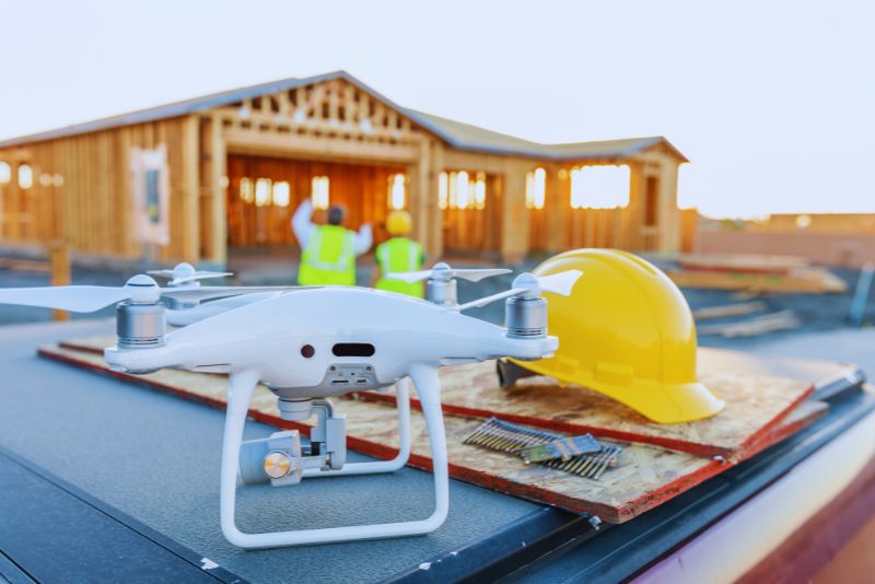
Drones: The Game-Changer in Construction Design Drone for construction design is revolutionizing the architectural landscape through their use in construction design. By offering an accurate and comprehensive view of construction sites, these aerial devices equip architects with valuable insights, enabling them to create more precise and effective designs. Drones and Site Analysis Site analysis is a critical aspect of the construction design phase. Equipped with advanced imaging and LIDAR technology, drones capture high-resolution images, topography, and geographical data. This wealth of information allows architects to gain a deeper understanding of the construction site and plan more effectively, thus enhancing design accuracy and minimizing potential issues. Also Read: Sky High Supervision: Drones for Construction Progress Monitoring Drones for Enhanced Workflow Efficiency Beyond providing accurate data, drones also speed up the design process. The real-time information they capture can be seamlessly integrated with Building Information Modeling (BIM) software. This integration facilitates smooth communication among architects, engineers, and construction teams, significantly enhancing workflow efficiency. Read More: Drone info turning construction civil dirt works to pay dirt Real-World Implementation: Drones in Action From residential developments to large-scale infrastructure projects, the use of drones for construction design has proven beneficial in a variety of cases. These unmanned aerial vehicles are instrumental in designing complex structures, assessing site feasibility, and conducting environmental impact assessments, making them an invaluable tool in modern construction. The Future of Drones in Construction Design As technology continues to advance, the potential applications of drones in construction design are bound to expand. With the integration of AI and machine learning, drones could soon provide predictive modeling, enhancing decision-making and further optimizing the design process. Read More: Five ways drones will change the way buildings are designed Revolutionizing Construction Design with Drones In conclusion, the use of drones for construction design is significantly altering the industry’s dynamics. By providing real-time, accurate data and facilitating improved communication, drones are not just transforming the design phase; they are redefining the future of construction itself.
Drones for Construction Progress Monitoring

Pioneering Project Oversight: UAV for Construction Progress Monitoring Harnessing drones for construction progress monitoring has become an industry standard in the fast-paced and complex world of construction. These airborne assistants provide accurate, real-time data, offering construction managers an unprecedented overview of their projects, saving time, and enhancing decision-making. Transforming Construction Management with Drones In construction, drones’ utility extends beyond mere surveillance. They map the construction site, measure volumes, inspect structures, and capture high-resolution images and videos. The data collected aids in progress tracking, improves safety, and provides the evidence needed for project updates, quality control, and even dispute resolution. Also Read: Mastering Risky Environments: Drones in Hazardous Areas for Data Collection Technology Behind UAV for Construction Progress Monitoring Drones used in construction often come equipped with sophisticated GPS and imaging technology. Their onboard sensors collect data that can be used to generate 3D models, heatmaps, and more. This information can be further analyzed to provide critical insights and predict potential issues, enhancing project planning and execution. Read More: Drone Footage Reveals Shanghai Planetarium Construction Progress Case Studies: Drones in Action From skyscraper construction in bustling cities to remote infrastructure development, drones are increasingly at the forefront. They help maintain schedule adherence, budget control, and quality standards by providing accurate and timely updates on construction progress. The Future of Drones in Construction Progress Monitoring The future of drone use in construction progress monitoring is promising, with ongoing advances in technology set to further enhance their capabilities. The incorporation of AI and machine learning algorithms can aid in predictive analysis, resource allocation, and risk management, amplifying their value in construction project management. Read More: NEOM THE LINE: See satellite images and drone footage of the building site Revolutionizing Construction Progress Monitoring with Drones In conclusion, the integration of drones into construction progress monitoring marks a significant milestone in the industry. By delivering real-time, accurate data and insights, drones are not just improving construction project management, but revolutionizing it. The sky is the limit when it comes to the potential of drones in the construction industry.
How Drones in Hazardous Areas Collect Data Safely and Efficiently

Transforming Data Collection: Drones in Hazardous Areas Drones in hazardous areas deployment for data collection has been a game-changer in various industries. Their ability to traverse dangerous environments and deliver real-time, accurate data is revolutionizing operations, while ensuring a higher degree of safety for personnel. Benefits of Using Drones in Hazardous Areas for Data Collection Drones provide an invaluable advantage in hazardous areas. They mitigate risks by reducing human exposure to danger, and their advanced sensor technology allows for comprehensive data collection that can significantly improve decision-making and efficiency in various operational processes Also Read: Revolutionizing Inspections: The Role of Drones for NDT in Oil & Gas and Petrochemical Industries Data Collection Drones: How Do They Work? Equipped with a myriad of sensors and high-resolution cameras, drones can effectively map hazardous areas, monitor environmental conditions, and capture visual data for inspections. The information collected can be processed and analyzed to provide insights and drive more effective strategic decision-making. Read More: Confined Space Drones: Reducing Hazardous Exposure Real-World Applications: Drones Collecting Data in Hazardous Areas Whether it’s mapping radiation levels in a nuclear power plant or collecting data in a chemical factory, drones are an instrumental tool. Their flexibility and versatility make them apt for a variety of applications, significantly transforming traditional methods of data collection in hazardous areas. The Future of Drones in Hazardous Area Data Collection The potential of drones extends far into the future, with advancements in technology such as AI and machine learning promising to augment their capabilities further. Enhanced data analysis, real-time tracking, and predictive maintenance are just a few areas where these advancements could lead. Read More: NOAA launches first of its kind drone in Hurricane Ian to research areas unsafe for Hurricane Hunters Impact of Drones in Hazardous Area Data Collection In conclusion, UAVs in hazardous areas for data collection are setting new standards in safety and operational efficiency. Their versatile applications and the valuable data they provide are driving significant transformation in industries known for their risk-prone environments.
Drones for NDT in Oil & Gas and Petrochemical Industries
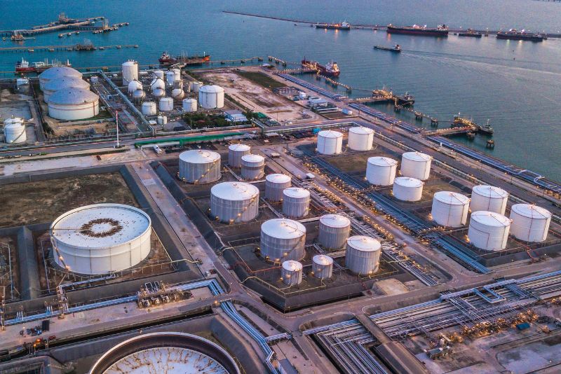
Elevating Inspection Standards: Drones for NDT in Oil & Gas and Petrochemical The adoption of drones for NDT (Non-Destructive Testing) inspections has unlocked unprecedented possibilities for the oil & gas and petrochemical industries. Not only has it improved the safety of personnel, but it has also significantly boosted efficiency and cost-effectiveness. A New Era of Inspection: Why Use UAV for NDT? When utilizing this technology for inspection, several benefits come to light. Drones offer greater accessibility, are able to operate in hazardous or difficult-to-reach areas, and minimize the need for human involvement in potentially dangerous situations. Moreover, they significantly speed up the inspection process, leading to considerable cost and time savings. Also Read: Changing the Game: Using Drones for Stockpile Calculation in Coal Mining The Mechanism: How Does Unmanned Aircraft for NDT Work? Drones used for NDT inspections are equipped with an array of sensors and imaging technologies, enabling them to effectively assess the integrity of structures. They capture high-resolution imagery and data, which is then analyzed to identify potential defects or areas of concern. Read More: Terra Drone invests in RoNik to offer advanced nondestructive testing and inspections Practical Applications: Drones for NDT in Action The oil & gas and petrochemical industries are known for their complex and vast infrastructures. Drones have proven to be an invaluable tool for inspecting such facilities, drastically reducing the time, costs, and risks traditionally associated with NDT inspections. Read More: Sky-high Solutions: 5 Benefits of Using Drones in Petrochemicals Industry The Future: Next Steps for Drones and NDT As technology continues to advance, so too does the potential for drones in NDT inspections. The integration of AI and machine learning could further enhance data analysis, while the development of specialized sensors may increase the range of defects detectable by drones. Read More: Nondestructive Testing (NDT) Trends The Impact: UAV for NDT Transforming Industries In conclusion, this sophisticated technology for NDT inspections are reshaping traditional inspection methods in the oil & gas and petrochemical industries. With their ability to improve safety, efficiency, and cost-effectiveness, drones have cemented their place as a crucial instrument in the future of these industries.