How Drone Topographic Mapping Captured 124 km² in 1 Month
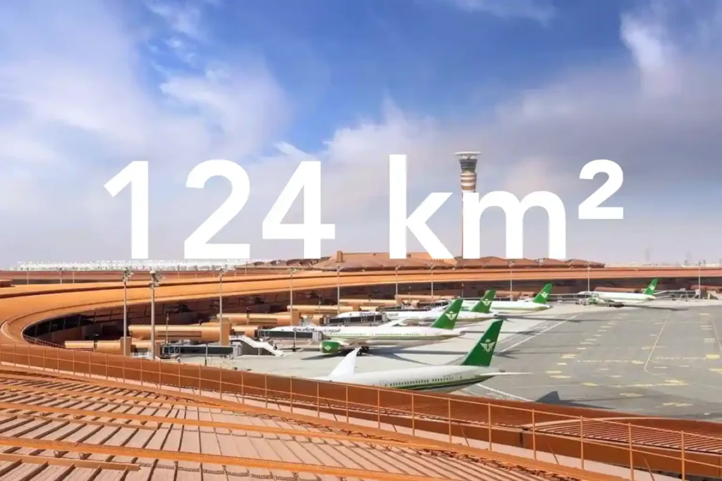
Every decision in a sewer upgrade or drainage expansion depends on the fidelity of the ground surface you hand to designers. In a dense urban corridor next to an international airport, conventional total station and GNSS traverses face line-of-sight gaps and obstruction bias that create uneven accuracy and patchy coverage. That risk is real in North Jeddah, where the area of interest lies adjacent to the airport and spans built-up neighborhoods. Here is what surface truth looks like at the city scale. We captured a continuous 124 square kilometer topographic dataset in North Jeddah and delivered it as a CAD-ready package in under three months from kickoff. Field acquisition took one month. Processing took two months. This timeline gives engineers a single authoritative surface rather than stitched pockets of data collected over a long period. Surface truth is more than a pretty map. It is a defensible stack of products that design teams can trace. The deliverables included an orthomosaic for planimetrics, a Digital Surface Model and Digital Terrain Model for elevation control, contours, 2D CAD drawings, the full list of ground control and independent checkpoints, a documented accuracy assessment, and a formal survey report. These artifacts allow design leads to audit decisions and sign off with confidence. Accuracy management begins at acquisition. We flew an RTK-enabled drone platform with a full-frame photogrammetry camera and built a high-grade control network. A Trimble R12 receiver established and measured ground control points for adjustment and independent checkpoints for validation. This control strategy reduces reliance on interpolation and tightens both horizontal and vertical residuals across built-up corridors. The counterfactual underscores the stakes. A traditional approach across this environment would require multiple field teams for about three months and still lean on interpolation between sparse points. The drone-based program concluded the full scope in less than three months while improving accuracy and completeness for downstream CAD and hydraulics. This difference shortens design cycles and cuts rework for utility corridors and drainage upgrades. Dense Neighborhoods and Airport Constraints The area of interest covers 124 square kilometers in North Jeddah and sits adjacent to the airport, which makes both data capture and flight planning uniquely complex. Large coverage with airport proximity raises operational constraints, while dense neighborhoods create measurement blind spots for traditional crews. Airport-adjacent realities. In an airport environment, teams must plan flight lines to respect controlled airspace and safety buffers. You manage takeoff and landing zones carefully, maintain strict altitude profiles, and schedule sorties to minimize conflicts with traffic patterns. Geofencing unlocks, NOTAM checks, and close coordination with authorities are standard steps for this kind of work. The goal is predictable, repeatable acquisition without drift in GNSS solutions or interruptions to coverage. Built-up urban fabric. High building density, narrow corridors, and road canyons reduce line of sight for total stations and can introduce GNSS multipath for traditional rovers. That combination produces coverage gaps and uneven accuracy when you rely on sparse spot levels collected over long traverses. The case conditions explicitly note that built-up areas make conventional topographic surveys “very challenging” and time-consuming. Why an aerial approach fits this terrain. A drone survey and mapping workflow captures consistent overlap above obstacles and decouples the line of sight from ground constraints. With a DJI M350 RTK and Zenmuse P1 full-frame sensor, you can execute systematic blocks that maintain geometry across long corridors while tying everything to a robust control network. This approach improves continuity through tight streets and variable roof heights. Time pressure from scale. Because the 124 km² footprint is large and the timeframe is short, a ground-only campaign would require many teams for an extended period, yet still lean on interpolation between sparse points. The case estimates that a traditional approach could take about three months with multiple crews in this exact built-up context. Drone acquisition compresses the field schedule while maintaining fidelity for downstream design. What this environment demands from the dataset. To serve urban sewer design, the surface must be continuous across roads, intersections, and residential blocks near the airport. That means full orthomosaic coverage for planimetrics and elevation products that remain stable across building shadows and narrow corridors. These conditions are exactly why the project leveraged drone photogrammetry for the topographic survey requirement in this location. The Method: RTK Photogrammetry Built for Accuracy and Scale Objective and scope. The brief required a drone-based photogrammetry program to produce a topographic map for a groundwater sewer network design. We planned for city-scale coverage and design-ready outputs that engineers could trust. Control first. We began with a high-grade GNSS control strategy. A Trimble R12 established the Primary Reference Marker and measured both Ground Control Points for adjustment and Independent Checkpoints for validation. This gives us traceable horizontal and vertical control across built-up corridors where the line of sight is limited. Airframe and sensor. We executed an acquisition with a DJI M350 RTK paired to a Zenmuse P1 full-frame camera. RTK fixes stabilized camera center positions during flight, which improved the initial network geometry and reduced corrections downstream. Block design and sortie planning. We divided the 124 square kilometer area into flight blocks that respected airport proximity and dense neighborhoods. We set systematic flight lines to keep overlap consistent through narrow streets and variable roof heights, and we staged takeoff and landing zones to maintain safe operations. Acquisition window. Field capture finished in one month. This compressed window ensured consistent lighting and seasonal conditions across the entire mosaic, which reduces seams and radiometric variation. Photogrammetric processing. We ran a rigorous pipeline to turn imagery and control into design-ready surfaces: Import imagery and GNSS metadata, then perform initial alignment with RTK positions. Constrain the bundle adjustment with GCPs, while holding ICPs blind for an independent accuracy check. Generate dense point clouds, then derive the Digital Surface Model and bare earth Digital Terrain Model. Create the orthomosaic for planimetrics, followed by contours suitable for design at the requested scale. Export CAD-ready drawings and the coordinate lists for all control and checkpoints. Validation and QA. We
Drone-Based Progress Tracking: Enhancing Accuracy, Safety, and Efficiency in Construction Projects
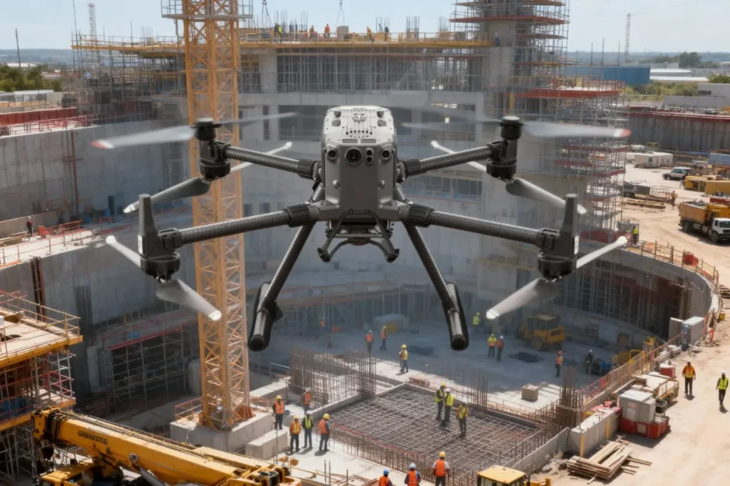
Highlight the Challenge in Project Monitoring Construction is a race against time, budgets, and safety risks. Projects involve thousands of moving parts, from contractors and materials to heavy machinery and schedules and keeping them aligned is one of the most difficult tasks in the industry. Progress monitoring is supposed to be the safeguard, yet in reality, it often becomes a bottleneck. Traditional site monitoring depends heavily on manual inspections and delayed reporting. Supervisors walk large areas, note down progress, and submit updates days or even weeks later. By the time this information reaches decision-makers, it is already outdated. This gap between planned schedules and actual progress on-site leads to missed deadlines, safety oversights, and costly inefficiencies. At the same time, construction sites themselves pose challenges: limited visibility across sprawling projects, safety risks during inspections, and technical constraints with point-based surveys. As a result, managers often work with incomplete or inaccurate data, a dangerous position when millions of dollars are at stake. The Cost of Monitoring Inefficiencies Industry data shows just how severe these challenges are. 22% of construction projects are delivered 250 days later than planned, while 13% experience delays of at least one year. The financial implications are staggering. Flyvbjerg’s research highlights that a one-year delay adds $1.2 billion in extra costs, or about $3.3 million per day. These numbers reveal that the issue is not only about missed schedules — it is about direct financial losses, strained relationships with stakeholders, and reputational damage for construction firms. In short, poor monitoring is not a small inefficiency; it is a systemic problem that erodes profitability and trust across the value chain. Demonstrate Benefits for Stakeholders The value of Drone-Based Progress Tracking extends far beyond visual updates. It directly empowers each stakeholder in the construction ecosystem with reliable data that improves accuracy, decision-making, and accountability. Stakeholder / Area Benefit from Drone-Based Progress Tracking Project Managers Access real-time dashboards, orthophotos, and time-lapse maps for faster decisions and early delay detection. Engineers Gain centimeter-accurate 3D point clouds for volumetric analysis, cut-fill calculations, and structural checks. Clients & Investors Receive transparent visual reporting via orthophotos, 3D digital twins, and virtual fly-throughs. Site Operations Reduce downtime since drone surveys do not interrupt ongoing construction activities. Safety Teams Lower risks by inspecting hazardous or hard-to-reach areas remotely, ensuring compliance and safer workflows. Cross-Team Coordination Integrate deliverables into BIM/GIS systems, aligning contractors, architects, and stakeholders on progress. In short, drones transform construction monitoring from a reactive process into a proactive one. Every stakeholder, from managers to engineers to investors, gains the clarity and confidence needed to deliver projects on time, within budget, and to specification. Encourage Adoption of Drone Solutions The case for adopting Drone-Based Progress Tracking is no longer about future potential. It is about immediate, measurable impact on accuracy, safety, and efficiency. For construction enterprises competing in fast-growing markets like Saudi Arabia, where Vision 2030 sets ambitious infrastructure and smart city goals, integrating drones into project monitoring workflows is becoming a necessity rather than an option. Start with Pilot Projects to Prove ROI Enterprises unsure of the value can begin with pilot projects on small to mid-sized sites. A single drone deployment can demonstrate how aerial mapping reduces survey time, improves reporting accuracy, and enhances safety. Data from these pilots often show 5 to 10 times faster survey speeds and measurable labor cost reductions, convincing stakeholders of the technology’s scalability. Integrate Drones into Existing Workflows Modern drones are designed to integrate seamlessly with project management and engineering tools. Orthophotos, point clouds, and 3D models produced by drones can be imported directly into BIM, GIS, or project scheduling platforms. This integration allows construction firms to maintain continuity without overhauling their workflows. Instead of replacing systems, drones add a new layer of speed and accuracy to existing processes. Scale with Specialized Service Providers Rather than investing heavily in equipment and training, many companies achieve rapid adoption by partnering with specialized drone service providers such as Terra Drone Arabia. These providers bring advanced hardware like LiDAR-equipped drones, trained pilots, and experienced data analysts, ensuring enterprise-grade results. Outsourcing drone services allows companies to scale monitoring across multiple sites while avoiding the risks of managing in-house fleets. Embrace Transparency and Safety Culture Adopting drone monitoring signals a cultural shift toward transparency and proactive safety management. With visual, data-driven evidence of site progress and hazards, disputes between contractors, project managers, and clients can be resolved objectively. Drone adoption also demonstrates a commitment to worker safety by reducing the need for hazardous manual inspections. This improves compliance with local safety standards and enhances corporate reputation. Incentives for Early Adoption To accelerate adoption and see measurable results before committing to long-term contracts. We offer a free 3-month drone progress monitoring program to reduce entry barriers. Looking Ahead: Industry 4.0 and Vision 2030 Alignment Drones are not an isolated innovation. They are part of a broader movement toward smart construction, where digital twins, IoT sensors, and AI-driven analytics work together to transform the built environment. Under Saudi Arabia’s Vision 2030 and Industry 4.0, drones will be standard tools for infrastructure development, helping ensure megaprojects are delivered on time, within budget, and at the highest safety standards. For companies that act now, adopting drones means not only solving today’s monitoring challenges but also positioning themselves as leaders in tomorrow’s smart construction ecosystem.
How Drones Cut Oil & Gas Inspection Time from 2 Weeks to 4 Hours
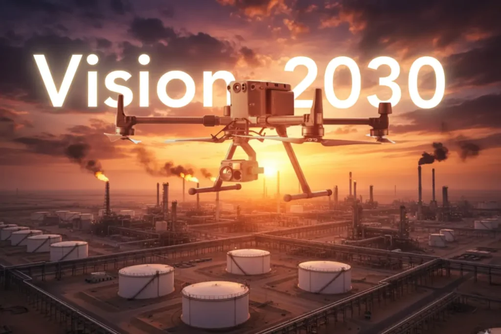
Capturing the Inspection Challenge Oil and gas remain central to Saudi Arabia’s economy and are critical to achieving the ambitions of Vision 2030. But maintaining the sector’s massive infrastructure from refineries and pipelines to storage tanks has always been a time-consuming, expensive, and risky process. Traditional inspections often rely on scaffolding, cranes, and shutdowns that disrupt operations for weeks at a time. Take the example of a diesel tank inspection. Traditionally, building and dismantling scaffolding, shutting down operations, and deploying manual crews could stretch the process to two weeks or more. During this period, the asset would be offline, resulting in millions of dollars in lost revenue. Now, drones are rewriting this story. The same inspection that once consumed two weeks was completed in just four hours using drones. That is a time savings of 13 days and 20 hours, transforming downtime into uptime and showing exactly why drones are a strategic pillar of Vision 2030. How Drones Transform Energy Operations The adoption of drones in oil and gas is not just about saving time; it is about transforming how the industry works. Faster Workflows: Drones bypass the need for scaffolding and manual climbs. With automated flight paths, they scan entire assets in hours, collecting high-resolution imagery and thermal data that can be analyzed immediately. High Accuracy: Drones equipped with zoom cameras, thermal sensors, and LiDAR detect cracks, corrosion, and leaks invisible to the naked eye. They capture centimeter-level detail, ensuring no defect goes unnoticed. Cost Efficiency: In energy and utilities, drone inspections can cut operational costs by 50–70%. They enable more frequent checks without shutdowns and reduce the manpower and equipment costs of traditional inspections. Safety Gains: Workers no longer need to scale flare stacks, powerlines, or refinery structures. By replacing risky climbs with aerial inspections, companies reduce workplace accidents in hazardous environments by as much as 91%. These technical advantages show why drones are not optional add-ons but enablers of efficiency, safety, and sustainability. Why This Matters for Vision 2030 Economic Efficiency: Faster inspections mean less downtime and higher productivity. Saving nearly 14 days of downtime in one inspection is not just impressive. It is transformative for an industry where every hour of output counts. Sustainability: Drones detect methane leaks faster and more frequently, reducing emissions by 30% or more. This supports the Kingdom’s environmental commitments under Vision 2030 and global climate frameworks. Safety and Social Impact: Reducing accident risk by 91% ensures that workers are safer, healthier, and more productive. This aligns with Vision 2030’s focus on enhancing quality of life. Cross-Sector Relevance: The same drone technology driving oil and gas efficiency also supports smart cities, utilities, agriculture, and environmental monitoring. By investing in drones, Saudi Arabia builds cross-industry capabilities that amplify the impact of Vision 2030. Drones are not just inspection tools; they are strategic assets that deliver measurable results across the national agenda. Roadmap for Scaling Drones in Vision 2030 To fully realize these benefits, Saudi Arabia must accelerate the adoption of drones across industries under Vision 2030. Regulatory Acceleration: Expand frameworks for safe beyond-visual-line-of-sight (BVLOS) operations, enabling drones to handle pipeline monitoring, logistics, and regional inspections without human oversight. Local R&D and Manufacturing: Invest in Saudi-based drone hardware, sensors, and data analytics platforms. This ensures the Kingdom builds sovereign capabilities and reduces reliance on imports. Ecosystem Platforms: Strengthen collaboration through platforms like SADEX, where regulators, operators, and innovators align standards, showcase real-world applications, and create joint ventures. Scaling Across Sectors: Move from pilots to national deployment by embedding drones into routine operations for oil and gas, utilities, smart cities, and agriculture. By following this roadmap, Saudi Arabia can position drones as a national infrastructure layer, not just a sector-specific tool.
Drones as a Pillar of Vision 2030: Integrating National Strategy and Unmanned Aerial Systems
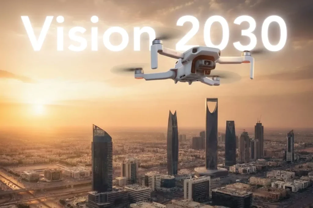
Saudi Arabia’s Vision 2030 is one of the most ambitious transformation programs in the world, aiming to diversify the economy, empower new industries, and deliver smarter, more sustainable cities. Achieving these goals requires advanced digital technologies, and drones are quickly proving themselves to be a pillar of this national strategy. Globally, drones have reshaped industries by cutting costs, reducing risks, and accelerating the delivery of projects. For the Kingdom, the potential is even greater. With its vast energy assets, ambitious smart city projects, and focus on sustainability, Saudi Arabia can lead the Middle East in drone adoption through forward-thinking regulation, public–private partnerships, and large-scale deployment across industries. Building Technical and Strategic Relevance Saudi Arabia’s Vision 2030 rests on three central pillars: creating vibrant societies, diversifying the economy, and building a sustainable future. Drones directly support these objectives by acting as scalable tools that capture, process, and deliver actionable data across the Kingdom’s critical industries. Vision 2030 Goals Supported by Drones Smart Cities Modern smart cities such as NEOM and The Line require live, accurate, and dynamic datasets to function. Drones generate digital twins of entire districts by combining LiDAR scans, RGB imagery, and multispectral data into GIS platforms. Urban mobility strategies also depend on drones for traffic analysis, congestion detection, and integration with UAV Traffic Management (UTM) systems, ensuring safe coexistence of drones and traditional air traffic. By automating city-wide monitoring, drones reduce the time to collect planning data from months to days, enabling urban developers to respond faster to growth challenges. Energy and Utilities Drones have already demonstrated their ability to transform inspections. For example, during a diesel tank inspection at an oil depot, drones reduced downtime from two weeks to just four hours, saving 13 days and 20 hours of lost operations. In utilities, drones inspect transmission lines and substations without cutting off power supply. Thermal cameras detect hotspots in transformers or insulators, while high-resolution zoom sensors identify cracks or corrosion before failure occurs. Compared to ground or rope-access inspections, drones deliver datasets that are both more comprehensive and safer, while reducing inspection costs by 50–70%. Agriculture and Food Security Saudi Arabia’s arid climate demands resource efficiency. Drones support precision agriculture by using multispectral cameras to detect crop stress, identify nutrient deficiencies, and guide irrigation schedules. Drones reduce manual labor costs by 30% and power consumption by 20% by optimizing input distribution and flight-based spraying. Yield prediction models improve accuracy when fed with drone-acquired NDVI (Normalized Difference Vegetation Index) data, allowing farmers to plan harvests and contribute to Vision 2030’s food security objectives. Environmental Sustainability Climate change and sustainability goals require persistent environmental monitoring. Drones equipped with methane detection sensors can detect and quantify leaks with high sensitivity. Frequent inspections reduce leak persistence and can cut emissions by 30% or more compared to traditional surveys. For air quality monitoring, drones fly pre-programmed routes equipped with 5 and PM10 sensors, providing real-time readings across industrial zones. In biodiversity management, thermal and multispectral cameras track wildlife movement, detect changes in vegetation cover, and monitor desertification patterns, helping the Kingdom align with its climate resilience strategies. Digital Infrastructure and Drone Integration The Kingdom’s future-ready economy requires robust digital infrastructure. Drones are not just tools for inspection; they are data-generation engines feeding national systems. GIS Databases: Drone imagery provides georeferenced data that feeds national geographic information systems, supporting planning, defense, and disaster response. LiDAR Mapping: High-density LiDAR scans build 3D terrain models accurate to a few centimeters, creating the foundation for digital twins and advanced civil engineering projects. Mobile Mapping: Drones extend mobile mapping into remote or hard-to-reach areas, where traditional survey vehicles cannot operate. Autonomy at Scale: With platforms like DJI Dock 3, drones operate autonomously, flying pre-programmed routes, charging automatically, and uploading data directly to the cloud. This ensures repeatable, standardized data collection that supports national-scale projects without requiring thousands of manual pilots. By integrating drones into digital infrastructure, Saudi Arabia positions itself to accelerate Vision 2030 goals across smart cities, energy diversification, agricultural sustainability, and climate action. Strategic Roadmap for Adoption For drones to become a true pillar of Saudi Arabia’s Vision 2030, adoption must move beyond isolated projects and pilot programs. It requires a strategic roadmap that ties national benefits to ecosystem development and regulatory modernization. National Benefits of Drones in Vision 2030 Operational Efficiency Across industries, drones have proven their ability to dramatically reduce inspection time and costs. In oil and gas, drones cut tank inspection time from two weeks to four hours, eliminating nearly 14 days of downtime. In agriculture, drone spraying reduces labor by 30% and lowers energy use by 20%, maximizing yields in arid regions. For utilities, drones reduce operational costs by 50–70% by eliminating the need for scaffolding, helicopters, or long shutdowns. Safety Enhancement Drones reduce the need for workers to scale flare stacks, powerlines, or telecom towers. By removing crews from these hazardous environments, accident risks drop by as much as 91%. This safety record strengthens compliance with workplace safety regulations while improving employee well-being. Data-Driven Governance High-resolution geospatial datasets from drones feed into GIS systems and digital twin models. This data enables ministries and municipalities to manage resources, monitor progress, and make evidence-based decisions. From monitoring Vision 2030 mega-projects like NEOM to tracking carbon emissions, drone data ensures progress is measurable and transparent. Multi-Stakeholder Ecosystem Development For drones to scale nationally, adoption must involve all stakeholders: Government Agencies: The General Authority of Civil Aviation (GACA) defines safe airspace rules for drone flights. Expanding frameworks for beyond-visual-line-of-sight (BVLOS) operations will be critical to unlocking logistics, transportation, and regional inspection projects. Industry Leaders: Oil and gas companies, utilities, and telecom operators are already deploying drones at scale. Sharing data and standardizing procedures will help expand adoption across sectors. Mega Projects: Initiatives like NEOM and The Line are testbeds for smart city drone integration, from urban mobility corridors to autonomous inspection systems. Academia and R&D: Universities and innovation centers can accelerate research into sensor technology, battery endurance, and autonomous navigation, ensuring Saudi Arabia