How Drone Topographic Mapping Captured 124 km² in 1 Month
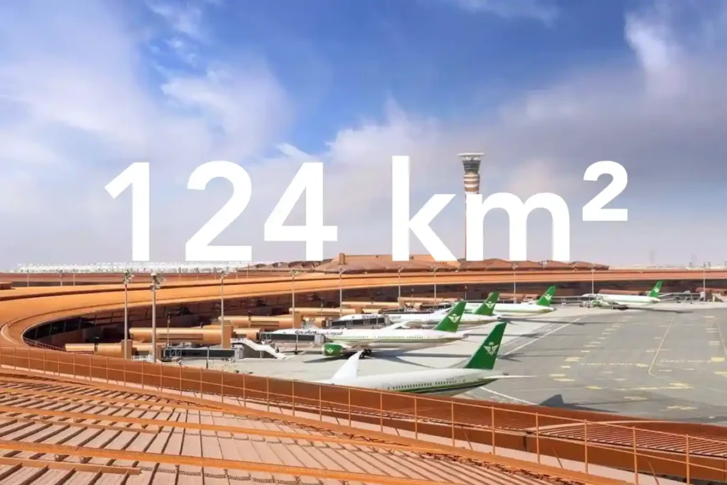
Every decision in a sewer upgrade or drainage expansion depends on the fidelity of the ground surface you hand to designers. In a dense urban corridor next to an international airport, conventional total station and GNSS traverses face line-of-sight gaps and obstruction bias that create uneven accuracy and patchy coverage. That risk is real in […]
Drone-Based Progress Tracking: Enhancing Accuracy, Safety, and Efficiency in Construction Projects
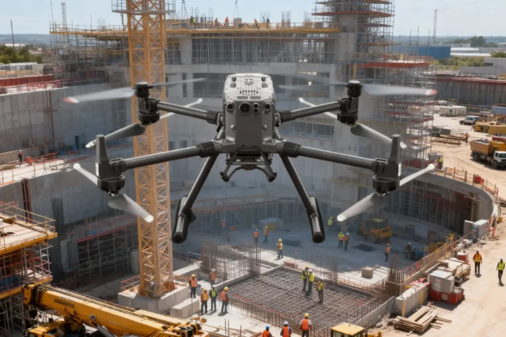
Highlight the Challenge in Project Monitoring Construction is a race against time, budgets, and safety risks. Projects involve thousands of moving parts, from contractors and materials to heavy machinery and schedules and keeping them aligned is one of the most difficult tasks in the industry. Progress monitoring is supposed to be the safeguard, yet in […]
Scaling Your Drone Fleet: Four Pillars for Pilots

Infrastructure managers often start small. One-off flights to inspect a bridge or survey an oil pipeline. Yet, when the time comes to expand, they encounter fragmented procedures, regulatory hurdles, and interoperability gaps. Scaling drone fleet capabilities provides the answer: a repeatable, secure, and high-impact program that spans dozens of assets without sacrificing quality or compliance. […]
Drone Survey in Saudi Arabia: Speeding to The Megaproject

Drone-based surveying in Saudi Arabia is rapidly redefining how infrastructure gets delivered. As the Kingdom embarks on Vision 2030’s multi-trillion-riyal transformation, drone surveying stands out as a critical catalyst. From NEOM’s futuristic skyline to the eco-sensitive terrain of Red Sea Global, the need for fast, accurate, and scalable geospatial intelligence has never been greater. Let’s […]
Drones as a Pillar of Vision 2030’s Infrastructure Strategy

Drones as a pillar of infrastructure strategy are becoming increasingly vital in realizing Saudi Arabia’s Vision 2030. This ambitious plan aims to diversify the economy and develop public service sectors, with a significant focus on infrastructure. Integrating drone technology into infrastructure projects offers unprecedented efficiency, safety, and data insights, aligning with the Kingdom’s transformative goals. […]
Saving $1 Million Worth of Downtime with Drone-Based NDT

Drone-based non-destructive testing solutions (NDT) are redefining how critical infrastructure is inspected across high-risk, asset-intensive industries. Whether in oil & gas, petrochemical processing, power generation, or heavy manufacturing, the need for accurate, timely, and safe inspection of complex structures has never been more pressing. Non-Destructive Testing (NDT) refers to a range of inspection techniques used […]
Advance Your Horizons: A Guide to Drone Career Path in 2025

The drone career path is no longer an emerging concept, it’s a well-defined route to high-value roles across industries that rely on precision, efficiency, and innovation. From flare stack inspections in oil & gas to aerial mapping in urban planning, drones have become a central part of modern operations. As we step into 2025, UAV […]
Drone Workforce Development: Building the Future Ahead

The rise of drone workforce development is reshaping modern industries worldwide. From oil and gas fields to construction zones and energy grids, drones have become indispensable tools for inspection, monitoring, and asset management. In an era defined by digital transformation and Industry 4.0, the demand for drone technologies is accelerating faster than ever. However, technology […]
Drones for Industrial Inspections: Transforming Asset Management

Drones for industrial inspections are rapidly redefining how organizations manage, monitor, and safeguard critical assets. Across sectors such as oil and gas, power generation, infrastructure, and mining, inspections are not only vital for ensuring operational safety, regulatory compliance, and efficiency, but also for preserving asset longevity and optimizing lifecycle management in heavy industries. Regular inspections […]
Predictive Modeling in Urban Planning: Urban Growth and Infrastructure Needs

Predictive modeling in urban planning is revolutionizing how cities grow and adapt to changing needs. As urban areas face rapid population growth, resource constraints, and environmental challenges, the demand for data-driven solutions has never been higher. Predictive modeling empowers planners to anticipate urban expansion, allocate resources effectively, and evaluate the impact of their decisions with […]