خدمات جيومكانية مرخّصة من GEOSA تشمل مسح ليدار، المسح بالليزر ثلاثي الأبعاد، تحليلات GIS، نمذجة BIM، والاستشعار عن بعد بالأقمار الصناعية. بيانات مكانية بهندسة دقيقة لقطاعات التعدين والنفط والغاز والبنية التحتية والتخطيط الحضري في المملكة العربية السعودية.
من مسح ليدار والمسوحات الأرضية بتقنية GNSS إلى الاستشعار عن بعد بالأقمار الصناعية وحلول GIS المؤسسية: نقدّم دورة الحياة الجيومكانية الكاملة تحت سقف واحد. مرخّصون من GEOSA، شريك Esri الفضي المعتمد، ومعتمدون بشهادات ISO لأكثر مشاريع المملكة تطلباً. مرخص بجيوصا, شريك Esri الفضي, ، و معتمد من الأيزو لأكثر المشاريع تطلباً في المملكة العربية السعودية.
جمع بيانات عالية الدقة
نوفر بيانات جيومكانية دقيقة عبر تقنيات متقدمة مثل التصوير المساحي وصور الأقمار الصناعية. معلومات موثوقة للتخطيط والتصميم واتخاذ القرار.
نحوّل البيانات الجيومكانية الخام إلى رؤى قابلة للتنفيذ عبر حلول GIS. تدعم هذه الخدمات التصور التفصيلي للمشاريع وإدارة الأصول وتخطيط البنية التحتية.
خبرة محلية بمعايير عالمية
بحضور قوي في المملكة، نجمع المعرفة المحلية بأفضل الممارسات العالمية. نضمن لعملائنا خدمات عالية الجودة تلبي المتطلبات التنظيمية المحلية والمعايير الدولية.
قدرات الخدمة
خدمات مكانية جغرافية شاملة من الاستحواذ الميداني إلى توصيل نظم المعلومات الجغرافية للمؤسسات. كل خدمة مدعومة بترخيص GEOSA، وشراكة Esri، وعمليات جودة معتمدة من ISO.
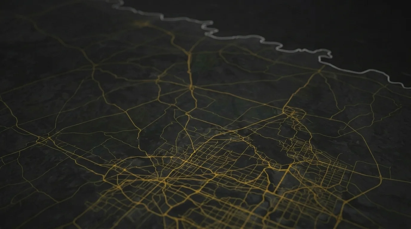
المسح ورسم الخرائط
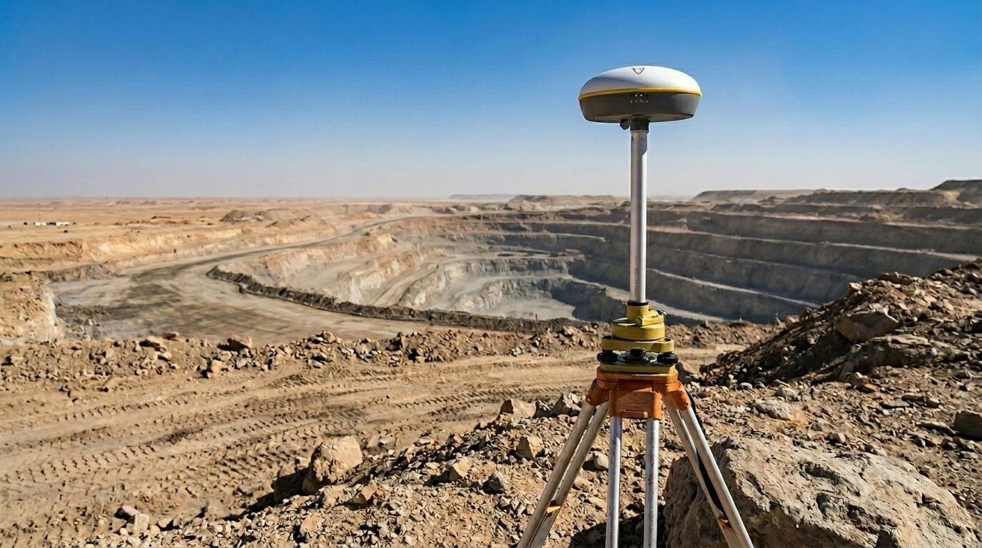
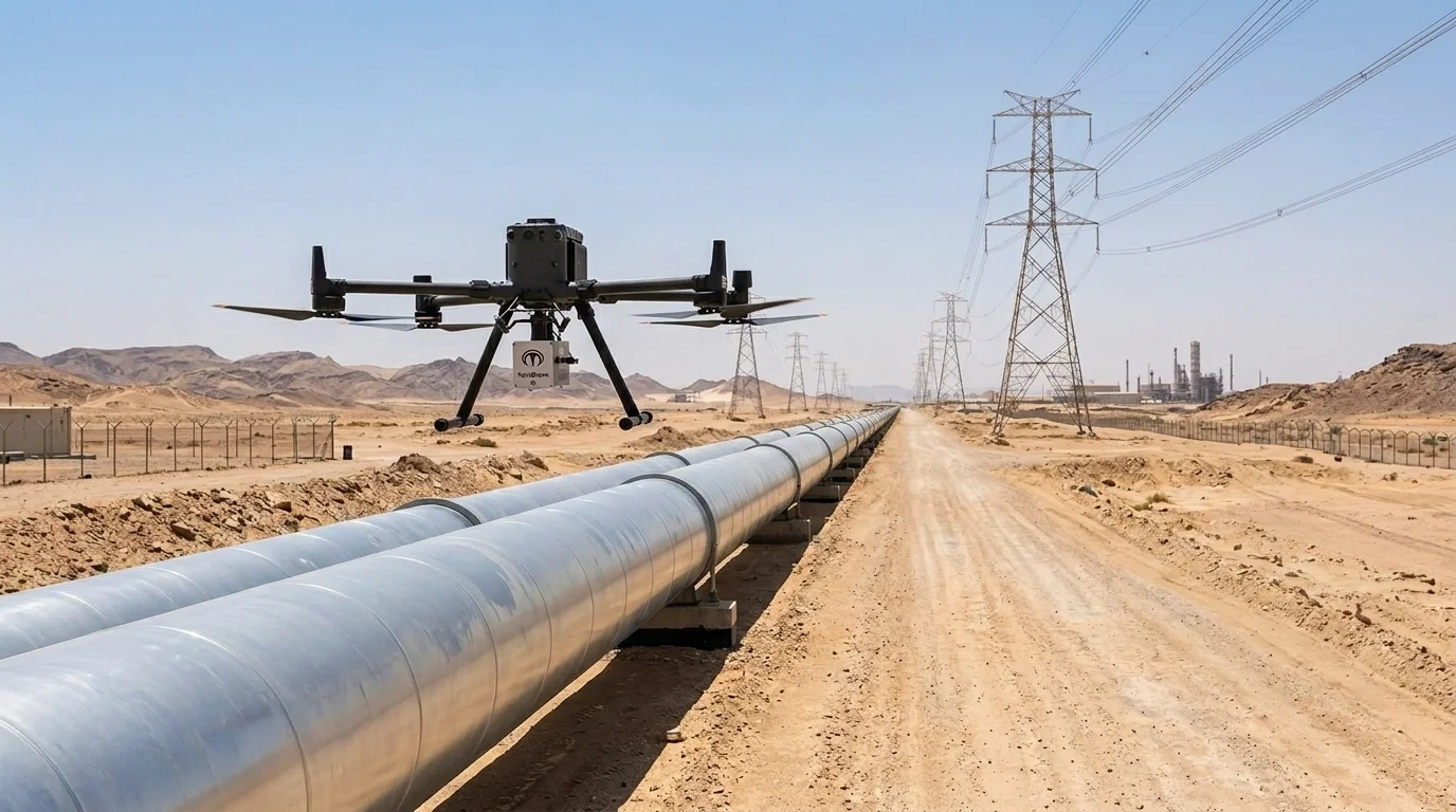
مسوحات طبوغرافية وشبكات تحديد المواقع العالمية (GPS) ومرافق تحت الأرض وخريطة الأعماق (باثيمترية) وهيدرولوجية شاملة باستخدام محطات الرصد المتكاملة، ومستقبلات GNSS RTK، والرادار المخترق للأرض (GPR). بيانات ميدانية دقيقة هندسية لتخطيط مواقع التعدين، وتحديد مسارات خطوط الأنابيب، والمشاريع البحرية، وتطوير البنية التحتية في جميع أنحاء المملكة العربية السعودية.
ما تواجهونه:
بيانات مسح قديمة غير موثوقة تسبب أخطاء في التصميم وتجاوزات في التكاليف
الأدوات والمرافق غير المكتشفة تحت الأرض تؤدي إلى أضرار أثناء الحفر وتأخير المشاريع
نقدّم:
مسح طبوغرافي (ليدار والتصوير المساحي)
مسح المرافق تحت الأرض (جي بي آر وأجهزة الاستشعار)
مسوحات قياس الأعماق والمسوحات الهيدروغرافية
شبكات التحكم الأرضي لأنظمة الملاحة بالراديو العالمي
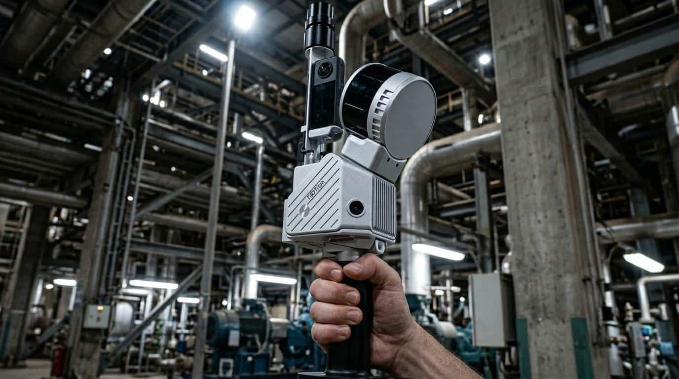
ليدار، المسح بالليزر، وبلوك نماذج معلومات البناء القائمة على الوضع الراهن
حوّل الأصول المادية إلى نماذج رقمية ثلاثية الأبعاد دقيقة بالسنتيمتر باستخدام مسح LiDAR الأرضي والمتنقل والجوي. من سحب النقاط الأولية إلى التسليمات الجاهزة لنمذجة معلومات البناء (LOD 100-500) في Revit و Navisworks و AutoCAD: العمود الفقري الرقمي لإدارة الأصول وصيانة المرافق وتخطيط التحديث في جميع أنحاء المملكة العربية السعودية.
ما تواجهونه:
لا توجد وثائق دقيقة للمنشآت الصناعية القديمة كما هي قائمة.
تعارضات التصميم وإعادة العمل المكلفة أثناء مشاريع التحديث والتوسعة
نقدّم:
مسح ليدار الأرضي والمتنقل
تحويل المسح الضوئي إلى BIM (مستوى التفاصيل 100-500)
بناء قواعد بيانات نظم المعلومات الجغرافية للمؤسسات وإجراء تحليلات مكانية متقدمة باستخدام منصة Esri ArcGIS. تحسين المسار، تصنيف استخدام الأراضي، تصور الأصول، وتحليلات مكانية تنبؤية مدعومة بالذكاء الاصطناعي لقطاعات التعدين والنفط والغاز وإدارة البنية التحتية في جميع أنحاء المملكة العربية السعودية.
ما تواجهونه:
بيانات مكانية معزولة تمنع الرؤية على مستوى المؤسسة للأصول الحيوية
عدم القدرة على الاستفادة من ذكاء الموقع للصيانة التنبؤية والتخطيط
نقدّم:
تطوير قواعد بيانات نظم المعلومات الجغرافية للمؤسسات (Esri ArcGIS)
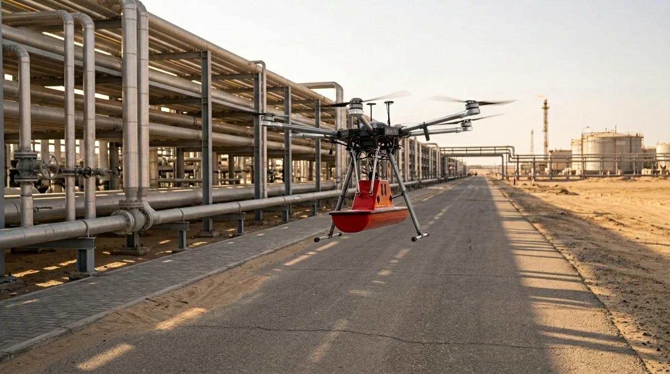
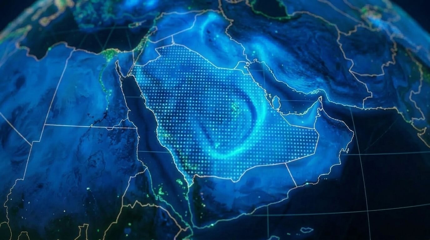
استغلال صور الأقمار الصناعية من أكثر من 20 مصدرًا، وتحليل متعدد الأطياف وفائق الطيف لتصنيف الغطاء الأرضي على نطاق واسع، ومراقبة الغطاء النباتي، والكشف عن التغيير، وتقييمات خط الأساس البيئي. دعم استكشاف التعدين، والتخطيط الزراعي، وتقييمات الأثر البيئي في جميع أنحاء المملكة العربية السعودية.
ما تواجهونه:
عدم القدرة على تتبع التغيرات البيئية أو الأصول على مر الزمن على نطاق واسع
مسوحات ميدانية مكلفة للمناطق التي لا يمكن الوصول إليها إلا عبر المراقبة بالأقمار الصناعية
كمخوّل شريك Esri الفضي و مرخص بجيوصا مشغل، تقدم Terra Drone Arabia حلولًا جغرافية مكانية بشكل أصلي ضمن بيئة ArcGIS. من جمع البيانات الميدانية باستخدام ماسحات LiDAR وأجهزة استقبال GNSS إلى لوحات معلومات نظم المعلومات الجغرافية الخاصة بالمؤسسات والتحليلات المكانية المدعومة بالذكاء الاصطناعي: تتدفق بياناتك بسلاسة من الاستحواذ إلى اتخاذ القرار.
مدعوم ب آيزو 9001:2015 إدارة الجودة, آيزو 45001:2018 شهادات السلامة المهنية، و آيزو 22301:2019 استمرارية الأعمال مضمونة، وجميع المخرجات تلبي أعلى المعايير لقطاعات التعدين والنفط والغاز والبنية التحتية في المملكة العربية السعودية.
من المسوحات الميدانية إلى لوحات معلومات نظم المعلومات الجغرافية للشركات: شريك واحد، سير عمل واحد.