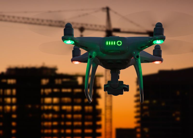
Saving $1 Million Worth of Downtime with Drone-Based NDT

Drone-based non-destructive testing solutions (NDT) are redefining how critical infrastructure is inspected across high-risk, asset-intensive industries. Whether in oil & gas, petrochemical processing, power generation, or heavy manufacturing, the need for accurate, timely, and safe inspection of complex structures has never been more pressing. Non-Destructive Testing (NDT) refers to a range of inspection techniques used to evaluate the condition of materials, components, or entire systems without causing damage or interrupting operations. Traditional NDT methods, such as ultrasonic testing, visual inspection, magnetic particle testing, or radiography have been industry staples for decades. However, they often require production shutdowns, extensive manual access setups like scaffolding or rope access, and, in many cases, expose technicians to confined spaces, heights, or hazardous environments. This operational friction becomes especially problematic when inspections must be frequent, time-sensitive, or performed across wide geographic areas, such as pipeline corridors, offshore facilities, high-voltage substations, or elevated flare stacks. Moreover, the global push toward predictive maintenance, digital twin modeling, and ESG compliance is facing pressure on industries to modernize how inspections are conducted and reported. Drone-based non-destructive testing solutions introduce a paradigm shift. These systems, equipped with high-resolution RGB cameras, thermal imagers, ultrasonic sensors, LiDAR payloads, and real-time data links, can access challenging or dangerous environments without interrupting ongoing operations. By flying above, around, or inside critical assets, drones offer a safer, faster, and more scalable way to detect structural anomalies, surface corrosion, material thinning, or thermal inefficiencies. In industrial ecosystems where every hour of downtime can cost hundreds of thousands of dollars, and where safety risks must be proactively managed, drone-based inspection methods are no longer experimental; it’s mission-critical technologies. These systems support smarter decision-making, enhance asset visibility, and enable a move away from reactive “run-to-fail” maintenance models toward condition-based monitoring and predictive diagnostics. Terra Drone Arabia, a regional leader in drone-enabled inspection and geospatial intelligence, brings this capability to life through a suite of drone platforms and payload integrations tailored for industrial NDT use cases. Whether it’s ultrasonic thickness measurement of refinery tanks, thermal analysis of electrical components, or LiDAR scans of hard-to-access infrastructure, drone-based non-destructive testing solutions now empowers industries to inspect with confidence, without compromise. The Cost of Downtime in Industrial Operations A recent “Value of Reliability” survey reveals that more than two-thirds of industrial businesses face unplanned outages at least once a month, each costing an average of nearly $125,000 per hour. Surprisingly, despite these high stakes, 21% of the surveyed companies still operate under a run-to-fail maintenance approach. This reactive approach may appear cost-effective on the surface by avoiding upfront maintenance costs or extended inspection procedures, but it exposes operations to exponentially higher risks. Downtime disrupts production schedules, leads to missed SLAs, and can even result in cascading failures across interconnected assets. In high-throughput sectors like oil & gas, refining, or power generation, the true cost of downtime extends beyond direct financial loss. It includes: Lost production output For a refinery producing 250,000 barrels per day, even a few hours offline could equate to millions in lost revenue and delayed distribution contracts. Asset degradation and damage escalation Without early detection, issues like internal corrosion, fatigue cracking, or thermal stress can intensify, leading to unplanned shutdowns or even catastrophic failure. Safety and environmental risks Critical infrastructure failures, especially in high-pressure vessels, pipelines, or flare stacks, can cause HSE incidents, regulatory violations, and environmental damage. Supply chain disruption Many industrial operations operate within tightly linked ecosystems. Equipment failure at one facility can trigger upstream or downstream impacts across multiple sites. The shift toward predictive maintenance is not just a technological evolution, it’s a strategic imperative. Predictive models rely on continuous data from inspection systems and sensor networks to forecast equipment health and flag deviations early. However, these models are only as reliable as the quality and frequency of the data they receive. That’s where drone-based non-destructive testing (NDT) adds measurable value. By enabling more frequent, high-resolution inspections without interrupting operations, drones ensure that predictive models are continuously fed with accurate field data. This enhances forecasting accuracy, enables smarter resource allocation, and reduces the risk of surprise failures. Moreover, drone-based inspections significantly lower the need for temporary infrastructure such as scaffolding, rope access, or specialized work permits. This results in faster turnaround times, reduced labor hours, and improved personnel safety, without compromising inspection quality. As industries across MENA and globally move into the modern Industry, reducing unplanned downtime is no longer a reactive tactic. It is a benchmark of digital maturity and operational excellence. Advantages of Drone-Based NDT Over Traditional Methods Traditional non-destructive testing (NDT) methods—while proven—often come with significant operational challenges, especially in industrial environments where scale, complexity, and safety are paramount. Inspections typically require partial or full equipment shutdowns, manual access solutions such as scaffolding or rope systems, and significant human presence in hazardous or confined environments. These limitations not only increase inspection time and cost but also elevate risk and restrict the frequency of assessments. Drone-based non-destructive testing solutions, on the other hand, offer a modern, flexible alternative that aligns with real-time operational needs and Industry standards. Below is a breakdown of the key advantages of drone-enabled NDT compared to traditional inspection practices. Operational Continuity Many traditional NDT methods necessitate shutting down operations, draining tanks, or isolating systems to allow safe access for inspectors. This process not only halts productivity but also introduces complex permitting, manpower scheduling, and safety planning requirements. Drone-based NDT enables real-time inspections without disrupting ongoing operations. Whether it’s inspecting flare stacks during combustion, capturing tank roof conditions while in service, or surveying active substations, drones can perform thorough assessments without affecting asset availability. This supports continuous production and minimizes financial losses tied to downtime. For example, a refinery flare tip inspection that would traditionally require shutdown, scaffolding, and days of preparation can now be completed in under an hour using a drone with high-resolution zoom optics and thermal overlays. Enhanced Safety Traditional manual NDT inspections often place technicians in hazardous positions—on high structures, inside confined vessels, or near live
Terra Drone Arabia Showcases Drone Solutions at NAP Tech 2025 to Advance Aramco’s Operational Excellence

Terra Drone Arabia recently participated in Saudi Aramco’s NAP Tech 2025, an event hosted by Saudi Aramco Northern Area Production (NAP) on May 13, 2025, in Tanajib, KSA. NAP Tech 2025 aimed to showcase the latest technological advancements and innovative solutions, providing a platform for networking, knowledge sharing, and collaboration among industry peers. Terra Drone Arabia’s participation highlighted its commitment to supporting Saudi Aramco by showcasing its drone services relevant to NAP operations. These services included surveillance and security patrols, innovative drone inspections for plants and facilities, and environmental monitoring. The company displayed three specific drone technologies: the DJI Dock 3 with DJI M4TD for inspection, surveillance, and environmental monitoring; the Terra Xross 1 for internal inspection and 3D modeling; and the Elios 3 for internal visual and NDT inspection. Terra Drone Arabia’s presence at NAP Tech 2025 was intended to demonstrate its efforts in localizing unique drone solutions and its partner network. The company aimed to show how these technologies could support Saudi Aramco’s operations. Key stakeholders involved in the event included Saudi Aramco NAP, DJI Enterprise, and Terra Drone, with the target audience being clients and the public.
Drones for Industrial Inspections: Transforming Asset Management

Drones for industrial inspections are rapidly redefining how organizations manage, monitor, and safeguard critical assets. Across sectors such as oil and gas, power generation, infrastructure, and mining, inspections are not only vital for ensuring operational safety, regulatory compliance, and efficiency, but also for preserving asset longevity and optimizing lifecycle management in heavy industries. Regular inspections form the backbone of both preventive and reactive maintenance strategies, enabling companies to detect early signs of wear, plan timely interventions, and avoid costly failures that can disrupt operations. Traditionally, inspection methods have been labor-intensive, costly, and high-risk. However, with the rise of unmanned aerial vehicles (UAVs), industries worldwide are embracing a technological shift that delivers faster, safer, and more accurate inspections. As global demand for smarter asset management grows, drone-based inspections are becoming an essential tool for forward-thinking companies. Traditional Industrial Inspection Methods Historically, industrial inspections relied heavily on manual techniques: Rope Access Technicians equipped with harnesses and specialized climbing equipment manually ascend structures such as flare stacks, towers, bridges, or wind turbines. Rope access offers flexibility in reaching high or complex locations but exposes workers to significant fall risks. Scaffolding and Elevated Work Platforms Building temporary scaffolding structures or deploying mechanical lifts allows inspectors to physically reach elevated or awkward areas. While effective, a scaffolding setup can take days and often incurs high labor and material costs. Additionally, it introduces project delays and increases the footprint at the worksite. Confined Space Entry Inspectors physically enter restricted environments like storage tanks, boilers, and ship ballast tanks. These operations require extensive safety protocols, including atmospheric testing, protective equipment, confined space permits, and standby rescue teams. Despite these precautions, confined space entry remains one of the highest-risk activities in industrial environments. Helicopter Surveys In sectors like utilities and oil and gas, helicopters are sometimes used for aerial inspections of pipelines, power lines, and remote facilities. While faster than ground surveys, helicopter operations are extremely expensive, weather-dependent, and present flight safety risks. Manual Visual Inspections Inspectors walk through facilities, visually checking for signs of wear, corrosion, cracks, or operational anomalies. This method depends heavily on human judgment, which can vary from inspector to inspector, leading to inconsistent reporting and subjective assessments. Contact-Based Testing Non-destructive testing (NDT) methods, such as ultrasonic thickness measurements or radiographic testing, require physical placement of sensors or devices onto structures. While offering precise measurements, these techniques necessitate direct access, often increasing risk and downtime. These techniques, although time-tested, come with inherent limitations that increasingly clash with modern demands for efficiency, safety, and precision. Safety risks remain a major concern. Inspectors are often exposed to hazardous environments, including heights, tight spaces, or chemically active areas. Time consumption is another challenge, as setting up access equipment and executing manual surveys can lead to operational delays. Furthermore, inspection costs escalate quickly due to labor, equipment rental, and production downtime. Most critically, traditional methods often produce subjective, lower-quality data compared to modern imaging and sensing technologies. As industries face mounting pressure to improve operational efficiency, ensure workforce safety, and meet environmental, social, and governance (ESG) commitments, traditional inspection methods are increasingly seen as unsustainable for the future. Stakeholders are demanding faster inspections, better data, fewer accidents, and lower environmental impact — all while maintaining regulatory compliance. This evolving landscape has set the stage for the rapid adoption of innovative solutions like drone inspection, where unmanned aerial technologies deliver a smarter, safer, and more efficient alternative. Drones for industrial inspections have emerged precisely because they address the deep-rooted challenges associated with manual methods, offering a future-forward solution that aligns with the demands of modern industry. Emergence of Drones in Industrial Inspections The development of drones for industrial inspections stems from the broader evolution of UAV technologies over the last two decades. Originally designed for military applications, drones have expanded into commercial and industrial sectors, offering safe and efficient alternatives to traditional inspection processes. By the early 2010s, industries realized that drones could capture detailed data while minimizing risks and operational disruptions. Today, inspection drones come equipped with advanced payloads such as: High-resolution optical cameras Thermal imaging sensors LiDAR scanning systems Ultrasonic and NDT inspection tools Different types of drones serve distinct purposes: Multirotor drones for detailed stationary inspections Fixed-wing drones for long-range infrastructure surveys Indoor collision-tolerant drones for confined spaces and GPS-denied environments This technological shift has empowered industries worldwide—from North America and Europe to the Middle East and Asia-Pacific regions—to modernize asset management practices. Key Benefits of Drone-Based Inspections The integration of drones for industrial inspections has introduced a profound shift in how industries approach asset maintenance and safety assurance. Moving beyond traditional methods, UAV technology offers layered advantages that enhance every stage of the inspection process from preparation to final reporting. Unparalleled Safety Enhancement Industrial environments such as refineries, offshore platforms, transmission towers, and confined tanks have long posed significant dangers to human inspectors. Falls from height, exposure to toxic gases, confined space incidents, and proximity to high-voltage systems are critical risks. Drones eliminate the need for physical access to hazardous zones, allowing inspections to be conducted remotely, thereby reducing injury risks and supporting compliance with stricter health and safety regulations. Drastic Acceleration of Inspection Timelines Traditionally, inspections could halt operations for days while scaffolding was erected, rope teams mobilized, and safety systems prepared. With drones, full-scale inspections can be completed in hours, not days, minimizing downtime and preventing costly interruptions, especially in sectors where every operational hour counts, such as oil and power generation. Significant Cost Reductions The traditional inspection model incurs heavy costs from scaffolding construction, equipment rentals, helicopter usage, specialized insurance, and labor overtime. Drone-based inspections streamline operations with minimal setup and reduced manpower, freeing up budgets for preventive maintenance investments rather than reactive crisis spending. High-Precision, Actionable Data Collection Drones offer a quantum leap in data richness and accuracy. Equipped with HD cameras, 4K video, thermal imaging, multispectral sensors, and LiDAR, UAVs collect detailed, objective datasets. This transition from subjective human observation to quantifiable data supports predictive maintenance models, informed investment
Telecommunications: How Its Safety Inspection Can Be Enhanced

Telecommunications infrastructure plays a crucial role in modern society, and ensuring its safety is paramount. Telecom tower LiDAR inspections have emerged as a game-changer, enhancing the safety and accuracy of inspections. This blog explores how LiDAR technology integrated into drones is revolutionizing telecommunications inspections by providing high-precision data, enabling remote monitoring, and significantly reducing risks. The Power of LiDAR in Telecommunications Inspections Telecommunications companies are increasingly turning to Drone-based LiDAR for inspections due to its ability to capture precise 3D models of telecom towers. LiDAR, for Light Detection and Ranging, uses laser pulses to measure distances, creating accurate digital representations of structures. These digital twin models allow for detailed analysis, helping to identify structural weaknesses or potential hazards that may not be visible to the naked eye. By employing aerial photography and aerial video capabilities, LiDAR-equipped drones can access hard-to-reach areas of telecom towers without putting human inspectors at risk. This modeling process improves the accuracy of inspections and allows for comprehensive services that can be conducted more efficiently and safely. Safety and Efficiency in Drone-based LiDAR Inspections The integration of LiDAR in telecommunications has significantly enhanced drone safety inspections. By eliminating the need for technicians to physically climb towers, drones reduce the risk of accidents and injuries. Instead, drones equipped with LiDAR technology provide a remote, bird’s-eye view of the tower, capturing every detail necessary for a thorough inspection. The services offered by Drone-based LiDAR include real-time data collection and instant analysis, enabling telecommunications companies to make quick, informed decisions. The precision and efficiency of LiDAR also lead to cost savings by reducing the need for repeat inspections and minimizing downtime. In A Nutshell The Future of Telecommunications Safety As the telecommunications industry continues to evolve, the role of LiDAR technology in drone safety inspections will only grow. By embracing these advanced services, companies can ensure the integrity of their infrastructure while protecting the safety of their workforce. The future of telecommunications inspections is here, and it’s safer, smarter, and more efficient than ever before.
Powerline Inspection: Redefining How Its Utility Is Managed

Powerline inspection visual data collecting can be a lengthy process for several reasons, even with a large team involved. Here are the key factors that contribute: Scale and Scope of Power Grids: Power grids cover vast areas, often extending over thousands of kilometers with multiple branches and components. Inspecting every line, pole, transformer, and other infrastructure component is inherently time-consuming due to the extensive network. Accessibility Challenges: Many powerlines are located in remote or hard-to-reach areas, such as mountains, forests, or across water bodies. Accessing these sites can be challenging and time-consuming, often requiring specialized equipment and vehicles. Data Quality and Detail: High-quality visual inspections involve not just a quick overview but a detailed check of each component. Inspectors look for cracks, corrosion, sagging, and other potential issues that might take time to be apparent. This level of detail requires time at each inspection site. Weather and Environmental Conditions: Inspections are often dependent on weather conditions. Adverse weather like rain, fog, or high winds can delay inspections because they not only make access more difficult but also impair the quality of visual data collected. Data Processing and Analysis: After collecting the visual data, significant time is required to process and analyze this information. With the volume of data collected, especially using high-resolution cameras or drones, processing and interpreting the data to identify issues and determine the health of the infrastructure can extend the timeline. Safety Protocols and Compliance: Ensuring the safety of the inspection teams and compliance with regulatory requirements also adds to the duration. Each inspection must be carried out with strict adherence to safety standards, which can limit the speed of work, especially in hazardous areas. Coordination and Logistics: Managing a large team and coordinating their tasks efficiently across a wide area involves substantial logistical efforts. Ensuring that all teams are equipped, in the right place, and working in sync is a complex task that impacts the overall timeframe. These factors combined mean that even with a substantial workforce, the process of comprehensively inspecting a power grid and analyzing the collected data can take a year or more. Furthermore, this practice is exposed to heightened risks while working on scaffolds or cranes, largely due to a complex interplay of various factors that compromise their safety. Firstly, the very act of working at significant heights inherently increases the likelihood of serious injury or death should a fall occur. Additionally, the stability of these high platforms can be compromised by improper setup, uneven terrain, or mechanical failures. The conditions under which these professionals operate can further exacerbate these risks. Adverse weather conditions, such as high winds, rain, or ice, can make the surfaces of scaffolds slippery and unstable, increasing the risk of falls. The physical condition of the equipment itself is equally critical; scaffolds and cranes that are worn out, damaged, or poorly maintained are prone to failure, which can precipitate accidents. Furthermore, the risks are compounded by human-related factors, such as improper use or assembly of the equipment. Using scaffolding or cranes on uneven surfaces, failing to utilize stabilizers correctly, or overloading the equipment can lead to unstable working platforms. Additionally, the lack of proper personal protective equipment (PPE) such as harnesses, lanyards, and helmets, or the improper use of these, can leave workers vulnerable to injuries. Human error also plays a crucial role in the safety of powerline inspectors. Mistakes made during climbing, overreaching, or failure to secure tools and materials can disrupt the balance or entangle the structure, leading to falls. The absence of adequate training and safety awareness concerning working at heights and equipment operation can lead to critical oversights. Moreover, fatigue and excessive workload contribute to impaired judgment and reduced physical capability, further heightening the likelihood of accidents. Thus, powerline inspectors must navigate a myriad of challenges that require strict adherence to safety protocols, proper equipment maintenance, and continuous training to mitigate the multifaceted risks associated with their high-altitude work environments. However, this inspection has been revolutionized by the advent of drone technology. Drones have transformed many industries, and powerline inspection is no exception. By leveraging advanced technology, drones, also known as utility inspection drones or powerline surveillance drones, are revolutionizing how we inspect and maintain powerlines. The traditional methods of powerline inspection have their limitations, and this is where drones come in, providing safer, more efficient, and cost-effective solutions. Regular inspection of powerlines is crucial to maintaining the integrity and reliability of electrical grids. Powerlines are the backbone of our electricity infrastructure, and any damage or faults can lead to significant disruptions and hazards. Therefore, ensuring that powerlines are in good condition is vital for both public safety and the continuity of electrical services. The integration of drone technology into powerline inspections marks a significant shift from traditional methods. Drones equipped with high-resolution cameras and sensors can quickly and efficiently inspect powerlines, providing detailed data that helps in the early detection of issues. This not only enhances the effectiveness of inspections but also reduces the risks associated with manual inspections. The Need for Powerline Inspection Maintaining the integrity of power through regular inspections has other numerous benefits. It helps in identifying potential problems before they escalate, ensuring uninterrupted power supply, and saving 30%-50% of money and time through several efficiencies and cost-saving mechanisms. Here is how they achieve these savings in both financial and temporal aspects: Saving Time: Increased Coverage Speed: Drones can fly quickly along powerlines and cover large distances in a fraction of the time it would take for ground crews or manned aircraft inspections. This rapid coverage means that more of the grid can be inspected in less time, leading to faster completion of inspection cycles. Immediate Data Acquisition: The data collected by drones is available in real-time or near real-time, which allows for immediate analysis and action. This immediacy reduces the cycle time from problem identification to decision-making compared to traditional methods that might require developing film or processing data from manual inspections. Reduced Setup Time: Drones eliminate the
Enhancing Grid Stability with Drone Technology

Precision Monitoring with UAVs Drone grid stability is increasingly vital as energy companies deploy these aerial devices to ensure that their infrastructure operates reliably and efficiently. Drones have become crucial in maintaining the stability of electrical grids, offering an aerial advantage that ground-based inspections cannot match. As drone technology continues to advance, its implementation is essential for the consistent, efficient operation of power networks. Drones streamline the inspection process by covering vast areas in a fraction of the time it would take ground crews to do so. They can easily access remote or difficult-to-reach areas without the need for human climbers or heavy machinery, which not only reduces costs but also minimizes the risk to human life. Early Detection of Potential Issues A key advantage of using drones for grid stability is their ability to identify early signs of potential disruptions, such as overgrowth interfering with power lines or early-stage damage that could lead to failures. Thermal imaging technology allows drones to detect overheating joints or components that could indicate electrical issues before they lead to power outages. By catching these problems early, energy companies can schedule maintenance before issues escalate, ensuring that the grid remains stable and reliable. This proactive approach to maintenance is crucial for avoiding costly and disruptive power outages. Enhancing Preventative Maintenance Practices Drones not only identify existing problems but also help in implementing preventative measures to enhance grid resilience. Detailed aerial data collected by drones assists in creating accurate maintenance schedules and resource allocation, optimizing the overall health of the power grid. Moreover, drone data can be integrated with advanced analytical tools to predict potential problem areas, allowing utility companies to address weaknesses in the grid before they result in failures. This predictive maintenance capability is transforming how energy sectors manage their infrastructure, shifting from reactive to preventive strategies. In A Nutshell The integration of drones in maintaining grid stability represents a pivotal shift towards more secure and efficient energy distribution. As drone technology continues to evolve, its role in electrical grid maintenance is set to expand, promising even greater enhancements in grid management and reliability. Read more about it here: Eliminate Grid Downtime With Drone Inspection
Drones in Energy Sector: Ensuring Infrastructure Integrity

Drones in the energy sector have become indispensable as global energy demand escalates, introducing innovative solutions for maintaining and managing the infrastructure that supports its production and distribution. In this context, drones, or unmanned aerial vehicles (UAVs), have emerged as a technological boon. By equipping the energy sector with aerial capabilities, drones not only streamline inspections but also revolutionize maintenance protocols, ensuring that the backbone of the global energy supply remains robust and uninterrupted. The Advent of UAV Technology in Energy Infrastructure The adoption of UAV technology within the energy sector marks a significant evolution from traditional methods, which often involve high costs and considerable risks. Drones are now extensively used for the inspection of pipelines, power lines, wind turbines, and solar panels—components critical to the energy infrastructure. Drones are not just tools for visual inspection; they are platforms for advanced sensors that measure everything from thermal signatures to gas leaks. This capability allows for a comprehensive health assessment of energy infrastructure, providing crucial data that informs the maintenance schedules and safety standards of the facilities. Their ability to capture real-time, high-quality data reduces the frequency and necessity of human inspections, thereby reducing exposure to hazardous working conditions. Drones, equipped with a variety of sensors, can perform complex surveillance tasks that go beyond simple visual inspections. They can be outfitted with thermal imaging cameras to detect overheating panels or machinery, multispectral sensors to assess the health of vegetation around solar panels, and LiDAR (Light Detection and Ranging) systems to create detailed topographical maps. This multi-faceted sensor technology allows for a much more nuanced understanding of the state of energy infrastructure, revealing problems that might not be visible to the naked eye. Furthermore, UAVs are instrumental in conducting geomagnetic surveys in the exploration phase of oil and gas production, providing data that helps pinpoint potential drilling sites more accurately than ever before. This application of drones not only speeds up the exploration process but also makes it more cost-effective and less environmentally invasive. The adaptability of drones to various environments plays a crucial role in their growing ubiquity in the sector. Whether flying over the high seas to monitor offshore oil platforms or weaving through the complex environments of hydroelectric power facilities, drones deliver a level of agility and precision that traditional methods simply cannot match. Moreover, the integration of drone technology into energy infrastructure management is continually evolving. For example, the development of autonomous drones, which can perform routine inspections without human intervention, is on the rise. These autonomous systems are programmed to navigate challenging environments and collect data autonomously, thereby further reducing the need for human involvement and enhancing safety. The impact of such technology is profound, transforming not just operational efficiencies but also the safety protocols within the energy sector. By minimizing the need for human inspectors to engage directly with potentially hazardous conditions, drones are not just tools of convenience but are essential instruments of safety and prevention. Enhancing Safety and Efficiency in Routine Inspections The implementation of drones in routine inspections represents a significant advancement in both safety and efficiency within the energy sector. These aerial devices are capable of accessing potentially hazardous areas with unparalleled precision, reducing the need for human inspectors to encounter dangerous conditions. This shift is particularly beneficial in environments that are inherently risky, such as the tall structures of wind turbines or the expansive and often unstable terrain of oil and gas fields. Drones enhance operational safety by conducting thorough inspections from a safe distance. Equipped with high-definition cameras and other sensory equipment, they can quickly identify structural weaknesses, corrosion, or other potential hazards on high-voltage power lines and oil pipelines. This capability not only protects workers from the risks associated with direct contact inspections but also significantly reduces the downtime that these inspections may require. Furthermore, the efficiency of using drones in routine inspections cannot be overstated. Traditional methods often involve large crews and heavy equipment, which can be both time-consuming and costly. Drones, on the other hand, can be deployed rapidly and frequently without the same level of resource commitment. They can cover large areas in a fraction of the time it would take ground crews to perform the same task, providing real-time feedback that is essential for the immediate assessment and response to any detected issues. Moreover, the data collected by drones during these inspections is of a higher quality and greater detail than what can typically be gathered through manual methods. Advanced imaging technologies, such as thermal imaging and 3D mapping, allow drones to capture a comprehensive view of the infrastructure’s condition. This data is invaluable for predictive maintenance, where the goal is to anticipate and resolve issues before they lead to failures. Additionally, the integration of artificial intelligence (AI) with drone technology furthers the potential of these inspections. AI algorithms can analyze the data collected by drones to detect patterns and predict potential problems before they become apparent to human observers. This application of AI enhances the predictive capabilities of maintenance strategies, shifting from a reactive to a proactive approach that ensures higher operational continuity and safety. Dive into how drones are crucial in energy sector: The importance of drones in the energy industry Revolutionizing Maintenance with Precise Data Collection The precision and comprehensiveness of the data collected by drones are transforming maintenance strategies within the energy sector from reactive to proactive and predictive models. These UAVs, equipped with state-of-the-art sensors, gather a variety of data types that enable a more detailed analysis of infrastructure health than ever before. For instance, drones equipped with thermal imaging can effortlessly identify hot spots on electrical grids or detect leaks in pipelines by observing variations in temperature that are indicative of faults. Similarly, optical and hyperspectral sensors offer insights into the condition of structures by capturing images across various wavelengths. These images can reveal corrosion, moisture accumulation, and other signs of deterioration that might not be visible to the naked eye. Moreover, the integration of vibration sensors on
The Integration of Drones and Building Information Modeling (BIM)

In the rapidly evolving world of construction technology, the integration of drones and Building Information Modeling (BIM) stands out as a pioneering advancement. This powerful combination enhances architectural planning, structural engineering, and project management, revolutionizing how projects are approached, managed, and executed. By marrying aerial insights with detailed 3D modeling, the construction industry is achieving unprecedented levels of precision and efficiency. The Evolution of Construction Technology The digitization of the construction industry has been significantly bolstered by advanced tools such as unmanned aerial vehicles (UAVs) paired with BIM technology. These innovations provide a dynamic platform for professionals to visualize, plan, and execute construction projects with enhanced accuracy and control. This section explores the historical development of both drones and BIM, explaining how their paths converged to form a symbiotic relationship in modern construction practices. Read more about design: Architecting from Above: The Use of Drones for Construction Design Drones: Aerial Efficiency on Construction Sites Unmanned aerial vehicles (UAVs), have transformed the construction industry by offering a unique perspective that can significantly enhance the efficiency of construction site operations. Here’s a deeper exploration of how drones contribute to aerial efficiency in construction sites: Real-Time Data Collection and Mapping Drones are equipped with high-resolution cameras and various sensors, which can gather comprehensive data from a construction site in real-time. This capability allows them to perform aerial surveys and create detailed maps much faster than traditional ground-based survey methods. Photogrammetry, a technique used by drones, involves capturing a series of photographs from the air and using them to generate topographic maps, 3D models, and volumetric measurements. These models are crucial for planning and verifying site conditions against project specifications. Enhanced Monitoring and Progress Tracking Drones can fly over a construction site multiple times a day, providing up-to-date imagery that helps project managers monitor ongoing work and track progress against the project timeline. This frequent monitoring helps in quickly identifying and resolving discrepancies from the project plan, ensuring that the construction stays on track. Moreover, the visual data collected can be integrated into BIM systems, allowing for a dynamic visual representation of progress that can be shared with stakeholders for better communication and collaboration. Improved Inspection and Quality Control The agility and maneuverability of drones make them ideal for inspecting hard-to-reach areas such as high roofs, tall buildings, and large-scale infrastructure. Drones can be used to conduct visual inspections for quality assurance, detecting issues like structural weaknesses, water pooling, and improper installations. Thermal imaging technology can also be attached to drones to detect leaks, insulation breakdowns, or electrical faults that are not visible to the naked eye. This proactive approach to maintenance and quality control can prevent costly repairs and delays later in the project. Safety Enhancements Using drones significantly reduces the need for manual inspections in dangerous or inaccessible areas. By employing drones for routine inspections, construction sites can minimize the risk of accidents and injuries associated with workers climbing scaffolds, navigating steep roofs, or traversing unstable structures. Drones can quickly provide a comprehensive view of a potentially hazardous situation, enabling safety managers to evaluate risks and implement safety measures effectively. Environmental Impact Assessments Drones can play a crucial role in monitoring the environmental impact of construction activities. They can be used to survey and monitor local wildlife, water bodies, and vegetation to ensure compliance with environmental regulations. UAVs can assess the site before construction begins and continue to monitor the area throughout the construction phase, providing data that helps minimize the project’s environmental footprint. Building Information Modeling: The Backbone of Modern Construction Building Information Modeling (BIM) is more than just software; it’s a process that provides a digital representation of the physical and functional characteristics of a facility. BIM serves as a comprehensive resource for decision-making throughout a building’s lifecycle, proving invaluable in modern construction practices. This segment delves into the components of BIM, its evolution over the years, and its role in streamlining construction operations. Synergistic Benefits of UAVs and BIM The convergence of UAV technology and BIM software creates a seamless, interactive, and highly efficient workflow that enhances various aspects of construction management. This section explains in detail the synergistic benefits of integrating these technologies, emphasizing improved accuracy, enhanced project management, and cost efficiency. Dive deep more: How BIM and drones help on the job site Enhanced Accuracy and Reduced Errors Drones are instrumental in capturing high-resolution images and precise measurements using sensors such as LiDAR (Light Detection and Ranging), GPS, and infrared. This data is critical in creating highly accurate BIM models. For example, LiDAR technology allows drones to produce point clouds, which are sets of data points in space that can be used to create 3D models of the terrain or built environment. Integrating these accurate measurements into BIM reduces discrepancies between planned models and actual site conditions, minimizing costly errors and rework. Moreover, UAVs provide the capability to frequently update the BIM process with current site conditions. This is particularly beneficial in dynamic construction environments where changes occur rapidly. By continuously feeding updated data into BIM systems, drones ensure that the BIM models remain reflective of the on-site reality, thereby enhancing the accuracy of the project workflow and reducing errors associated with outdated information. Improved Project Management Drones can provide real-time insights and aerial views that are invaluable for project management. By integrating these views with BIM, project managers can obtain a comprehensive understanding of the project status, resource allocation, and potential bottlenecks. This integration enables proactive management and decision-making, as it offers a visual documentation trail that can help in resolving disputes, verifying milestone completions, and adjusting project timelines effectively. The visual data and models generated from drone surveys can be shared across platforms, improving communication among architects, engineers, project managers, and clients. This real-time data ensures that all parties have access to the most current information, fostering a collaborative environment where decisions are made efficiently and transparently. Additionally, integrating drone data into BIM platforms facilitates easier annotations and modifications, which can be instantly accessed
Elevated Inspections: Harnessing Drones for Inspection
High-rise Inspection: Employing Drone for Flare Checks The use of drones for inspection of flares in industrial environments is fast gaining traction. Drone technology, equipped with advanced sensors and thermal imaging, is offering a safer, faster, and more efficient approach to flare inspection. Let’s delve into how drones are transforming this vital industrial process. The Role of Drones in Flare Inspections Traditional flare inspections often involve significant safety risks and operational downtime. Drones, with their aerial maneuverability and advanced imaging capabilities, offer an excellent solution. They can safely inspect flare stacks in operation, capturing high-resolution thermal images, and detecting anomalies such as leaks or structural weaknesses. Also Read: Flying Clean: How Drone for Oil Spill Combat is Changing the Game Benefits of Drone-aided Flare Inspections Drones offer numerous benefits in flare inspections. They reduce safety risks associated with manual inspections and eliminate the need for shutdowns, resulting in significant cost savings. Furthermore, the high-quality data collected enables more accurate diagnostics and better-informed maintenance decisions. Read More: Terra Drone Indonesia Uses Drone for Inspecting Chevron’s Flare Stacks The Future of Drone-led Flare Inspections Drone technology continues to evolve, promising even greater advantages in the future. Next-generation drones may offer enhanced sensors, AI-driven analytics, and longer flight times, further increasing their utility in flare inspections. As this technology advances, drones will undoubtedly play an integral role in industrial inspection procedures. In conclusion, drones are revolutionizing the way flare inspections are conducted. As industries continue to adopt technological advancements, drones will undoubtedly prove instrumental in making flare inspections safer, more efficient, and more reliable. See More: Terra Drone Conducts Flare Stack Inspection For State Energy Company ENAP