Terra Drone Arabia provides comprehensive aerial and underwater inspection services that drastically reduce downtime, improve safety, and deliver high-resolution actionable insights — all without scaffolding, shutdowns, or confined-space entry.
Existing Problems Our Customers Face
High-risk environments
Traditional inspection methods often require working at height, in confined spaces, or hazardous areas.
Operational downtime
Many inspections require partial or full shutdowns of operations, impacting productivity.
Inaccessibility
Vertical or internal assets such as tanks, chimneys, flare tips, and stacks are challenging to reach.
Data Limitations
Manual inspection methods can overlook micro-defects or fail to provide uniform, repeatable measurements.
High Inspection Costs
Expenses from scaffolding, rope access teams, shutdown coordination, and extended manpower increase overall inspection budgets.
Slow Turnaround for Critical Insights
Conventional methods often delay defect detection and reporting, slowing down decision-making for maintenance and repairs.
Benefits & Service Level Assurance (SLA)
Delivering Excellence in Surveying for Faster, Safer, and More Accurate Data Solutions
Non-contact & non-intrusive
No shutdown required for most inspections
Access to hazardous areas
Reach otherwise dangerous or inaccessible zones
High-resolution imagery
Down to sub-millimeter level visual and thermal data
Multi-modal inspection
Visual, thermal, and NDT (ultrasonic, EMAT, DFT) from drones & robots
Data turnaround
Initial report within 48–72 hours; full report in 3–5 business days
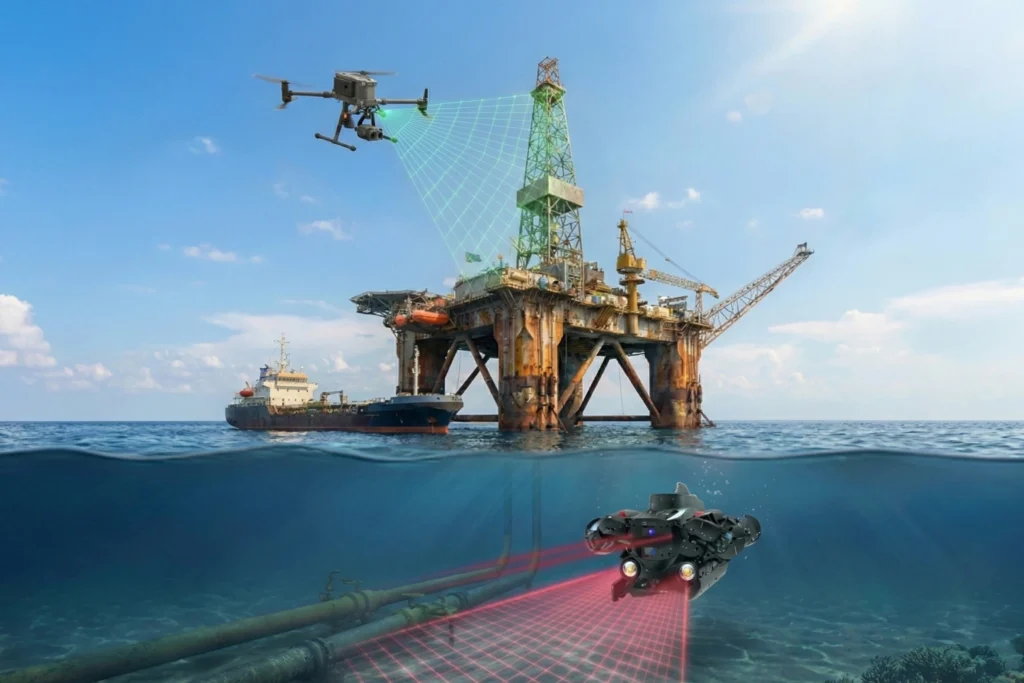
Advanced Geospatial Data Acquisition & Processing Technologies for Unmatched Precision. Systematic Use of Remote Sensing Techniques for Multi-Scale Environmental and Structural Analysis
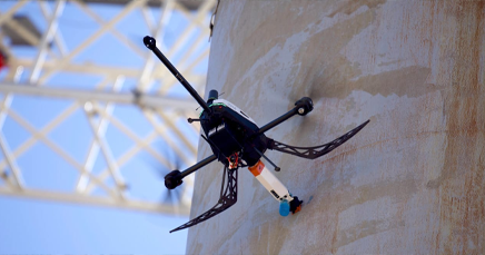
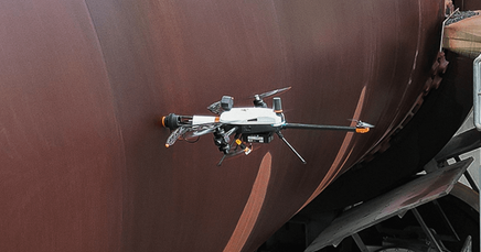
External Visual & Thermal (UAV)
Chimneys, flare stacks, roofs, panels
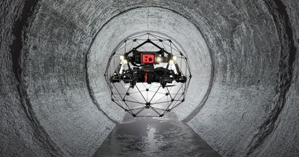
Internal Visual (Caged Drones)
Tanks, boilers, silos, pressure vessels
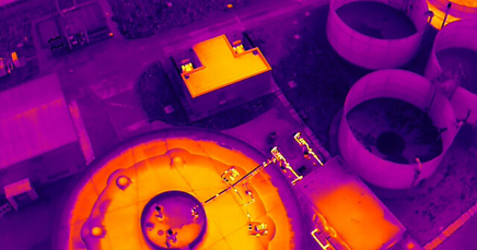
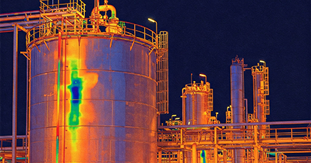
Thermal Imaging
Hotspots, insulation loss, corrosion under insulation
Ultrasonic Thickness (UT) via Drone
Shell thickness degradation
EMAT & DFT
Non-contact wall loss detection and thickness checks
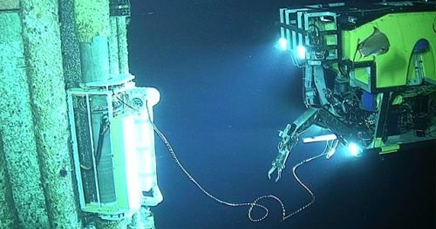
ROV-Based Underwater Inspection
Pipelines, submerged assets, tanks
Online & Offline Inspection
We offers an online (live asset) or offline (during maintenance) modes
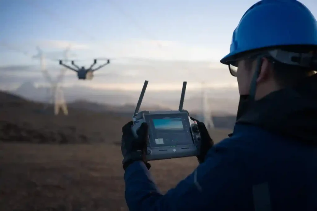
Relevant Drone & Payload Systems
Recommended platforms available for purchase or mission deployment:
Drone
DJI M350 RTK
DJI M400
DJI Mavic 4 Thermal
DJI Dock 3
Voliro
Terra Xross 1
Flyability Elios 3
Terra UT
Payload
Zenmuse H30T
Voliro UT Module
Voliro EMAT Module
Voliro DFT Module
Flyability UT Module
Terra UT Module
Terra DFT Module
Terrestrial Robotic
Deep Robotics LYNX M20
Deep Robotics X30
Underwater Drone
QYSEA Fifish Expert
QYSEA Fifish E-Go
QYSEA Fifish W6 NAVI
Typical Outputs
HD video and photo documentation (visual/thermal)
Drawing with annotated defect logs
Thermal gradient maps and hotspot analysis
Thickness measurement logs (UT, EMAT)
Inspection reports aligned with RBI or CMMS formats
Asset condition grading & risk ranking
3D structure reconstructions (if applicable)
General Use Cases
Cross-Sector Applications of Drone and Geospatial Technologies for Mapping & Survey
Oil & Gas
Flare tip inspection, tank internal check, offshore riser inspection
Yes, in most cases. Our drones provide 360° coverage with high-resolution footage and structured documentation. For critical welds or UT readings, manual confirmation may be done post-drone flight.
No. We assess the zone classification and use suitable mitigation (e.g., inerting) or collaborate with clients on pre-entry procedures. Full ATEX versions are in testing stages globally.