Advance Your Horizons: A Guide to Drone Career Path in 2025

Industrial drone pilot preparing for site inspection

The drone career path is no longer an emerging concept, it’s a well-defined route to high-value roles across industries that rely on precision, efficiency, and innovation. From flare stack inspections in oil & gas to aerial mapping in urban planning, drones have become a central part of modern operations. As we step into 2025, UAV professionals are becoming mission-critical to digital transformation efforts, particularly in regions like Saudi Arabia and the wider MENA area. Structured growth and proper certification aren’t just recommended — they are the foundation of long-term success in this field. The Starting Point: Entry-Level Drone Roles The first step into a UAV career often begins with support roles emphasizing learning by doing. Entry-level operators might assist with visual drone inspections of industrial assets, such as tanks, towers, or pipelines, or manage checklists during missions. These early positions are perfect for building technical awareness and field discipline. Foundational training in photogrammetry and GIS platforms like DJI Terra or ArcGIS Field Maps is commonly introduced at this stage. Additionally, formal certifications such as GACAR Part 107 (in Saudi Arabia) or equivalent national licenses ensure operators understand aviation safety, airspace rules, and mission planning, all essential to industrial compliance. Building Skills Through Certification and Field Experience Once the basics are in place, aspiring drone professionals should actively seek hands-on flight hours. The goal here is to become fluent with different payloads: thermal cameras, multispectral sensors, LiDAR scanners, and high-zoom RGB imaging systems. Industrial use cases, especially in oil & gas, power generation, and infrastructure — demand comfort with automated mission planning, waypoint routing, and live data interpretation. This is also the right time to dive into manufacturer training (like DJI Enterprise programs) or platforms such as Pix4D, FlightHub 2, and Terra Mapper to understand post-processing and mission management tools. In short, growing from operator to asset requires more than flying — it requires confidence in equipment, mission logic, and post-flight deliverables. Specializing in Industry Needs To stand out, professionals should tailor their skills to sector demands. For example, the oil & gas industry often requires familiarity with ultrasonic testing (UT) via drones, or non-destructive testing (NDT) using robotic systems like Voliro T. In agriculture, it’s all about multispectral mapping, NDVI analysis, and precision spraying logic. Each sector comes with its own vocabulary, safety culture, and data expectations. That’s why mid-level drone professionals must invest in contextual expertise: Utilities & power: risk-aware inspections, thermal fault detection Construction: BIM integration, volumetric analysis Renewable energy: panel array surveys, defect localization Urban planning: zoning data overlays, digital twin creation Software proficiencies become more important here too, with CAD, LiDAR data tools, and GIS integration forming the backbone of deliverables. Advancing to Mid-Level Roles With experience and specialization, many UAV professionals move into roles like Lead Operator or Mission Planner. These individuals oversee site planning, lead field teams, and ensure compliance with safety and flight protocols. They also contribute heavily to operational documentation — flight logs, asset reports, and pre/post-inspection forms. At this level, mentoring junior pilots and helping onboard new tech platforms is often part of the role. Professionals who excel here are the ones who balance technical confidence with operational discipline. People who don’t just fly well, but also communicate, document, and manage well. Reaching Leadership: Operations Manager or Technical Lead At the top of the drone career path are roles that go far beyond flight. UAV Operations Managers or Technical Leads manage entire drone programs, overseeing fleets, scheduling missions, setting internal SOPs, and liaising with regulators or enterprise clients. They often work closely with cross-functional teams: AI & data science units (for predictive analytics, anomaly detection) GIS departments (for model integration and spatial workflows) Compliance and safety teams (for audits, risk assessments, and reporting) Leaders in this space often participate in R&D discussions, vet new hardware, and pilot innovation projects, such as integrating digital twins, real-time mapping, or cloud-based remote inspections into day-to-day operations. This is where drone professionals evolve into decision-makers and strategists, shaping the future of industrial UAV adoption. Conclusion In 2025 and beyond, the drone career path is no longer limited to enthusiasts or specialists. It’s a legitimate, scalable career with entry points, vertical mobility, and global demand. The MENA region, especially Saudi Arabia under Vision 2030, is creating enormous opportunities for certified UAV professionals who combine technical excellence with industry understanding. Whether starting as a visual inspector or leading a national drone program, the career path is wide open. For those willing to invest in certification, specialization, and continuous learning, the drone industry isn’t just taking off. It’s landing big careers.

Drone Workforce Development: Building the Future Ahead

Drone operator managing inspection drone at oil and gas facility.

The rise of drone workforce development is reshaping modern industries worldwide. From oil and gas fields to construction zones and energy grids, drones have become indispensable tools for inspection, monitoring, and asset management. In an era defined by digital transformation and Industry 4.0, the demand for drone technologies is accelerating faster than ever. However, technology alone isn’t enough. As industries embrace unmanned aerial solutions, the need for a skilled, certified drone workforce is becoming critical, especially in countries like Saudi Arabia, where national goals like Vision 2030 prioritize innovation, localization, and the development of future-ready industries. The Role of Drones in Critical Industrial Applications The integration of drones into industrial operations is no longer a futuristic concept — it is a present-day necessity. Industries across the globe are rapidly adopting drone technology to enhance safety, boost operational efficiency, and gather higher-quality data than ever before. Drones are fundamentally changing the way critical infrastructure is built, maintained, and managed, offering companies a smarter, faster, and safer alternative to traditional methods. In today’s industrial landscape, drones fulfill several pivotal roles: aerial data capture, real-time monitoring, digital modeling, hazard detection, and predictive maintenance support. Their ability to deliver detailed information quickly, often without interrupting operations, is helping industries achieve more with fewer risks and lower costs. Let’s take a deeper look at how drones are making a difference across key industrial sectors: Oil & Gas Few sectors benefit from drones as much as oil and gas, where safety concerns, expansive assets, and harsh operating environments demand innovative solutions. Applications include: Flare Stack Inspections Traditionally, inspecting an active flare stack required a full shutdown, resulting in significant production losses. Now, drones equipped with thermal cameras can perform these inspections while the stack remains live, identifying heat anomalies, corrosion, and structural defects in real time. Pipeline Surveillance Long stretches of pipelines that traverse remote or sensitive areas can be monitored efficiently with drones. UAVs can detect leaks, ground movement, unauthorized encroachments, or potential erosion issues early, preventing environmental disasters and costly repairs. Offshore Platform Monitoring Drones equipped with high-resolution imaging and LiDAR sensors provide detailed views of complex offshore structures without risking diver safety or costly helicopter flyovers. The result: enhanced worker safety, reduced downtime, and improved asset reliability. Construction & Infrastructure Drones have become essential tools at every stage of construction and infrastructure projects. Applications include: Progress Monitoring UAVs deliver frequent, accurate site surveys, helping project managers track construction progress, verify contractor work, and identify potential delays early. Digital Twins Drones gather the precise spatial data needed to create detailed 3D digital twins of infrastructure assets — bridges, tunnels, airports, etc. These virtual replicas support smarter maintenance planning, remote inspections, and lifecycle management. Inspection of Existing Structures Bridges, high-rise buildings, and critical public infrastructure are inspected faster and more thoroughly using drones, minimizing disruption to traffic and operations.   With drone-driven site intelligence, developers and engineers can make better decisions, mitigate risks, and deliver projects more efficiently. Power & Utilities Maintaining a safe, reliable power grid depends heavily on proactive inspection and maintenance, areas where drones excel. Applications include: Transmission Line Inspection UAVs fly alongside live high-voltage power lines, capturing detailed images and thermal data to detect faults, hotspots, and wear without the need for human linemen to climb towers. Substation Monitoring Thermal drones quickly spot overheating components or insulation breakdowns in substations, preventing costly outages and safety hazards. Vegetation Management LiDAR-equipped drones identify vegetation encroaching on power lines, enabling utilities to optimize their trimming and clearing efforts to reduce wildfire risks and service interruptions. By adopting drone technology, utilities gain higher-frequency inspections, greater visibility across their networks, and better-informed maintenance strategies. Environmental & Agricultural Monitoring Drones are playing a vital role in advancing environmental stewardship and smart agriculture practices. Applications include: Crop Health Monitoring Multispectral imaging drones analyze plant health, soil moisture levels, and pest infestation patterns across agricultural fields, empowering farmers to make data-driven decisions that boost yields and reduce chemical usage. Land and Forest Management Drones map forest boundaries, monitor illegal logging activity, and assess biodiversity health in remote regions. Disaster Response and Environmental Impact Assessments After floods, oil spills, or wildfires, drones provide immediate situational awareness, enabling faster environmental impact assessments and targeted remediation efforts. Air and Water Quality Monitoring Specialized UAVs are equipped to capture air samples or perform water sampling missions to measure pollutants, supporting regulatory compliance and sustainability initiatives. By making environmental monitoring more accessible, faster, and cost-effective, drones are helping industries meet ESG (Environmental, Social, and Governance) targets and regulatory requirements. Why Drones are Indispensable in Industrial Applications Across all these sectors, the same core advantages of drones shine through: Risk Reduction Keep workers out of dangerous environments — drones handle the height, the depth, and the hazards. Cost Efficiency Reduce operational expenses by eliminating the need for scaffolding, helicopters, shutdowns, or large field teams. Data Quality Capture more comprehensive, high-resolution, and multi-dimensional datasets than traditional methods ever could. Operational Continuity Perform inspections, surveys, and monitoring tasks without halting production or disrupting critical services. In essence, drones are not just supplementary tools — they are now integral components of industrial asset management strategies worldwide. Current Challenges in Drone Workforce Development Despite surging demand, industries still face significant challenges in building a robust drone workforce: Talent Shortage While drone technology has advanced rapidly, the pipeline of qualified, industry-ready drone professionals has lagged behind. Many sectors report a shortage of certified UAV pilots and data analysts with practical, sector-specific expertise. Lack of Certified Drone Professionals Certification matters. Regulatory bodies increasingly require formal licensing (such as GACAR Part 107 in Saudi Arabia, or FAA Part 107 in the U.S.). Yet many aspiring drone operators lack access to structured, accredited training that meets industry standards. Limited Specialized Training in Industrial Applications Operating a recreational drone is very different from performing a LiDAR survey of a gas pipeline or conducting thermal inspections of electrical grids. Training programs must evolve to focus on industrial-specific applications — not just general drone operation.

How Can You Take Drone Photography To Another Level

Drone photography at golden hour

Embarking on the journey of drone photography opens up a world of breathtaking perspectives and unparalleled creative opportunities. Whether you’re capturing the vast, undulating sands of the Empty Quarter in Saudi Arabia or the intricate architectural details of a historic monument, the key to exceptional aerial imaging lies in a blend of technical prowess, artistic vision, and ethical practice. Navigating the Skies with Precision Success in UAV photography begins with a deep understanding of your equipment. Familiarizing yourself with the drone’s capabilities and controls is paramount. Practice in varied conditions to master smooth navigation and steady framing, ensuring your aerial shots are as stable as they are stunning. Remember, the quality of your aerial photography is directly linked to your proficiency in piloting your drone. The Art of Composition from Above When composing your shots from the sky, start by envisioning the frame divided by two horizontal and two vertical lines, creating nine equal parts—a technique known as the rule of thirds. Position key elements of your scene along these lines or at their intersections to create a balanced and engaging image. For example, place the horizon on the bottom third line for a sky-dominated shot or on the top third line for a ground-focused perspective. Utilize natural leading lines—such as roads, rivers, or shadows—to guide the viewer’s eye through the image. Experiment with symmetry, especially in architectural shots, by centering the subject to highlight its geometric patterns. Harnessing the Golden Hour To capture the rich, warm tones of the golden hour, plan your drone flights to coincide with the first hour after sunrise or the last hour before sunset. During these times, the sun’s low position in the sky produces softer, more diffused light, reducing harsh shadows and highlighting textures in the landscape. Use your drone’s camera settings to adjust for the lower light conditions; slightly increasing the ISO or lowering the shutter speed can help capture well-exposed images without sacrificing detail. Be mindful of the direction of the light—shooting with the sun behind you can illuminate the scene evenly while flying toward the sun can create dramatic silhouettes or backlighting effects. Read more about it here: HOW TO GET A PERFECT DRONE PHOTO DURING THE GOLDEN HOUR Ethical Considerations in the Sky Flying a drone responsibly means respecting the privacy and peace of others. Avoid flying over private property, crowded areas, or sensitive locations without permission. Before launching your drone, research local regulations, especially if you’re flying in regions with specific guidelines, such as Saudi Arabia. If your drone captures identifiable individuals or private homes, seek consent before publishing or sharing the images. Additionally, be mindful of wildlife and natural habitats—avoid disturbing animals or flying in protected conservation areas to ensure your photography practice leaves no negative impact. See more if you live in Saudi Arabia: Taking Flight: Understanding Drone Regulations in Saudi Arabia Equipping Yourself for Excellence A successful drone photography session starts with the right equipment. Choose a drone with a high-quality camera and a gimbal stabilizer to ensure sharp, stable images. Invest in polarizing or ND filters to manage reflections and reduce glare, particularly useful during bright days or when shooting water surfaces. Carry multiple batteries to extend your flight time, allowing for more exploration and creativity. Don’t forget spare memory cards to store your captures without worrying about running out of space. Lastly, consider a reliable carrying case to protect your gear during transport, especially when venturing into remote or rugged landscapes. Exceptional aerial imaging lies in a blend of technical prowess, artistic vision, and ethical practice. In A Nutshell Mastering the art of drone photography is a journey of continuous learning and exploration. By honing your technical skills, embracing the principles of composition and lighting, and flying with ethical considerations at the forefront, you unlock the potential to capture the world’s beauty from a whole new perspective. Whether it’s the sweeping dunes of a desert or the intricate designs of urban architecture, aerial photography allows us to tell stories that inspire, connect, and enlighten us.

Drone Safety Guide: Navigating the New Age of Aerial Operations

Advanced Safety Measures for Drone Operations in Varied Sectors. Drone Safety Guide : Navigating the New Age of Aerial Operations

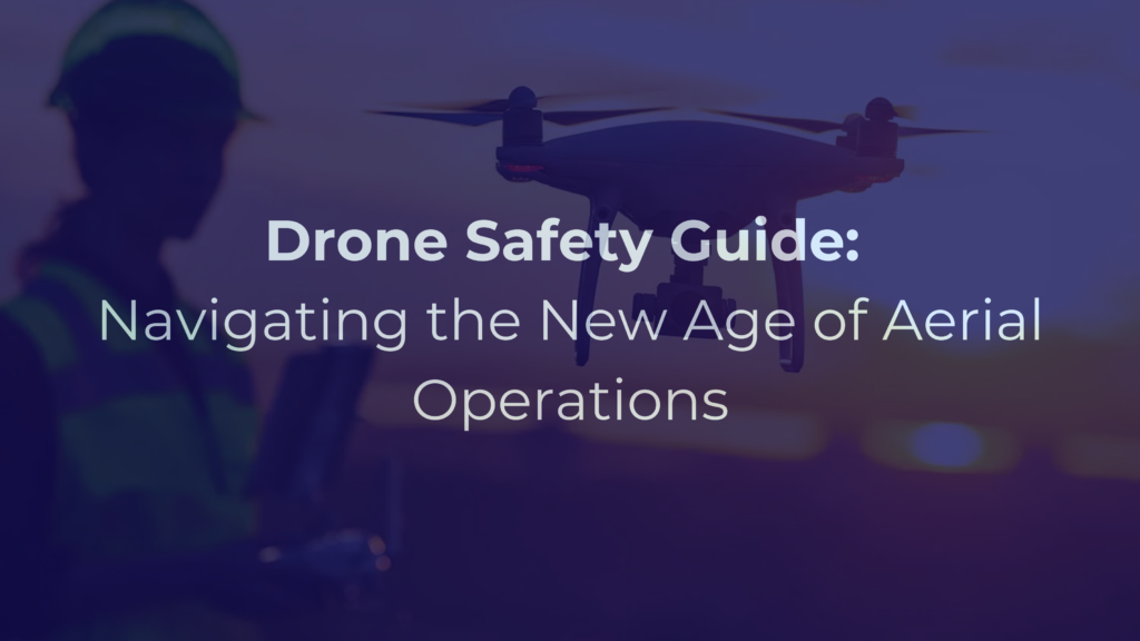
Introduction to Drone Safety The integration of drones into various sectors marks a significant shift in how businesses approach tasks like surveying, monitoring, and inspection. From the vast fields of agriculture where they monitor crop health to the intricate structures in construction and utility sectors where they inspect hard-to-reach areas, drones have become indispensable tools. Their application extends further into mining for exploration and mapping, and even in oil industries for pipeline inspections. This widespread adoption is driven by drones’ ability to enhance efficiency, reduce costs, and provide unique aerial perspectives. However, with this rapid integration comes a vital responsibility: ensuring the safe operation of these unmanned aerial vehicles (UAVs). This is where our Drone Safety Guide becomes an essential tool for every drone operator. Safety in drone operations encompasses a broad spectrum of considerations. Firstly, there’s the need for strict adherence to airspace regulations to prevent conflicts with manned aircraft, particularly in sectors like utilities and construction where operations often occur near urban areas. Secondly, privacy and data security are paramount, especially in sectors like mining and agriculture, where sensitive information is collected. Potential physical hazards to people, property, and critical infrastructure cannot be overlooked, requiring robust risk assessment and management strategies. Moreover, environmental considerations are crucial, particularly in sensitive areas where wildlife and habitat could be impacted. Training and certification of drone operators, along with ongoing education about evolving regulations and best practices, are fundamental to maintaining a safe operating environment. This comprehensive approach to drone safety ensures not only regulatory compliance but also fosters public trust and lays the foundation for the sustainable and responsible growth of drone technology across various industries. Delving deeper into these aspects, our Drone guide from a safety point of view offers an in-depth exploration of best practices, regulations, and innovative strategies to navigate the evolving landscape of drone usage. Identifying Key Risks in Drone Operation: A Detailed Perspective When it comes to operating drones, identifying and understanding the key risks is crucial for ensuring safe and efficient usage. Here’s the detailed perspective:  Weather Hazards: Electronics and Flight Stability: Extreme weather conditions like strong winds, heavy rain, or intense heat can impact the drone’s electronic systems, leading to malfunctions. High winds, for example, can cause drones to drift off course or struggle to maintain altitude, while heavy rain can lead to short-circuiting of vital components. Visibility and Control: Poor weather conditions such as fog, heavy rain, or snow can severely limit visibility. This is particularly hazardous for visual line-of-sight (VLOS) operations, where the operator must keep the drone within their sight at all times. Pre-flight Planning: Implementing comprehensive pre-flight weather checks and having contingency plans for adverse weather are key. This includes monitoring weather forecasts and understanding the weather thresholds for safe operation of specific drone models. Operational Missteps: Visual Contact and Spatial Awareness: Maintaining constant visual contact is crucial to prevent disorientation. Operators may lose sight of their drones due to distance, lighting conditions, or obstructions, increasing the risk of accidents or unintended airspace intrusions. Navigational Errors: Entering restricted airspace, whether inadvertently or due to navigational errors, can have legal ramifications and pose safety risks. This is particularly critical near airports, military bases, or other sensitive areas. Distance and Altitude Misjudgments: Misjudging the drone’s proximity to obstacles, especially in urban or densely populated areas, can lead to collisions. Understanding the drone’s altitude in relation to surrounding structures is essential for safe operation. Technical Failures: Battery Life and Power Management: Unexpected battery drain or failure mid-flight can lead to a loss of control. Understanding and monitoring the drone’s battery health and having clear protocols for low-battery scenarios are critical. GPS Reliability: GPS glitches can misguide a drone, leading to incorrect positioning or flight paths. Ensuring that drones have reliable GPS systems and backup navigation options is vital. Routine Maintenance: Regularly scheduled maintenance checks and immediate attention to any technical anomalies can prevent unexpected failures. This includes firmware updates, hardware inspections, and calibration of sensors. Interference and Security Risks: Radio Frequency (RF) Interference: RF interference, whether from environmental sources or intentional jamming, can disrupt the communication link between the drone and the operator. Cybersecurity Threats: The risk of hacking or unauthorized access to the drone’s data transmission systems raises concerns about data integrity and privacy. Employing strong encryption and secure data storage practices is essential. Respecting Privacy: When operating in areas where individuals might have an expectation of privacy, it’s crucial to adhere to privacy laws and ethical guidelines to avoid intrusions and potential legal issues. By meticulously addressing these detailed aspects of weather hazards, operational missteps, technical failures, and interference/security risks, as outlined in our drone safety guide, drone operators and organizations can significantly enhance the operational safety and reliability of their drone programs. This level of detailed attention, as emphasized in the drone guide from a safety point of view, is not just about mitigating risks but also about establishing a culture of safety and responsibility in the burgeoning field of drone operations.  Strategies for Mitigating Risks in Drone Operation To ensure safety and efficiency in drone operations, it is crucial to adopt a multifaceted approach to risk mitigation. The following strategies provide a detailed roadmap: Weather Preparedness: In-depth Weather Analysis: Operators should not only check general weather forecasts but also understand specific weather patterns that can affect drone flights, such as wind gusts, localized rainstorms, or temperature extremes. Understanding Drone Capabilities: Different drones have varying levels of tolerance to weather conditions. Operators must be familiar with the specific limitations and capabilities of their equipment, like maximum wind resistance and operational temperature ranges. Emergency Weather Protocols: Developing detailed emergency response plans for sudden weather changes, such as rapid wind speed increases or unexpected precipitation, is essential for safe operation. Operator Training and Guidelines: Extensive Training Programs: Training programs should cover a wide range of topics, including basic flight controls, advanced navigational techniques, emergency response, and scenario-based simulations to prepare for unexpected situations. Regulatory Knowledge: A deep understanding of local, national,

Mastering Drones: A Guide for Business and Innovation

Provides an essential overview of drones, focusing on their types, applications, and key features for business and technological advancement.

Intro In the evolving landscape of technology, drones have transitioned from their initial role as military instruments to become a cornerstone in civilian and business applications, marking a significant shift in both perception and utility. This surge in drone adoption is fueled by their increasing affordability and accessibility, inviting a broader range of users and applications. Businesses, in particular, have harnessed drones to enhance operational efficiency, reduce costs, and explore new revenue streams. These unmanned aerial vehicles offer a versatile tool for various industries, revolutionizing processes with their unique capabilities. However, integrating drones into business operations isn’t without challenges. Selecting the appropriate drone model from a plethora of options in the market demands a nuanced understanding of the technology. This can be a daunting task, particularly for organizations new to this domain and lacking specialized expertise in aerospace engineering. The decision-making process involves navigating a complex matrix of features, capabilities, and suitability to specific business needs, underscoring the need for informed guidance in this rapidly expanding field. Deciding to incorporate drones into your business strategy is a long-term investment where quality often correlates with cost. While consumer-grade drones are budget-friendly, they may fall short in meeting complex business needs, whereas industrial-grade drones require significant investment. The key to a beneficial return on investment (ROI) is a balanced choice. This decision-making process necessitates a basic understanding of drone technology, including configurations, data capabilities, training, maintenance, and regulatory considerations. By identifying the specific challenges your business aims to address with drones, you can more precisely determine the suitable drone type. This focused approach not only simplifies your search but also ensures you select a drone that truly enhances your business operations and optimizes ROI. Understanding Drone Types: Fixed Wing, Multirotor, and Hybrid VTOL Explained Drones, a rapidly evolving technological marvel, have diversified into various categories based on their design and flight capabilities. Among these, Fixed Wing, Multirotor, and Hybrid Fixed Wing VTOL drones are particularly notable, each with distinct features, advantages, and limitations. Fixed Wing Drones Advantages: Longer Flight Endurance: Fixed wing drones excel in endurance, capable of flying for several hours, making them ideal for long-range missions. Higher Cruising Speed: With aerodynamic efficiency, they can reach higher speeds, suitable for covering large areas quickly. Emergency Glide Capability: Their ability to glide in case of power loss ensures a safer descent and potential recovery. Disadvantages: Smaller Payload Capacity: Due to their streamlined design, they are limited in the weight and size of the payload they can carry. Inability to Hover: Fixed wing drones cannot remain stationary in the air, which can be a drawback for tasks requiring precise positioning. Space for Takeoff and Landing: They need runways or launchers for takeoff and large, clear areas for landing, limiting their use in confined spaces. Notes: Fixed wing drones are less prevalent in the consumer market and are primarily used for specialized applications like agricultural surveys, geographical mapping, and military reconnaissance. The manufacturing process is more complex, focusing on aerodynamics and efficiency. Notable models include the Delair UX11 and SenseFly eBee, with many manufacturers exploring hybrid designs to combine the benefits of fixed and rotary-wing features. Multirotor Drones Advantages: Larger Payload Capacity: These drones can carry heavier and larger payloads, making them suitable for professional photography, delivery, and industrial inspections. Hovering Capability: Multirotor drones can hover precisely, essential for tasks requiring stationary flight like aerial photography or detailed inspections. Vertical Takeoff and Landing (VTOL): They can take off and land vertically, making them versatile in urban environments and confined spaces. Disadvantages: Limited Flight Time: Typically, multirotor drones have shorter flight times, usually around 20-30 minutes, due to higher power consumption. Lower Speeds: They are generally slower compared to fixed-wing drones, limiting their efficiency over large areas. Vulnerability in Emergencies: Without the ability to glide, multirotors rely on complex failsafe mechanisms or parachutes to mitigate crash risks during power failures. Notes: Multirotor drones, including quadcopters, hexacopters, and octocopters, dominate the consumer and professional drone market. Brands like DJI with their Phantom and Mavic series, Autel Robotics, Parrot, and Skydio offer a range of models catering to various needs, from casual photography to industrial applications. Hybrid Fixed Wing VTOL Drones Characteristics: Combined Advantages: These drones integrate the endurance and speed of fixed-wing designs with the hovering and VTOL capabilities of multirotors. Performance Trade-offs: While they offer a balance of features, they may not excel in all aspects compared to specialized fixed wing or multirotor drones. Notes: Hybrid drones are increasingly popular in professional sectors, including environmental monitoring, search and rescue, and precision agriculture. They often involve sophisticated design and engineering, reflecting in their higher price point. Notable examples include the WingtraOne, Quantum Systems Trinity F90+, and JOUAV CW-20. Each drone category offers specific strengths and limitations, making them suitable for different applications. Understanding these nuances is essential for choosing the right drone, whether for recreational enjoyment, professional assignments, or industrial operations. Understanding the Diverse Payload Capabilities of Drones Drones, with their remarkable versatility, have become indispensable tools across various sectors. This transformation is largely driven by their ability to carry a wide array of payloads, each tailored to specific activities. From sensing and remote sensing tasks to manipulating the physical environment and transporting goods or passengers, the potential applications are vast and continually expanding. Sensing & Remote Sensing (Camera/Sensor) RGB (Visual) Cameras: Applications: Aerial photography, real estate, surveillance, and wildlife monitoring. Specifics: High-resolution imagery for detailed landscape and object analysis. Infra-red Sensors: Applications: Search and rescue, building inspections, and energy audits. Specifics: Detects heat signatures, useful in identifying living beings or heat leaks in structures. Multispectral Sensors: Applications: Precision agriculture and environmental monitoring. Specifics: Captures data from various light spectrums to assess plant health, water quality, etc. LiDAR (Light Detection and Ranging): Applications: Topographical surveys, forestry, urban planning, and archaeology. Specifics: Generates precise 3D models of the ground and structures, even through vegetation. Gas Sensing Devices: Applications: Industrial inspections, environmental monitoring, and leak detection. Specifics: Measures concentrations of various gases, such as methane or carbon

الدليل الشامل: كيف تختار الدرون المناسب لك

A complete guideline to understand the basic of drones

Intro Over the years, the phrase “drones” has evolved from just a fancy term to a widespread tool seen across the globe. Originally conceived for combat scenarios, these aerial devices now serve countless peaceful purposes. They’ve become increasingly affordable, thus making them accessible for many. Whether it’s for capturing breathtaking aerial photos or aiding farmers in monitoring vast fields, drones have become invaluable in numerous industries. As businesses tap into the potentials of these machines, they’re finding ways to cut costs, enhance efficiency, and even carve out new revenue streams. For those intrigued by the drone universe, this guide is your key. There’s a challenge, though. With so many drones available, how do you pick the right one? The market is full of choices. For a business wanting to make the most of drones, the sheer number of options can be overwhelming. And if drones are new for you or your team, making a wise choice can feel even harder. But choosing a drone isn’t something to rush. It’s a long-term decision. Going for a low-cost drone might seem tempting, but it could lack the features you need. On the other hand, a high-end drone might have great features but could be too costly for your budget. Every business wants value for their money, so finding the right balance is crucial. The key is to start with knowledge. By understanding the basics of drones – what they can do, the types of data they can collect, how to maintain them, and any other related details – you set a good foundation. Think about your needs and the problems a drone can solve for you. With that clarity, you can then focus on finding the drone that matches those needs in the market. Disclaimer : This guide focuses on regular drones, not the ones used by the military. The information provided is up-to-date as of August 2023. Guideline: Understanding Drones and Their Flight Categories Drones, as we know them, have evolved in design and capability. When it comes to selecting one, understanding how they fly can make all the difference. There are several categories based on this criterion, and each comes with its own set of advantages and drawbacks. Here’s a closer look: 1. Fixed-Wing Drones These drones have rigid wings like an airplane. They don’t have the hovering capability of multirotor drones, but they can cover longer distances. Advantages: Endurance: They can stay airborne for longer periods. Speed: They boast a higher cruising speed. Emergency Safety: If there’s a problem, they can glide without power.   Disadvantages: Payload Limit: They can’t carry as much weight. Lack of Hover: They can’t stay in one place in the air. Space Requirement: They need a runway or open space to take off and land.   Notes: The market for these drones isn’t as expansive. The design and engineering process is more demanding. Most fixed-wing drones are made for hobbyists or professionals, leaving a gap in the mid-tier market. Some well-known manufacturers include Delair and Sensefly. Many manufacturers, however, are transitioning to hybrid designs     2. Multirotor Drones These are perhaps what most people think of when they hear the word “drone”. They have multiple rotors, which give them the ability to hover in place. Advantages: Payload Flexibility: They can carry a reasonable amount of weight. Stationary Flight: Unlike fixed-wing drones, they can hover in a single spot. Space Flexibility: They can take off and land vertically, without needing a runway.   Disadvantages: Flight Time: Their flight duration is typically shorter. Speed Constraints: They usually have a slower cruising speed. Emergency Safety: If there’s a malfunction, they can’t glide. Extra systems or parachutes may be needed for safety.   Notes: Many major drone companies focus on these designs. Over 90% of the drones worldwide are multirotor drones. Popular brands include DJI, Autel, Parrot, and Skydio.   3. Hybrid Fixed-Wing VTOL (Vertical Take-Off and Landing) These drones try to combine the best of both worlds. They have fixed wings for long-distance flight and rotors for hovering. Advantages and Drawbacks: These drones aim to merge the benefits of both fixed-wing and multirotor drones. However, they may compromise slightly on performance.   Notes: Typically aimed at professional usage. They’re gaining rapid popularity in the drone market. Their design and engineering are more advanced than the other types. Renowned brands in this category are JOUAV, Quantum Systems, and Wingtra.   By understanding these categories, potential users can determine which type is best suited for their needs. Whether it’s hovering over a specific spot or covering vast distances, there’s a drone out there tailored for every purpose. Type of Payload that Drones Can Carry Based on Type of Activities Drones have evolved from basic flying machines to advanced devices capable of numerous tasks. The variety of payloads they can carry is a testament to this adaptability. Different payloads serve various purposes, ranging from collecting data to performing tangible actions or even transporting goods. Here’s a breakdown: a) Sensing & Remote Sensing (Camera/Sensor): i) RGB (Visual) Captures data in red, green, and blue wavelengths to produce images similar to standard cameras. Use Cases: Aerial photography, event filming, property monitoring. ii) Infra-red Detects data in the infrared spectrum to produce images indicating temperature differences. Use Cases: Search and rescue operations, monitoring crop health, detecting heat loss in buildings. iii) Multispectral Captures light in specific bands of the visible and near-infrared spectrums to produce detailed images. Use Cases: Monitoring crop health, forest health analyses, shoreline changes. iv) LiDAR Uses laser beams to measure distances, producing accurate 3D maps and models. Use Cases: Topographical mapping, elevation model creation, forest canopy research. v) Gas Sensing Detects specific gases in the atmosphere to determine concentrations. Use Cases: Gas leak detection, air quality monitoring, volcanic activity assessment. vi) Magnetic Measures magnetic fields to gather data on magnetic properties. Use Cases: Finding mineral deposits, locating buried structures, underwater investigations. vii) Hyperspectral Gathers information across many narrow bands of the electromagnetic spectrum. Use Cases: Mineral detection

arالعربية
Powered by TranslatePress