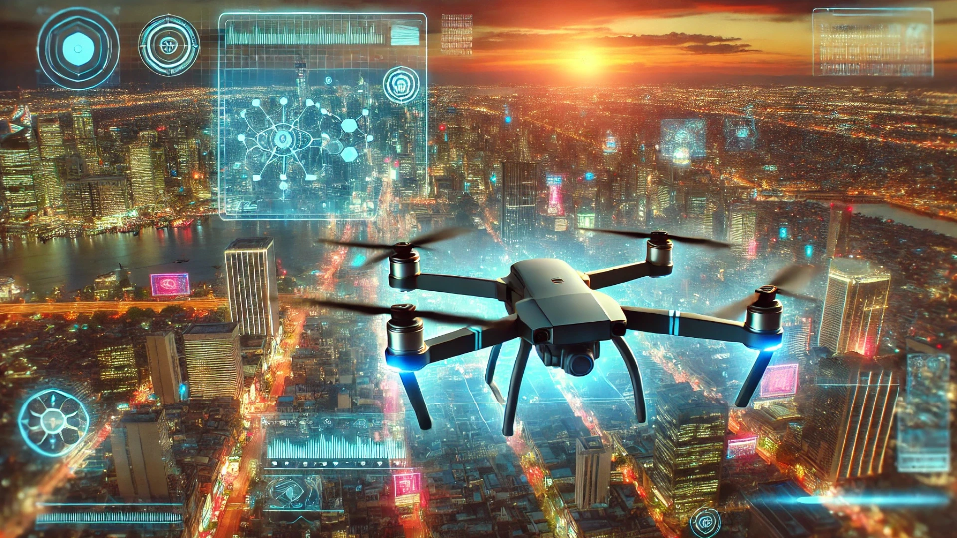
Smart city drones are transforming the way urban areas operate by introducing innovative solutions to complex challenges. As cities worldwide aim to enhance efficiency, safety, and sustainability, drones have become indispensable tools for achieving these goals. From collecting precise data to supporting public services, these unmanned aerial systems integrate seamlessly into the fabric of modern urban life, advancing the vision of smart cities.
The Emergence of Smart Cities
Smart cities represent the future of urban development, where technology, data, and innovative solutions converge to create efficient, sustainable, and people-centric living environments. At their core, smart cities aim to enhance urban living by addressing challenges like overpopulation, resource management, and environmental sustainability. These cities use interconnected technologies to monitor, analyze, and optimize every aspect of urban infrastructure and services—from transportation and energy systems to public safety and environmental monitoring.
Drones, often referred to as unmanned aerial vehicles (UAVs), have become indispensable tools in the evolution of smart cities. Their ability to provide real-time data, access hard-to-reach areas, and operate autonomously aligns perfectly with the objectives of a smart city. Unlike traditional tools, drones offer unparalleled efficiency in capturing vast amounts of data with minimal human intervention. They not only complement existing technologies but also unlock new possibilities in urban planning and management.
The concept of smart cities relies heavily on the integration of data from multiple sources. Drones play a pivotal role in this ecosystem by serving as mobile data collection platforms. Whether they’re scanning building facades for maintenance needs, surveying traffic flow, or monitoring air quality, drones act as the eyes of a smart city, enabling officials and planners to make informed decisions quickly. For instance, drones equipped with high-resolution cameras and LiDAR sensors can generate detailed 3D maps, essential for creating digital twins—virtual replicas of urban environments that allow simulations for infrastructure development or disaster management.
Moreover, smart cities are designed to be dynamic, adapting to the ever-changing needs of their residents. Drones provide the agility and flexibility required to meet these needs. For example, during emergencies, drones can be deployed instantly to assess damage, deliver medical supplies, or provide situational awareness, showcasing their unmatched versatility in real-world applications.
In addition, the rise of drones in smart cities is fueled by advancements in artificial intelligence (AI) and machine learning. These technologies enable drones to process data on the fly, detect patterns, and even make autonomous decisions. By integrating AI-powered drones into smart city infrastructure, municipalities can achieve greater efficiency, reduce costs, and enhance safety.
As smart cities continue to evolve, drones are expected to play an even more integral role. Their ability to gather accurate, actionable data while operating in diverse environments ensures they remain a cornerstone of urban innovation. With the rapid pace of technological advancements, drones are not just tools but essential enablers of the smart city vision—a future where technology and urban living harmoniously coexist.
Data Collection in Digital Twin Production
In the context of smart cities, digital twins are transformative tools that bring urban planning and management into the digital age. A digital twin is a virtual replica of a physical environment, designed to simulate, analyze, and optimize urban systems. This technology has become a cornerstone of smart city initiatives, enabling planners, engineers, and decision-makers to predict outcomes, improve resource allocation, and ensure long-term sustainability.
Drones play a critical role in the creation and continuous updating of digital twins by serving as high-efficiency data collection platforms. Traditional data collection methods often involve labor-intensive and time-consuming ground surveys, which can delay decision-making and project timelines. Drones, however, offer a faster and more precise alternative, enabling urban planners to generate comprehensive models with minimal disruption to daily activities.
The use of drones for 3D mapping is one of the most significant advancements in this domain. Equipped with high-resolution cameras, drones can capture detailed imagery of urban landscapes. These images are then processed using advanced photogrammetry software to create accurate 3D models of buildings, streets, and other infrastructure. These models allow city planners to visualize urban environments in fine detail, making it easier to identify design flaws, improve infrastructure layouts, and plan for future development.
Beyond 3D mapping, drones equipped with LiDAR (Light Detection and Ranging) sensors elevate the accuracy of topographical surveys. LiDAR technology emits laser pulses that measure distances and capture elevation data, making it invaluable for projects requiring precision, such as flood mitigation planning or utility infrastructure placement. For instance, using LiDAR-equipped drones, city planners can identify elevation changes across urban areas, assess potential drainage issues, or optimize the placement of solar panels for maximum efficiency.
Photogrammetry is another method where drones excel, particularly in creating orthomosaic maps. These maps, which are composed of high-resolution, georeferenced images stitched together, offer city planners a bird’s-eye view of urban areas. With this data, municipalities can monitor changes in land use, track construction progress, and detect encroachments or zoning violations. The level of detail provided by these maps helps cities plan with greater accuracy and ensures that infrastructure developments are aligned with regulatory requirements.
Moreover, drones contribute to dynamic data collection, which is essential for keeping digital twins updated in real time. Unlike static models that can quickly become outdated, digital twins enriched with drone data can adapt to changing urban conditions. For instance, after a natural disaster, drones can rapidly assess damage and update digital twin models, enabling authorities to plan recovery efforts efficiently.
The integration of drone-collected data into digital twins also supports predictive analytics. By combining real-time data from drones with historical and environmental data, digital twins can forecast traffic congestion, infrastructure wear and tear, or even the environmental impact of urban development. This capability empowers city planners to take proactive measures, reducing risks and enhancing urban resilience.
In summary, drones revolutionize the way data is collected for digital twin production in smart cities. Their ability to capture high-resolution imagery, perform precise surveys, and provide real-time updates ensures that digital twins remain accurate and relevant. By leveraging drone technology, cities can unlock the full potential of digital twins, driving smarter, more sustainable urban development.
The Many Applications of Drones in Smart Cities

Drones have become indispensable in smart cities, revolutionizing urban management with their versatility and efficiency. Their adaptability allows them to address diverse needs, from infrastructure inspections to public safety, contributing to the seamless functioning of urban ecosystems. As drones integrate more advanced sensors, cameras, and artificial intelligence, their applications in smart cities continue to expand, transforming how cities operate and serve their residents.
One of the most notable applications of drones in smart cities is facade inspections. Traditionally, building inspections involve scaffolding, cranes, or high-risk manual work, which is time-consuming, costly, and hazardous. Drones equipped with high-resolution cameras and thermal imaging sensors eliminate these challenges by capturing detailed data from building exteriors quickly and safely. These inspections can identify structural issues, detect energy inefficiencies, and assess maintenance needs, ensuring that urban infrastructure remains in optimal condition while significantly reducing operational costs.
Public safety is another critical area where drones excel. They play a pivotal role in surveillance, helping law enforcement monitor public spaces during large-scale events or daily operations. By providing real-time aerial views, drones enable security teams to identify potential risks, manage crowd control, and respond swiftly to incidents. In addition, drones equipped with infrared sensors can conduct nighttime surveillance or locate missing persons in challenging environments, enhancing public safety and emergency response efforts.
Environmental sustainability is at the heart of smart city initiatives, and drones contribute significantly through air quality monitoring. Equipped with sensors to measure pollutants like carbon monoxide, nitrogen dioxide, and particulate matter, drones collect data that helps environmental agencies pinpoint pollution sources. This information guides policymakers in developing effective mitigation strategies, such as introducing green zones or optimizing traffic flows to reduce emissions. By providing actionable insights, drones enable cities to improve air quality and protect public health.
The use of drones for facade cleaning is an innovative solution that boosts efficiency while reducing costs. High-rise buildings in modern cities often require specialized equipment and teams for exterior cleaning, which can be expensive and labor-intensive. Drones equipped with water jets or cleaning mechanisms can access hard-to-reach areas effortlessly, completing the task more quickly and with minimal disruption to building occupants. This application showcases the potential of drones to simplify urban maintenance tasks.
Medical delivery is another area where drones are making a tangible impact. In densely populated urban areas, traffic congestion can delay the transport of critical medical supplies. Drones bypass these challenges by flying directly to their destinations, ensuring timely delivery of blood samples, medications, or vaccines. During emergencies, drones can deliver life-saving supplies to inaccessible areas, enhancing the city’s healthcare system and emergency response capabilities.
Beyond these applications, drones support traffic management by monitoring congestion and providing real-time data to optimize signal timings. For example, drones can identify bottlenecks and suggest alternative routes, reducing travel time for commuters and minimizing vehicle emissions. Additionally, they inspect infrastructure like bridges, roads, and utilities, allowing cities to detect wear and tear early, prioritize maintenance, and avoid costly failures.
Drones are also invaluable in disaster response, providing aerial views of disaster-stricken areas to guide rescue operations and assess damage. Whether it’s a flood, earthquake, or fire, drones deliver real-time data that enables first responders to act quickly and allocate resources effectively. These capabilities strengthen a city’s resilience and enhance its ability to recover from crises.
The versatility of drones extends further as they integrate with other technologies, such as artificial intelligence and the Internet of Things (IoT). For instance, drones equipped with AI algorithms can analyze data on the fly, identifying patterns or anomalies that inform decision-making. Meanwhile, combining drone data with IoT networks allows cities to monitor infrastructure, energy consumption, and environmental conditions holistically.
In conclusion, drones are redefining urban management with their diverse applications. From infrastructure inspections and public safety to environmental monitoring and medical deliveries, drones provide innovative solutions that enhance the efficiency, safety, and sustainability of smart cities. Their integration into urban ecosystems ensures that cities can adapt to evolving challenges and deliver a higher quality of life for their residents.
Implementing Unmanned Traffic Management Systems

As the number of drones in urban areas grows, the need for organized airspace becomes increasingly urgent. Unmanned Traffic Management (UTM) systems are essential for coordinating drone operations and ensuring safety. These systems prevent collisions and manage interactions between manned and unmanned aircraft.
Unifly, a leader in UTM technology, has developed solutions that address these challenges. One notable case is the implementation of Unifly’s UTM system at the Port of Antwerp-Bruges. This system optimized drone operations, enabling seamless collaboration between various stakeholders. Such success stories highlight the potential for UTM systems to support large-scale drone adoption in smart cities.
By integrating UTM platforms, cities can unlock the full potential of drones while maintaining regulatory compliance and public safety. These systems facilitate coordinated operations among drone operators, ensuring that airspace is used efficiently.
Overcoming Challenges in Urban Drone Integration
Despite their immense potential, smart city drones face several challenges. Regulatory frameworks remain complex, with stringent approval processes for drone operations in populated areas. To navigate these obstacles, cities must work closely with aviation authorities and technology providers.
Privacy concerns also require careful consideration. While drones enhance public safety and efficiency, they raise questions about surveillance and data security. Transparent policies and privacy safeguards are essential to building public trust.
Technical limitations, such as battery life and payload capacity, can restrict the scope of drone operations. However, ongoing advancements in drone technology promise to address these challenges. Improved battery performance, autonomous navigation, and weather-resilient designs are paving the way for more reliable drone systems.
The Future of Drones in Smart Cities
The future of smart city drones lies in their integration with other advanced technologies. By combining drone data with Internet of Things (IoT) devices and artificial intelligence (AI), cities can create comprehensive urban management systems. For instance, IoT sensors on drones can monitor infrastructure, while AI analyzes the data to predict maintenance needs or optimize energy usage.
Scaling up drone operations is another key trend. As technology improves, cities will deploy drones for more diverse functions, covering larger areas and addressing complex challenges. This evolution will enable cities to achieve their sustainability and efficiency goals on an unprecedented scale.
خاتمة
Smart city drones are revolutionizing urban development by enhancing efficiency, safety, and sustainability. Their applications, from digital twin production to public security, demonstrate their transformative potential. By addressing regulatory and technical challenges and leveraging UTM systems, cities can unlock the full benefits of drones. As technology continues to evolve, smart city drones will play an even greater role in shaping the cities of the future, creating smarter, more sustainable urban environments.

