Mapping the Future of Jeddah’s Infrastructure
As Saudi Arabia accelerates its urban transformation under Vision 2030, the demand for high-precision geospatial data has never been higher. A critical component of this progress is the “Design for Sanitary Projects in Jeddah – Phase One,” a massive infrastructure initiative requiring an exact topographic understanding of the landscape. Terra Drone Arabia was engaged to spearhead the drone-based photogrammetry works for a project boundary area in North Jeddah totaling approximately 116.54 sqkm.
The mission was clear: capture high-resolution aerial imagery and process it into a detailed topographic map that would serve as the foundational blueprint for engineering design. By replacing traditional ground methods with state-of-the-art Unmanned Aircraft Systems (UAVs), Terra Drone Arabia delivered a data suite, including digital orthophotos, 3D models, and contour maps with the speed and precision required for large-scale utility planning.
The Technical Arsenal: Hardware for Engineering Precision
To meet the stringent quality standards of the project, Terra Drone Arabia deployed a sophisticated fleet of equipment designed for accuracy and durability in the Saudi climate.
- UAV Excellence: The primary workhorse for the mission was the DJI M350 RTK, supported by the DJI Mavic 3 Enterprise for specialized tasks.
- Sensor Sophistication: Drones were equipped with the Zenmuse P1 full-frame sensor, featuring a 45MP resolution and a global mechanical shutter to eliminate motion blur during high-speed data acquisition.
- Geodetic Precision: To anchor the aerial data to the real world, the team utilized Trimble R12 and Emlid RS3 GNSS systems, ensuring centimeter-level positioning for every pixel captured.
Methodology: The PPK & GCP
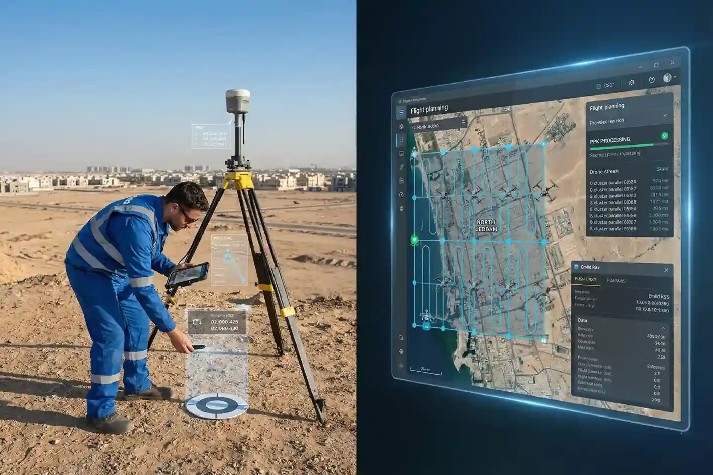
Mapping 116 square kilometers requires more than just flying drones; it requires a systematic operational strategy. Terra Drone Arabia divided the survey area into eight clusters, allowing for parallel data collection and processing to optimize the project timeline.
The project utilized a Post-Processed Kinematic (PPK) workflow. During flight, a base station collected satellite data simultaneously with the drone. Post-flight, this data was merged to correct the drone’s GPS coordinates, significantly reducing positional errors before processing even began. To further verify and refine accuracy, the team established a network of Ground Control Points (GCPs) and Independent Check Points (ICPs) across the terrain. This dual-layer approach ensured that the final maps reflected the actual ground positions with extreme reliability.
From Raw Data to Engineering Intelligence
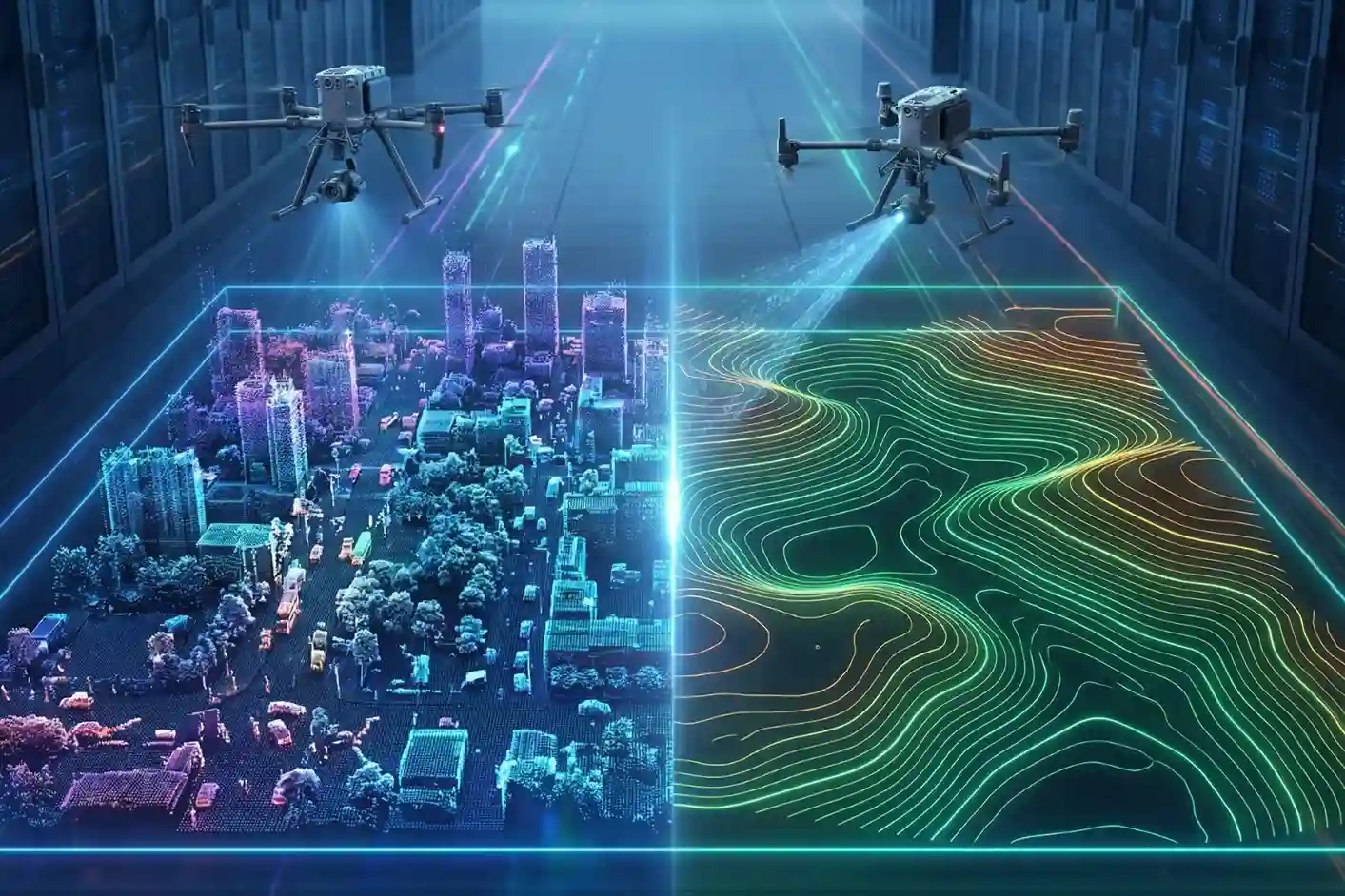
The raw imagery underwent a rigorous multi-stage processing pipeline within a high-performance Agisoft workspace.
- RGB Acquisition & Alignment: Over 10,000 photos per district were aligned using high-accuracy generic preselection.
- Dense Cloud & Mesh Generation: A 3D point cloud was reconstructed to form the basis of the elevation models.
- Digital Orthophotos: These geometrically corrected image maps provide a factual, high-resolution visual base for situational awareness, far exceeding the quality of standard satellite imagery.
- Digital Elevation Models (DEM): The Digital Surface Model (DSM) captured every feature on the landscape, from buildings to vegetation.
- The Digital Terrain Model (DTM) was then extracted by filtering out non-ground objects to provide a “bare-earth” representation essential for hydrological and sanitary modeling.
Fueling Jeddah’s Sanitary Transformation
The technical success of this mission is measured in centimeters. The final accuracy assessment revealed a vertical RMSE of 9.5 centimeters, providing the engineering teams with a high level of confidence for their design works.
By utilizing drone technology, Terra Drone Arabia achieved:
- Safety: Removing human surveyors from the “3D” tasks (Dull, Dangerous, and Dirty) typically associated with large-scale topographic work.
- Productivity: Mapping areas at a rate of up to 4,000 hectares per day, a feat impossible for traditional ground crews.
- Clarity: Producing map resolutions as fine as 5 cm/pixel, allowing for the clear interpretation of building extents, curbs, and fences.
Leading the Drone Revolution
The completion of the North Jeddah survey marks another milestone for us as a leading drone solution provider in the region. By merging advanced hardware with expert software engineering, the team delivered a coherent, high-precision dataset that will directly support the development of vital sanitary infrastructure. As the Kingdom continues its rapid development, we remain at the forefront, turning complex aerial data into the intelligence that builds cities.