The Complete DJI Enterprise Software Guide: From Data to Intel

Drones alone are no longer enough for operational purposes. While a high-performance aircraft is the “muscle” of the operation, it is merely a vehicle for sensors. To truly unlock value, reliable software is needed to process large amounts of data acquired during field missions. The complexity of modern infrastructure means that “one size fits all” no longer exists; the software must be compatible with your specific needs, whether that requires the agility of the cloud, the “fortress” security of an on-premises server, real-time awareness, or intelligent automation. Understanding this shift, DJI is equipping its equipment with a reliable, integrated software ecosystem designed to bridge the gap between a flight and a finished report. The Management Pillar: Command, Control, and Sovereignty In the professional drone landscape of 2026, management is no longer just about tracking flight paths; it is about exercising absolute authority over data and real-time operations. DJI’s management pillar is defined by two distinct architectures that cater to different organizational security requirements: FlightHub 2 (Public Cloud) for agile, multi-site coordination, and FlightHub 2 On-Premises for missions requiring an “air-gapped” fortress of data sovereignty. 1. The AIO (All-in-One) Hardware The DJI FlightHub 2 AIO is the cornerstone of localized drone management. It is a 3.01 kg portable server specifically engineered to run the full On-Premises software stack without an internet connection. Edge Computing Power: The unit is powered by an Intel® Core™ Ultra 7 Processor 265 and 64 GB of DDR5 RAM, allowing it to handle up to 20 simultaneous devices (drones and docks) with a peak resource utilization of approximately 80%. GPU-Accelerated Intelligence: An integrated NVIDIA RTX™ 2000 Ada graphics card drives the localized DJI Terra modeling engine, enabling the AIO to process $500$ drone images into a detailed 3D model in just five minutes. Data Redundancy: Storage is secured by three 2 TB NVMe SSDs. While one is reserved for the system, the other two operate in a RAID 1 mirrored configuration, ensuring that a hardware drive failure does not result in the loss of critical mission data. 2. Technical Command: Virtual Cockpit and Automation The software architecture transitions drone operation from a field-level task to a centralized command center experience. Virtual Cockpit: This interface allows remote operators to pilot drones using a mouse and keyboard. Features like FlyTo automation calculate safe, efficient routes with a single click, while intelligent object tracking uses on-device AI to detect and monitor vehicles or vessels automatically. Independent Frontend Components: FlightHub 2 On-Premises is modular, offering three independent frontend components, such as Flight Routes Editor, Virtual Cockpit, and Project/Map. These can be integrated directly into an organization’s existing software stack, significantly reducing the development workload for custom platforms. 3. Sovereignty and System Integration Sovereignty is achieved through total isolation of the drone’s data cycle from the public internet. Air-Gapped Deployment: Organizations can deploy the platform on physical machines within a Local Area Network (LAN) or private cloud servers, ensuring that photos, videos, telemetry, and flight logs never leave the internal firewall. MQTT Bridge and OpenAPI: To support high-level industrial integration, the system includes an MQTT Bridge for bridging and forwarding messages to SCADA or other enterprise systems. The RESTful OpenAPI allows developers to call core platform capabilities directly, enabling seamless integration with existing IT workflows. Secure Authentication: The platform supports OAuth 2.0 and Single Sign-On (SSO), allowing for unified authentication and granular user permission management within a corporate identity system. 4. Connectivity Reliability For missions in signal-deprived or restricted areas, the management pillar utilizes hardened communication links. 4G Enhanced Transmission: When combined with a DJI Cellular Dongle 2 and a dedicated private 4G APN card, the system maintains high-definition video transmission and coordination even when the standard SDR signal is obstructed by terrain or structures. Manual Mastery and Mission Automation In the field, the software is the primary interface between the human operator and the aircraft’s hardware. DJI’s “Field Pillar” is divided between DJI Pilot 2 (the DJI Enterprise app), which excels at high-stakes manual mastery, and DJI GS Pro, designed for rigorous mission automation. 1. DJI Pilot 2: Real-Time Tactical Awareness DJI Pilot 2 is the default flight control application for modern enterprise drones, serving as the pilot’s cockpit for situational awareness. Augmented Reality (AR) Overlay: Pilot 2 utilizes AR projection to display Home Points, PinPoints, and mission Waypoints directly within the camera view. This allows the pilot to maintain high situational awareness without constantly switching to a map view. Advanced Payload Control: It provides deep integration for hybrid sensors, including Link Zoom, which allows for simultaneous zooming with both thermal and visual sensors. Pilots can also activate Discrete Mode for sensitive night operations, turning off all aircraft lights with a single tap. Tactical AI Features: The app supports Smart Track, which uses on-device AI to automatically follow moving subjects like vehicles or vessels, significantly reducing the pilot’s cognitive load during complex missions. Pre-Flight Integrity: Every mission begins with a comprehensive pre-flight checklist that integrates aircraft status, sensor health, and localized environmental parameters to ensure a safe takeoff. 2. DJI GS Pro: Professional Mission Architecture While Pilot 2 is built for the pilot, DJI GS Pro (Ground Station Pro) is built for the mission architect. This iPad-based application is specialized for repeatable, automated workflows that require millimeter precision. Complex Waypoint Missions: GS Pro supports up to 99 waypoints per mission group. Each waypoint can be programmed with up to 15 consecutive actions, such as precise gimbal pitching, aircraft rotation, and timed photo capture, ensuring every data point is captured exactly as planned. 3D Map POI (Circle and Vertical): Specialized modes allow for high-fidelity data collection of tall structures. Circle Mode automates a spiral flight path around a building, while Vertical Mode executes precise “up-and-down” paths to gather data for vertical reconstructions, such as bridge pylons or skyscrapers. GIS Data Integration: Operators can import KML, SHP, KMZ, and ZIP files directly into GS Pro. This allows construction and survey teams to overlay project boundaries or specific geometries onto the map to
Drone Battery Storage & Safety: The Essential Guide
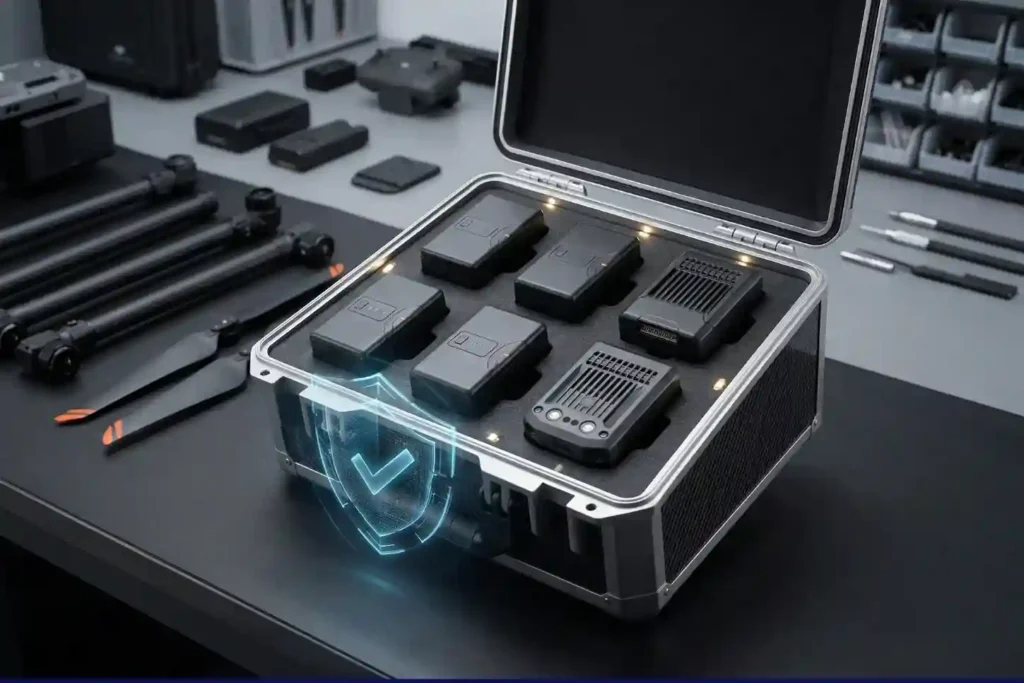
In recent years, lithium-ion battery incidents have surged globally, with reports showing a 17% increase in related fires due to mishandling during storage and charging. A single lithium battery failure can trigger “thermal runaway,” a catastrophic chain reaction where temperatures spike from 100°C to over 1,000°C in seconds. Alarmingly, over 50% of these fires occur when devices are not even in use. Lithium batteries are powerful but volatile; if handled incorrectly, they create severe fire and injury risks. For an operator, an overlooked battery in a hot vehicle or a fully charged cell left in a drawer isn’t just a maintenance error; it’s a potential disaster waiting to happen. The Intelligence of the Battery Management System (BMS) Modern drone batteries, specifically those from DJI, are far more than simple “power bricks.” They are equipped with an internal Battery Management System (BMS) that serves as the brain of the power cell. Auto-Discharge Logic: DJI batteries are programmed to protect themselves. If left inactive for 5–10 days, they will automatically begin to discharge to a safer storage level of approximately 60%. The Thermal Sweet Spot: High heat is the leading cause of battery swelling and internal failure. To maintain the integrity of the chemical layers, batteries must be stored in a controlled environment between 15°C-25°C. Safe “State of Charge” (SoC): Storing a battery at 100% or 0% is the fastest way to kill its lifespan. Professional standards require storage at 40-60% charge to minimize stress on the cells. Maximum Reliability and Fleet Longevity Every professional operator desires a fleet that is ready at a moment’s notice. Correct battery care directly translates into Equipment Reliability, extending the life of your batteries and reducing unexpected downtime during critical missions. Calibration for Accuracy: By calibrating your batteries every 3 months (or ~20 cycles), you ensure that the “Return-to-Home” (RTH) calculations in your app are accurate. This prevents in-flight power loss or aircraft failure due to false voltage readings. Warranty & Compliance: Following these strict manufacturer procedures is often a requirement to maintain your DJI warranty, comply with aviation safety guidance, and protect your insurance coverage. Safety of Infrastructure: Using fire-resistant LiPo bags or metal cases protects your personnel, aircraft, facilities, and vehicles from the intense heat of a lithium fire, which is notoriously difficult to extinguish once it begins. Your Professional Battery Safety Checklist To ensure your operations remain safe and compliant, implement these procedures immediately: Immediate Storage Prep: Verify batteries are at 40-60% charge before putting them away. Power off and remove batteries from the aircraft; never store them inside the drone. Place them in a fire-resistant container in a dry, ventilated area. Long-Term Maintenance (Every 3 Months): Perform a Calibration Cycle: Charge to 100%, discharge to 10-15%, let it cool, then recharge to 100%. For long-term storage, fully charge once every 3–6 months, then discharge back to 50-60% to maintain chemical activity. Grounding Procedures: Immediately retire any battery showing signs of swelling, overheating during use, rapid voltage drops, or error messages in the DJI app. Never attempt to repair a damaged battery; isolate it and dispose of it through approved recycling channels. Read the full guide here
How DJI FlyCart 30 Delivers in Difficult Terrain and High Altitudes

In 2026, drone delivery has transitioned from an emerging trend into a formidable operational challenge. As global industries push for total automation, the real test lies in the “Last Mile”—the final, most difficult stretch of the supply chain. While the world demands faster connectivity, remote and mountainous terrains continue to pose a multi-million dollar bottleneck that traditional logistics simply cannot solve. There is an increasing number of critical occasions where rapid delivery is the only viable path forward. Whether it is transporting a specialized industrial spare part to prevent a costly plant shutdown, delivering life-saving healthcare and drugs to isolated clinics, or rushing emergency packs to disaster-stricken areas, the window for success is often measured in minutes. These high-stakes scenarios demand more than just transport; they require fast response times and agile operations that can bypass jagged peaks and impassable roads. This is where the DJI FlyCart 30 plays a significant and transformative role. By combining heavy-lift power with the maneuverability of a specialized UAV, it turns a logistical nightmare into a streamlined, high-speed aerial corridor, ensuring that critical supplies reach their destination exactly when they are needed most. The Engineering of High-Altitude Heavy Lifting The FlyCart 30 is a masterpiece of industrial redundancy and high-torque aerial engineering. It is designed to maintain a 95 kg Maximum Takeoff Weight (MTOW) at sea level while retaining the agility needed to navigate tight mountain corridors. 1. The Coaxial Propulsion Advantage Unlike standard quadcopters, the FlyCart 30 utilizes a 4-axis, 8-propeller coaxial design. Thrust Density: By stacking two motors on each arm, DJI increases the total thrust without significantly expanding the drone’s footprint. The 54-inch carbon fiber composite propellers are driven by motors with a 100×33 mm stator size, capable of generating up to 4,000 W of peak power per rotor. Active Redundancy: If a single motor or propeller fails during a heavy-lift mission, the flight controller immediately redistributes torque to the remaining seven units. This “emergency landing mode” allows the drone to remain stable and land safely even with a 30 kg-40 kg payload attached. Heat Dissipation: To prevent motor burnout during long climbs, the motor housings are aerodynamically optimized for passive cooling, ensuring consistent performance during the 18-minute full-load flight window. 2. Mastering Atmospheric Density and Altitude At 6,000 meters, the air is roughly 50% less dense than at sea level. The FlyCart 30 overcomes this through “oversized” aerodynamics: Pitch and Torque: The flight controller uses a specialized high-altitude firmware profile that adjusts the RPM and pitch response of the blades to maintain lift in thin air. Payload Scaling: While it can fly to 6,000 m without a load, the safe operating ceiling for a full 30 kg payload is 3,000 m. This reflects the physical reality of battery discharge rates and motor strain at extreme altitudes. 3. Intelligent Winch Dynamics and Swing Control The Winch System Kit is more than just a rope; it is a sensor-integrated delivery tool. Swing Control Algorithm: When carrying a slung load, the drone’s IMU (Inertial Measurement Unit) detects the pendulum frequency of the cargo. The FlyCart 30 then performs subtle, counter-active “attitude adjustments” micro-tilting the aircraft to dampen the swing and keep the center of gravity stable. Automatic Touchdown Release: The winch clump features a pressure sensor. Once it detects that the cargo has made contact with the ground and the cable tension has dropped, it automatically triggers the release mechanism. Cable Cut Protection: In the event of an emergency (e.g., the cable snagging on a cliff edge), the pilot can trigger an emergency cable cut, jettisoning the line to save the aircraft. 4. Power Integrity: The DB2000 Intelligent Battery The heartbeat of the system is the DB2000 Intelligent Battery 38,000 mAh, which is designed for industrial abuse. Self-Heating Technology: Lithium batteries lose efficiency in the cold. To operate at 20°C, the DB2000 uses internal heating elements to bring the cells to an optimal operating temperature before takeoff. Dual-Battery Redundancy: In dual-battery mode, the system draws power in parallel. If one battery experiences a cell failure or voltage drop, the other can provide enough current for an emergency return-to-home. Hot-Swapping: To minimize downtime between delivery “loops,” the batteries can be swapped while the drone’s internal systems remain powered, allowing for continuous logistical cycles. To provide a high-level technical breakdown, the “unwavering reliability” of the DJI FlyCart 30 is not just a marketing claim—it is an engineering requirement achieved through multi-layered sensor fusion, hardened electrical architectures, and fail-safe mechanical systems. Unwavering Reliability in Harsh Climates In mountainous or industrial environments, reliability is defined by a drone’s ability to maintain “situational integrity” when external conditions (visibility, temperature, and connectivity) deteriorate. 1. Multi-Directional “All-Weather” Sensing The FlyCart 30 moves beyond traditional visual-only obstacle avoidance by integrating Front and Rear Active Phased Array Radars (Models RD241608RF/RB). Active Phased Array Technology: Unlike standard sensors, these radars use electronic beam steering to scan the environment thousands of times per second. Because radar uses radio waves rather than light, it can “see” through fog, dust, and heavy rain where the Binocular Vision System (FOV: 90° horizontal, 106° vertical) might be blinded. Horizontal and Vertical Precision: The radar provides a 360° detection range of 1.5 m- 50 meters and an altitude detection range up to 200 meters. This allows the drone to perform “Terrain Follow” flights, automatically adjusting its altitude to the steep, jagged contours of a mountain face. 2. Hardened Ingress Protection (IP55) The IP55 rating is a critical technical benchmark for industrial machinery. Dust Protection (5): The first ‘5’ indicates that while the system is not 100% dust-tight, ingress of dust is not enough to interfere with the operation of the electronics. This is vital for takeoffs in dry, rocky mountain basins. Water Protection (5): The second ‘5’ means the aircraft is protected against low-pressure water jets from any angle. In practice, this allows the FlyCart 30 to continue a delivery mission during a sudden torrential downpour or heavy sleet that would ground an IP44-rated consumer drone. 3. The
Terra Xross 1: Redefining the Standard for Confined Space Inspection

In the heavy industrial landscape, the most critical assets, such as storage tanks, massive boilers, underground mine shafts, and ship cargo holds are often the most dangerous to inspect. Traditional manual methods require scaffolding, specialized high-risk permits, and placing human lives in dark, dusty, and oxygen-depleted environments. The Terra Xross 1, developed by Terra Drone Corporation in Japan, eliminates these risks by making challenging indoor environments accessible, simple, and safe for every worksite. Navigational Supremacy in GPS-Denied Zones The Terra Xross 1 is specifically engineered to thrive where standard drones fail. By integrating advanced LiDAR-based navigation, the system overcomes the obstacles of indoor dust and total darkness. Stable Flight without GPS: LiDAR sensors ensure steady hovering and precision flight, making operation straightforward even in confined, complex geometries. Visual Odometry: Coupled with LiDAR, visual sensors allow the drone to maintain its position in GPS-denied environments with high reliability. Real-Time 3D Mapping: During Beyond Visual Line of Sight (BVLOS) operations, the drone provides a real-time 3D data view. This grants operators total situational awareness, ensuring safe navigation around internal obstacles without direct line of sight. Precision Imaging and Persistent Operation Industrial maintenance requires high-fidelity data to identify microscopic cracks, corrosion, or structural anomalies. The Terra Xross 1 delivers this intelligence through a robust sensory and power stack: 4K 180° Tilt Camera: The integrated camera provides high-resolution 4K footage, while the 180-degree tilt capability allows for thorough obstacle verification and close-up structural analysis of ceilings and tight corners. Integrated LED Lighting: High-intensity LED illumination ensures that even the darkest chimneys or tanks are rendered with professional-grade clarity. The Tether Advantage: While standard batteries provide 10 minutes of agile flight, the optional Tether System allows for continuous power. This removes the risk of battery exhaustion, enabling exhaustive mapping and multi-hour inspections of massive assets without the need for frequent swaps. Spatiotemporal Cloud Intelligence: Through the Terra Xross Cloud, captured images and videos are automatically associated with 3D point cloud data. This allows maintenance teams to manage data intuitively and share actionable insights with stakeholders worldwide in real-time. Make Innovation Your New Norm From the refineries of the Eastern Region to the shipping ports of the Red Sea, the Terra Xross 1 is transforming how Saudi Arabia maintains its industrial integrity. By offering a platform that balances simplicity with hardcore industrial performance, Terra Drone Arabia is helping companies reduce downtime and prioritize worker safety. Experience the future of industrial maintenance. Contact us today for a FREE demo and see how the Terra Xross 1 can elevate your confined space inspection capabilities to the next level.
Coastal LiDAR: Precision Mapping for Saudi Arabia’s Environmental Restoration

The coastal ecosystems of the Arabian Gulf have historically faced immense ecological pressure, particularly following the significant environmental disruptions of the early 1990s. Recognizing the critical need for sustainable recovery, we conducted a coastal restoration drone LiDAR survey to provide the high-fidelity data necessary for environmental remediation. This mission was not merely about mapping; it was about creating a digital foundation for the restoration of over 414 square kilometers of vital coastal habitats north of Jubail. The Precision of LiDAR and Photogrammetry Fusion The technical ambition of the project rested on the fusion of two advanced aerial technologies to capture the complex coastal landscape. LiDAR Prowess: The survey deployed Light Detection and Ranging (LiDAR) to generate high-density 3D point clouds with a targeted accuracy of 4–8 points per m2. Terrain Penetration: This technology proved essential for its ability to penetrate coastal vegetation and capture ground surface details that traditional methods often missed. Visual Fidelity: Simultaneously, photogrammetry was utilized to achieve a Ground Sampling Distance (GSD) of 6–10 cm, providing the high-resolution visual textures required for detailed 3D modeling. Global Standards: Every data point collected adhered to the SANSRS geospatial reference standard, ensuring engineering-grade reliability across all four project zones. Engineering Excellence for Harsh Coastal Zones Executing a survey of this magnitude required a sophisticated hardware fleet designed to withstand the environmental extremes of the Eastern Region. The Fleet: We deployed a dual-platform strategy using the DJI M350 RTK multirotor for high-precision targeting and the Trinity Pro VTOL fixed-wing system for broad-area efficiency. Sensor Sophistication: The mission utilized the Zenmuse L1 and Qube 240 sensors, capable of delivering system accuracies of less than 3 cm. Ground Truth: To anchor the aerial data, the team established a network of Permanent Reference Markers (PRMs) and benchmarks linked directly to the national geodetic network. Tidal Orchestration: In a display of meticulous operational planning, flight schedules were synchronized with tidal cycles to ensure remediation areas were visible and accessible for maximum data quality. Delivering Actionable Environmental Intelligence The raw data was transformed into a suite of sophisticated deliverables that now serve as critical decision-making tools for the restoration effort. Classified Point Clouds: Point cloud data was processed and classified into categories such as vegetation, ground, and man-made structures for targeted analysis. Topographic Models: The survey resulted in highly accurate Digital Surface Models (DSM) and bare-earth Digital Terrain Models (DTM), which were essential for hydrological and geological studies. Final Blueprint: The production of orthophoto mosaics and precise contour lines provided the comprehensive map layouts required for ongoing rehabilitation activities. Through this coastal restoration drone LiDAR survey, we successfully demonstrated that “Embodied AI” and advanced aerial sensing are the vital components needed to protect and restore the Middle East’s most fragile ecosystems. Based on the technical scope and environmental significance of the Coastal Restoration Drone LiDAR Survey, here are four visual suggestions designed to illustrate the complexity and precision of the mission executed north of Jubail.
Airins’ Autonomous Solutions: Transforming Environmental Monitoring

As we move through 2026, the global push toward Net-Zero and environmental accountability has reached a critical inflection point. Traditional monitoring relying on manual sampling or static sensors is no longer sufficient to meet the speed and precision required by modern regulatory frameworks like OGMP 2.0. The “blind spots” in industrial facilities and aquatic ecosystems represent significant operational and environmental risks. Airins has emerged as a leader in this transition, bridging the gap between raw environmental data and actionable intelligence. By integrating high-precision UAV payloads with the AIRINS.ai (Soarability Spatiotemporal Insights) cloud platform, Airins provides a 360-degree view of atmospheric and aquatic health. This “Embodied AI” approach replaces slow, dangerous manual labor with autonomous systems capable of visualizing methane clouds, mapping urban air quality, and sampling remote water bodies with surgical precision. II. Methane Intelligence: MetScan + AIRINS.ai Methane is responsible for approximately 30% of global warming since the Industrial Revolution. For the Oil & Gas sector, detecting “super-emitters” is both an environmental necessity and a safety priority. High-Precision Laser Detection: The MetScan V1 utilizes Tunable Laser Absorption Spectroscopy (TDLAS) to detect methane from significant distances—up to 800m at night and 500m during the day. 3D Quantification: Unlike traditional handheld “sniffers,” MetScan integrated with AIRINS.ai allows for the 3D screening and quantification of methane. It generates high-resolution grid heatmaps and point clouds that visualize the exact shape and concentration of a leak. Operational Workflow: This system supports automated LDAR (Leak Detection and Repair) programs by pinpointing the source of emissions at natural gas wells, storage tanks, and pipelines, even in areas that are difficult for humans to access. Atmospheric Mapping: Sniffer4D + AIRINS.ai Urbanization and industrial expansion have made hyper-local air quality data vital for smart city planning and emergency response. Multi-Gas Simultaneous Sensing: The Sniffer4D Nano 2+ is a compact, powerful payload capable of sensing up to nine different gases and particulates simultaneously. Real-Time 3D Distributions: When paired with the AIRINS.ai platform, it provides real-time 3D spatial air pollutant distributions. This allows operators to see exactly how a plume of NO2, SO2, or PM2.5 is moving through a complex urban or industrial landscape. Emergency & HAZMAT Response: In the event of an industrial accident, Sniffer4D provides immediate situational awareness via 4G/5G data transmission and high-intensity warning LEDs, allowing first responders to map “danger zones” without entering them. Ecosystem Integration: The hardware is designed for seamless mounting on major UAV platforms like the DJI Matrice 350 and can even be integrated into “Drone-in-a-Box” (DIB) solutions for 24/7 automated city-wide monitoring. Aquatic Sampling: Speedip V2+ Water sampling has historically been one of the most labor-intensive and high-risk environmental tasks, often requiring boats and teams to enter potentially contaminated or unstable waters. BVLOS Precision Sampling: The Speedip V2+ enables Beyond Visual Line of Sight (BVLOS) water sampling. It allows a single operator to fly to a GPS-coordinated location and collect a sample at a designated depth without ever touching the water Radar-Guided Stability: The system uses millimeter-wave (mm-wave) radar to detect the distance to the water surface with millimeter precision, ensuring the drone maintains a safe hover even in moving water or waves Contamination Control: Speedip offers dedicated containers for diverse scenarios, including medical-grade stainless steel for PFAS-critical sampling and anti-corrosive materials for industrial runoff Night Operations: Integrated night-vision cameras and high-intensity spotlights allow for emergency sampling during nighttime spills or in low-visibility environments like tunnels or deep canyons The AIRINS.ai Platform The true power of the Airins ecosystem is the AIRINS.ai (SSI) platform, which serves as the “brain” for all gathered environmental data. Centralized Data Hub: Whether it is methane concentrations from MetScan, air quality maps from Sniffer4D, or sampling logs from Speedip, all data is centralized in a browser-based platform for easy access. Actionable Reporting: AIRINS.ai moves beyond raw numbers, using AI-assisted analytics to generate structured reports and identify “hotspots” that require immediate engineering attention Mission Synchronization: The platform supports real-time synchronization between onsite pilots and offsite command centers, facilitating rapid decision-making during environmental crises. Scaling Environmental Intelligence The transition from reactive to proactive environmental stewardship requires tools that are as dynamic as the ecosystems they protect. By combining the precision of MetScan, the versatility of Sniffer4D, and the ruggedness of Speedip under the unified intelligence of AIRINS.ai, Airins has set a new standard for autonomous monitoring. As global industries face increasing pressure to verify their environmental claims, Airins provides the transparent, high-fidelity data needed to turn sustainability goals into measurable reality.
How Drones Conducted A Parallel Processing in A 116 sqkm Infrastructure Survey

Mapping the Future of Jeddah’s Infrastructure As Saudi Arabia accelerates its urban transformation under Vision 2030, the demand for high-precision geospatial data has never been higher. A critical component of this progress is the “Design for Sanitary Projects in Jeddah – Phase One,” a massive infrastructure initiative requiring an exact topographic understanding of the landscape. Terra Drone Arabia was engaged to spearhead the drone-based photogrammetry works for a project boundary area in North Jeddah totaling approximately 116.54 sqkm. The mission was clear: capture high-resolution aerial imagery and process it into a detailed topographic map that would serve as the foundational blueprint for engineering design. By replacing traditional ground methods with state-of-the-art Unmanned Aircraft Systems (UAVs), Terra Drone Arabia delivered a data suite, including digital orthophotos, 3D models, and contour maps with the speed and precision required for large-scale utility planning. The Technical Arsenal: Hardware for Engineering Precision To meet the stringent quality standards of the project, Terra Drone Arabia deployed a sophisticated fleet of equipment designed for accuracy and durability in the Saudi climate. UAV Excellence: The primary workhorse for the mission was the DJI M350 RTK, supported by the DJI Mavic 3 Enterprise for specialized tasks. Sensor Sophistication: Drones were equipped with the Zenmuse P1 full-frame sensor, featuring a 45MP resolution and a global mechanical shutter to eliminate motion blur during high-speed data acquisition. Geodetic Precision: To anchor the aerial data to the real world, the team utilized Trimble R12 and Emlid RS3 GNSS systems, ensuring centimeter-level positioning for every pixel captured. Methodology: The PPK & GCP Mapping 116 square kilometers requires more than just flying drones; it requires a systematic operational strategy. Terra Drone Arabia divided the survey area into eight clusters, allowing for parallel data collection and processing to optimize the project timeline. The project utilized a Post-Processed Kinematic (PPK) workflow. During flight, a base station collected satellite data simultaneously with the drone. Post-flight, this data was merged to correct the drone’s GPS coordinates, significantly reducing positional errors before processing even began. To further verify and refine accuracy, the team established a network of Ground Control Points (GCPs) and Independent Check Points (ICPs) across the terrain. This dual-layer approach ensured that the final maps reflected the actual ground positions with extreme reliability. From Raw Data to Engineering Intelligence The raw imagery underwent a rigorous multi-stage processing pipeline within a high-performance Agisoft workspace. RGB Acquisition & Alignment: Over 10,000 photos per district were aligned using high-accuracy generic preselection. Dense Cloud & Mesh Generation: A 3D point cloud was reconstructed to form the basis of the elevation models. Digital Orthophotos: These geometrically corrected image maps provide a factual, high-resolution visual base for situational awareness, far exceeding the quality of standard satellite imagery. Digital Elevation Models (DEM): The Digital Surface Model (DSM) captured every feature on the landscape, from buildings to vegetation. The Digital Terrain Model (DTM) was then extracted by filtering out non-ground objects to provide a “bare-earth” representation essential for hydrological and sanitary modeling. Fueling Jeddah’s Sanitary Transformation The technical success of this mission is measured in centimeters. The final accuracy assessment revealed a vertical RMSE of 9.5 centimeters, providing the engineering teams with a high level of confidence for their design works. By utilizing drone technology, Terra Drone Arabia achieved: Safety: Removing human surveyors from the “3D” tasks (Dull, Dangerous, and Dirty) typically associated with large-scale topographic work. Productivity: Mapping areas at a rate of up to 4,000 hectares per day, a feat impossible for traditional ground crews. Clarity: Producing map resolutions as fine as 5 cm/pixel, allowing for the clear interpretation of building extents, curbs, and fences. Leading the Drone Revolution The completion of the North Jeddah survey marks another milestone for us as a leading drone solution provider in the region. By merging advanced hardware with expert software engineering, the team delivered a coherent, high-precision dataset that will directly support the development of vital sanitary infrastructure. As the Kingdom continues its rapid development, we remain at the forefront, turning complex aerial data into the intelligence that builds cities.
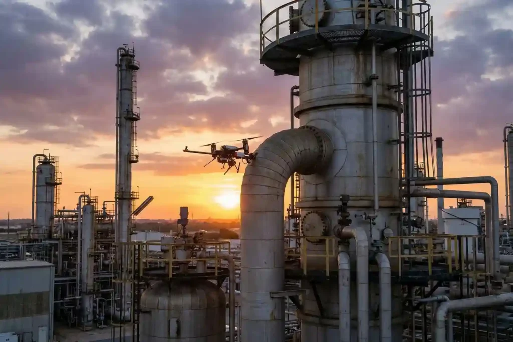
The EMAT Test: High-Precision NDT Without the Mess
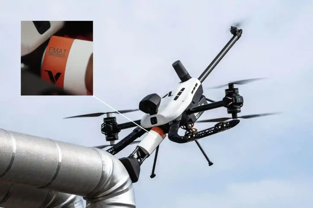
For decades, Ultrasonic Testing (UT) has been the gold standard for verifying asset integrity, yet it remains plagued by operational “friction”. Traditional piezoelectric transducers require a liquid coupling medium, such as water or gel o transmit sound waves into a material. This necessitates extensive surface preparation, including the removal of coatings, rust, and dirt, followed by a tedious cleanup of chemical residues. When these inspections occur at height, the friction multiplies. Organizations must invest heavily in scaffolding or rope access, exposing personnel to high-risk environments while assets remain offline. The Voliro T changes this equation by bringing EMAT (Electromagnetic Acoustic Transducer) technology to the sky, offering the first truly “dry” high-precision NDT solution. The Science of “Touchless” Sound EMAT represents a fundamental shift in how we generate ultrasonic waves. Unlike traditional UT, which relies on mechanical vibrations from a probe, EMAT induces sound waves directly within the metal surface of the asset. The Lorentz Force: The transducer uses a combination of a static magnetic field and a high-frequency alternating current in a coil to trigger the “Lorentz Force” within the material’s surface. Dry Inspections: Because the sound is generated inside the material, no liquid couplant or mechanical coupling is required. Resilience to Contaminants: EMAT thrives on rough, greasy, or oxidized surfaces where traditional gel-based UT would fail. Coating Penetration: The technology can measure wall thickness through existing protective coatings, eliminating the need for abrasive stripping. High-Temperature Performance: EMAT is ideal for inspecting heated assets where standard couplants would instantly boil or evaporate. Technical Synergy of the Voliro T Payload The Voliro T EMAT payload is engineered to deliver laboratory-grade data in the harshest industrial conditions. Precision Specs: The system operates at a high frequency of 3.5–4 MHz, providing a resolution of 0.06 mm. Measurement Range: It accurately measures wall thickness from 2 mm to 150 mm. Operational Flexibility: The probe supports Echo-to-Echo, Single-Echo, and Auto Thickness modes to suit various metallurgical conditions. Lift-off Capability: The sensor maintains a stable signal with a maximum lift-off of 4 mm, allowing it to work over rough textures or thin coatings. Active Contact: Utilizing the Voliro T’s 6-DoF flight architecture, the drone applies stable force to ensure the 30 mm diameter probe remains perfectly positioned against the asset. The Economics of Aerial EMAT Transitioning to an aerial EMAT workflow isn’t just a technical upgrade; it is a massive financial optimization. 4X Faster Results: While manual NDT is slow and labor-intensive, the Voliro T can collect 50–100 high-precision readings per hour. Significant ROI: Case studies indicate that aerial EMAT can save operators over $150,000 per inspection by eliminating scaffolding and minimizing asset downtime. Zero Residue: Because it is a dry process, there is no chemical cleanup required after the flight, protecting sensitive assets from couplant-induced corrosion. Enhanced Safety: The drone removes personnel from hazardous heights, “hot” zones, and toxic environments, conducting the entire survey from the safety of the ground. Implementing the Dry NDT Strategy From elevated flare stacks and large storage tanks to small suppression rings and angled pipeline sections, the Voliro T EMAT system provides a scalable, compliant solution for the digital age. With live A-Scan visualization and immediate data syncing, your engineering team can make structural decisions in real-time. Contact us and architect your autonomous future today. Let us audit your site requirements and deploy the Voliro T EMAT ecosystem wherever you are.
Voliro T: Redefining Structural Integrity Inspections through Aerial NDT
For years, industrial drones have been celebrated as the “eyes in the sky,” providing invaluable visual and thermal data from a safe distance. However, for asset integrity managers, a significant “last mile” remained: the inability to perform physical, contact-based testing without expensive scaffolding, risky rope access, or heavy machinery. Enter the Voliro T. This is not just another drone; it is an advanced aerial robotics platform designed to touch, push, and interact with the world. By bridging the gap between remote sensing and physical interaction, the Voliro T allows organizations to perform complex Non-Destructive Testing (NDT) on live assets with unprecedented speed and safety. A Masterclass in Robotic Agility The technical superiority of the Voliro T is not merely a result of its flight capabilities, but rather its specialized architecture as a 6-degrees-of-freedom (6-DoF) aerial robot. While conventional drones are under-actuated, meaning they must tilt their entire body to move laterally the Voliro T utilizes a unique vectoring thrust system that decouples its orientation from its position. This allows the platform to maintain a specific pose in space while simultaneously applying force, a requirement for high-fidelity NDT data acquisition. Stable Contact and Interaction Mechanics: The platform’s unique design features six tiltable rotors that can vector thrust in any direction. This configuration allows the drone to apply up to 30 N of stable, continuous force against a structure while maintaining a steady flight position. Beyond linear force, the system can generate several N m of torque, enabling the sensor to “seat” itself firmly against curved or irregular surfaces to ensure proper coupling for ultrasonic signals. True 360° Omnidirectional Mobility: The Voliro T is capable of interacting with structures at any angle: vertical walls, horizontal ceilings, or even the undersides of complex industrial geometries. This omnidirectional freedom allows the drone to remain “stuck” to a surface while the airframe itself rotates to avoid obstacles or adjust for shifting wind conditions. Operators can transition from a standard horizontal flight to a vertical “wall-climbing” mode without losing the active sensor link. Assisted Autonomy and GPS-Denied Operations: The Voliro T is equipped with sophisticated assisted autonomy that simplifies the process of making contact with an asset. Automated flight modes handle the precision required for the “approach and touch” phase, reducing the cognitive load on the pilot during high-stakes inspections. These systems are designed to function reliably in GPS-denied environments, such as inside large storage tanks, under steel bridge decks, or within boiler rooms, where traditional satellite-dependent drones would fail to maintain stability. Unmatched Versatility via Open Platform Design: The system is built as an open platform, featuring an interchangeable payload interface that allows for rapid field transitions between various NDT methods. Specific payload designs, such as the 33 cm long EMAT or the 32 cm long UT units, are balanced to work in harmony with the drone’s center of gravity. This versatility ensures that a single flight mission can be reconfigured for different inspection objectives, from screening for relative material loss with PEC to measuring absolute wall thickness with EMAT. The Payloads: Structural Intelligence Delivered Ground-truth data isn’t just a buzzword in 2026; it is a millimetric reality. The Voliro T ecosystem moves beyond simple photography, utilizing a sophisticated suite of swappable payloads designed for specific metallurgical and structural challenges. By integrating these sensors with the platform’s ability to apply $30~N$ of stable force, you gain access to laboratory-grade NDT data from the air. 1. Acoustic & Ultrasonic Intelligence: EMAT vs. UT While both payloads measure wall thickness, their technical applications differ based on the surface condition and the need for speed. EMAT (Electromagnetic Acoustic Transducer): * This 33 cm payload is the “dry-scan” champion, utilizing radially polarized shear waves to measure thickness without any liquid couplant. Operating at a frequency of 3.5–4 MHz, it provides a resolution of $0.06~mm$ across a thickness range of $2–150 mm. Compliant with ASTM E1816-18, it supports Echo-to-Echo, Single-Echo, and Auto Thickness measurement modes, with data visualized via a live A-Scan in the Voliro App. Ultrasonic Transducer (UT) Standard & High-Temp: The standard UT payload uses compression waves and a water-based gel couplant to deliver precision measurements compliant with EN 12668-1 and ISO 16831:2012. For active assets, the High-Temperature UT variant is a mission-critical tool, capable of operating in environments ranging from 0 °C to 260 °C (32–500 °F). Both UT versions feature a 5 MHz dual-element transducer and a natural focus depth of $10 mm, ideal for detecting internal corrosion or erosion in steel structures. 2. Surface Integrity: DFT & PEC Understanding the “skin” of an asset is just as vital as knowing its internal thickness. Dry Film Thickness (DFT): This ultra-lightweight (0.27 kg) payload uses two distinct technical methods: magnetic induction for coating thickness on ferrous metals and eddy current for non-ferrous metals. It offers a measurement range of up to 1.5 mm (60 mils) on ferrous surfaces and is compliant with a massive array of international standards, including ISO 2178, 2360, 2808, and ASTM D 7091. Pulsed Eddy Current (PEC) Sensor: The PEC payload is a powerful screening tool that measures relative volumetric material loss without direct metal contact. It is uniquely capable of measuring through non-ferrous materials such as insulation (rock-wool, blankets), fireproofing, and even marine growth or seawater. With a maximum liftoff of 100 mm, it provides an average wall thickness reading representative of its footprint, making it the perfect tool for identifying “hidden” corrosion under insulation (CUI). 3. Electrical & Wind Infrastructure: The LPS Tester Specifically engineered for the wind energy sector, the LPS (Lightning Protection System) payload ensures turbine blades can survive the elements. Wind Turbine LPS Tester: This system performs 4-wire resistance measurements (Kelvin sensing) to evaluate the full-circuit integrity of a turbine’s lightning protection. The setup includes an 820 ft (250 m) tether cable, allowing for inspections up to a maximum height of 250 m AGL. Compliant with IEC/EN 61400-24, the onboard Mostec micro-ohmmeter provides a resolution of 0.01 MΩ and can measure resistances ranging from 0.001 to 1000
FIFISH E-Master: The Seafloor Mapping Revolution
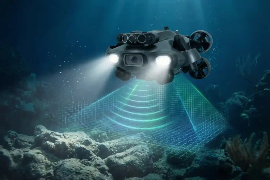
Navigating the Industrial Abyss The Complexity of 2026: Subsea operations have evolved beyond simple visual checks to requiring high-precision data, physical interaction, and deep-water endurance. The Multi-Disciplinary Challenge: No single tool fits all tasks, aquaculture requires agility, while offshore energy demands heavy-duty payloads and millimetric metrology. The Solution: Introducing the QYSEA FIFISH ROV Lineup, an AI-powered fleet designed to provide modular, scalable, and intelligent solutions for every underwater industrial sector. Specialized Tools for Specialized Missions The shift toward autonomous subsea auditing requires more than just a camera on a tether; it requires a specialized workforce of robotic agents. QYSEA’s lineup is engineered to bridge the gap between raw data collection and actionable engineering intelligence. 1. FIFISH V-EVO: The High-Frame-Rate Visual Metrology Standard The FIFISH V-EVO is the premier choice for visual-first inspections where motion clarity and environmental realism are critical. High-Speed Imaging Architecture: The V-EVO features a 4K UHD camera capable of 60 frames per second (fps). This higher frame rate is essential for capturing smooth footage of fast-moving turbine blades, propeller shafts, or moving biological stock in aquaculture, preventing the “motion blur” that plagues standard 30fps ROVs. Adaptive AI Plankton Filtering: One of the primary barriers to underwater clarity is “marine snow” suspended particles and plankton that reflect light and obscure details. The V-EVO utilizes an Adaptive AI filtering algorithm to digitally remove these visual obstructions in real-time, restoring clarity to images even in nutrient-rich or turbid coastal waters. Optics and Illumination: With a 166° ultra-wide field of view (FOV) and 5,000-lumen LED lights (5500K color temperature), the V-EVO maximizes situational awareness, allowing pilots to see structural contexts that narrower lenses miss. AI Vision Station Lock: Using machine vision, the V-EVO can lock onto a specific underwater subject, maintaining its relative position and focus with a single touch, which is critical for long-term observation of slow-growing corrosion or biological samples. 2. FIFISH E-GO: Biomimetic Agility for Industrial Productivity Designed with a “Hammerhead” shark-inspired form factor, the E-GO focuses on hydrodynamic efficiency and rapid operational switching. Ring-Wing Motor Propulsion: The E-GO utilizes a patented ring-wing motor system that provides a 30% power increase over traditional designs. This allows the drone to maintain speeds of 3+ knots even when fighting strong lateral currents common in open-water cage farming. The 9-Second Modular Ecosystem: To minimize site downtime, the E-GO features a quick-release accessory system allowing for tool installation in under 9 seconds. This enables a single ROV to transition from a net-repair mission to a water-quality sampling mission in seconds. Hot-Swappable Dual Power: The E-GO’s dual-battery architecture supports hot-swapping, meaning the ROV can stay powered on and connected to the station while batteries are replaced, enabling continuous “infinite” workflows without restarting missions. Macro Precision: A focused 10cm macro range allows the E-GO to perform extreme close-up inspections of welds, bolts, and delicate marine life that would be out of focus for standard industrial cameras. 3. FIFISH V6 PLUS: The Expert in Millimetric Structural Metrology The V6 PLUS is the enterprise benchmark for non-destructive testing (NDT) and precision measurements. Machine Vision AR Ruler: Moving beyond simple visual estimation, the V6 PLUS features a patented AR Ruler system. By combining machine vision with a laser scaler, it achieves a measurement precision of ±1cm, allowing engineers to accurately measure the length, width, and area of structural defects directly through the FIFISH App. Sonic Distance & Altitude Lock: Dual sonar sensors provide real-time distance and altitude tracking. The “Distance Lock” maintains a fixed stand-off distance from a hull or wall, while “Altitude Lock” maintains a fixed height above the seabed, ensuring the ROV does not drift during delicate NDT scans. Deep-Water Operational Envelope: Rated for 150 meters, the V6 PLUS is built for the deeper inspection requirements of hydropower dams, reservoir gates, and bridge pilings. 4. FIFISH V6 EXPERT: The Multi-Tool Platform for Complex Intervention The V6 EXPERT is the “Swiss Army Knife” of the lineup, designed to carry heavy payloads and diverse sensor arrays. Q-IF Interface Expansion: The V6 EXPERT features a heavy-duty Q-Interface that supports the simultaneous integration of up to 20+ professional tools. These include water samplers (100ml to 1500ml), pH/salinity/turbidity sensors, retrieval hooks, and underwater dozers. Onshore Power Supply System (OPSS): For missions requiring days of continuous monitoring, the V6 EXPERT can be tethered to an onshore power system, removing battery limitations and allowing the drone to stay submerged indefinitely for long-duration infrastructure audits. Enhanced 6000 Lumen Illumination: Dual 3000-lumen headlights provide the ultra-bright lighting necessary for the V6 EXPERT to perform manipulation tasks in the absolute darkness of deep-sea tunnels or silt-heavy environments. 5. FIFISH E-MASTER: The Vessel Hull and Bathymetric Specialist The E-MASTER is a revolutionary industrial AI ROV engineered for hull inspections and seabed mapping. Q-DVL Stabilized Hovering: The E-MASTER integrates both forward and downward Q-DVL (Doppler Velocity Log) modules. This allows for Station Lock Hovering against vertical hulls or moving currents, ensuring the drone remains perfectly steady while measuring biofouling or coating degradation. Integrated Bathymetric Mapping (QY-BT): By fusing data from the Q-DVL and echosounders, the E-MASTER can perform automated 2D and 3D seafloor mapping. Operators can generate topographic maps and calculate reservoir capacities with a single click. AI Measurement Accuracy: Using the QY-MT system, the E-MASTER can analyze underwater objects and fractures with a staggering 99.7% measurement accuracy, providing the high-fidelity data required for class-certified hull inspections. 6. FIFISH X1: The Heavy-Duty Offshore Intervention Powerhouse The X1 is a mission-class ROV designed to handle the most demanding conditions in the offshore energy sector. Heavy Payload and Propulsion: The X1 supports an massive 15kg payload capacity and is powered by the Q-Motor Pro system, which allows it to hold its position and operate in currents up to 4.0 knots. U-INS Plus Inertial Navigation: This system fuses data from the Q-DVL, accelerometers, gyroscopes, and magnetometers to enable precise 3D route planning. The X1 can autonomously navigate complex “jackets” and oil rig structures, following preset paths while the operator focuses on data collection. Tri-Directional Collision Avoidance: To protect the