Shahed-136: Affordable Protection for Strategic Sites

The modern battlefield is undergoing a rapid and permanent transformation. The Shahed-136 has transitioned from a niche experimental tool into what experts call a “single reliable weapon” for asymmetric warfare. These slow-moving loitering munitions are designed for one purpose: to strike deep into enemy territory with high precision. They have moved the front lines away […]
Owning A Drone vs Hiring a Vendor: Which One Do You Actually Need?

Many business owners see the price tag of a high-end drone and think that is the only cost they need to worry about. But buying a professional drone is like looking at an iceberg. The purchase price is just the small part you see above the water. Beneath the surface is a massive collection of […]
Drone Defense Overview: Exploring the Drone Detection Solution

The sky is becoming a busy place as commercial drones are now used for everything from delivery to photography. While most are harmless, the proliferation of these machines creates new risks for critical infrastructure like power plants and large public events. Traditional security cannot stop a threat that comes from above. This is why modern […]
Safe Site Measurement: Visual RTK GNSS Measurement for Elevation Models and Surface Mapping

In the high-stakes environments of 2026, topographic surveying has evolved. We have moved past simple coordinates and into the realm of complex Digital Elevation Models (DEM) and Digital Surface Models (DSM). However, a persistent challenge remains: the vertical barrier. Whether it is an unstable pit wall in a quarry or a jagged stockpile in a […]
The Complete DJI Enterprise Software Guide: From Data to Intel

Drones alone are no longer enough for operational purposes. While a high-performance aircraft is the “muscle” of the operation, it is merely a vehicle for sensors. To truly unlock value, reliable software is needed to process large amounts of data acquired during field missions. The complexity of modern infrastructure means that “one size fits all” […]
Drone Battery Storage & Safety: The Essential Guide

In recent years, lithium-ion battery incidents have surged globally, with reports showing a 17% increase in related fires due to mishandling during storage and charging. A single lithium battery failure can trigger “thermal runaway,” a catastrophic chain reaction where temperatures spike from 100°C to over 1,000°C in seconds. Alarmingly, over 50% of these fires occur […]
Terra Xross 1: Redefining the Standard for Confined Space Inspection

In the heavy industrial landscape, the most critical assets, such as storage tanks, massive boilers, underground mine shafts, and ship cargo holds are often the most dangerous to inspect. Traditional manual methods require scaffolding, specialized high-risk permits, and placing human lives in dark, dusty, and oxygen-depleted environments. The Terra Xross 1, developed by Terra Drone […]
FIFISH E-Master: The Seafloor Mapping Revolution

Navigating the Industrial Abyss The Complexity of 2026: Subsea operations have evolved beyond simple visual checks to requiring high-precision data, physical interaction, and deep-water endurance. The Multi-Disciplinary Challenge: No single tool fits all tasks, aquaculture requires agility, while offshore energy demands heavy-duty payloads and millimetric metrology. The Solution: Introducing the QYSEA FIFISH ROV Lineup, an […]
The QYSEA ROV: Intelligence for the Subsea Era

Navigating the Industrial Abyss The Complexity of 2026: Subsea operations have evolved beyond simple visual checks to requiring high-precision data, physical interaction, and deep-water endurance. The Multi-Disciplinary Challenge: No single tool fits all tasks, aquaculture requires agility, while offshore energy demands heavy-duty payloads and millimetric metrology. The Solution: Introducing the QYSEA FIFISH ROV Lineup, an […]
Cloud-First Mapping: Accelerating Construction Timelines with ArcGIS Online and ArcGIS Enterprise
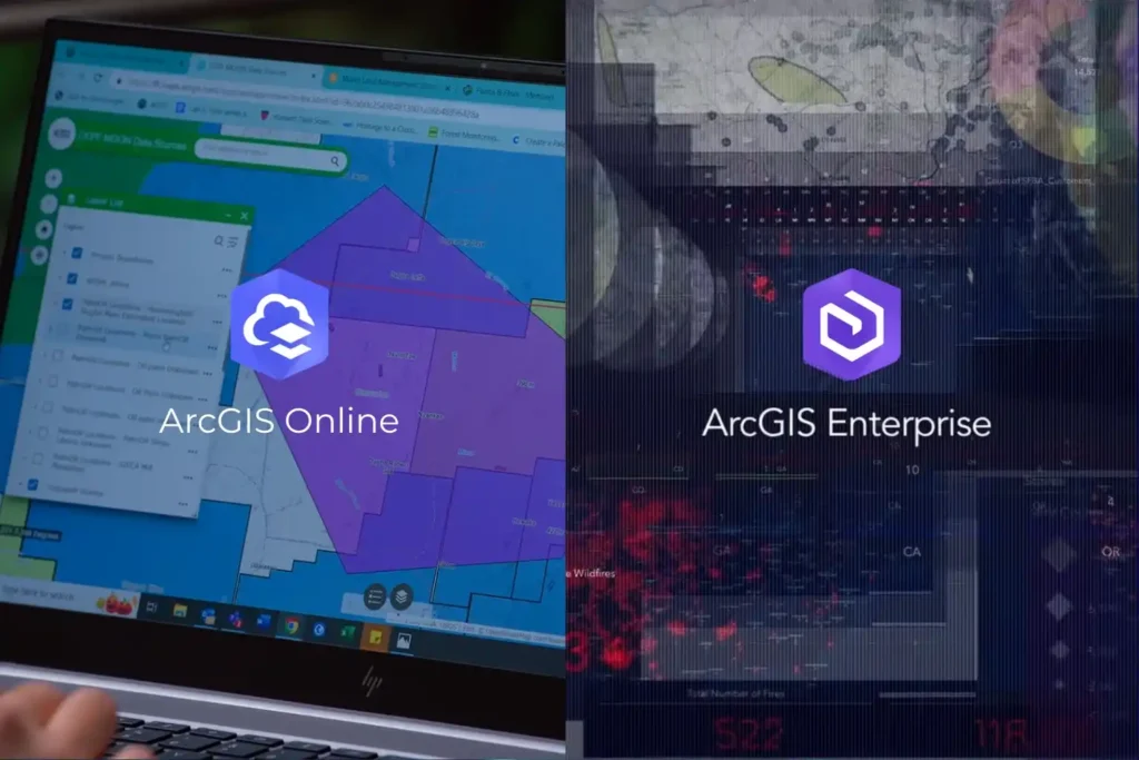
Every drone mission, whether it is an inspection of a solar farm in NEOM or a volumetric survey in the Empty Quarter ends with a massive influx of data. Thousands of images, high-density point clouds, and thermal layers require a “home.” Without a robust platform to organize and visualize this information, your drone program is […]