8x Faster Your Minerals Exploration With Drone and Satellite Applications
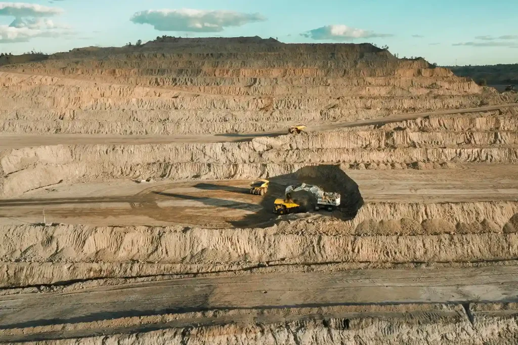
The Evolving Challenges of Mineral Exploration The race for critical minerals has intensified. Copper, lithium, cobalt, and rare earths are in unprecedented demand to power renewable energy, electric vehicles, and digital technologies. By 2040, lithium demand could reach 1,326 kt, copper 36,379 kt, and rare earths 169 kt. But traditional mineral exploration methods struggle to keep pace. Ground crews require weeks to map terrain, and costs continue to climb with lithium exploration investment surpassing $1 billion in 2024 alone. Field operations are slow, labor-intensive, and often environmentally disruptive. Remote Sensing Technologies in Exploration Mineral exploration is increasingly data-driven, and remote sensing has become the backbone of early-stage decision-making. By combining satellite-based and drone-based technologies, geologists can access unprecedented levels of spatial, spectral, and temporal data, which traditional surveys cannot achieve at scale. Satellite-Based Applications Multispectral & Hyperspectral Imaging Multispectral sensors capture data across a limited number of discrete bands (often 5–10), while hyperspectral sensors collect data across hundreds of contiguous spectral bands. This capability allows geologists to detect subtle differences in mineral composition by analyzing reflectance spectra. For instance: Hydrothermal alteration zones, key indicators of copper or gold deposits, display unique absorption features in the shortwave infrared (SWIR) range. Iron oxides, clays, and carbonates each have distinct spectral signatures, making it possible to map surface mineral assemblages with high precision. Hyperspectral data, when fused with geological maps, allows for rapid anomaly detection across large regions, helping exploration teams focus ground efforts only where it matters. Synthetic Aperture Radar (SAR & InSAR) SAR uses microwave signals to penetrate clouds, smoke, or even vegetation, making it invaluable in regions with frequent dust storms or tropical climates. It excels in detecting structural geology features: Lineaments and fault systems, often associated with mineralization pathways. Lithological boundaries, aiding in regional geological mapping. InSAR (Interferometric SAR) can monitor ground deformation at millimeter accuracy, which is essential not only for exploration but also for environmental baseline studies and mine site stability assessments. Digital Elevation Models (DEMs) High-resolution DEMs provide the third dimension of exploration data: elevation. These models are derived from stereo imagery, radar, or LiDAR and offer critical terrain intelligence: Drainage patterns that may indicate secondary mineral deposits. Structural controls such as folds, domes, or intrusions, often associated with ore bodies. Watershed and slope analysis for logistical planning of access roads, drilling pads, and camp infrastructure. DEM-derived slope and aspect models also assist in understanding erosion processes and landscape evolution, factors often correlated with mineral deposition. This reality makes one thing clear: the industry needs rapid, accurate, and scalable geospatial intelligence in pre-mining stages. Remote sensing, powered by a combination of satellite and drone-based imagery, is redefining how exploration companies detect mineral prospects before drilling begins. Drone-Based Applications While satellites provide regional context, drones deliver the site-specific precision that exploration companies need to make confident drilling and investment decisions. By flying closer to the surface and carrying specialized payloads, drones capture centimeter-level data that traditional ground teams or satellites cannot match in resolution. High-Resolution Photogrammetry Drone-mounted RGB cameras use overlapping imagery to create orthophotos, digital surface models (DSMs), and digital terrain models (DTMs). With ground control points (GCPs) or real-time kinematic (RTK) positioning, these models achieve 1–5 cm accuracy. This level of detail enables mapping of outcrops, faults, and fractures invisible in satellite imagery. Photogrammetry also produces accurate volumetric measurements, useful for quantifying overburden or monitoring stockpiles during later mining phases. Its visual clarity makes it ideal for geological mapping, allowing teams to distinguish rock types and alteration zones quickly. UAV-LiDAR LiDAR-equipped drones emit thousands of laser pulses per second, penetrating vegetation and recording ground elevation with 2–3 cm vertical accuracy. In forested or bush-covered terrains, UAV-LiDAR produces bare-earth models that expose structural geology otherwise hidden from view. LiDAR intensity data also helps differentiate rock and soil types based on reflectance properties, adding another layer of geological interpretation. With high point densities (up to 300 points/m²), LiDAR is invaluable for fault detection, fracture mapping, and slope stability analysis. Geophysical Payloads Beyond optical and laser scanning, drones now carry advanced geophysical sensors once restricted to manned aircraft: Aeromagnetic Surveys: Detect magnetic anomalies linked to mineralized intrusions. UAV-borne magnetometers can fly at low altitudes (<50 m AGL), producing higher-resolution datasets than fixed-wing aircraft. Electromagnetic (EM) Surveys: UAV-EM systems measure conductivity contrasts to locate ore bodies rich in sulfides or clays. These surveys highlight targets buried beneath cover sequences. Ground Penetrating Radar (GPR): Shallow subsurface imaging up to several meters deep, useful for detecting weathered ore caps or buried structures. Multispectral & Thermal Sensors: Identify surface alteration halos, monitor moisture variations, and highlight thermal anomalies that may point to mineralization zones. Productivity and Efficiency Gains Drones excel not only in resolution but also in operational productivity: Traditional ground-based topographic surveys average 8 km per day per team. Drone surveys can map up to 60 km per day per team, delivering an 8x improvement. Geophysical surveys benefit similarly, with UAV-mounted systems covering more ground in less time and at lower cost than manned aircraft or ground crews. Faster data collection means earlier availability of actionable datasets, enabling exploration managers to move from prospecting to drilling much more rapidly. Geophysical Payloads One of the most significant advancements in drone-based exploration lies in their ability to carry specialized geophysical instruments, enabling surveys that previously required expensive manned aircraft or labor-intensive ground crews. These payloads allow exploration companies to detect anomalies hidden beneath the surface, drastically improving subsurface intelligence in early-stage mineral exploration. Aeromagnetic Surveys Drones equipped with fluxgate or optically pumped magnetometers measure variations in the Earth’s magnetic field caused by subsurface rocks. Technical Edge: UAVs can fly low and slow (30–50 m AGL, ~8–15 m/s), enabling high-resolution magnetic data capture compared to manned aircraft, which typically operate at higher altitudes (~100–200 m AGL). Resolution: UAV magnetic surveys can detect subtle anomalies as small as tens of nanotesla (nT), crucial for identifying mineralized intrusions, dykes, or skarn deposits. Applications: Ideal for mapping ferromagnetic minerals like magnetite, or indirect indicators of copper